Photo: Wikipedia
Strategic Assessment of Franklin, TN
Multiple tactical vulnerabilities. Population density, target proximity, or disaster risk are likely compounding. A retreat property and exit planning is required.
What does the Strategic Assessment tell us?
Our Strategic Assessment grades tactical survivability of an area. Major population centers, military targets, fallout zones, natural disasters, and border exposure all drive risk — lower exposure means a more defensible position in a crisis.
This is heavily inspired by Joel Skousen's Strategic Relocation book. Highly recommended you checkout the book ($)What does this tell us?
Our Strategic Assessment grades tactical survivability of an area. Major population centers, military targets, fallout zones, natural disasters, and border exposure all drive risk — lower exposure means a more defensible position in a crisis.
This is heavily inspired by Joel Skousen's Strategic Relocation book. Highly recommended you checkout the book ($)Strategic Pillars

Key Distances
Regional Safe Places
Below is our recommended "safe zones" in Tennessee and the surrounding area based on our strategic heuristics. For most people, it's unrealistic to live in a “safe zone” full-time due to work, family or other personal reasons. They tend to be more rural. However, many of these areas are perfect for second homes and retreat properties that double as a vacation home or even a short-term rental.
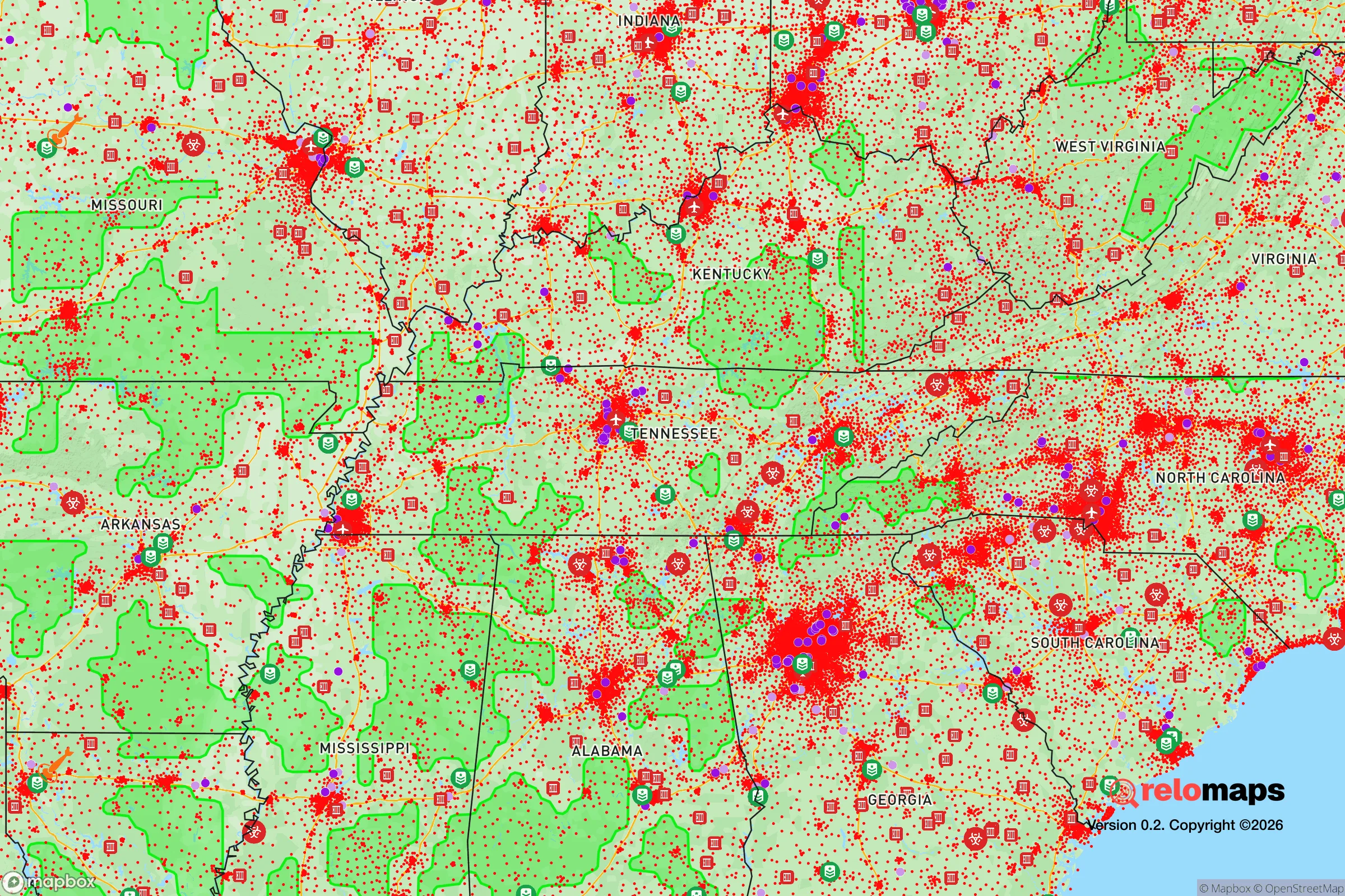
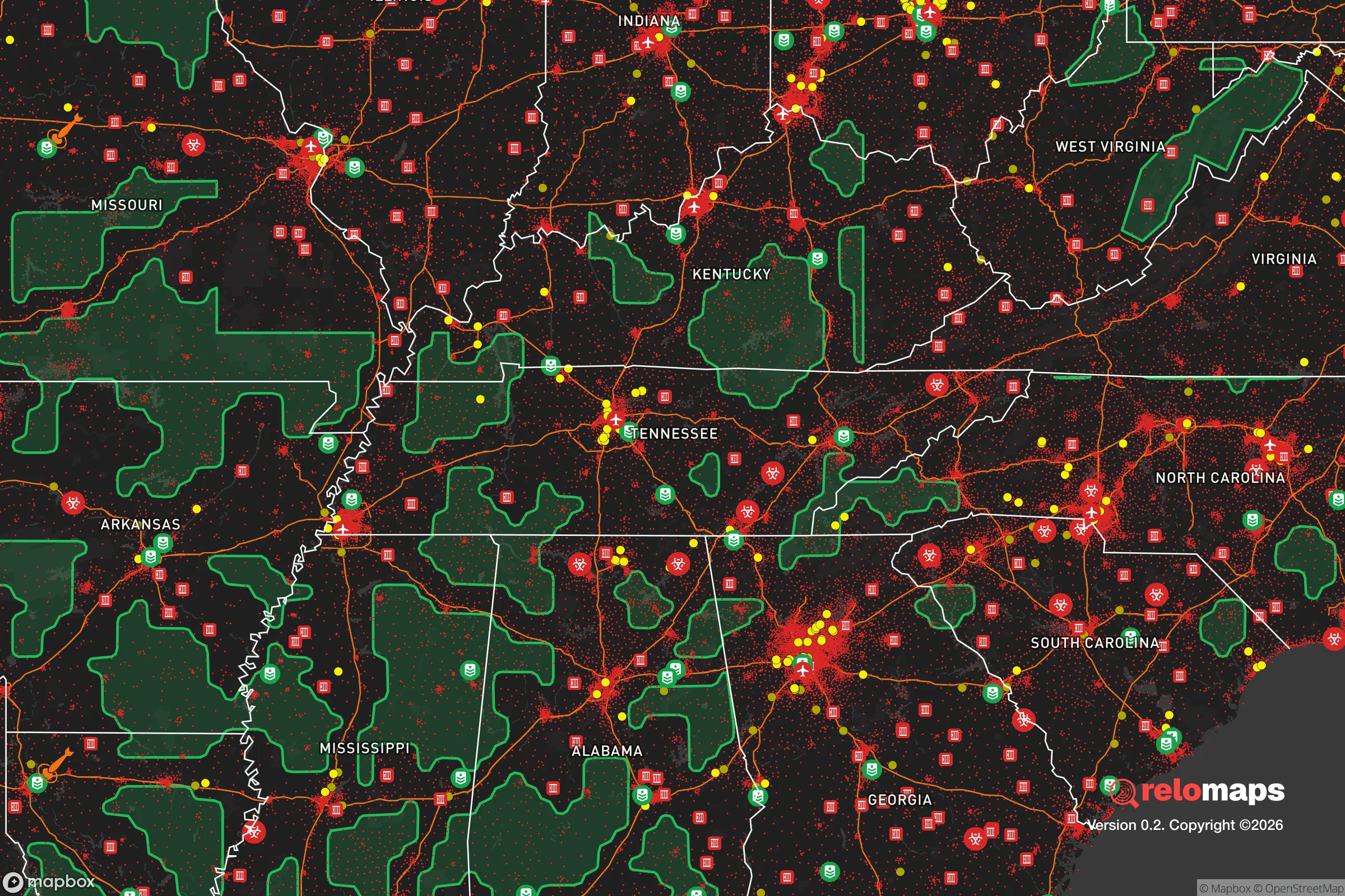
Important Note: For informational purposes only. This does not mean nothing bad ever happens in the green zones. Please use common sense. This is based on public data and modeled with AI. We tried to take a conservative approach but mistakes happen. We update this regularly as new information becomes available.
Solar Generator Recommendations
Backup power matters more here than in safer locations. We've picked three solar generators across budgets and capacity tiers — start with the budget unit if you only need a few essentials, or step up if you want to run a fridge and HVAC for days at a time.

Jackery Portable Power Station Explorer 300
Budget OptionPower on the Go: Weighing only 11 lbs, it's convenient to set up and store with book-sized foldable solar panels

BLUETTI Portable Power Station AC180
Designed for both indoor and outdoor scenarios, AC180 is highly capable as it has a robost capacity and continuous output power.

EF ECOFLOW DELTA Pro Ultra Power Station
Upgraded PickEcoFlow DELTA Pro Ultra is a whole-home energy system designed to grow with your family. Integrated with the Smart Home Panel 2, it scales to meet your evolving energy needs — keeping your home powered, intelligent, and secure through every stage of life.
We earn a commission, at no additional cost to you.
Strategic Assessment Analysis
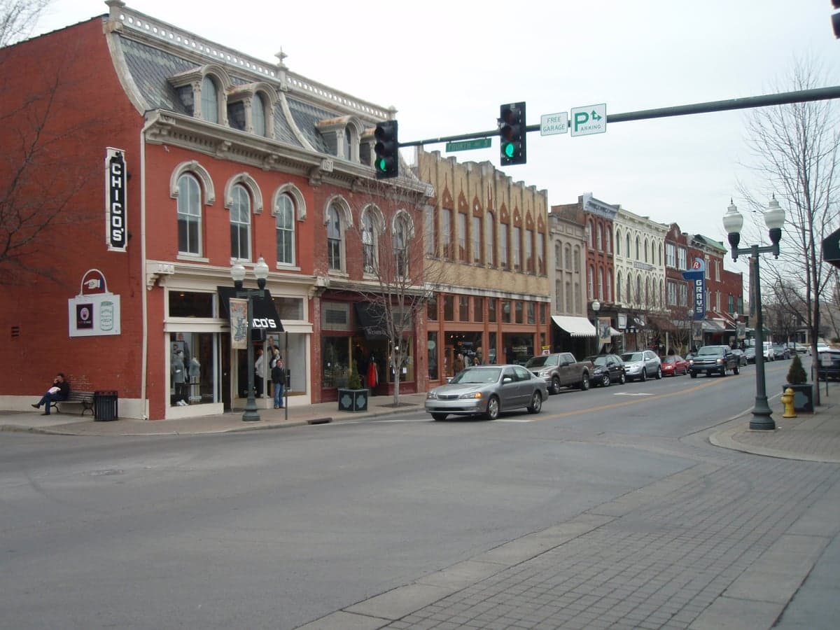
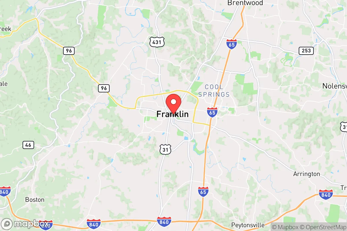
Franklin, Tennessee, often tops lists for its quality of life, but from a strategic relocation standpoint, its real value lies in a specific combination of geographic resilience and economic insulation that is increasingly rare. Positioned roughly 20 miles south of Nashville, Franklin sits in a sweet spot: close enough to a major metro for supply access and employment, yet far enough to avoid the immediate blast radius of a high-value target like a state capital or major transportation hub. The area’s sustained growth—population nearly doubled from 2000 to 2020—signals a community that has already weathered economic shocks and drawn in a self-reliant, conservative-leaning population. For a prepper or survivalist, this isn’t just a nice place to live; it’s a location with a built-in buffer against the cascading failures that often follow a major crisis.
Geographic position and natural advantages for long-term security
Franklin’s geography offers several underappreciated defensive advantages. The city sits on the Western Highland Rim, a plateau that provides natural elevation and drainage away from the flood-prone Cumberland River basin. This means less risk of catastrophic flooding during infrastructure failures, and the rolling hills create natural chokepoints and observation points—useful if movement becomes restricted. The area is also rich in hardwood forests and limestone bedrock, which supports reliable groundwater aquifers. Unlike the flat, open farmland to the west, Williamson County’s terrain offers cover and concealment. The nearby Harpeth River and numerous creeks provide a surface water source that, with proper filtration, can sustain a household. Furthermore, Franklin’s position along Interstate 65 and State Route 96 gives it two solid evacuation corridors: north toward Kentucky or south toward Alabama, avoiding the single-point-of-failure risk of a major interstate junction. The city’s elevation—around 750 feet—also means it’s less prone to the tornado alley dynamics of areas further west, though severe weather remains a factor.
Risks, exposures, and proximity to fallout-relevant landmarks
The primary strategic weakness of Franklin is its proximity to Nashville, a city with multiple high-value targets. Nashville is home to a major international airport (BNA), a large Amtrak station, and several interstate bridges over the Cumberland River—all potential choke points or targets in a coordinated disruption. The city also hosts the Tennessee Valley Authority’s (TVA) Cumberland Fossil Plant (about 40 miles northwest) and the nearby Gallatin Fossil Plant, both of which, while not nuclear, are critical infrastructure that could be targeted or fail under stress. More concerning is the proximity to the Oak Ridge National Laboratory (about 150 miles east), a major nuclear research facility. While 150 miles is outside the immediate fallout zone for a conventional event, prevailing winds from the west could carry particulate matter toward the Nashville basin in a worst-case scenario. Franklin’s position south of Nashville means it’s slightly downwind of the city’s industrial and transportation emissions, but also downwind of any potential chemical or radiological release from the north. The city itself has no major military bases or nuclear power plants within 50 miles, which is a positive, but the I-65 corridor is a known evacuation route for Nashville, meaning that in a mass exodus, Franklin could become a bottleneck or a target for looting. The 2020 Nashville bombing and the 2023 Covenant School shooting in Nashville demonstrate that even “safe” suburbs are not immune to cascading events.
Practical resilience for a relocator: food, water, energy, and defensibility
For a relocator focused on self-sufficiency, Franklin’s practical resilience is mixed but workable. Water: The city draws from the Harpeth River and the Cumberland River via the Franklin Water Treatment Plant. In a grid-down scenario, this system is vulnerable. However, the area’s high water table and numerous private wells (common in rural parts of Williamson County) offer a backup. A prepper should prioritize a property with a well or access to a reliable spring. Food: Williamson County is still agricultural, with working farms and livestock operations within a 15-minute drive of downtown. The Franklin Farmers Market is one of the strongest in the state, and local food co-ops like The Produce Place provide a network for barter and supply. The county’s soil is fertile for gardening, and the growing season runs from April to October. Energy: The grid is served by the Tennessee Valley Authority, which has a strong track record of reliability, but is also a single point of failure. Solar potential is moderate—about 4.5 peak sun hours per day—enough for a modest off-grid setup but not for heavy loads. Natural gas is widely available, which is a plus for heating and cooking during outages. Defensibility: Franklin’s suburban layout is a double-edged sword. The historic downtown area is walkable and defensible due to its compact street grid and brick buildings, but the sprawling subdivisions on the outskirts are vulnerable to perimeter breaches. The local law enforcement (Franklin Police Department and Williamson County Sheriff’s Office) is well-funded and professional, with a strong community policing ethos. However, in a widespread crisis, response times would degrade. The area’s strong gun culture and high rate of concealed carry permit holders (Tennessee is a constitutional carry state) mean that a prepared individual will find like-minded neighbors, but also that a visible prepper setup could attract unwanted attention. The best strategy is to blend in—maintain a normal-looking home with hidden caches and a defensible perimeter.
The overall strategic picture for Franklin is one of calculated risk. It is not a remote bunker location, nor is it a high-risk urban core. It occupies a middle ground that rewards preparation and community integration. The city’s strong economy, low crime rate (consistently among the safest in Tennessee), and conservative governance provide a stable baseline. The primary threats are not from within but from external shocks—a Nashville-centric disaster, a grid failure, or a supply chain collapse. For a single individual or family willing to invest in a well, solar panels, and a food storage plan, Franklin offers a defensible, resource-rich environment with a like-minded population. The key is to avoid the trap of complacency that comes with its polished image. Treat it as a forward operating base, not a final fortress. If you can secure a property with a well, a garden, and a good relationship with your neighbors, Franklin is one of the better bets in the Mid-South for riding out the next decade’s uncertainties.
* Values derived from national, state, county, city and local statistics and may differ in a specific area. Last updated: 2026-04-15T23:53:45.000Z
Narrative content on this page is AI-generated and may contain mistakes. Verify any details that matter before acting on them.
ReloMaps may earn a commission from affiliate links at no extra cost to you.