Photo: Wikipedia
Strategic Assessment of Greensburg, PA
Meaningful friction. Expect exposure to either population pressure, blast zones, or natural disaster risk. Consider buying a retreat property.
What does the Strategic Assessment tell us?
Our Strategic Assessment grades tactical survivability of an area. Major population centers, military targets, fallout zones, natural disasters, and border exposure all drive risk — lower exposure means a more defensible position in a crisis.
This is heavily inspired by Joel Skousen's Strategic Relocation book. Highly recommended you checkout the book ($)What does this tell us?
Our Strategic Assessment grades tactical survivability of an area. Major population centers, military targets, fallout zones, natural disasters, and border exposure all drive risk — lower exposure means a more defensible position in a crisis.
This is heavily inspired by Joel Skousen's Strategic Relocation book. Highly recommended you checkout the book ($)Strategic Pillars

Key Distances
Regional Safe Places
Below is our recommended "safe zones" in Pennsylvania and the surrounding area based on our strategic heuristics. For most people, it's unrealistic to live in a “safe zone” full-time due to work, family or other personal reasons. They tend to be more rural. However, many of these areas are perfect for second homes and retreat properties that double as a vacation home or even a short-term rental.


Important Note: For informational purposes only. This does not mean nothing bad ever happens in the green zones. Please use common sense. This is based on public data and modeled with AI. We tried to take a conservative approach but mistakes happen. We update this regularly as new information becomes available.
Solar Generator Recommendations
Backup power matters more here than in safer locations. We've picked three solar generators across budgets and capacity tiers — start with the budget unit if you only need a few essentials, or step up if you want to run a fridge and HVAC for days at a time.

Jackery Portable Power Station Explorer 300
Budget OptionPower on the Go: Weighing only 11 lbs, it's convenient to set up and store with book-sized foldable solar panels

BLUETTI Portable Power Station AC180
Designed for both indoor and outdoor scenarios, AC180 is highly capable as it has a robost capacity and continuous output power.

EF ECOFLOW DELTA Pro Ultra Power Station
Upgraded PickEcoFlow DELTA Pro Ultra is a whole-home energy system designed to grow with your family. Integrated with the Smart Home Panel 2, it scales to meet your evolving energy needs — keeping your home powered, intelligent, and secure through every stage of life.
We earn a commission, at no additional cost to you.
Strategic Assessment Analysis
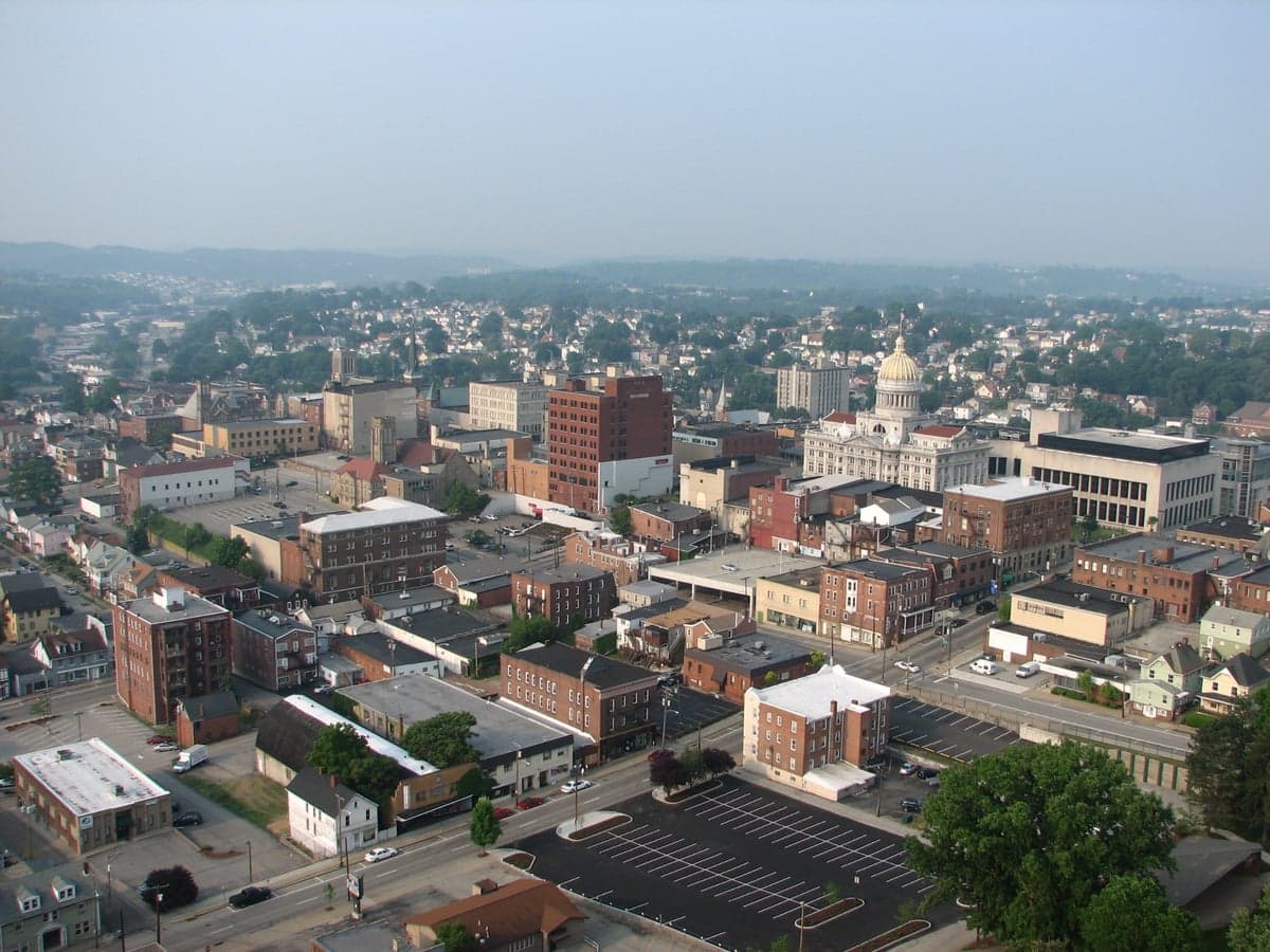
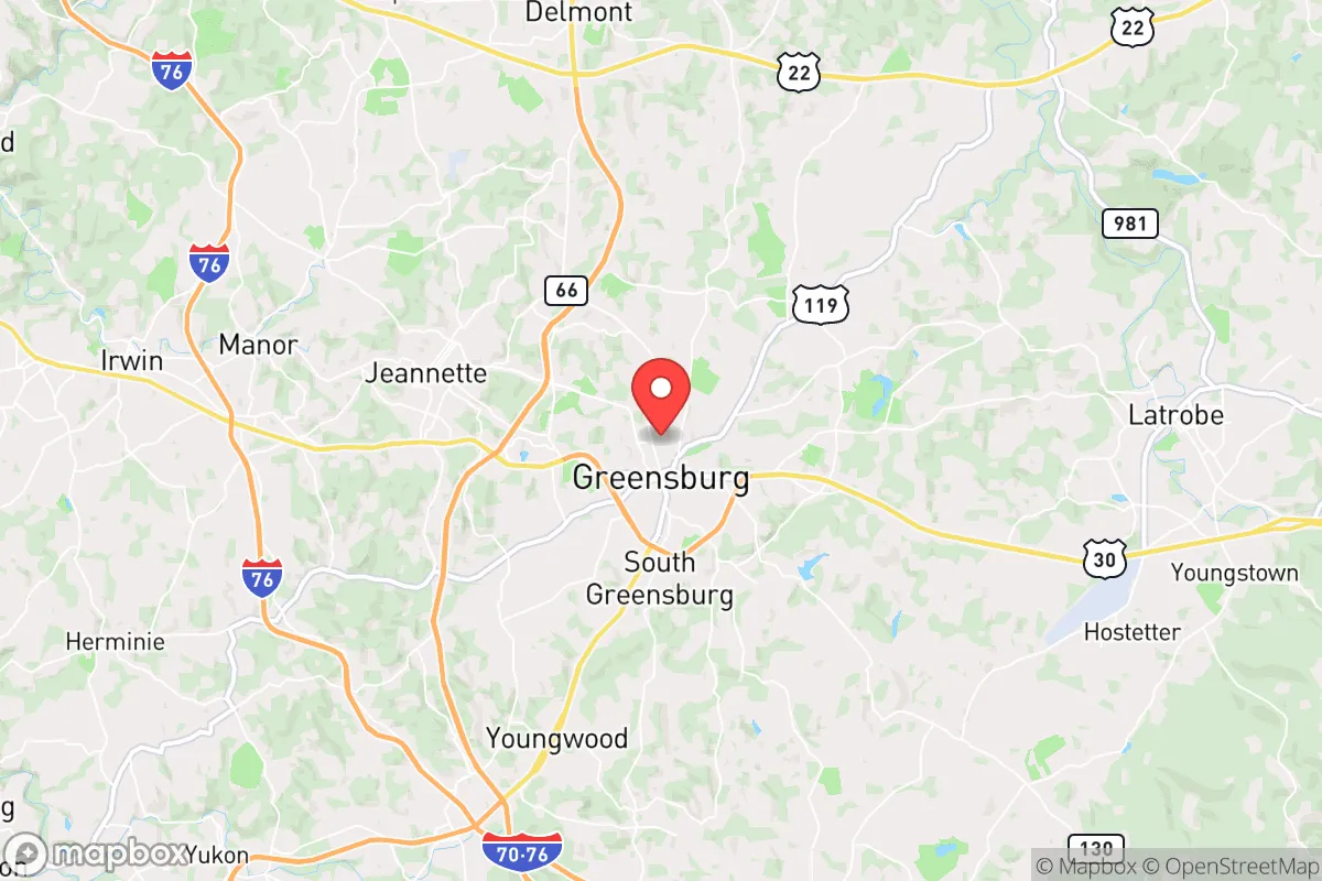
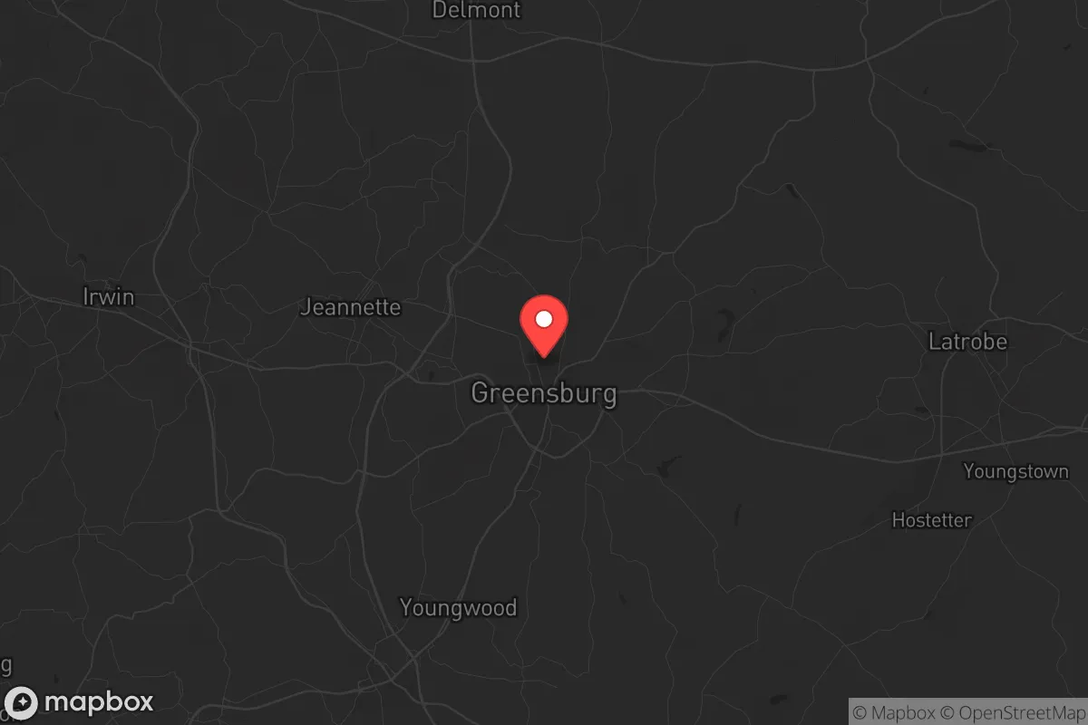
Greensburg, Pennsylvania, offers a compelling strategic position for those prioritizing resilience and self-reliance in an uncertain future. Sitting roughly 30 miles southeast of Pittsburgh, this Westmoreland County seat provides a buffer from the immediate chaos of a major metropolitan area while retaining access to its resources. The city's location along the Laurel Highlands ridge gives it natural elevation advantages, and its history as a regional trade hub means the infrastructure for sustained living exists, if you know where to look. For a relocator with a prepper mindset, Greensburg represents a calculated middle ground—close enough to leverage urban assets, far enough to avoid the worst of a collapse scenario.
Geographic position and natural advantages for long-term security
Greensburg sits atop the Allegheny Plateau at an elevation of roughly 1,100 feet, which provides a natural defensive posture against flooding and offers clear lines of sight in all directions. The surrounding Laurel Highlands are characterized by rolling hills, dense hardwood forests, and numerous small watersheds—terrain that slows movement and complicates any large-scale incursion. The area's karst geology means groundwater is plentiful, with dozens of springs and creeks feeding into the Loyalhanna Creek and the larger Kiski-Conemaugh system. This water abundance is a critical advantage: unlike arid regions where water becomes a weapon, Greensburg's natural hydrology ensures that even a grid-down scenario leaves residents with accessible sources. The region's four-season climate also supports subsistence agriculture, with a growing season of roughly 150 days and ample rainfall averaging 40 inches annually. For a family looking to establish a food-producing homestead, the soil here—primarily silt loam over limestone—is fertile enough for orchards, root vegetables, and small grains. The local topography also provides numerous natural choke points: the ridges and valleys funnel movement along predictable routes, making it easier to monitor and control access to your property or community.
Risks, exposures, and proximity to fallout-relevant landmarks
No strategic assessment is honest without addressing the liabilities. Greensburg's primary risk is its proximity to Pittsburgh, a major population center and regional transportation hub. In a mass casualty event or civil unrest scenario, the city could see a surge of refugees fleeing the urban core along Route 30, the Pennsylvania Turnpike (I-76), and the Parkway East (I-376). These corridors are direct lines from Pittsburgh to Greensburg, and they will become clogged or dangerous within hours of a crisis. The city itself is also within 50 miles of the Beaver Valley Nuclear Power Station, a pressurized water reactor on the Ohio River. While a meltdown is unlikely, the prevailing winds in this region blow from the west, meaning fallout from a Beaver Valley incident would track directly over Greensburg. Additionally, the nearby Westinghouse nuclear fuel fabrication facility in Columbia County and the Shippingport Atomic Power Station site are secondary concerns. On the positive side, Greensburg is far enough from major military installations—like the Army's logistics hub at the Pittsburgh International Airport Air Reserve Station—that it avoids being a primary target in a kinetic conflict. The city's own infrastructure, including the Westmoreland County Airport and the local rail lines, is modest enough to be overlooked by strategic planners. For the prepper, the key takeaway is that Greensburg is not a target, but it is a potential destination for those fleeing targets. Your plan must account for managing that inflow.
Practical resilience: food, water, energy, and defensibility
For a relocator serious about self-sufficiency, Greensburg's practical assets are solid but require work. The local water supply comes from the Municipal Authority of Westmoreland County, which draws from the Youghiogheny River and several reservoirs. In a grid-down scenario, these systems will fail, but the area's groundwater is accessible via shallow wells—most properties outside the immediate city center can tap into the aquifer at 50 to 100 feet. Rainwater catchment is also viable, with average annual precipitation supporting a 1,000-square-foot roof yielding roughly 25,000 gallons per year. Food production is feasible: the surrounding farmland grows corn, soybeans, and hay, and there are numerous small-scale Amish and Mennonite operations within a 20-mile radius that can serve as both suppliers and community partners. The local farmers' markets in Greensburg and nearby Latrobe offer direct access to produce, meat, and dairy, but in a crisis, these will be among the first resources stripped. Energy resilience is a mixed bag. The region has decent solar insolation—about 4.2 peak sun hours per day—but the frequent cloud cover from lake-effect weather means solar panels alone won't cut it. A hybrid system with a small wind turbine (the area averages 10-12 mph winds) and a backup generator running on propane or diesel is the realistic baseline. Defensibility is where Greensburg shines. The city's layout, with its historic downtown grid surrounded by residential neighborhoods and then rural farmland, creates natural layers of security. Properties on the outskirts, particularly along the ridges east of town, offer commanding views of approach routes. The local population is predominantly working-class and rural-minded, with a strong hunting and firearms culture—Westmoreland County has one of the highest per-capita gun ownership rates in Pennsylvania. This means you are unlikely to be the only armed household on your block, which is a deterrent in itself. However, it also means that any resource competition will be met with resistance, so building relationships with neighbors before a crisis is non-negotiable.
The overall strategic picture for Greensburg is one of calculated viability. It is not a remote bunker location—it is a semi-urban hub with real exposure to Pittsburgh's problems and the risks of nuclear infrastructure. But for the conservative-minded relocator who values community, defensible terrain, and the ability to produce their own food and water, it offers a foundation that can be hardened over time. The key is to act before the crisis, not during it. Secure a property with a well and good southern exposure, stockpile supplies for a minimum of six months, and integrate into the local network of like-minded residents. Greensburg won't save you from every scenario, but it gives you a fighting chance—and in the world we're heading toward, that's more than most places can offer.
* Values derived from national, state, county, city and local statistics and may differ in a specific area. Last updated: 2026-05-01T08:51:20.000Z
Narrative content on this page is AI-generated and may contain mistakes. Verify any details that matter before acting on them.
ReloMaps may earn a commission from affiliate links at no extra cost to you.