Photo: Wikipedia
Strategic Assessment of Hallowell, ME
Meaningful friction. Expect exposure to either population pressure, blast zones, or natural disaster risk. Consider buying a retreat property.
What does the Strategic Assessment tell us?
Our Strategic Assessment grades tactical survivability of an area. Major population centers, military targets, fallout zones, natural disasters, and border exposure all drive risk — lower exposure means a more defensible position in a crisis.
This is heavily inspired by Joel Skousen's Strategic Relocation book. Highly recommended you checkout the book ($)What does this tell us?
Our Strategic Assessment grades tactical survivability of an area. Major population centers, military targets, fallout zones, natural disasters, and border exposure all drive risk — lower exposure means a more defensible position in a crisis.
This is heavily inspired by Joel Skousen's Strategic Relocation book. Highly recommended you checkout the book ($)Strategic Pillars

Key Distances
Regional Safe Places
Below is our recommended "safe zones" in Maine and the surrounding area based on our strategic heuristics. For most people, it's unrealistic to live in a “safe zone” full-time due to work, family or other personal reasons. They tend to be more rural. However, many of these areas are perfect for second homes and retreat properties that double as a vacation home or even a short-term rental.


Important Note: For informational purposes only. This does not mean nothing bad ever happens in the green zones. Please use common sense. This is based on public data and modeled with AI. We tried to take a conservative approach but mistakes happen. We update this regularly as new information becomes available.
Solar Generator Recommendations
Backup power matters more here than in safer locations. We've picked three solar generators across budgets and capacity tiers — start with the budget unit if you only need a few essentials, or step up if you want to run a fridge and HVAC for days at a time.

Jackery Portable Power Station Explorer 300
Budget OptionPower on the Go: Weighing only 11 lbs, it's convenient to set up and store with book-sized foldable solar panels

BLUETTI Portable Power Station AC180
Designed for both indoor and outdoor scenarios, AC180 is highly capable as it has a robost capacity and continuous output power.

EF ECOFLOW DELTA Pro Ultra Power Station
Upgraded PickEcoFlow DELTA Pro Ultra is a whole-home energy system designed to grow with your family. Integrated with the Smart Home Panel 2, it scales to meet your evolving energy needs — keeping your home powered, intelligent, and secure through every stage of life.
We earn a commission, at no additional cost to you.
Strategic Assessment Analysis
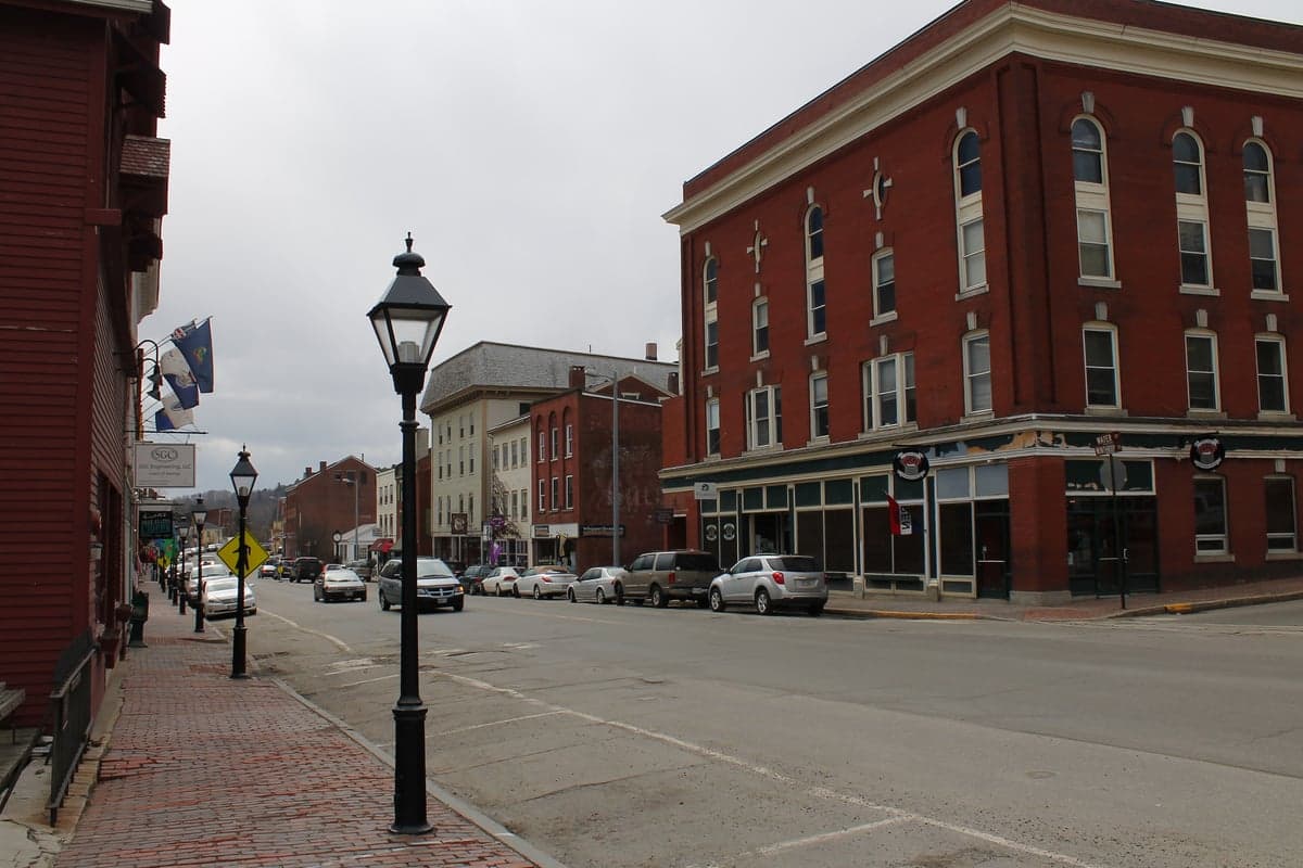
Hallowell, Maine, presents a mixed strategic picture for the conservative prepper or survivalist. While its small-town character and deep-water Kennebec River access offer some resilience advantages, its position in the state's most populous corridor and proximity to high-value infrastructure create significant vulnerabilities. The city's historic downtown, nestled on a steep riverbank, is charming but not built for modern security or self-sufficiency. For a relocator prioritizing low profile, defensible terrain, and distance from mass casualty triggers, Hallowell requires careful trade-off analysis rather than an automatic green light.
Geographic position and natural advantages for long-term survival
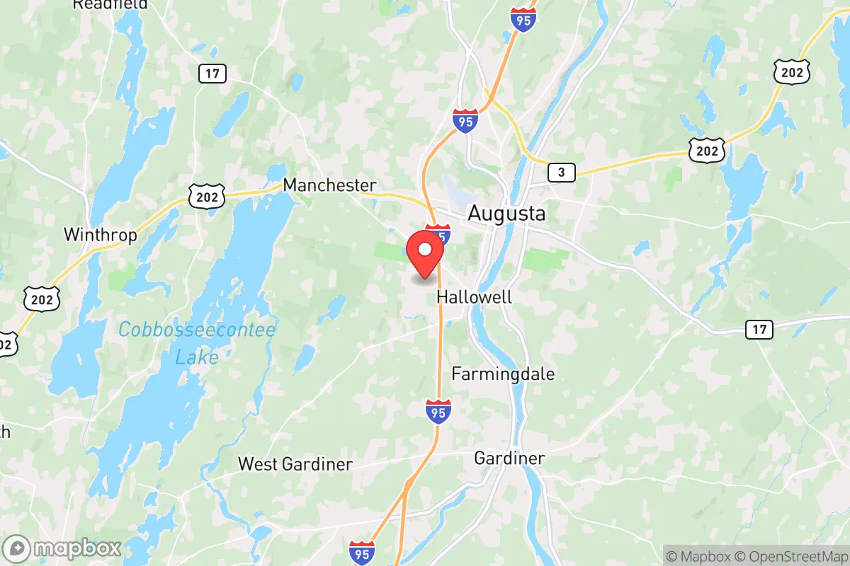
Hallowell sits on the west bank of the Kennebec River, roughly six miles south of the state capital Augusta and about 55 miles northeast of Portland. The immediate terrain is hilly and forested, with the river providing a natural barrier to the east and the rolling Maine woods to the west. The area's primary natural advantage is water: the Kennebec is a major, reliable freshwater source that does not depend on municipal infrastructure. The surrounding watershed is extensive, and the region receives roughly 42 inches of precipitation annually, making rainwater catchment viable. Soils in the Kennebec Valley are among the best in Maine for small-scale agriculture, with glacial till and river-deposited loam supporting gardens and orchards. The local growing season runs roughly from mid-May to late September, which is short but workable for cold-hardy crops like potatoes, kale, and root vegetables. The forest cover provides ample firewood, building material, and game—white-tailed deer, turkey, and small game are plentiful. However, the terrain is not defensible in a military sense; the river valley funnels movement, and the hills are gentle enough to be traversed on foot or ATV. A determined group could approach from multiple directions, and the dense tree line limits observation distance to a few hundred yards in most spots.
Risks, exposures, and proximity to fallout-relevant landmarks
Hallowell's biggest strategic liability is its location within the Interstate 95 corridor, the primary north-south artery through Maine. In a collapse scenario, this highway becomes a funnel for displaced populations moving away from Portland, Boston, and the New York megalopolis. Hallowell sits just off I-95 at Exit 109, making it a natural stopping point for anyone fleeing south or heading north to the less populated counties. The city is also only 6 miles from the Augusta State Airport and the Maine State Capitol complex—both potential targets for civil unrest or targeted strikes in a major conflict. The Bath Iron Works shipyard, a critical naval asset, is 25 miles south in Bath, and the Portsmouth Naval Shipyard is 75 miles south. Any major conflict involving the U.S. Navy puts these facilities on the target list, and Hallowell is within the fallout plume radius for a conventional or low-yield nuclear strike on either. The Maine Yankee nuclear waste storage site in Wiscasset, 30 miles south, is a long-term contamination risk if compromised. Natural hazards are less dramatic but real: the Kennebec floods regularly in spring, and the downtown area has experienced significant inundation events. Ice jams and rapid snowmelt can cut off river crossings, isolating Hallowell from the east side of the river. Winter storms are severe, with average snowfall around 70 inches, and power outages lasting a week or more are common after nor'easters.
Practical resilience for a relocator: food, water, energy, and defensibility
For a relocator looking to build a self-sufficient homestead, Hallowell's immediate area offers mixed prospects. The city itself is built on a steep slope with narrow streets and old wooden houses—not ideal for fortification or long-term storage. Most residential lots are small, under a quarter-acre, limiting garden space and livestock options. The real opportunity lies in the surrounding unincorporated townships and rural parcels west of the river, where land is cheaper and zoning is minimal. Water access is excellent if you own riverfront or have a well; the aquifer in the Kennebec Valley is productive, and most rural properties can drill a well at reasonable depth. Energy resilience is a challenge: the grid is vulnerable to ice storms, and solar potential is moderate due to winter cloud cover and low sun angle. A hybrid system with solar panels, a small wind turbine, and a wood stove is the most practical approach. Heating is almost entirely dependent on wood or oil; natural gas is not widely available outside Augusta. Food resilience requires serious planning. The growing season is short, and soil pH tends to be acidic, requiring amendment. Local agriculture is dominated by dairy and hay, not row crops. You will need to stockpile non-perishables, learn food preservation, and build relationships with local farmers for meat and eggs. The nearest major grocery is a Hannaford in Augusta, 10 minutes north, which would be stripped in hours during a panic. Defensibility is poor in town but improves significantly 10-15 miles west, where road density drops and terrain becomes more rugged. The Kennebec itself is a barrier that can be controlled at bridges, but there are multiple crossings within a 15-mile radius, making chokepoint defense difficult. The local population is aging and not particularly survival-oriented; most residents are liberal-leaning and dependent on state services, which could create friction in a prolonged crisis.
The overall strategic picture for Hallowell is one of moderate potential with high risk. It is not a bug-out destination for a family seeking remote, defensible, low-profile land. The proximity to Augusta, I-95, and critical infrastructure makes it a likely zone of conflict or displacement in a major event. However, for a relocator who is willing to live 15-20 minutes west of town on a rural parcel, the area offers reliable water, decent soil, and a climate that, while harsh, is survivable with proper preparation. The local economy is stable but not booming, with property taxes around 1.2% of assessed value and median home prices under $300,000—affordable by Northeast standards. The community is small (roughly 2,500 residents) and insular, which can be a double-edged sword: you will not be welcomed quickly, but once accepted, you gain a network of local knowledge. If your strategy is to live quietly, build a self-sufficient homestead, and avoid attention, the Hallowell area can work—but only if you buy land outside the city limits, invest heavily in off-grid infrastructure, and accept that you are within a 2-hour drive of multiple high-value targets. For a pure survivalist seeking isolation and defensibility, northern Maine or the western mountains offer a better risk profile. Hallowell is a compromise location: close enough to resources to be convenient in normal times, but close enough to danger to be problematic in bad ones.
* Values derived from national, state, county, city and local statistics and may differ in a specific area. Last updated: 2026-05-01T03:37:33.000Z
Narrative content on this page is AI-generated and may contain mistakes. Verify any details that matter before acting on them.
ReloMaps may earn a commission from affiliate links at no extra cost to you.