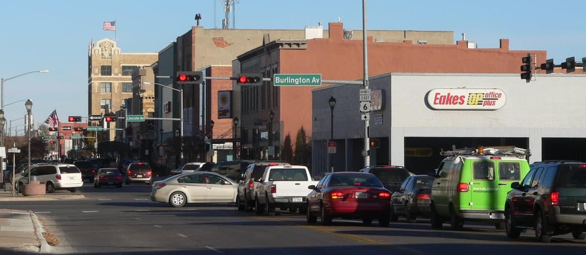
Photo: Wikipedia
Strategic Assessment of Hastings, NE
Strong survivability profile. Good buffer from population centers, with manageable environmental and tactical risks.
What does the Strategic Assessment tell us?
Our Strategic Assessment grades tactical survivability of an area. Major population centers, military targets, fallout zones, natural disasters, and border exposure all drive risk — lower exposure means a more defensible position in a crisis.
This is heavily inspired by Joel Skousen's Strategic Relocation book. Highly recommended you checkout the book ($)What does this tell us?
Our Strategic Assessment grades tactical survivability of an area. Major population centers, military targets, fallout zones, natural disasters, and border exposure all drive risk — lower exposure means a more defensible position in a crisis.
This is heavily inspired by Joel Skousen's Strategic Relocation book. Highly recommended you checkout the book ($)Strategic Pillars

Key Distances
Regional Safe Places
Below is our recommended "safe zones" in Nebraska and the surrounding area based on our strategic heuristics. For most people, it's unrealistic to live in a “safe zone” full-time due to work, family or other personal reasons. They tend to be more rural. However, many of these areas are perfect for second homes and retreat properties that double as a vacation home or even a short-term rental.
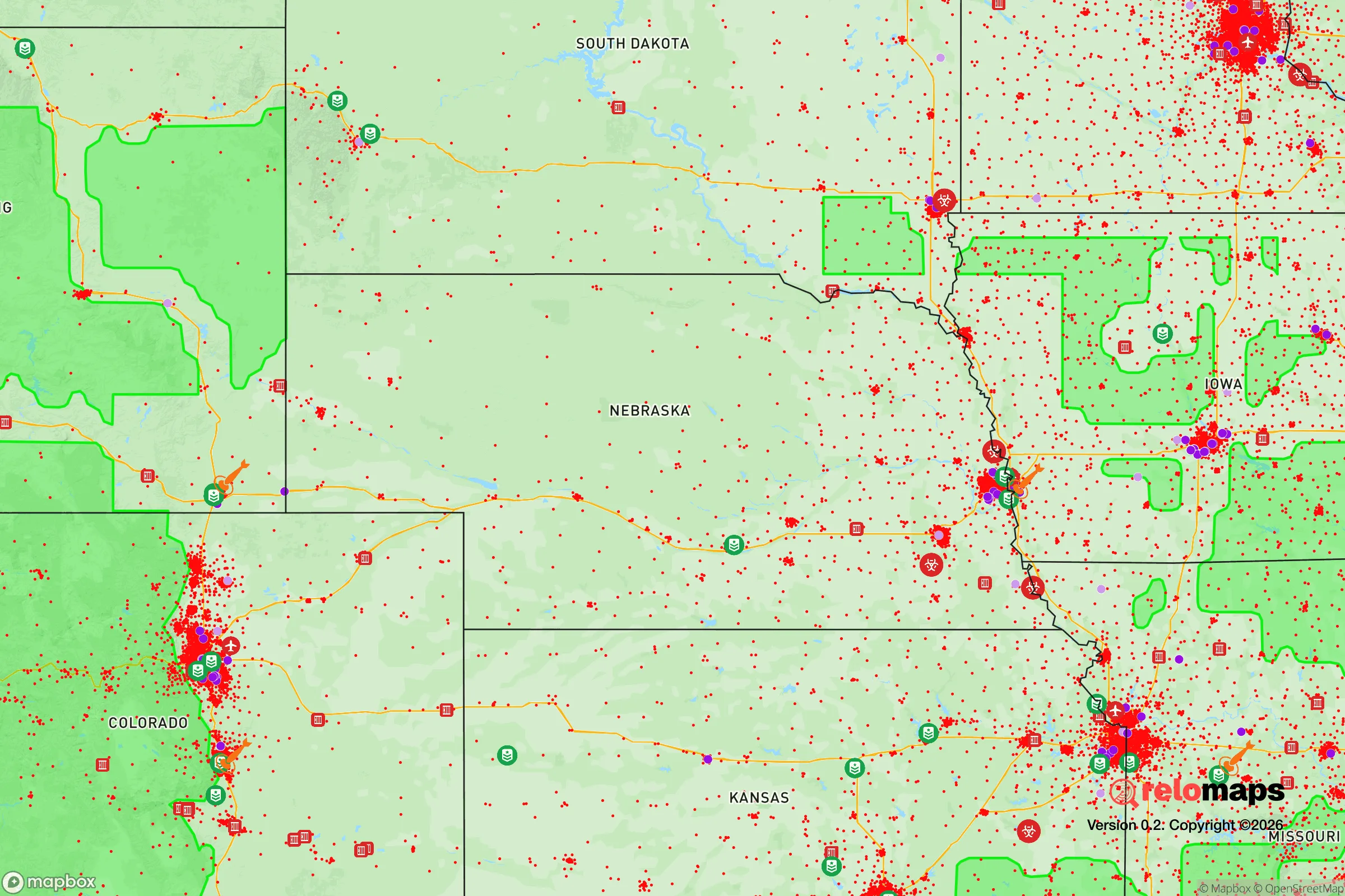
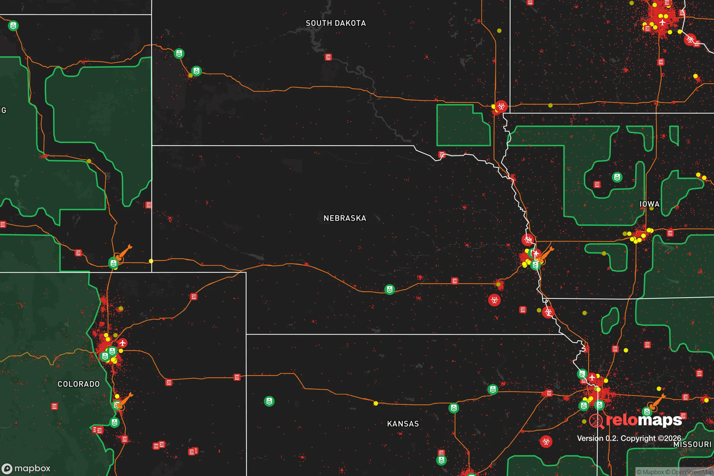
Important Note: For informational purposes only. This does not mean nothing bad ever happens in the green zones. Please use common sense. This is based on public data and modeled with AI. We tried to take a conservative approach but mistakes happen. We update this regularly as new information becomes available.
Solar Generator Recommendations
Backup power matters more here than in safer locations. We've picked three solar generators across budgets and capacity tiers — start with the budget unit if you only need a few essentials, or step up if you want to run a fridge and HVAC for days at a time.

Jackery Portable Power Station Explorer 300
Budget OptionPower on the Go: Weighing only 11 lbs, it's convenient to set up and store with book-sized foldable solar panels

BLUETTI Portable Power Station AC180
Designed for both indoor and outdoor scenarios, AC180 is highly capable as it has a robost capacity and continuous output power.

EF ECOFLOW DELTA Pro Ultra Power Station
Upgraded PickEcoFlow DELTA Pro Ultra is a whole-home energy system designed to grow with your family. Integrated with the Smart Home Panel 2, it scales to meet your evolving energy needs — keeping your home powered, intelligent, and secure through every stage of life.
We earn a commission, at no additional cost to you.
Strategic Assessment Analysis
Hastings, Nebraska, sits in a sweet spot that few relocators fully appreciate: far enough from the major metropolitan corridors to avoid the worst of cascading grid failures and civil unrest, yet close enough to the I-80 and I-135 junctions to maintain supply-chain access if the national grid holds. The city’s population hovers around 25,000, which is large enough to sustain a hospital, a regional airport, and multiple grocery distribution centers, but small enough that a determined community can still organize block-level mutual aid. For a conservative-leaning prepper looking at long-term resilience, Hastings offers a rare combination of agricultural self-sufficiency, low population density, and a political culture that still values local control over federal mandates.
Geographic position and natural advantages for long-term survival
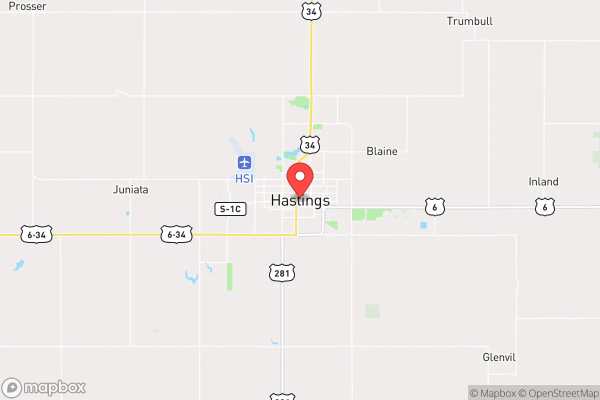
Hastings sits in south-central Nebraska, roughly 100 miles west of Lincoln and 150 miles west of Omaha. That distance matters. In a scenario where coastal supply chains collapse or major interstate corridors become chokepoints, Hastings is far enough inland to avoid the immediate ripple effects of port shutdowns or fuel shortages. The surrounding Adams County is flat, fertile, and irrigated by the Ogallala Aquifer, meaning the land itself can produce food without relying on fragile just-in-time delivery networks. The Platte River basin is about 20 miles north, providing a secondary water source if municipal wells are compromised. The area’s elevation (roughly 1,900 feet) and continental climate mean winters are cold enough to slow the spread of vector-borne diseases, but summers are warm enough for extended growing seasons with proper planning. The lack of major topographic barriers also means that, in a grid-down scenario, overland travel to and from Hastings is feasible with basic off-road capability—no mountain passes or river gorges to bottleneck movement.
Risks, exposures, and proximity to fallout-relevant landmarks
The most significant risk to Hastings is its proximity to the Offutt Air Force Base near Omaha, roughly 120 miles northeast. Offutt is a major command-and-control node for U.S. Strategic Command, making it a high-priority target in any peer-level conflict. While 120 miles provides some standoff from a direct ground-zero blast, prevailing winds from the west-northwest mean that fallout from a surface burst at Offutt could drift toward Hastings within 6–12 hours, depending on weather. The same logic applies to the Minuteman III silo fields scattered across western Nebraska and eastern Colorado; while Hastings is not directly in the primary target set, it sits within the secondary fallout zone for several silo complexes. On the plus side, Hastings has no military installations, no major defense contractors, and no critical infrastructure that would make it a first-wave target. The city’s rail yard and grain elevators are strategic assets, but they are not high-value enough to warrant a dedicated warhead. The real exposure is not direct attack but the secondary effects: refugees from Omaha and Lincoln fleeing westward along I-80, overwhelming local resources. In 2026, the city’s emergency management office has no formal plan for mass evacuation reception, so individual preppers should plan for self-sufficiency during the first 72 hours of any crisis.
Practical resilience for a relocator: food, water, energy, and defensibility
Hastings sits atop the Ogallala Aquifer, one of the largest freshwater reserves in North America. Municipal water comes from wells drawing from that aquifer, and the city’s water treatment plant has backup generator capacity for about 48 hours of continuous operation. For a relocator, this means that a deep well on private property (200–400 feet) can provide reliable water even if municipal systems fail. The surrounding farmland produces corn, soybeans, and wheat in abundance, and the local grain elevators store enough calories to feed the county for months—though access would depend on social organization, not market economics. The Hastings Regional Airport (HSI) has a 6,000-foot runway capable of handling C-130s and smaller cargo aircraft, which could be a lifeline for resupply if ground routes are compromised. Energy-wise, the city is served by the Nebraska Public Power District, which draws from a mix of coal, natural gas, and wind. The nearby Platte River provides hydroelectric capacity, but the grid is vulnerable to cyberattack and EMP. Solar panels with battery storage are a wise investment here; the area averages 220 sunny days per year, enough to keep a modest home running year-round. Defensibility is moderate. Hastings is laid out on a grid with wide streets and few natural chokepoints, which makes it hard to defend against a determined mob. However, the city’s low crime rate and strong community ties mean that organized neighborhood watch groups are already in place informally. The Adams County Sheriff’s Office has about 30 sworn deputies, and the Hastings Police Department maintains a SWAT team. In a prolonged crisis, the most defensible posture is a rural property within 10–15 miles of town, where you can maintain a low profile while still accessing the city’s resources.
The overall strategic picture for Hastings is cautiously optimistic. It is not a hardened bunker location, nor is it a remote mountain redoubt. What it offers is a realistic middle ground: a community-sized town with enough infrastructure to support a post-collapse recovery, located far enough from primary targets to avoid the worst of the initial shock, and surrounded by enough agricultural capacity to feed itself. The biggest vulnerability is the human factor—the potential for refugee flows from the east and the lack of formal contingency planning at the municipal level. For a relocator willing to invest in a well, solar panels, and a few acres of garden ground, Hastings provides a foundation that is both livable in normal times and survivable in bad ones. The local culture is still rooted in self-reliance, church networks, and neighborly obligation—values that tend to hold up better than government programs when the lights go out. If you are looking for a place that balances access to modern amenities with genuine preparedness potential, Hastings deserves a serious look.
* Values derived from national, state, county, city and local statistics and may differ in a specific area. Last updated: 2026-05-03T20:30:14.000Z
Narrative content on this page is AI-generated and may contain mistakes. Verify any details that matter before acting on them.
ReloMaps may earn a commission from affiliate links at no extra cost to you.