Photo: Wikipedia
Strategic Assessment of Hoover, AL
Meaningful friction. Expect exposure to either population pressure, blast zones, or natural disaster risk. Consider buying a retreat property.
What does the Strategic Assessment tell us?
Our Strategic Assessment grades tactical survivability of an area. Major population centers, military targets, fallout zones, natural disasters, and border exposure all drive risk — lower exposure means a more defensible position in a crisis.
This is heavily inspired by Joel Skousen's Strategic Relocation book. Highly recommended you checkout the book ($)What does this tell us?
Our Strategic Assessment grades tactical survivability of an area. Major population centers, military targets, fallout zones, natural disasters, and border exposure all drive risk — lower exposure means a more defensible position in a crisis.
This is heavily inspired by Joel Skousen's Strategic Relocation book. Highly recommended you checkout the book ($)Strategic Pillars

Key Distances
Regional Safe Places
Below is our recommended "safe zones" in Alabama and the surrounding area based on our strategic heuristics. For most people, it's unrealistic to live in a “safe zone” full-time due to work, family or other personal reasons. They tend to be more rural. However, many of these areas are perfect for second homes and retreat properties that double as a vacation home or even a short-term rental.
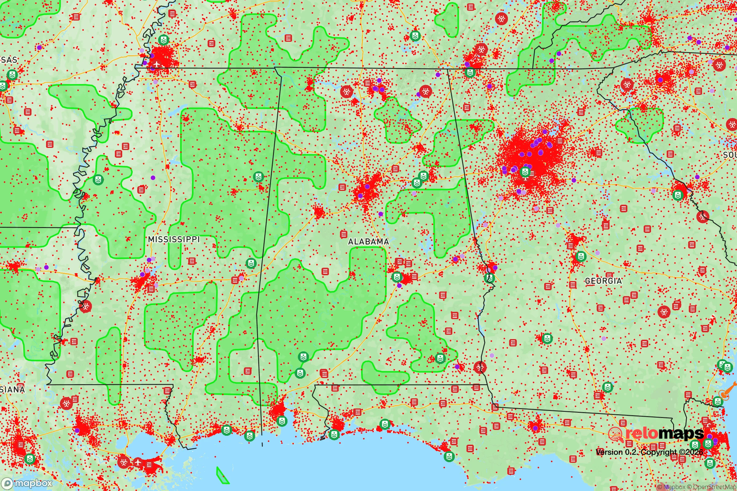
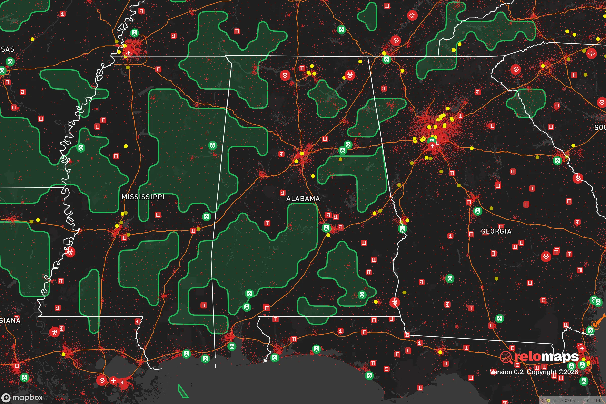
Important Note: For informational purposes only. This does not mean nothing bad ever happens in the green zones. Please use common sense. This is based on public data and modeled with AI. We tried to take a conservative approach but mistakes happen. We update this regularly as new information becomes available.
Solar Generator Recommendations
Backup power matters more here than in safer locations. We've picked three solar generators across budgets and capacity tiers — start with the budget unit if you only need a few essentials, or step up if you want to run a fridge and HVAC for days at a time.

Jackery Portable Power Station Explorer 300
Budget OptionPower on the Go: Weighing only 11 lbs, it's convenient to set up and store with book-sized foldable solar panels

BLUETTI Portable Power Station AC180
Designed for both indoor and outdoor scenarios, AC180 is highly capable as it has a robost capacity and continuous output power.

EF ECOFLOW DELTA Pro Ultra Power Station
Upgraded PickEcoFlow DELTA Pro Ultra is a whole-home energy system designed to grow with your family. Integrated with the Smart Home Panel 2, it scales to meet your evolving energy needs — keeping your home powered, intelligent, and secure through every stage of life.
We earn a commission, at no additional cost to you.
Strategic Assessment Analysis
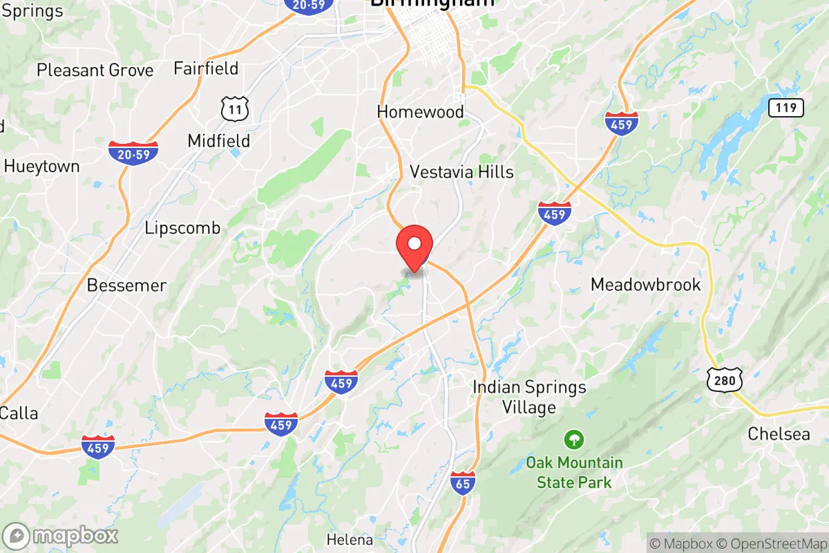
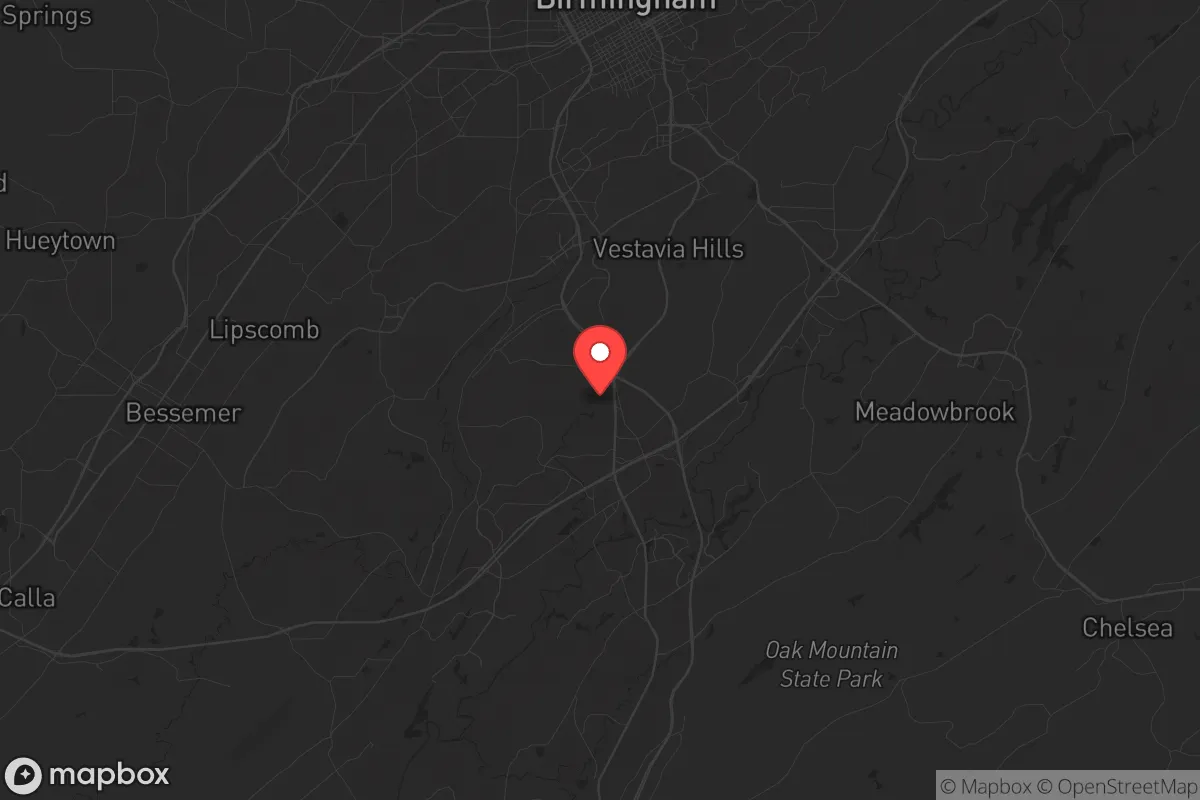
Hoover, Alabama, sits in a geographic sweet spot that offers genuine strategic depth for those thinking seriously about long-term resilience. Nestled just south of Birmingham along the I-65 corridor, the city benefits from the economic and logistical advantages of a major metro area while maintaining enough distance from the urban core to avoid the worst fallout of a crisis. The area’s topography—rolling hills, abundant groundwater, and a temperate climate—provides a natural buffer against both man-made and natural disruptions. For a relocator with a prepper mindset, Hoover represents a calculated balance: close enough to resources, far enough from the blast radius.
Geographic position and natural advantages for long-term security
Hoover’s location in the Ridge and Valley region of Alabama gives it a defensible terrain that flatland cities simply cannot match. The area is crisscrossed by ridges, hollows, and hardwood forests that break up sightlines and create natural chokepoints—useful if civil order ever degrades. The Cahaba River runs through the western edge of the city, providing a reliable surface water source that is less likely to be contaminated than the industrial rivers near Birmingham. The city sits at an elevation of roughly 600 feet, which is high enough to avoid flood risks from the Gulf Coast hurricane zones but low enough to avoid the severe winter weather that plagues the Appalachian spine. The local climate supports year-round gardening with a growing season of about 220 days, and the soil in the surrounding rural areas is workable for small-scale agriculture. For a relocator, this means you can realistically supplement food supplies from your own land within a single season. The area also has relatively low seismic risk and no active fault lines, which is a plus for infrastructure stability during a prolonged emergency.
Risks, exposures, and proximity to fallout-relevant landmarks
The most significant vulnerability for Hoover is its proximity to Birmingham, which sits just 12 miles north. Birmingham is a major transportation hub with an international airport, a large rail yard, and several chemical plants along the I-20/59 corridor. In a mass casualty event or a major infrastructure failure, the city could become a source of refugees, supply chain disruptions, or secondary hazards. The Birmingham metropolitan area also has a population density that could turn chaotic quickly if food or fuel supplies are cut. Additionally, Hoover itself is not immune to industrial risk: the city is within 30 miles of the Browns Ferry Nuclear Plant in Limestone County, which, while not a direct blast danger, could pose a contamination risk in a worst-case scenario. The prevailing winds in the region generally blow from the south and southwest, meaning fallout from a nuclear incident at Browns Ferry would likely drift toward the Tennessee border, not directly over Hoover—but that’s a statistical comfort, not a guarantee. The city also sits near the intersection of I-65 and I-459, which are major evacuation routes. In a crisis, these highways could become clogged or targeted. For a relocator, the key takeaway is that Hoover is not a remote bunker; it’s a suburban buffer zone. You need to have a plan for securing your perimeter and a secondary retreat location further south or east, such as into the Talladega National Forest or the rural counties around Clanton.
Practical resilience for a relocator: food, water, energy, and defensibility
Hoover’s suburban character actually works in its favor for practical prepping. The city has a robust municipal water system drawing from the Cahaba River and several deep wells, but the real advantage is the prevalence of private wells in the surrounding unincorporated areas. Many homes in the outlying parts of Hoover and adjacent communities like Helena and Pelham have access to groundwater that is less dependent on the grid. The local power grid is served by Alabama Power, which has a reputation for reliability but is still vulnerable to ice storms and cyberattacks. Solar is viable here—the region gets about 210 sunny days per year, which is enough for a modest off-grid setup if paired with battery storage. Food resilience is mixed: Hoover has multiple grocery chains, including Publix and Walmart, but in a prolonged disruption, those shelves will empty fast. The better bet is the local farmers’ markets and the network of small farms in Shelby County, which is one of the most agriculturally productive counties in the state. The city also has a strong hunting culture, with deer and turkey populations that are healthy in the surrounding woodlands. For defensibility, Hoover’s layout is a double-edged sword. The newer subdivisions are built with cul-de-sacs and winding roads that create natural security perimeters, but they also limit escape routes. The older parts of the city, near the Riverchase area, have more grid-like streets that are easier to patrol but harder to secure. A relocator should prioritize a property with a well, a southern exposure for solar, and at least two vehicle access points. The local gun culture is strong and legal—Alabama is a constitutional carry state—so you can expect neighbors to be armed and capable, which is a net positive for neighborhood watch dynamics.
Overall, Hoover offers a strategic position that is hard to beat in the Southeast for someone who wants to be prepared without living off the grid. The city’s economic base is diversified enough that it will likely recover faster than many other areas after a major disruption, and its natural resources are sufficient for a medium-term survival scenario. The biggest risks are the proximity to Birmingham and the vulnerability of the I-65 corridor, but those can be mitigated with a solid plan and a secondary location. For a conservative-minded relocator who values community, self-reliance, and a lower tax burden, Hoover is a strong candidate—just don’t expect it to be a fortress. It’s a place to build a life that can weather the storm, not a place to hide from it.
* Values derived from national, state, county, city and local statistics and may differ in a specific area. Last updated: 2026-04-19T18:54:25.000Z
Narrative content on this page is AI-generated and may contain mistakes. Verify any details that matter before acting on them.
ReloMaps may earn a commission from affiliate links at no extra cost to you.