Photo: Wikipedia
Strategic Assessment of Huntington, WV
Meaningful friction. Expect exposure to either population pressure, blast zones, or natural disaster risk. Consider buying a retreat property.
What does the Strategic Assessment tell us?
Our Strategic Assessment grades tactical survivability of an area. Major population centers, military targets, fallout zones, natural disasters, and border exposure all drive risk — lower exposure means a more defensible position in a crisis.
This is heavily inspired by Joel Skousen's Strategic Relocation book. Highly recommended you checkout the book ($)What does this tell us?
Our Strategic Assessment grades tactical survivability of an area. Major population centers, military targets, fallout zones, natural disasters, and border exposure all drive risk — lower exposure means a more defensible position in a crisis.
This is heavily inspired by Joel Skousen's Strategic Relocation book. Highly recommended you checkout the book ($)Strategic Pillars

Key Distances
Regional Safe Places
Below is our recommended "safe zones" in West Virginia and the surrounding area based on our strategic heuristics. For most people, it's unrealistic to live in a “safe zone” full-time due to work, family or other personal reasons. They tend to be more rural. However, many of these areas are perfect for second homes and retreat properties that double as a vacation home or even a short-term rental.


Important Note: For informational purposes only. This does not mean nothing bad ever happens in the green zones. Please use common sense. This is based on public data and modeled with AI. We tried to take a conservative approach but mistakes happen. We update this regularly as new information becomes available.
Solar Generator Recommendations
Backup power matters more here than in safer locations. We've picked three solar generators across budgets and capacity tiers — start with the budget unit if you only need a few essentials, or step up if you want to run a fridge and HVAC for days at a time.

Jackery Portable Power Station Explorer 300
Budget OptionPower on the Go: Weighing only 11 lbs, it's convenient to set up and store with book-sized foldable solar panels

BLUETTI Portable Power Station AC180
Designed for both indoor and outdoor scenarios, AC180 is highly capable as it has a robost capacity and continuous output power.

EF ECOFLOW DELTA Pro Ultra Power Station
Upgraded PickEcoFlow DELTA Pro Ultra is a whole-home energy system designed to grow with your family. Integrated with the Smart Home Panel 2, it scales to meet your evolving energy needs — keeping your home powered, intelligent, and secure through every stage of life.
We earn a commission, at no additional cost to you.
Strategic Assessment Analysis
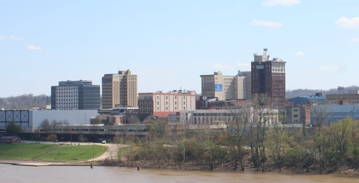
Huntington, West Virginia, offers a surprisingly resilient strategic position for those looking to step back from the chaos of major metropolitan areas while still maintaining access to critical infrastructure. Nestled in the western tip of the state along the Ohio River, this city of roughly 45,000 provides a buffer from the immediate fallout zones of the East Coast megalopolis, yet sits within a day's drive of multiple regional supply hubs. For the conservative prepper or survival-minded individual, Huntington’s combination of geographic isolation, industrial history, and Appalachian ruggedness makes it a viable base for long-term sustainability planning, provided you understand its specific vulnerabilities.
Geographic position and natural advantages for long-term security
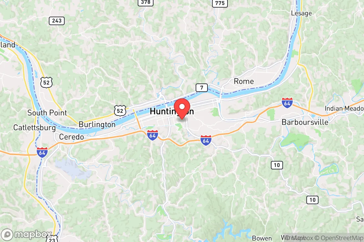
Huntington’s location at the confluence of the Ohio River and the Guyandotte River is its primary strategic asset. The Ohio River Valley provides a natural transportation corridor for bulk goods and water resources, but the city itself is tucked into a narrow valley flanked by the Appalachian foothills. This topography creates natural chokepoints—only a handful of major roads (I-64, US-52, and WV-2) lead into the area, making it easier to monitor and control access during civil unrest. The surrounding hills and hollows offer countless off-grid retreat opportunities within a 30-minute drive, where a family could establish a secondary cache or bug-out location with relative privacy. The region’s dense hardwood forests provide ample fuel for heating and cooking, and the local water table is generally reliable for well drilling, though you’ll want to test for acid mine drainage in certain areas. Huntington’s distance from major military targets is a notable plus: the nearest strategic bombing targets (Norfolk Naval Base, Washington D.C., or the Ohio-class submarine facilities in Kings Bay) are all over 400 miles away, significantly reducing the risk of direct nuclear fallout or conventional strike scenarios.
Risks, exposures, and proximity to fallout-relevant landmarks
No location is without risk, and Huntington has several exposure points that demand attention. The most immediate concern is the Ohio River itself: while a water source is an asset, the river also carries industrial traffic and is upstream from several chemical plants and aging locks and dams. A catastrophic failure at the Robert C. Byrd Lock and Dam (just downstream) or a spill from the Marathon Petroleum refinery in nearby Catlettsburg, Kentucky, could contaminate the water supply for weeks. Huntington is also within 100 miles of the Portsmouth Gaseous Diffusion Plant in Piketon, Ohio—a decommissioned uranium enrichment facility that still holds radioactive waste. While not an active target, a major earthquake along the New Madrid Seismic Zone (which has a 7-10% chance of a magnitude 7+ event in the next 50 years) could destabilize waste storage there. Closer to home, the city’s reliance on the I-64 corridor means that a major accident or intentional blockage at the I-64 bridge over the Ohio River could sever supply lines for days. For the prepper, these risks are manageable with proper planning—maintaining a 90-day food and water reserve, having a river-crossing alternative route (the Silver Memorial Bridge is a secondary option), and avoiding low-lying flood zones near the riverbanks.
Practical resilience for a relocator: food, water, energy, and defensibility
Huntington’s practical resilience for a relocator is mixed but workable. Food security is a strong point: the surrounding tri-state area (WV, KY, OH) has a robust agricultural base, with local farmers’ markets in Huntington, Ashland, and Ironton operating year-round. The West Virginia Department of Agriculture runs a “Farm to Food Bank” program that can be a resource for bulk purchasing. For long-term storage, the region’s cool, humid climate is suitable for root cellaring, and there are several Amish and Mennonite communities within an hour’s drive (around Gallipolis, Ohio) that sell bulk grains, seeds, and livestock. Water is the biggest vulnerability: Huntington draws its municipal water from the Ohio River, which is treated but could be compromised. A well on your property is ideal, but if you’re in the city limits, plan on a Berkey filter or similar system plus a 55-gallon drum rotation. Energy is a bright spot: West Virginia is a coal and natural gas state, and Huntington sits near the Marcellus Shale formation. While the grid is aging, the local utility (AEP) has a relatively stable record. For off-grid capability, solar is viable but expect only 4-5 peak sun hours per day in winter—supplement with a wood stove and a small generator. Defensibility is where Huntington shines: the city’s layout, with its hills and river bends, creates natural defensive positions. The old industrial buildings and rail yards can be repurposed as hardened shelters or supply depots. The local population is generally self-reliant and armed—West Virginia has some of the most permissive gun laws in the country, with no permit required for open or concealed carry. The downside is that Huntington has a higher-than-average crime rate (especially property crime), so a visible security posture is necessary, but the community is tight-knit and suspicious of outsiders, which can be an advantage in a collapse scenario.
The overall strategic picture for Huntington is that of a solid B-tier relocation option for the conservative prepper. It lacks the pristine isolation of Montana or the self-sufficiency of a rural Texas homestead, but it offers a realistic middle ground: close enough to supply chains and medical facilities (St. Mary’s Medical Center and Cabell Huntington Hospital are both Level II trauma centers) to be practical for daily life, yet far enough from the primary fallout zones to give you a fighting chance. The key is to treat Huntington as a base of operations rather than a final redoubt—establish a primary residence in the city or a nearby suburb like Barboursville or Ceredo, but secure a secondary property in the hills (think Wayne County or Lincoln County) with a well, septic, and solar array. The local culture is deeply conservative and community-oriented, which aligns with the mindset of mutual aid and neighborly defense. If you can handle the humidity, the occasional flood risk, and the reality that you’re still within a 2-hour drive of a major city (Charleston, WV), Huntington provides a defensible, resource-rich anchor point for weathering the coming storms.
* Values derived from national, state, county, city and local statistics and may differ in a specific area. Last updated: 2026-05-01T19:31:08.000Z
Narrative content on this page is AI-generated and may contain mistakes. Verify any details that matter before acting on them.
ReloMaps may earn a commission from affiliate links at no extra cost to you.