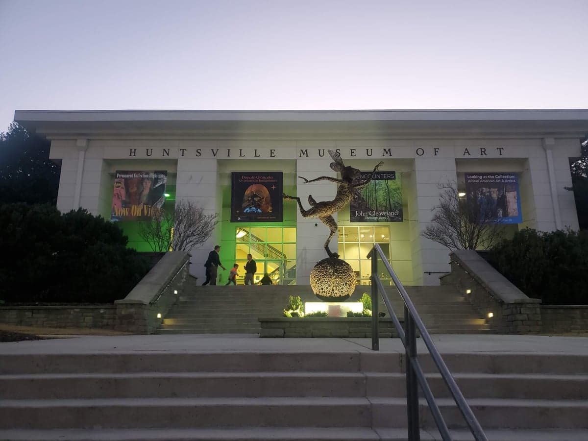
Photo: Wikipedia
Strategic Assessment of Huntsville, AL
Meaningful friction. Expect exposure to either population pressure, blast zones, or natural disaster risk. Consider buying a retreat property.
What does the Strategic Assessment tell us?
Our Strategic Assessment grades tactical survivability of an area. Major population centers, military targets, fallout zones, natural disasters, and border exposure all drive risk — lower exposure means a more defensible position in a crisis.
This is heavily inspired by Joel Skousen's Strategic Relocation book. Highly recommended you checkout the book ($)What does this tell us?
Our Strategic Assessment grades tactical survivability of an area. Major population centers, military targets, fallout zones, natural disasters, and border exposure all drive risk — lower exposure means a more defensible position in a crisis.
This is heavily inspired by Joel Skousen's Strategic Relocation book. Highly recommended you checkout the book ($)Strategic Pillars

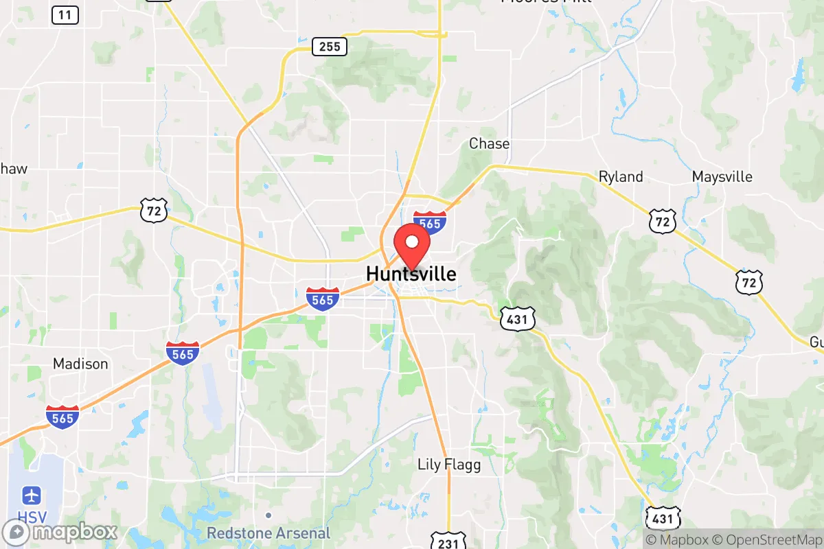
Key Distances
Regional Safe Places
Below is our recommended "safe zones" in Alabama and the surrounding area based on our strategic heuristics. For most people, it's unrealistic to live in a “safe zone” full-time due to work, family or other personal reasons. They tend to be more rural. However, many of these areas are perfect for second homes and retreat properties that double as a vacation home or even a short-term rental.
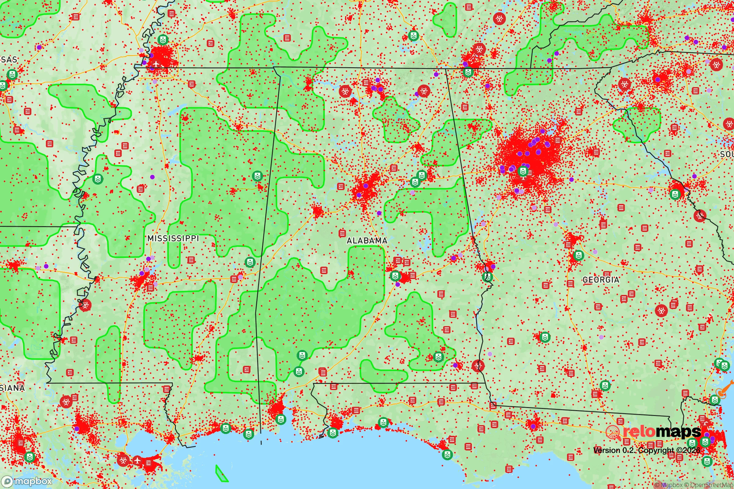
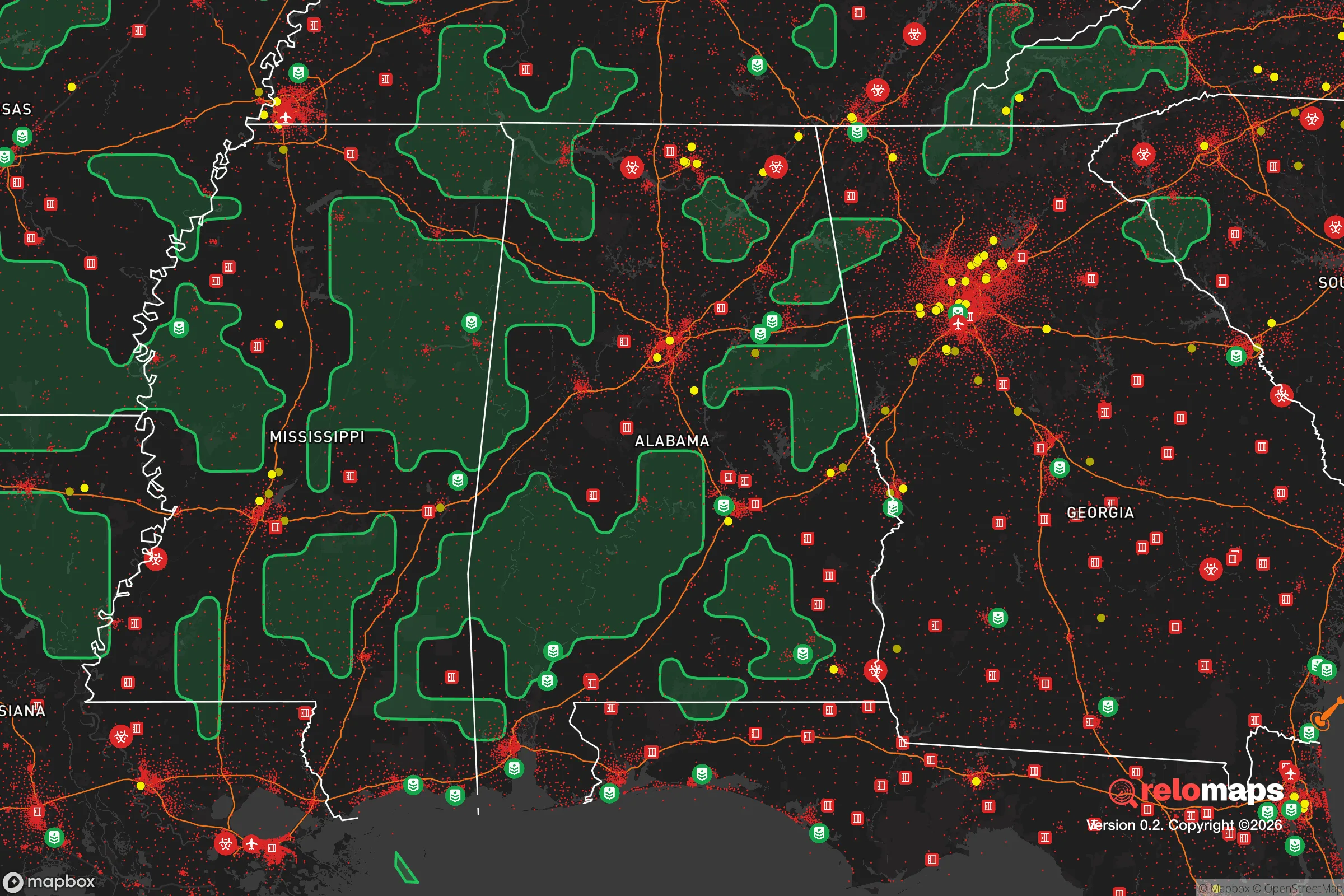
Important Note: For informational purposes only. This does not mean nothing bad ever happens in the green zones. Please use common sense. This is based on public data and modeled with AI. We tried to take a conservative approach but mistakes happen. We update this regularly as new information becomes available.
Solar Generator Recommendations
Backup power matters more here than in safer locations. We've picked three solar generators across budgets and capacity tiers — start with the budget unit if you only need a few essentials, or step up if you want to run a fridge and HVAC for days at a time.

Jackery Portable Power Station Explorer 300
Budget OptionPower on the Go: Weighing only 11 lbs, it's convenient to set up and store with book-sized foldable solar panels

BLUETTI Portable Power Station AC180
Designed for both indoor and outdoor scenarios, AC180 is highly capable as it has a robost capacity and continuous output power.

EF ECOFLOW DELTA Pro Ultra Power Station
Upgraded PickEcoFlow DELTA Pro Ultra is a whole-home energy system designed to grow with your family. Integrated with the Smart Home Panel 2, it scales to meet your evolving energy needs — keeping your home powered, intelligent, and secure through every stage of life.
We earn a commission, at no additional cost to you.
Strategic Assessment Analysis
Huntsville, Alabama, offers a compelling strategic position for those prioritizing resilience, combining a robust economic base with a geographic location that buffers it from the most acute risks facing other parts of the country. Its inland, elevated terrain in the Tennessee Valley provides natural advantages against coastal storm surges and seismic activity, while its distance from major metropolitan centers like Atlanta, Nashville, and Birmingham—each roughly 90–120 minutes away—reduces exposure to the cascading effects of urban unrest or infrastructure collapse. For a relocator with a prepper mindset, Huntsville presents a rare balance: a functioning city with deep institutional stability, yet one that remains off the primary vectors of national vulnerability.
Geographic position and natural advantages for long-term stability
Huntsville sits in the Appalachian foothills at an elevation of roughly 600–800 feet, placing it above floodplains and away from the hurricane-prone Gulf Coast, which is 350 miles south. The region’s geology is stable—no significant fault lines, no sinkhole-prone karst terrain like in parts of Florida or Tennessee, and minimal tornado risk compared to the Dixie Alley corridor further west. The Tennessee River, which flows just south of the city, provides a reliable freshwater source, while the surrounding Wheeler and Guntersville lakes offer both recreational utility and emergency water reserves. The climate is humid subtropical, with four distinct seasons; winters are mild enough to avoid prolonged freeze events that could cripple infrastructure, yet summers are not extreme enough to cause widespread heat-related failures. This moderate climate reduces the strain on power grids and agriculture, making the area more self-sufficient during supply chain disruptions. The local topography—rolling hills, forested ridges, and limestone bluffs—also offers natural defensibility, with numerous rural pockets within 20–30 minutes of downtown where a relocator could establish a more secluded homestead without sacrificing access to the city’s resources.
Risks, exposures, and proximity to fallout-relevant landmarks
No location is without risk, and Huntsville’s primary exposure stems from its own critical infrastructure. The city is home to Redstone Arsenal, a U.S. Army base that houses the Army Materiel Command, the Missile Defense Agency, and NASA’s Marshall Space Flight Center. This concentration of high-value military and aerospace assets makes Huntsville a potential target for state-level adversaries in a conflict scenario, though the risk of a direct kinetic strike on the continental U.S. remains low in the near term. More immediate concerns include the presence of the Tennessee Valley Authority’s (TVA) Browns Ferry Nuclear Plant, located 30 miles west in Athens, Alabama. While the plant has a strong safety record, any major incident—whether from sabotage, natural disaster, or grid failure—could necessitate evacuation of a 10-mile radius, which would include parts of western Madison County. Additionally, Huntsville’s proximity to Interstate 65, a major north-south corridor, means that during a national crisis, the city could see an influx of refugees from Nashville (120 miles north) or Birmingham (100 miles south), straining local resources. The city’s growth has also led to suburban sprawl along the I-565 corridor, creating choke points that could complicate evacuation or resupply during a grid-down event. For the prepper, the key is to locate in the more rural northern or eastern parts of the county, away from the Arsenal and the nuclear plant’s plume zone, while maintaining a low profile to avoid drawing attention during unrest.
Practical resilience for a relocator: food, water, energy, and defensibility
Huntsville’s practical resilience is strong, particularly for those willing to invest in off-grid capabilities. The region’s growing season runs from April to October, allowing for substantial home food production; the local soil, primarily clay-loam, is workable with raised beds or amendments, and the area has a thriving network of farmers’ markets, seed exchanges, and agricultural extension services through Alabama A&M University. Water is abundant—average annual rainfall is 54 inches, and the Tennessee River basin provides a deep aquifer. A well-drilled to 200–400 feet can yield 10–20 gallons per minute, sufficient for a household and small-scale irrigation. Rainwater catchment is also viable, with roof runoff from a 2,000-square-foot home yielding roughly 60,000 gallons per year. Energy-wise, Huntsville’s grid is served by TVA, which has a diversified mix of nuclear, hydro, coal, and natural gas, making it more stable than grids in Texas or California. However, for true resilience, solar with battery storage is practical—the area receives about 200 sunny days per year, and net metering is available through local utilities. Defensibility is a mixed picture: the city itself is a typical suburban environment with open layouts, but the surrounding rural areas offer properties with tree cover, natural barriers (creeks, ridges), and low population density. The local gun culture is strong, with numerous ranges and gun shops, and Alabama’s constitutional carry law (effective 2022) means no permit is required for concealed carry, which aligns with a self-reliant mindset. The community is also tight-knit, with a high proportion of military and aerospace professionals who tend to be organized, disciplined, and prepared—a social asset during any crisis.
The overall strategic picture for Huntsville is that of a high-functioning secondary city with genuine resilience advantages, but one that requires deliberate positioning to mitigate its unique risks. Its economic stability—driven by federal defense and aerospace spending—means it is less likely to experience the kind of rapid decline seen in rust-belt or single-industry towns, and its educated, civically engaged population provides a social buffer against chaos. However, the presence of Redstone Arsenal and Browns Ferry means that a relocator must choose their specific location carefully, favoring the northern and eastern exurbs (e.g., New Market, Gurley, or Grant) over the western suburbs closer to the nuclear plant. For the conservative-leaning prepper, Huntsville offers a rare combination: a functioning city with jobs, schools, and healthcare, yet within 30 minutes of land where you can live off-grid, raise food, and keep a low profile. It is not a bug-out location in the wilderness sense, but rather a strategic base of operations—a place where you can maintain a normal life while being ready for the abnormal. If the goal is to be prepared for civic unrest or mass casualty events without retreating to a remote cabin, Huntsville is one of the better bets in the Southeast.
* Values derived from national, state, county, city and local statistics and may differ in a specific area. Last updated: 2026-04-19T18:55:52.000Z
Narrative content on this page is AI-generated and may contain mistakes. Verify any details that matter before acting on them.
ReloMaps may earn a commission from affiliate links at no extra cost to you.