

Photo: Wikipedia
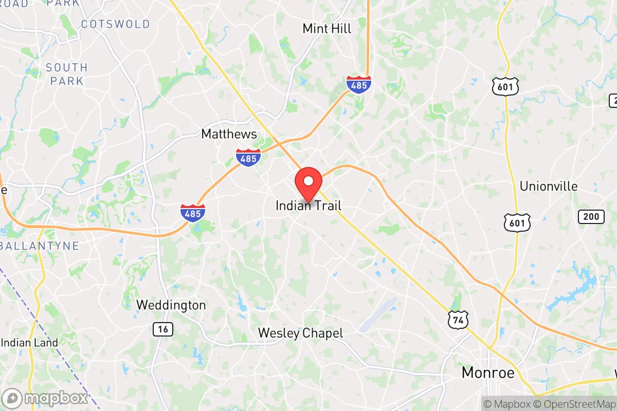
Strategic Assessment of Indian Trail, NC
Multiple tactical vulnerabilities. Population density, target proximity, or disaster risk are likely compounding. A retreat property and exit planning is required.
What does the Strategic Assessment tell us?
Our Strategic Assessment grades tactical survivability of an area. Major population centers, military targets, fallout zones, natural disasters, and border exposure all drive risk — lower exposure means a more defensible position in a crisis.
This is heavily inspired by Joel Skousen's Strategic Relocation book. Highly recommended you checkout the book ($)What does this tell us?
Our Strategic Assessment grades tactical survivability of an area. Major population centers, military targets, fallout zones, natural disasters, and border exposure all drive risk — lower exposure means a more defensible position in a crisis.
This is heavily inspired by Joel Skousen's Strategic Relocation book. Highly recommended you checkout the book ($)Strategic Pillars

Key Distances
Regional Safe Places
Below is our recommended "safe zones" in North Carolina and the surrounding area based on our strategic heuristics. For most people, it's unrealistic to live in a “safe zone” full-time due to work, family or other personal reasons. They tend to be more rural. However, many of these areas are perfect for second homes and retreat properties that double as a vacation home or even a short-term rental.


Important Note: For informational purposes only. This does not mean nothing bad ever happens in the green zones. Please use common sense. This is based on public data and modeled with AI. We tried to take a conservative approach but mistakes happen. We update this regularly as new information becomes available.
Solar Generator Recommendations
Backup power matters more here than in safer locations. We've picked three solar generators across budgets and capacity tiers — start with the budget unit if you only need a few essentials, or step up if you want to run a fridge and HVAC for days at a time.

Jackery Portable Power Station Explorer 300
Budget OptionPower on the Go: Weighing only 11 lbs, it's convenient to set up and store with book-sized foldable solar panels

BLUETTI Portable Power Station AC180
Designed for both indoor and outdoor scenarios, AC180 is highly capable as it has a robost capacity and continuous output power.

EF ECOFLOW DELTA Pro Ultra Power Station
Upgraded PickEcoFlow DELTA Pro Ultra is a whole-home energy system designed to grow with your family. Integrated with the Smart Home Panel 2, it scales to meet your evolving energy needs — keeping your home powered, intelligent, and secure through every stage of life.
We earn a commission, at no additional cost to you.
Strategic Assessment Analysis
Indian Trail, North Carolina, presents a mixed bag for the strategic relocator. Its rapid growth and suburban sprawl offer a veneer of normalcy, but a closer look reveals a location that is simultaneously positioned for resilience and dangerously exposed. For the conservative prepper or survivalist, this town is less a bunker and more a forward operating base—close enough to the chaos of a major metropolitan area to be affected by it, yet far enough to offer a fighting chance if you have a plan. The key is understanding that Indian Trail's advantages are logistical, not defensive; its resilience depends entirely on your ability to leverage its position before the balloon goes up.
Geographic position and natural advantages for long-term stability
Indian Trail sits in Union County, roughly 25 miles southeast of Charlotte. This places it in the Piedmont region, a zone of rolling hills and clay soils that is generally less prone to the catastrophic natural disasters that plague other parts of the country. You are not in hurricane alley's direct strike zone, nor are you on a major fault line. The area's elevation, around 600-700 feet, provides decent drainage and reduces the risk of the kind of catastrophic flooding seen in coastal or river-bottom communities. The climate is temperate, with four distinct seasons, meaning you can grow food for a good portion of the year, but you'll also need to deal with occasional ice storms and summer heat that can stress power grids. The real natural advantage here is the abundant freshwater supply from the Catawba River basin and numerous smaller creeks and ponds. For a relocator, this means well water is a viable option, and surface water sources are plentiful if you know where to look. The land itself is not a fortress, but it is a workable canvas for a self-sufficient setup, provided you secure a property with a good well and some acreage away from the densest subdivisions.
Risks, exposures, and proximity to fallout-relevant landmarks
This is where the analysis gets sobering. Indian Trail's greatest liability is its proximity to Charlotte, a major financial hub and transportation nexus. In a scenario of civic unrest, mass casualty events, or a coordinated attack, Charlotte is a high-value target. The city is home to Bank of America's global headquarters, a major airport (CLT) that is a hub for American Airlines, and a significant rail and interstate junction (I-85, I-77). Any of these could be a primary or secondary target. The fallout from a major event in Charlotte—whether from a dirty bomb, a cyberattack on the financial system that triggers panic, or a conventional attack on infrastructure—will ripple outward. Indian Trail is close enough that you will see the effects: refugees fleeing the city, supply chain disruptions hitting local stores, and potential law enforcement diversion away from the suburbs. Furthermore, the town itself is a bedroom community with limited industrial or agricultural self-sufficiency. It relies on just-in-time delivery for food, fuel, and medicine. A prolonged grid-down scenario or a major supply chain interruption would empty grocery shelves within 72 hours. The area also has a nuclear power plant, the Catawba Nuclear Station, located about 30 miles southwest near Lake Wylie. While the plant is well-regulated, it is a fixed point of concern for any prepper. A major incident there, however unlikely, would complicate an evacuation or relocation plan. The proximity to Charlotte also means that Indian Trail is on the path of any large-scale evacuation, making major roads like I-485 and US-74 potential chokepoints that could become impassable.
Practical resilience for a relocator: food, water, energy, and defensibility
For the individual or family looking to establish a resilient foothold, Indian Trail requires a proactive, not passive, approach. Water is the first and most critical factor. Municipal water in the area comes from the Catawba River, which is vulnerable to contamination or disruption. A property with a tested, deep well is non-negotiable. You should also have a plan for hand-pumping or a solar-powered pump, as grid power is not reliable in a crisis. Food security is a challenge due to the suburban nature of most lots. HOA restrictions are common and can be hostile to visible food production, livestock, or even clotheslines. You will need to either find a property outside of an HOA or be prepared to operate a discreet, high-yield garden (raised beds, vertical gardening) and consider indoor growing options like hydroponics. Local soil is clay-heavy and acidic, requiring amendment for serious agriculture. Energy resilience is achievable. The area gets good sun, making solar panels a viable investment. Pairing solar with battery storage and a backup generator (propane or diesel) is the standard for a prepared household. Wood heat is also a solid option, as firewood is relatively available in the rural parts of the county. Defensibility is the weakest link. Indian Trail is a sprawling suburb with many ingress and egress points. It is not a defensible position in the military sense. Your security will be at the household level: a well-built home with reinforced doors, good visibility from the street, and a neighborhood watch that is actually prepared to act. The best strategy is to be a gray man—low profile, well-stocked, and capable of hunkering down while the chaos passes. The local law enforcement presence (Union County Sheriff's Office) is generally competent and conservative-leaning, but they will be overwhelmed in a major event. Do not rely on them for your personal security.
The overall strategic picture for Indian Trail is one of calculated risk. It is not a remote retreat, nor is it a hardened survivalist compound. It is a suburban buffer zone that offers a decent quality of life during normal times and a fighting chance during a crisis, provided you have done the work. The town's growth is a double-edged sword: it brings amenities and a strong tax base, but also increases density and dependency on fragile supply chains. For the conservative relocator who values community, proximity to work, and a lower cost of living compared to the Northeast or West Coast, Indian Trail can work. But you must treat it as a location to be hardened, not a location that is inherently safe. Your plan should include a 72-hour bug-out bag for a rapid evacuation (if Charlotte becomes a hot zone), a 30-day supply of food and water for sheltering in place, and a long-term strategy for self-sufficiency that includes alternative energy, water, and food production. If you can secure a property with a well, some land, and no HOA, Indian Trail is a viable base of operations. If you are buying a cookie-cutter house on a quarter-acre lot with a homeowners association, you are simply renting a spot in a fragile system. Choose accordingly.
* Values derived from national, state, county, city and local statistics and may differ in a specific area. Last updated: 2026-05-03T20:25:34.000Z
Narrative content on this page is AI-generated and may contain mistakes. Verify any details that matter before acting on them.
ReloMaps may earn a commission from affiliate links at no extra cost to you.