
Photo: Wikipedia
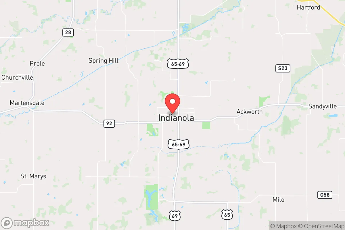
Strategic Assessment of Indianola, IA
Workable tactical position. Some exposure to population density or targets, but generally defensible in a crisis.
What does the Strategic Assessment tell us?
Our Strategic Assessment grades tactical survivability of an area. Major population centers, military targets, fallout zones, natural disasters, and border exposure all drive risk — lower exposure means a more defensible position in a crisis.
This is heavily inspired by Joel Skousen's Strategic Relocation book. Highly recommended you checkout the book ($)What does this tell us?
Our Strategic Assessment grades tactical survivability of an area. Major population centers, military targets, fallout zones, natural disasters, and border exposure all drive risk — lower exposure means a more defensible position in a crisis.
This is heavily inspired by Joel Skousen's Strategic Relocation book. Highly recommended you checkout the book ($)Strategic Pillars

Key Distances
Regional Safe Places
Below is our recommended "safe zones" in Iowa and the surrounding area based on our strategic heuristics. For most people, it's unrealistic to live in a “safe zone” full-time due to work, family or other personal reasons. They tend to be more rural. However, many of these areas are perfect for second homes and retreat properties that double as a vacation home or even a short-term rental.


Important Note: For informational purposes only. This does not mean nothing bad ever happens in the green zones. Please use common sense. This is based on public data and modeled with AI. We tried to take a conservative approach but mistakes happen. We update this regularly as new information becomes available.
Solar Generator Recommendations
Backup power matters more here than in safer locations. We've picked three solar generators across budgets and capacity tiers — start with the budget unit if you only need a few essentials, or step up if you want to run a fridge and HVAC for days at a time.

Jackery Portable Power Station Explorer 300
Budget OptionPower on the Go: Weighing only 11 lbs, it's convenient to set up and store with book-sized foldable solar panels

BLUETTI Portable Power Station AC180
Designed for both indoor and outdoor scenarios, AC180 is highly capable as it has a robost capacity and continuous output power.

EF ECOFLOW DELTA Pro Ultra Power Station
Upgraded PickEcoFlow DELTA Pro Ultra is a whole-home energy system designed to grow with your family. Integrated with the Smart Home Panel 2, it scales to meet your evolving energy needs — keeping your home powered, intelligent, and secure through every stage of life.
We earn a commission, at no additional cost to you.
Strategic Assessment Analysis
Indianola, Iowa, sits in a sweet spot that few relocation guides talk about: close enough to Des Moines to tap into its resources, but far enough to avoid being caught in the blast radius—literal or figurative—when things go sideways. This Warren County seat of roughly 16,000 people offers a blend of agricultural self-sufficiency, low crime, and a politically conservative population that values preparedness, making it a strong candidate for those looking to weather civic unrest, economic collapse, or natural disasters. The town’s resilience isn’t just theoretical—it’s baked into its geography, infrastructure, and community mindset.
Geographic position and natural advantages for long-term stability
Indianola’s location is its first line of defense. It sits about 12 miles south of Des Moines, placing it outside the immediate chaos of a major metropolitan area while still within a reasonable drive for supply runs or medical care. The surrounding Warren County is predominantly rural, with rolling farmland, scattered woodlots, and a low population density—roughly 100 people per square mile compared to Des Moines’ 2,500. This buffer zone means that in a crisis, you’re not competing with millions for food, fuel, or escape routes. The terrain is flat to gently rolling, which is ideal for small-scale agriculture, livestock, and rainwater catchment. The area sits atop the Dakota Aquifer, a massive underground water source that’s less vulnerable to surface contamination than the shallow wells found in many Midwestern towns. For a relocator thinking in decades, not just months, that’s a critical advantage. The climate is temperate—hot summers, cold winters—but without the extreme drought or flood risks that plague the coasts or the Plains. Tornadoes are a real threat, but Indianola’s position in central Iowa puts it in a lower-risk zone than the notorious “Tornado Alley” farther west. The town itself is built on high ground, with no major floodplains in the immediate area, so you’re not worrying about your basement filling up every spring.
Risks, exposures, and proximity to fallout-relevant landmarks
No location is perfect, and Indianola has its share of vulnerabilities. The most obvious is its proximity to Des Moines, which is home to roughly 700,000 people in the metro area. In a major civil unrest scenario—think food shortages, grid collapse, or a pandemic—that population could become a liability. Refugees, looters, or simply desperate people will flow south along Highway 65/69, the main artery connecting Indianola to the capital. The town itself is not defensible in a military sense; it’s a grid of streets with no natural barriers like rivers or hills to funnel traffic. You’d need to rely on community networks and local law enforcement, which is small—Warren County has about 30 deputies for the entire county. On the fallout front, there’s no nuclear power plant within 100 miles, but Des Moines does have a major rail hub and an interstate highway system that could be a target for sabotage or attack. The nearest significant military installation is Camp Dodge in Johnston, about 20 miles north of Des Moines—close enough that a strike on it could send fallout drifting south. More realistically, the biggest risk is economic: Indianola’s economy is tied to agriculture, Simpson College, and a few manufacturing plants. A prolonged recession or supply chain collapse would hit hard, though the town’s self-sufficiency would soften the blow compared to a city dependent on imports. For the prepper, the key takeaway is that Indianola is not a fortress—it’s a community that requires active participation in its defense and resilience.
Practical resilience for a relocator: food, water, energy, and defensibility
For someone serious about self-reliance, Indianola offers a solid foundation. The soil is rich—Iowa’s famous black loam—and the growing season runs from April to October, long enough for corn, beans, squash, and most vegetables. Warren County has a strong network of local farmers, and the Warren County Farmers Market operates from May to October, giving you a chance to build relationships before a crisis hits. Water is abundant: the average annual rainfall is about 35 inches, and the aquifer is deep and clean. A simple hand pump or solar-powered well can keep you hydrated even if the grid goes down. Energy is trickier. The local grid is reliable day-to-day, but Iowa’s wind farms—there are several within 50 miles—mean that in a prolonged outage, you’re competing with industrial users for backup power. Solar is a good bet; the area gets about 200 sunny days per year, enough for a modest off-grid setup. Natural gas is available in town, but rural properties rely on propane or heating oil, which require storage and delivery. Defensibility is where Indianola shines for the prepared relocator. The town itself is not a fortress, but the surrounding countryside offers plenty of options: farmhouses with clear sightlines, gravel roads that are easy to block, and neighbors who are likely armed and conservative. Warren County has a strong gun culture—there are multiple shooting ranges and gun shops within 20 miles—and the local sheriff’s office is known for being pro-Second Amendment. For a single individual or family, buying a few acres outside of town (prices are still reasonable, around $5,000–$10,000 per acre) gives you space for a garden, a root cellar, and a defensible perimeter. The biggest practical weakness is medical care. Indianola has a small hospital, MercyOne, but it’s a critical-access facility with limited trauma capability. For serious injuries or chronic conditions, you’re looking at a 30-minute drive to Des Moines, which could be a problem if the roads are blocked or the city is in chaos. Stockpiling antibiotics, first-aid supplies, and learning basic emergency medicine is non-negotiable here.
The overall strategic picture for Indianola is one of calculated trade-offs. It’s not a remote bunker in the mountains—you’re still within striking distance of a major city and its associated risks. But for the conservative relocator who wants to stay connected to civilization while maintaining a high degree of self-sufficiency, it’s a strong bet. The community is stable, the land is productive, and the political climate is aligned with preparedness values. The key is to act now—buy land, dig a well, plant a garden, and get to know your neighbors before the next crisis hits. Indianola won’t save you from everything, but it gives you a fighting chance, which is more than most places can offer.
* Values derived from national, state, county, city and local statistics and may differ in a specific area. Last updated: 2026-04-29T22:47:03.000Z
Narrative content on this page is AI-generated and may contain mistakes. Verify any details that matter before acting on them.
ReloMaps may earn a commission from affiliate links at no extra cost to you.