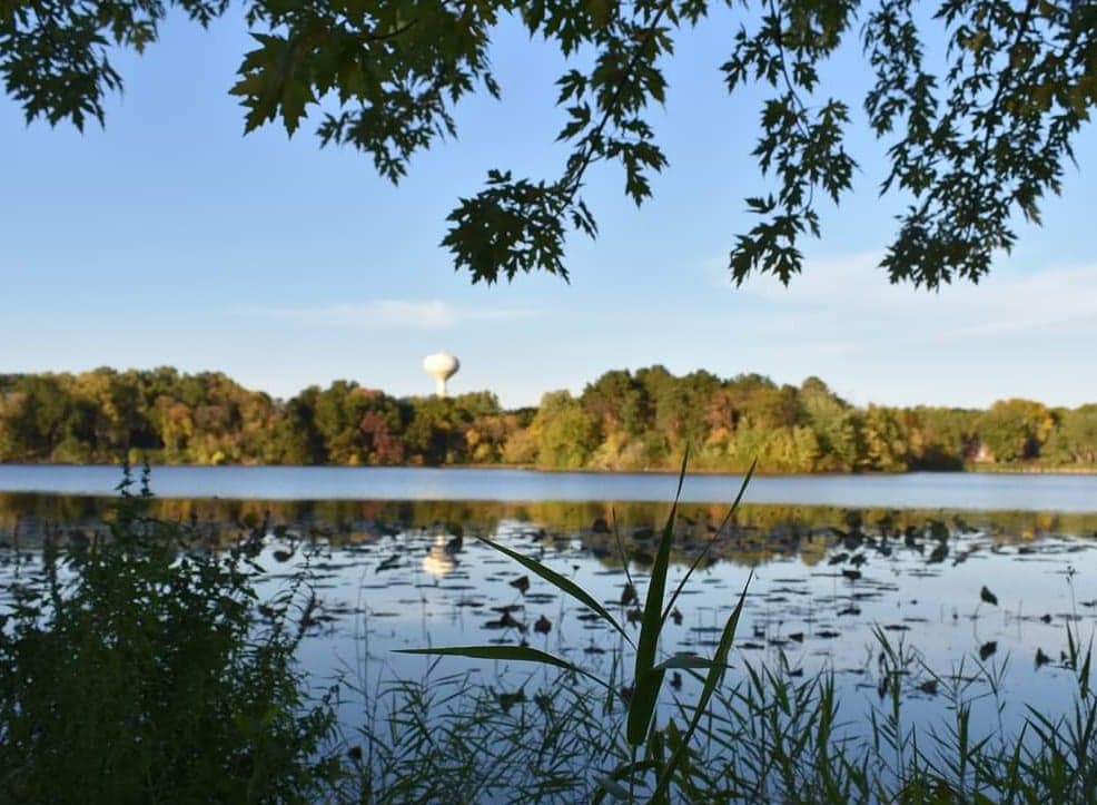
Photo: Wikipedia
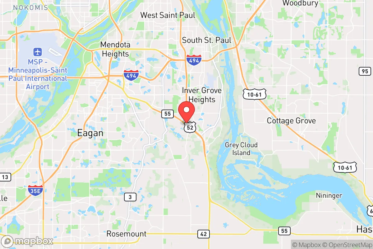
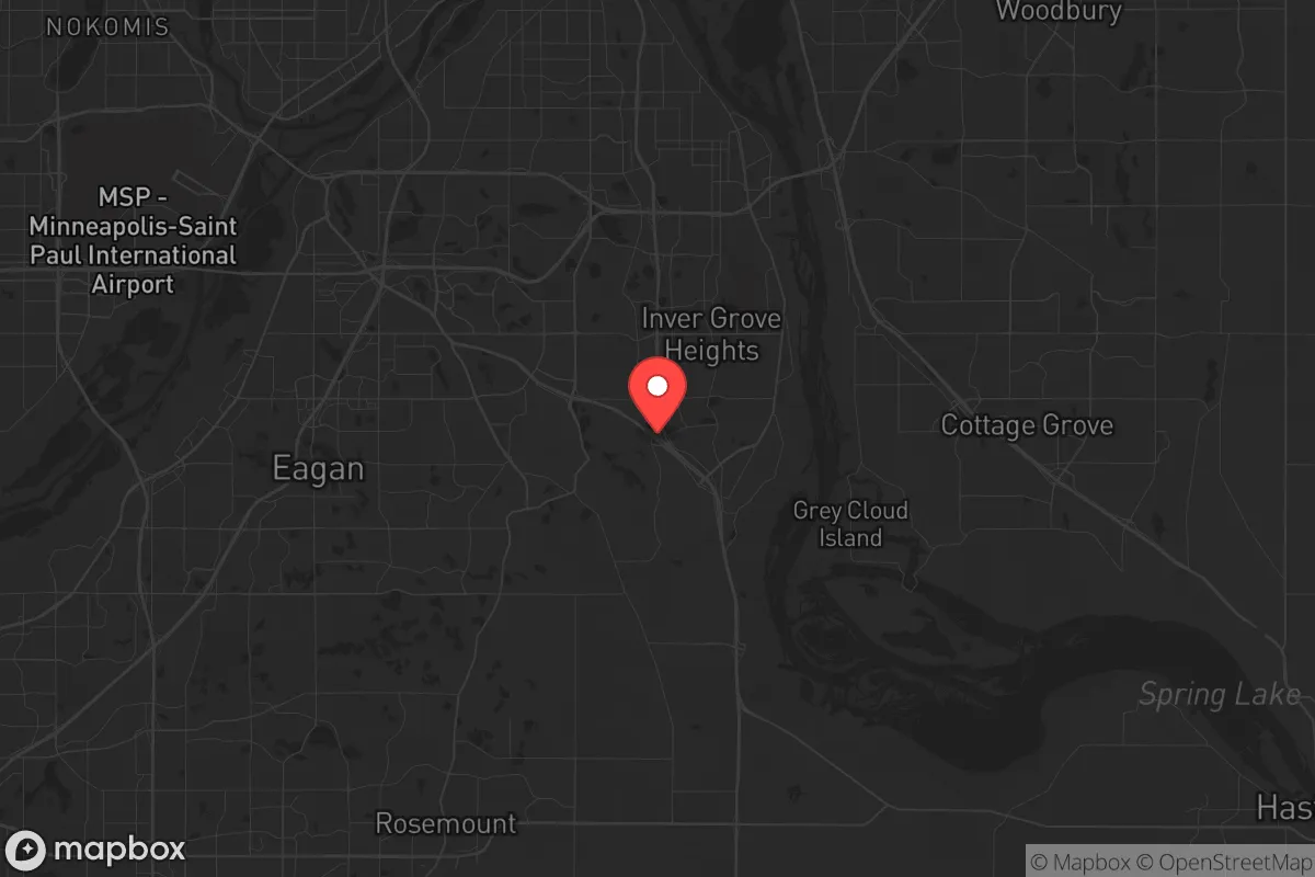
Strategic Assessment of Inver Grove Heights, MN
Meaningful friction. Expect exposure to either population pressure, blast zones, or natural disaster risk. Consider buying a retreat property.
What does the Strategic Assessment tell us?
Our Strategic Assessment grades tactical survivability of an area. Major population centers, military targets, fallout zones, natural disasters, and border exposure all drive risk — lower exposure means a more defensible position in a crisis.
This is heavily inspired by Joel Skousen's Strategic Relocation book. Highly recommended you checkout the book ($)What does this tell us?
Our Strategic Assessment grades tactical survivability of an area. Major population centers, military targets, fallout zones, natural disasters, and border exposure all drive risk — lower exposure means a more defensible position in a crisis.
This is heavily inspired by Joel Skousen's Strategic Relocation book. Highly recommended you checkout the book ($)Strategic Pillars

Key Distances
Regional Safe Places
Below is our recommended "safe zones" in Minnesota and the surrounding area based on our strategic heuristics. For most people, it's unrealistic to live in a “safe zone” full-time due to work, family or other personal reasons. They tend to be more rural. However, many of these areas are perfect for second homes and retreat properties that double as a vacation home or even a short-term rental.


Important Note: For informational purposes only. This does not mean nothing bad ever happens in the green zones. Please use common sense. This is based on public data and modeled with AI. We tried to take a conservative approach but mistakes happen. We update this regularly as new information becomes available.
Solar Generator Recommendations
Backup power matters more here than in safer locations. We've picked three solar generators across budgets and capacity tiers — start with the budget unit if you only need a few essentials, or step up if you want to run a fridge and HVAC for days at a time.

Jackery Portable Power Station Explorer 300
Budget OptionPower on the Go: Weighing only 11 lbs, it's convenient to set up and store with book-sized foldable solar panels

BLUETTI Portable Power Station AC180
Designed for both indoor and outdoor scenarios, AC180 is highly capable as it has a robost capacity and continuous output power.

EF ECOFLOW DELTA Pro Ultra Power Station
Upgraded PickEcoFlow DELTA Pro Ultra is a whole-home energy system designed to grow with your family. Integrated with the Smart Home Panel 2, it scales to meet your evolving energy needs — keeping your home powered, intelligent, and secure through every stage of life.
We earn a commission, at no additional cost to you.
Strategic Assessment Analysis
Inver Grove Heights, Minnesota, occupies a strategic but precarious position for those prioritizing resilience and preparedness. Located roughly 10 miles southeast of downtown St. Paul along the Mississippi River, this suburban city of about 36,000 offers a mix of river bluffs, agricultural land, and suburban infrastructure that can support a self-sufficient lifestyle—but only if you understand its vulnerabilities. The area’s proximity to the Twin Cities metropolitan area is a double-edged sword: it provides access to resources and supply chains, but it also places you within the fallout zone of a major population center that would be a primary target for civil unrest, infrastructure collapse, or a mass casualty event. For the conservative-minded relocator who views the current national trajectory with concern, Inver Grove Heights is a location that demands careful trade-off analysis rather than blind optimism.
Geographic position and natural advantages for long-term survival
Inver Grove Heights sits on the bluffs overlooking the Mississippi River, giving it a natural elevation advantage over flood-prone areas downstream. The city’s topography includes steep ravines and wooded corridors that offer defensible terrain and visual screening from main roads. The Mississippi River itself is a double-edged asset: it provides a reliable water source for filtration and irrigation, but it also serves as a potential vector for contamination or unwanted traffic during a crisis. The surrounding Dakota County is predominantly agricultural, with corn and soybean fields within a 15-minute drive, meaning local food production is feasible if supply chains break down. The region’s four-season climate—cold winters and humid summers—requires robust preparation for heating, water freezing, and crop storage, but it also discourages casual migration from warmer regions. The city’s position along Highway 52 and Interstate 494 gives quick access to regional logistics hubs, but those same roads would become choke points during an evacuation or civil unrest scenario. For a relocator, the key advantage is the ability to blend suburban anonymity with rural-adjacent resources, provided you secure a property with well water, septic, and defensible sightlines.
Risks, exposures, and proximity to fallout-relevant landmarks
The most significant risk for Inver Grove Heights is its location within the Twin Cities metropolitan statistical area, which houses over 3.6 million people. In a mass casualty event—whether from a coordinated attack, pandemic, or economic collapse—this population density would create cascading failures in healthcare, law enforcement, and food distribution. The city is within 20 miles of the Minneapolis–St. Paul International Airport (MSP), a high-value target for any adversary, and within 30 miles of the Xcel Energy nuclear plant in Monticello, Minnesota. While the Monticello plant is upriver and upwind in prevailing conditions, a catastrophic release could still affect the region depending on weather patterns. Additionally, the Mississippi River corridor is a natural transportation route that could be used by hostile actors or refugees moving through the area. The city’s own infrastructure—including a wastewater treatment plant and electrical substations along the river—are potential points of failure. For the prepper, the proximity to these landmarks means you must plan for evacuation routes that avoid major highways and bridges, and you should assume that local law enforcement will be overwhelmed within hours of a major event. The city’s relatively low crime rate (violent crime is about 60% of the national average) is a positive, but it reflects peacetime conditions, not crisis resilience.
Practical resilience for a relocator: food, water, energy, and defensibility
For a relocator serious about self-sufficiency, Inver Grove Heights offers a mixed bag. The city’s water supply comes from the Mississippi River, treated by the St. Paul Regional Water Services—a centralized system that would be vulnerable to contamination or disruption. A well-equipped property with a private well and a backup hand pump is essential; the local water table is accessible at depths of 50–150 feet in most areas, but drilling permits and costs vary. Food resilience is more promising: the surrounding farmland means you can establish relationships with local farmers for direct purchasing, and the city’s zoning allows for backyard chickens and small livestock on lots of sufficient size. Community gardens exist but are limited; you’ll want to secure a property with at least a quarter-acre for serious food production. Energy resilience is a weak point: the grid is reliable in peacetime but is part of the MISO interconnection, which has faced strain during extreme weather events. Solar panels with battery storage are viable given the region’s 4.5 peak sun hours per day in summer, but winter production drops significantly. A backup generator with a 500-gallon propane tank is a practical investment. Defensibility is moderate: the bluffs and ravines provide natural barriers, but the suburban layout with cul-de-sacs and interconnected streets makes it hard to control access points. A property on a dead-end road near the river bluffs offers the best balance of seclusion and escape routes. The city’s police force is well-funded (about $2.5 million annual budget per 10,000 residents), but in a crisis, they will prioritize the downtown core and major arteries, leaving outlying neighborhoods to fend for themselves.
The overall strategic picture for Inver Grove Heights is one of calculated risk. It is not a remote survivalist retreat—you are still within the gravitational pull of a major metropolitan area that would be a focal point for chaos. But for the relocator who wants to maintain a professional career or family ties in the Twin Cities while building a resilient homestead, it offers a viable middle ground. The key is to treat the city as a base of operations rather than a final redoubt: secure a property with independent water, energy, and food systems, establish relationships with rural suppliers in Dakota County, and have a pre-planned bug-out route to the less populated areas of southeastern Minnesota or western Wisconsin. The conservative prepper mindset here is not about isolation but about layered preparedness—knowing that the city’s conveniences are temporary and that your survival depends on your ability to disconnect from the grid and the population when the situation demands it. Inver Grove Heights is a place to live strategically, not to hide, and that requires constant vigilance and investment in your own infrastructure. If you are willing to do the work, it can be a solid anchor in an uncertain future. If you are looking for a turnkey retreat, look farther north or west.
* Values derived from national, state, county, city and local statistics and may differ in a specific area. Last updated: 2026-04-24T11:39:36.000Z
Narrative content on this page is AI-generated and may contain mistakes. Verify any details that matter before acting on them.
ReloMaps may earn a commission from affiliate links at no extra cost to you.