Photo: Wikipedia
Strategic Assessment of Jacksboro, TX
Workable tactical position. Some exposure to population density or targets, but generally defensible in a crisis.
What does the Strategic Assessment tell us?
Our Strategic Assessment grades tactical survivability of an area. Major population centers, military targets, fallout zones, natural disasters, and border exposure all drive risk — lower exposure means a more defensible position in a crisis.
This is heavily inspired by Joel Skousen's Strategic Relocation book. Highly recommended you checkout the book ($)What does this tell us?
Our Strategic Assessment grades tactical survivability of an area. Major population centers, military targets, fallout zones, natural disasters, and border exposure all drive risk — lower exposure means a more defensible position in a crisis.
This is heavily inspired by Joel Skousen's Strategic Relocation book. Highly recommended you checkout the book ($)Strategic Pillars

Key Distances
Regional Safe Places
Below is our recommended "safe zones" in Texas and the surrounding area based on our strategic heuristics. For most people, it's unrealistic to live in a “safe zone” full-time due to work, family or other personal reasons. They tend to be more rural. However, many of these areas are perfect for second homes and retreat properties that double as a vacation home or even a short-term rental.


Important Note: For informational purposes only. This does not mean nothing bad ever happens in the green zones. Please use common sense. This is based on public data and modeled with AI. We tried to take a conservative approach but mistakes happen. We update this regularly as new information becomes available.
Solar Generator Recommendations
Backup power matters more here than in safer locations. We've picked three solar generators across budgets and capacity tiers — start with the budget unit if you only need a few essentials, or step up if you want to run a fridge and HVAC for days at a time.

Jackery Portable Power Station Explorer 300
Budget OptionPower on the Go: Weighing only 11 lbs, it's convenient to set up and store with book-sized foldable solar panels

BLUETTI Portable Power Station AC180
Designed for both indoor and outdoor scenarios, AC180 is highly capable as it has a robost capacity and continuous output power.

EF ECOFLOW DELTA Pro Ultra Power Station
Upgraded PickEcoFlow DELTA Pro Ultra is a whole-home energy system designed to grow with your family. Integrated with the Smart Home Panel 2, it scales to meet your evolving energy needs — keeping your home powered, intelligent, and secure through every stage of life.
We earn a commission, at no additional cost to you.
Strategic Assessment Analysis
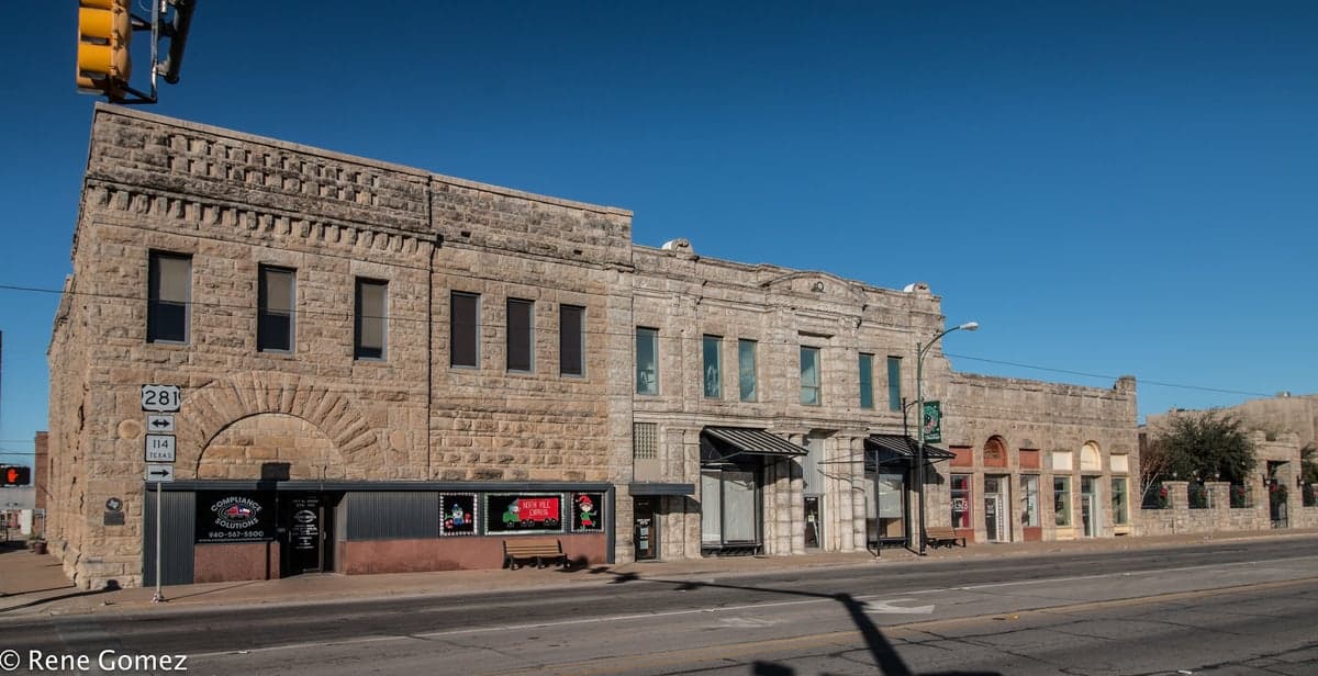
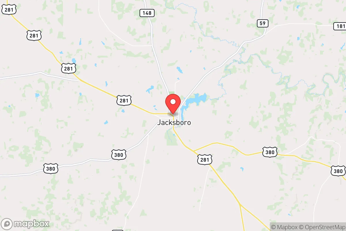
Jacksboro, Texas, sits in a strategic sweet spot that resilience-minded relocators should take seriously: far enough from major metro chaos to avoid the worst of civic unrest or fallout, yet close enough to access critical supplies and medical infrastructure when things are stable. Located in Jack County, roughly 60 miles northwest of Fort Worth and 90 miles from the Dallas-Fort Worth metroplex, this town of about 4,500 people offers a buffer zone that many preppers and conservative families are actively seeking. The area's position along U.S. Highway 281 and State Highway 148 provides reliable evacuation routes north toward Oklahoma or west into the sparsely populated ranchlands, while the surrounding terrain—rolling hills, limestone bluffs, and the nearby LBJ National Grasslands—offers natural cover and resource potential that flatland communities simply cannot match.
Geographic position and natural advantages for long-term security
Jacksboro's location is its primary strategic asset. The town sits on the edge of the Cross Timbers region, a transitional zone between the blackland prairies and the western plains, which means diverse ecosystems and more reliable water sources than areas further west. The LBJ National Grasslands, just 15 miles east, covers over 20,000 acres of public land that can serve as a buffer zone, hunting ground, and emergency resource area—though relocators should note that federal land management can shift unpredictably. The nearby Brazos River and its tributaries, including the West Fork of the Trinity River, provide surface water options that are rare in much of Texas, and the area's average annual rainfall of about 32 inches supports decent well yields and garden viability. For those concerned with EMP or grid-down scenarios, the rural topography means fewer high-tension power lines and substations within immediate blast radius, and the limestone bedrock offers natural shielding for underground structures. The town's elevation—around 1,100 feet—also reduces flood risk compared to communities along the major river bottoms, while still sitting high enough to avoid the worst of Texas summer heat extremes.
Risks, exposures, and proximity to fallout-relevant landmarks
No location is perfect, and Jacksboro has specific vulnerabilities that a serious prepper must weigh. The most obvious concern is proximity to the Dallas-Fort Worth metroplex, which at 60-90 miles puts Jacksboro within the outer ring of any major urban evacuation or fallout plume from a WMD or industrial disaster. The DFW area contains multiple chemical plants, refineries, and the Pantex nuclear weapons assembly plant near Amarillo is roughly 250 miles northwest—close enough that prevailing winds from the south-southwest could carry fallout toward Jacksboro in a worst-case scenario. Additionally, U.S. Highway 281 is a primary evacuation route from Fort Worth, meaning that during any major crisis, this road could become clogged with refugees, creating security and supply-chain problems. The town itself has no major hospital—the nearest full-service facility is in Graham, about 20 miles west—and the local police force is small, so relocators should not expect rapid emergency response in a widespread event. Tornado risk is moderate, with Jack County averaging 3-5 tornado warnings per year, and the area sits in the western edge of "Tornado Alley," so storm shelters are a wise investment. Wildfire risk is low to moderate due to the mixed grass and woodland terrain, but drought years can elevate that threat.
Practical resilience for a relocator: food, water, energy, and defensibility
For a family or individual serious about self-sufficiency, Jacksboro offers a workable baseline that requires deliberate upgrades. Water is the most critical factor: the area's groundwater is generally good quality, with wells typically producing 10-30 gallons per minute at depths of 100-300 feet, though new well permits require testing and can take 60-90 days to process. The city water system draws from Lake Jacksboro, a 300-acre reservoir that provides decent capacity but is vulnerable to drought and contamination—so a private well or rainwater catchment system is non-negotiable for long-term resilience. Food production is viable: the growing season runs 230-240 days, and the sandy loam soils support gardens, orchards, and small livestock operations, though deer and feral hogs can be persistent pests. Local hunting is excellent—white-tailed deer, turkey, and wild hogs are abundant on both public and private land—and the LBJ Grasslands allow limited hunting with a permit. Energy resilience is mixed: the local electric cooperative, United Cooperative Services, has a decent reliability record but is still tied to the ERCOT grid, which has proven fragile during winter storms. Solar potential is good, with an average of 5.5 peak sun hours per day, and many rural properties already have propane tanks for backup heating and cooking. Defensibility is solid for a small town: the terrain offers natural choke points along the river valleys and ridge lines, and the low population density means fewer potential threats. However, the town's layout—a compact downtown with spread-out subdivisions—means that perimeter security is challenging without a coordinated neighborhood watch or mutual-aid group. Property prices remain affordable, with median home values around $180,000 and acreage parcels available for $3,000-$6,000 per acre, making it feasible to buy a defensible homestead with good sightlines and multiple access points.
The overall strategic picture for Jacksboro is one of cautious optimism for the prepared relocator. It is not a hardened bunker location—it lacks the extreme isolation of far West Texas or the deep woods of East Texas—but it offers a realistic balance of accessibility, resources, and buffer from urban collapse. The key trade-off is proximity to DFW: close enough to benefit from its economic and medical infrastructure during normal times, but close enough to be affected by its crises. For a conservative-leaning family that wants to be part of a small, self-reliant community with decent farmland, reliable water, and a conservative political culture (Jack County voted +78 for Trump in 2020), Jacksboro is a strong candidate. The smart move is to buy land with a good well, install solar with battery backup, build a storm shelter, and establish relationships with local ranchers and farmers before any crisis hits. The town itself has a functional hardware store, a grocery store, and a few local suppliers, but serious preppers will want to stockpile ammunition, medical supplies, and long-term food storage well in advance. Jacksboro won't save you from a direct hit, but it gives you a fighting chance in the kind of slow-burn collapse that many are quietly preparing for.
* Values derived from national, state, county, city and local statistics and may differ in a specific area. Last updated: 2026-05-23T03:37:43.000Z
Narrative content on this page is AI-generated and may contain mistakes. Verify any details that matter before acting on them.
ReloMaps may earn a commission from affiliate links at no extra cost to you.