Photo: Wikipedia
Strategic Assessment of Johnston, IA
Meaningful friction. Expect exposure to either population pressure, blast zones, or natural disaster risk. Consider buying a retreat property.
What does the Strategic Assessment tell us?
Our Strategic Assessment grades tactical survivability of an area. Major population centers, military targets, fallout zones, natural disasters, and border exposure all drive risk — lower exposure means a more defensible position in a crisis.
This is heavily inspired by Joel Skousen's Strategic Relocation book. Highly recommended you checkout the book ($)What does this tell us?
Our Strategic Assessment grades tactical survivability of an area. Major population centers, military targets, fallout zones, natural disasters, and border exposure all drive risk — lower exposure means a more defensible position in a crisis.
This is heavily inspired by Joel Skousen's Strategic Relocation book. Highly recommended you checkout the book ($)Strategic Pillars

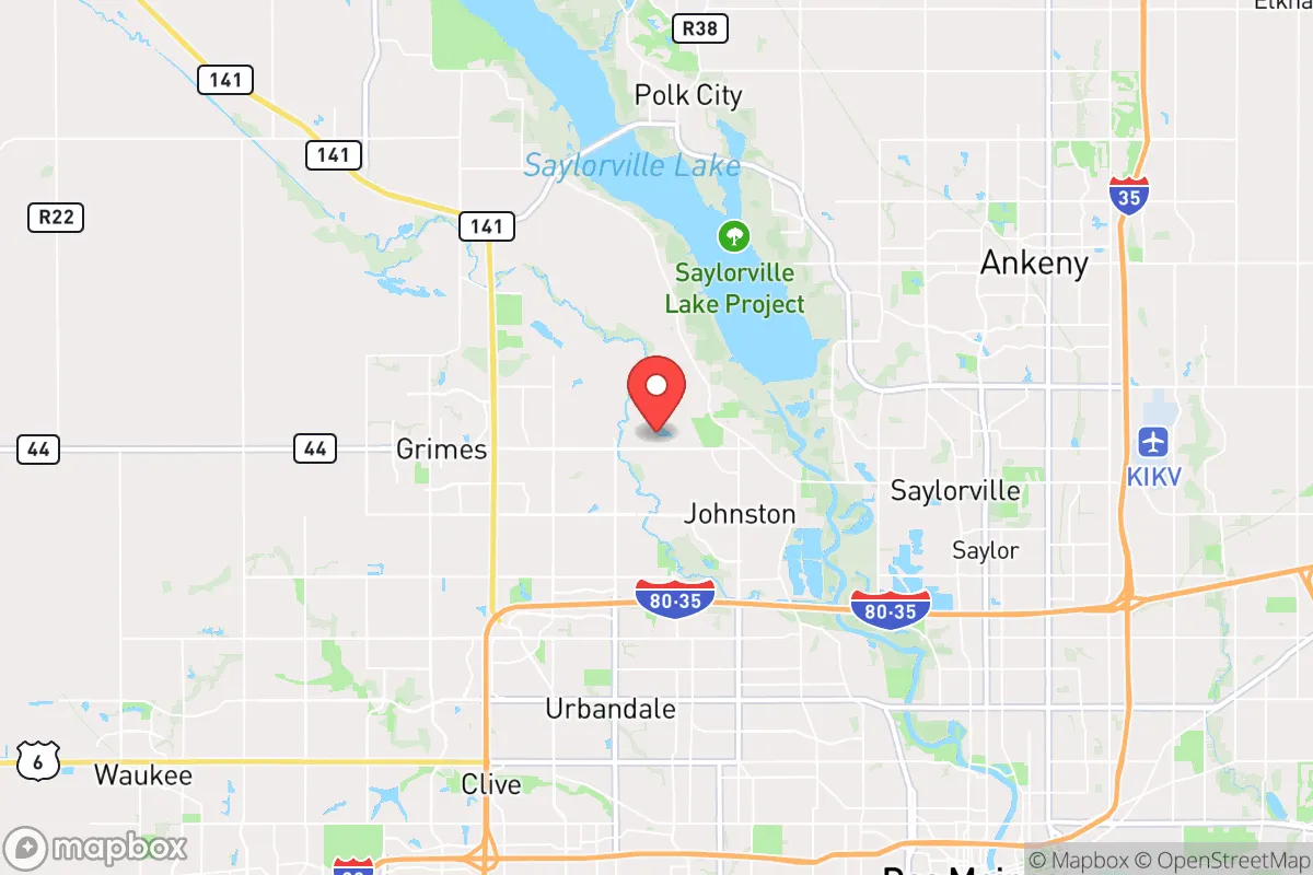
Key Distances
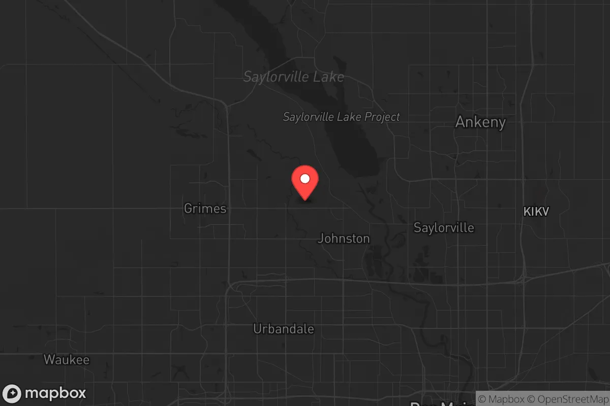
Regional Safe Places
Below is our recommended "safe zones" in Iowa and the surrounding area based on our strategic heuristics. For most people, it's unrealistic to live in a “safe zone” full-time due to work, family or other personal reasons. They tend to be more rural. However, many of these areas are perfect for second homes and retreat properties that double as a vacation home or even a short-term rental.


Important Note: For informational purposes only. This does not mean nothing bad ever happens in the green zones. Please use common sense. This is based on public data and modeled with AI. We tried to take a conservative approach but mistakes happen. We update this regularly as new information becomes available.
Solar Generator Recommendations
Backup power matters more here than in safer locations. We've picked three solar generators across budgets and capacity tiers — start with the budget unit if you only need a few essentials, or step up if you want to run a fridge and HVAC for days at a time.

Jackery Portable Power Station Explorer 300
Budget OptionPower on the Go: Weighing only 11 lbs, it's convenient to set up and store with book-sized foldable solar panels

BLUETTI Portable Power Station AC180
Designed for both indoor and outdoor scenarios, AC180 is highly capable as it has a robost capacity and continuous output power.

EF ECOFLOW DELTA Pro Ultra Power Station
Upgraded PickEcoFlow DELTA Pro Ultra is a whole-home energy system designed to grow with your family. Integrated with the Smart Home Panel 2, it scales to meet your evolving energy needs — keeping your home powered, intelligent, and secure through every stage of life.
We earn a commission, at no additional cost to you.
Strategic Assessment Analysis
Johnston, Iowa, sits in a deceptive sweet spot: close enough to Des Moines to tap into its economic and logistical backbone, yet far enough to avoid being swallowed by the worst of its urban chaos. For a relocator thinking in terms of strategic depth, this suburb of roughly 25,000 offers a rare combination of institutional stability, agricultural self-sufficiency, and low natural hazard risk. The city’s position along the Beaver Creek floodplain and its proximity to Interstate 35 and 80 give it both a buffer and a lifeline, but the real question is whether that buffer is thick enough when the lights go out.
Geographic position and natural advantages for long-term stability
Johnston’s geography is its strongest card. Sitting on the eastern edge of the Loess Hills transition zone, the area benefits from deep, fertile topsoil and a temperate climate that supports year-round food production. The Raccoon River and Beaver Creek run through or near the city, providing surface water access that many Midwestern suburbs lack. Unlike communities in the Corn Belt that rely entirely on groundwater, Johnston has multiple watersheds within a 10-mile radius, which matters when municipal pumps fail or the grid goes down. The terrain is gently rolling, not flat, which offers natural drainage and some concealment for small-scale agriculture or livestock. Winters are cold but manageable—average January lows hover around 14°F—and summer heat rarely exceeds 95°F, meaning a well-insulated home with a wood stove or solar backup can remain livable without external power. The city’s elevation, roughly 850 feet above sea level, puts it above most flood zones, though low-lying areas near Beaver Creek can see minor inundation during heavy rains. For a prepper, the key takeaway is that Johnston sits on a geologic and hydrologic sweet spot: no earthquake faults, no hurricane tracks, no wildfire corridors, and only occasional tornado warnings that rarely materialize into direct hits. The last EF-2 tornado to strike the immediate area was in 2004, and the city’s building codes have tightened since then.
Risks, exposures, and proximity to fallout-relevant landmarks
The biggest vulnerability for Johnston is its proximity to Des Moines, 12 miles to the southeast. In a scenario involving civil unrest, supply chain collapse, or a mass casualty event, Des Moines becomes a liability. The city is home to the Iowa State Capitol, the state’s largest hospital network (UnityPoint and MercyOne), and the Des Moines International Airport—all potential targets for disruption. Johnston sits directly along the I-35/I-80 corridor, which in a crisis would become a chokepoint for refugees fleeing from the south and east. The city’s own infrastructure—water treatment, electrical substations, and natural gas lines—is tied to the regional grid, meaning a coordinated attack on Des Moines’ power distribution could leave Johnston in the dark for days or weeks. There are no military bases or nuclear power plants within 50 miles, which reduces the risk of direct fallout, but the proximity to the state’s political and economic hub means that any large-scale event in Des Moines will ripple outward. Johnston’s police force is small—around 35 sworn officers—and would be overwhelmed if a significant number of displaced persons moved north. The city’s emergency management plan relies on mutual aid from Polk County, which would be stretched thin. For a relocator, the calculus is simple: Johnston is defensible only if you have a plan to seal off access points and maintain local supply lines before the crisis hits.
Practical resilience for a relocator: food, water, energy, and defensibility
Johnston’s practical resilience is mixed but workable. On the food front, the city is surrounded by active farmland—corn, soybeans, and some livestock operations—within a 5-mile radius. The Johnston Farmers’ Market runs from May to October, but a prepper should not rely on that. Instead, look at the network of small-scale producers in the surrounding towns of Grimes, Urbandale, and Polk City. There are at least a half-dozen u-pick orchards and vegetable farms within 20 minutes, and the Soil and Water Conservation District offers workshops on home gardening and rainwater catchment. Water is the stronger asset: the city draws from the Raccoon River and has a backup well field near Saylorville Lake. A motivated relocator could install a hand pump or solar-powered well on a rural property within the city limits—several lots in the northern part of Johnston still have agricultural zoning. Energy is the weak link. Johnston’s residential grid is above-ground and vulnerable to ice storms and wind damage. Natural gas is the primary heating fuel, but the distribution network is centralized. A propane tank with a backup generator is the minimum viable setup; solar panels with battery storage are better, but the city’s homeowners’ associations in newer subdivisions may restrict visible panels. Defensibility is moderate. The city’s layout is a mix of cul-de-sacs and arterial roads, which can be blocked with vehicles or debris. The Beaver Creek greenbelt provides a natural barrier on the west side, and the interstate ramps can be monitored from elevated positions. However, Johnston has no gated communities and no private security forces. The best strategy is to buy on the northern or western fringe, where lot sizes are larger and neighbors are farther apart. The Johnston Public Library and the city’s community center could serve as rally points, but they are not hardened structures. A relocator should plan to be self-sufficient for at least 30 days, with a focus on water storage, medical supplies, and ammunition for small-game hunting.
The overall strategic picture for Johnston is one of cautious optimism. It is not a remote bunker—it is a suburb with a Target and a Starbucks—but it has the raw ingredients for resilience if you are willing to put in the work. The city’s low crime rate, strong schools, and conservative-leaning local government (Polk County voted +8 R in 2024) create a social environment that values self-reliance and community cooperation. The risks are real: proximity to Des Moines, reliance on fragile infrastructure, and a population density that could become a liability in a panic. But for a single individual or a family looking to plant roots in a place that can weather a storm—literal or societal—Johnston offers a foundation. The key is to treat it as a base of operations, not a final redoubt. Build your supplies, know your neighbors, and keep a vehicle gassed up and pointed north. If the world holds together, you have a comfortable life in a growing city. If it doesn’t, you have a fighting chance.
* Values derived from national, state, county, city and local statistics and may differ in a specific area. Last updated: 2026-04-29T20:34:54.000Z
Narrative content on this page is AI-generated and may contain mistakes. Verify any details that matter before acting on them.
ReloMaps may earn a commission from affiliate links at no extra cost to you.