Photo: Wikipedia
Strategic Assessment of Kentwood, MI
Meaningful friction. Expect exposure to either population pressure, blast zones, or natural disaster risk. Consider buying a retreat property.
What does the Strategic Assessment tell us?
Our Strategic Assessment grades tactical survivability of an area. Major population centers, military targets, fallout zones, natural disasters, and border exposure all drive risk — lower exposure means a more defensible position in a crisis.
This is heavily inspired by Joel Skousen's Strategic Relocation book. Highly recommended you checkout the book ($)What does this tell us?
Our Strategic Assessment grades tactical survivability of an area. Major population centers, military targets, fallout zones, natural disasters, and border exposure all drive risk — lower exposure means a more defensible position in a crisis.
This is heavily inspired by Joel Skousen's Strategic Relocation book. Highly recommended you checkout the book ($)Strategic Pillars

Key Distances
Regional Safe Places
Below is our recommended "safe zones" in Michigan and the surrounding area based on our strategic heuristics. For most people, it's unrealistic to live in a “safe zone” full-time due to work, family or other personal reasons. They tend to be more rural. However, many of these areas are perfect for second homes and retreat properties that double as a vacation home or even a short-term rental.


Important Note: For informational purposes only. This does not mean nothing bad ever happens in the green zones. Please use common sense. This is based on public data and modeled with AI. We tried to take a conservative approach but mistakes happen. We update this regularly as new information becomes available.
Solar Generator Recommendations
Backup power matters more here than in safer locations. We've picked three solar generators across budgets and capacity tiers — start with the budget unit if you only need a few essentials, or step up if you want to run a fridge and HVAC for days at a time.

Jackery Portable Power Station Explorer 300
Budget OptionPower on the Go: Weighing only 11 lbs, it's convenient to set up and store with book-sized foldable solar panels

BLUETTI Portable Power Station AC180
Designed for both indoor and outdoor scenarios, AC180 is highly capable as it has a robost capacity and continuous output power.

EF ECOFLOW DELTA Pro Ultra Power Station
Upgraded PickEcoFlow DELTA Pro Ultra is a whole-home energy system designed to grow with your family. Integrated with the Smart Home Panel 2, it scales to meet your evolving energy needs — keeping your home powered, intelligent, and secure through every stage of life.
We earn a commission, at no additional cost to you.
Strategic Assessment Analysis
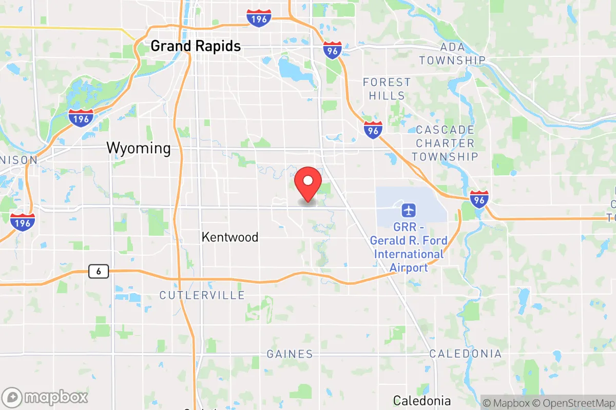
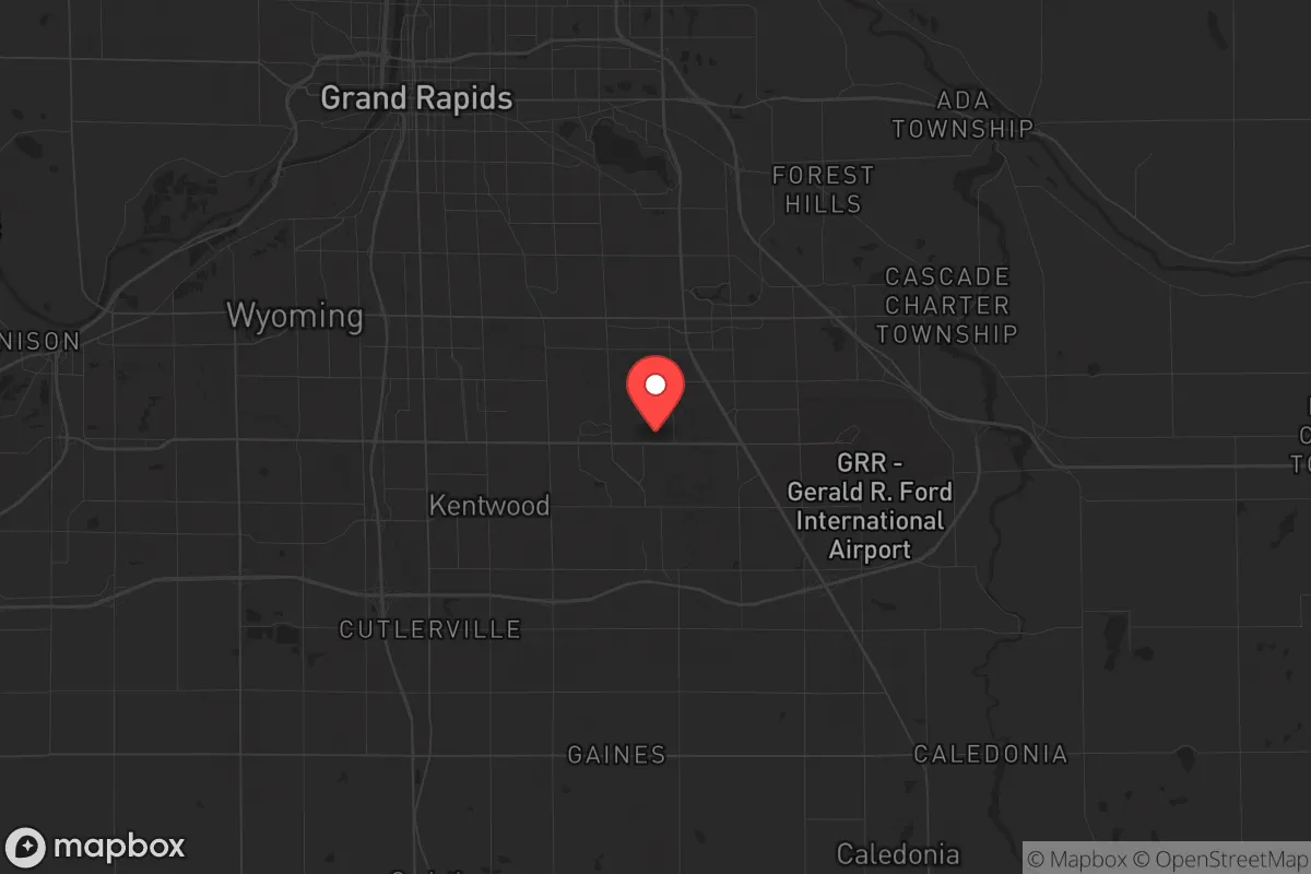
Kentwood, Michigan, sits in a position that demands a hard-nosed look from anyone serious about long-term resilience. It’s a suburban city of about 55,000 people, tucked into the southwestern corner of the state, roughly 10 miles southeast of Grand Rapids. For a prepper or survivalist, the immediate takeaway is mixed: you get proximity to a major metro’s infrastructure—hospitals, supply chains, transport hubs—without being inside the blast radius of a primary target. The area’s resilience hinges on its location within the Great Lakes region, which offers abundant fresh water and a climate that, while harsh in winter, provides natural barriers to mass migration during a crisis. But the same proximity to Grand Rapids, a city of 200,000 with a major airport and industrial base, also introduces risks that a conservative-leaning relocator must weigh carefully. This assessment breaks down the strategic calculus for Kentwood, focusing on geographic advantages, exposure to fallout-relevant landmarks, and practical day-to-day survivability for individuals and families.
Geographic position and natural advantages for long-term survival
Kentwood’s location within the Grand Rapids metropolitan area is a double-edged sword, but the natural advantages of the region are significant. The city sits on the Grand River watershed, with the Thornapple River and several smaller creeks running nearby, providing access to surface water that is less contested than in arid western states. The Great Lakes—Lake Michigan is about 30 miles west—act as a massive freshwater reservoir, and the prevailing westerly winds mean that fallout from a nuclear event on the East Coast or in the Midwest would likely be blown away from this area, not toward it. The terrain is relatively flat, with mixed hardwood forests and agricultural land within a 20-minute drive. This means you’re not boxed in by mountains or deserts; you have multiple egress routes if you need to bug out. The soil is fertile, and the growing season, while short (roughly 140 days), is long enough for cold-hardy crops like potatoes, squash, and root vegetables. For a family looking to establish a semi-self-sufficient homestead, the land around Kentwood is more forgiving than the rocky soils of New England or the alkaline plains of the Dakotas. The region’s low population density relative to the coasts also means less competition for resources in a collapse scenario—though you’re still within a 30-minute drive of 1.2 million people in the Grand Rapids metro, which is a vulnerability we’ll address next.
Risks, exposures, and proximity to fallout-relevant landmarks
The biggest strategic risk for Kentwood is its proximity to Grand Rapids, which hosts Gerald R. Ford International Airport (a civilian and cargo hub), multiple rail yards, and the Amway corporate headquarters—a potential target for economic disruption. While Grand Rapids is not a primary nuclear target like Chicago or Detroit, it’s a secondary target for any adversary aiming to cripple the Midwest’s supply chain. The airport is roughly 8 miles from central Kentwood, meaning a ground burst there would put the city in the moderate fallout zone (downwind, depending on weather). More concerning is the presence of the Palisades Nuclear Plant, about 50 miles southwest near South Haven. While it’s currently in decommissioning, the spent fuel pools remain a radiological hazard if targeted or damaged. Kentwood is also within 150 miles of the Fermi 2 nuclear plant near Detroit, and the Davis-Besse plant in Ohio—both are potential targets for sabotage or accident. For a prepper, the calculus is clear: you’re close enough to a major metro to benefit from its resources in peacetime, but close enough to be affected by its destruction in wartime. The city’s location on the I-96 corridor also makes it a natural chokepoint for refugees fleeing Detroit or Chicago during a crisis. Expect civil unrest and resource competition within the first 72 hours of a major event. The local government is typical of a mid-sized Michigan suburb—competent for day-to-day operations but likely overwhelmed by a mass casualty event. The Kent County Sheriff’s Office has about 400 deputies, but that force would be stretched thin if the city becomes a waypoint for displaced populations.
Practical resilience for a relocator: food, water, energy, and defensibility
For a single individual or family moving to Kentwood with a prepper mindset, the practical aspects of resilience are where the city shines or fails depending on your preparation. Water is the strongest asset: the city draws from groundwater wells and the Grand River, but you’ll want a private well if you buy property outside the urban core. The water table is high (20-40 feet deep in most areas), so hand-pumps or solar-powered well pumps are viable. Food production is feasible but requires effort. The soil is loamy and well-drained in the southern parts of Kentwood, but the northern areas have more clay. You can grow tomatoes, peppers, beans, and corn in a standard garden, but you’ll need a greenhouse to extend the season. Local farmers’ markets are abundant in summer, but you should plan for a 6-month winter storage period. Energy is a mixed bag: the grid is reliable by Michigan standards, but winter ice storms can knock out power for days. Solar panels are viable (the area gets about 160 sunny days per year, below the national average), but you’ll need battery storage or a generator for the cloudy months. Natural gas is widely available, so a dual-fuel generator is a smart investment. Defensibility is the weak point. Kentwood is a suburban grid of cul-de-sacs and strip malls—hard to defend against a determined group. Your best bet is to buy a property on the southern or eastern fringe, where lots are larger (1-5 acres) and you have more setback from roads. The city’s police response time is about 8-10 minutes for priority calls, but in a widespread event, expect that to stretch to hours or never. For a family, the schools are decent (Kentwood Public Schools has a 90% graduation rate), but the curriculum leans progressive, so conservative parents may want to supplement with homeschooling materials. The local gun culture is strong—there are multiple ranges and gun shops within 20 minutes—and Michigan is a shall-issue state for concealed carry, which is a plus for self-defense. The biggest practical concern is the cold: winter temperatures average in the teens, and a prolonged power outage in January could be lethal without proper heating. Wood stoves are common in rural areas, but many suburban homes lack chimney infrastructure. If you’re relocating, prioritize a property with a fireplace or the ability to install a wood-burning stove.
The overall strategic picture for Kentwood is one of calculated risk. It offers the freshwater abundance and agricultural potential that make the Great Lakes region a top-tier survival zone, but it’s not a remote redoubt. You’re trading the security of isolation for the convenience of infrastructure—and that trade works only if you’re prepared to bug in with supplies for at least 90 days, or bug out to a more remote property in the Upper Peninsula or northern Michigan within the first 24 hours of a crisis. For a conservative relocator who values community, access to medical care, and the ability to work remotely while building resilience, Kentwood is a viable base. But don’t mistake it for a fortress. The city’s fate in a major event will be determined by events in Grand Rapids and Chicago, not by anything you do in your backyard. If you’re willing to invest in off-grid water, a wood stove, and a solid security plan, Kentwood can work. If you’re looking for a place where you can ride out the collapse without seeing a neighbor for weeks, look further north. The bottom line: Kentwood is a good place to start, but not a place to finish, if you’re serious about long-term survival.
* Values derived from national, state, county, city and local statistics and may differ in a specific area. Last updated: 2026-04-29T20:39:15.000Z
Narrative content on this page is AI-generated and may contain mistakes. Verify any details that matter before acting on them.
ReloMaps may earn a commission from affiliate links at no extra cost to you.