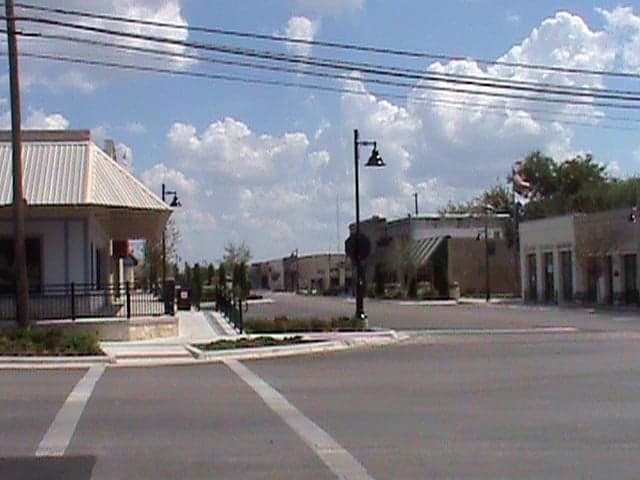
Photo: Wikipedia
Strategic Assessment of Killeen, TX
Meaningful friction. Expect exposure to either population pressure, blast zones, or natural disaster risk. Consider buying a retreat property.
What does the Strategic Assessment tell us?
Our Strategic Assessment grades tactical survivability of an area. Major population centers, military targets, fallout zones, natural disasters, and border exposure all drive risk — lower exposure means a more defensible position in a crisis.
This is heavily inspired by Joel Skousen's Strategic Relocation book. Highly recommended you checkout the book ($)What does this tell us?
Our Strategic Assessment grades tactical survivability of an area. Major population centers, military targets, fallout zones, natural disasters, and border exposure all drive risk — lower exposure means a more defensible position in a crisis.
This is heavily inspired by Joel Skousen's Strategic Relocation book. Highly recommended you checkout the book ($)Strategic Pillars

Key Distances
Regional Safe Places
Below is our recommended "safe zones" in Texas and the surrounding area based on our strategic heuristics. For most people, it's unrealistic to live in a “safe zone” full-time due to work, family or other personal reasons. They tend to be more rural. However, many of these areas are perfect for second homes and retreat properties that double as a vacation home or even a short-term rental.


Important Note: For informational purposes only. This does not mean nothing bad ever happens in the green zones. Please use common sense. This is based on public data and modeled with AI. We tried to take a conservative approach but mistakes happen. We update this regularly as new information becomes available.
Solar Generator Recommendations
Backup power matters more here than in safer locations. We've picked three solar generators across budgets and capacity tiers — start with the budget unit if you only need a few essentials, or step up if you want to run a fridge and HVAC for days at a time.

Jackery Portable Power Station Explorer 300
Budget OptionPower on the Go: Weighing only 11 lbs, it's convenient to set up and store with book-sized foldable solar panels

BLUETTI Portable Power Station AC180
Designed for both indoor and outdoor scenarios, AC180 is highly capable as it has a robost capacity and continuous output power.

EF ECOFLOW DELTA Pro Ultra Power Station
Upgraded PickEcoFlow DELTA Pro Ultra is a whole-home energy system designed to grow with your family. Integrated with the Smart Home Panel 2, it scales to meet your evolving energy needs — keeping your home powered, intelligent, and secure through every stage of life.
We earn a commission, at no additional cost to you.
Strategic Assessment Analysis
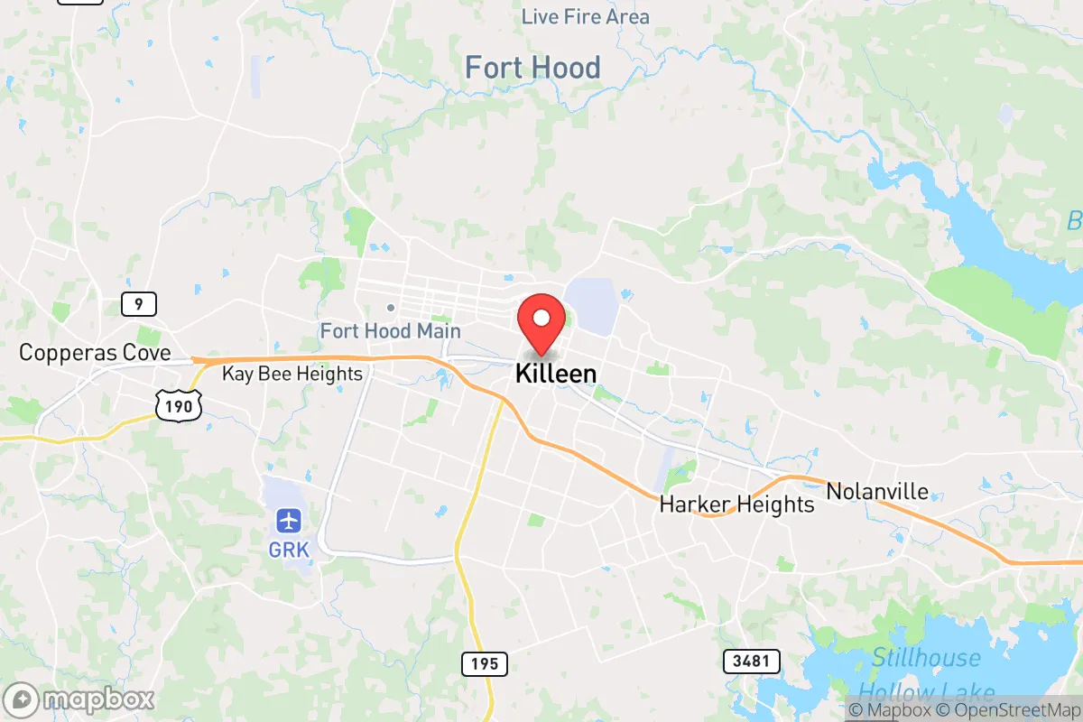
Killeen, Texas, sits at a strategic crossroads that offers a mix of resilience and exposure for those serious about preparedness. Its location in Central Texas, roughly 70 miles north of Austin and 150 miles south of Dallas, places it within a day’s drive of major population centers while maintaining enough distance to avoid the worst of urban collapse scenarios. The city’s economy is anchored by Fort Cavazos (formerly Fort Hood), one of the largest military installations in the world, which provides a stabilizing influence in terms of infrastructure, employment, and a population accustomed to discipline and order. For a relocator with a survivalist mindset, Killeen’s proximity to military assets and its position along the I-35 corridor offer both advantages and liabilities that demand careful consideration.
Geographic position and natural advantages for long-term survival
Killeen’s geography is defined by the Balcones Escarpment, a geological fault line that creates a transition zone between the rolling hills of the Hill Country to the west and the flatter Blackland Prairie to the east. This terrain offers a mix of defensible positions—low hills, creek valleys, and scattered woodlands—that can provide cover and natural barriers in a grid-down scenario. The area sits atop the Edwards Aquifer, one of the most reliable groundwater sources in Texas, which means well water is a viable option for those who secure property with drilling rights. Surface water is available from the Lampasas River and Stillhouse Hollow Lake, a 6,400-acre reservoir located about 15 miles southeast, which serves as a primary water source for the region. The climate is temperate, with hot summers and mild winters, allowing for year-round gardening and livestock management. However, the region is prone to periodic droughts and flash flooding, so water storage and rainwater catchment systems are non-negotiable for any serious prepper setup. The natural advantages here are real but require active management—this isn’t a self-sustaining paradise, but it’s a workable base for those willing to put in the labor.
Risks, exposures, and proximity to fallout-relevant landmarks
The biggest strategic liability for Killeen is its proximity to Fort Cavazos, a major military installation that houses the III Corps, 1st Cavalry Division, and the 3rd Armored Division. In a national emergency—whether civil unrest, foreign conflict, or a cascading infrastructure failure—Fort Cavazos becomes a high-value target for both state and non-state actors. The base is a hub for heavy armor, aviation, and logistics, meaning any large-scale disruption could draw military traffic, checkpoints, or even combat operations through the surrounding area. Killeen itself is directly adjacent to the base, with neighborhoods like Harker Heights and Copperas Cove forming a contiguous urban sprawl. This density creates a choke point: if the base locks down or is attacked, evacuation routes along Highway 190 and I-35 could become impassable. Additionally, the city is within 100 miles of the South Texas Nuclear Project (a nuclear power plant near Bay City) and the Pantex nuclear weapons assembly plant near Amarillo, though the latter is farther away. More immediate is the risk of industrial accidents along the I-35 corridor, which carries hazardous materials daily. For a survivalist, the presence of a major military base is a double-edged sword—it provides a potential source of security and supplies, but it also paints a target on the region. The key is to position yourself on the outer edges of the metro area, away from the base’s main gates and the likely flow of military traffic.
Practical resilience for a relocator: food, water, energy, and defensibility
For someone looking to establish a resilient homestead in the Killeen area, the practical considerations break down into four pillars. Water: The Edwards Aquifer is the gold standard here, but drilling a well can cost $10,000–$20,000 depending on depth and yield. Rainwater collection is legal and encouraged in Texas, with no state-level restrictions, and the average annual rainfall of 32 inches means a 1,000-square-foot roof can capture about 20,000 gallons per year. Food: The growing season runs from March to November, and the local soil—clay-heavy in the east, loamy in the west—supports vegetables, fruit trees, and small livestock. Bell County has a strong agricultural extension office through Texas A&M that offers soil testing and workshops. For bulk storage, the cost of living is about 10% below the national average, making it feasible to stockpile supplies without breaking the bank. Energy: The Texas power grid (ERCOT) is notoriously unreliable during winter storms and summer heat waves. Solar is a smart investment here, with an average of 230 sunny days per year. Off-grid setups are permitted in unincorporated areas of Bell County, but check zoning if you’re inside city limits—Killeen has building codes that can complicate DIY solar installations. Defensibility: The terrain offers natural chokepoints along creek beds and ridge lines, but the urban sprawl means you’ll likely have neighbors within earshot. Rural properties west of Killeen, toward the towns of Kempner and Lampasas, provide more isolation and better sightlines. The local gun culture is strong—Texas is a constitutional carry state, and Bell County has a high rate of firearm ownership—which means you’re not alone in your mindset, but it also means you should expect others to be armed and prepared. Community resilience is a mixed bag: the military population is transient, so long-term neighborly bonds can be harder to build than in a small farming town.
Overall, Killeen presents a strategic picture that demands trade-offs. It’s not a remote bunker location—you’re within striking distance of Austin, Waco, and the I-35 corridor, which means you’ll face the fallout of urban collapse if things go sideways. But it’s also not a soft target: the military presence, the aquifer access, and the relatively low cost of entry make it a viable base for someone who wants to be prepared without going full off-grid hermit. The smart play is to buy land on the western fringe, invest in water and solar infrastructure, and build relationships with the local veteran and prepper communities. If you’re looking for a place that balances access to resources with a realistic chance of riding out a crisis, Killeen is worth a hard look—just don’t expect it to be a safe zone. It’s a working-class city with real grit, and that grit might be exactly what you need when the lights go out.
* Values derived from national, state, county, city and local statistics and may differ in a specific area. Last updated: 2026-05-03T04:47:13.000Z
Narrative content on this page is AI-generated and may contain mistakes. Verify any details that matter before acting on them.
ReloMaps may earn a commission from affiliate links at no extra cost to you.