Photo: Wikipedia
Strategic Assessment of Lakeville, MN
Meaningful friction. Expect exposure to either population pressure, blast zones, or natural disaster risk. Consider buying a retreat property.
What does the Strategic Assessment tell us?
Our Strategic Assessment grades tactical survivability of an area. Major population centers, military targets, fallout zones, natural disasters, and border exposure all drive risk — lower exposure means a more defensible position in a crisis.
This is heavily inspired by Joel Skousen's Strategic Relocation book. Highly recommended you checkout the book ($)What does this tell us?
Our Strategic Assessment grades tactical survivability of an area. Major population centers, military targets, fallout zones, natural disasters, and border exposure all drive risk — lower exposure means a more defensible position in a crisis.
This is heavily inspired by Joel Skousen's Strategic Relocation book. Highly recommended you checkout the book ($)Strategic Pillars

Key Distances
Regional Safe Places
Below is our recommended "safe zones" in Minnesota and the surrounding area based on our strategic heuristics. For most people, it's unrealistic to live in a “safe zone” full-time due to work, family or other personal reasons. They tend to be more rural. However, many of these areas are perfect for second homes and retreat properties that double as a vacation home or even a short-term rental.


Important Note: For informational purposes only. This does not mean nothing bad ever happens in the green zones. Please use common sense. This is based on public data and modeled with AI. We tried to take a conservative approach but mistakes happen. We update this regularly as new information becomes available.
Solar Generator Recommendations
Backup power matters more here than in safer locations. We've picked three solar generators across budgets and capacity tiers — start with the budget unit if you only need a few essentials, or step up if you want to run a fridge and HVAC for days at a time.

Jackery Portable Power Station Explorer 300
Budget OptionPower on the Go: Weighing only 11 lbs, it's convenient to set up and store with book-sized foldable solar panels

BLUETTI Portable Power Station AC180
Designed for both indoor and outdoor scenarios, AC180 is highly capable as it has a robost capacity and continuous output power.

EF ECOFLOW DELTA Pro Ultra Power Station
Upgraded PickEcoFlow DELTA Pro Ultra is a whole-home energy system designed to grow with your family. Integrated with the Smart Home Panel 2, it scales to meet your evolving energy needs — keeping your home powered, intelligent, and secure through every stage of life.
We earn a commission, at no additional cost to you.
Strategic Assessment Analysis
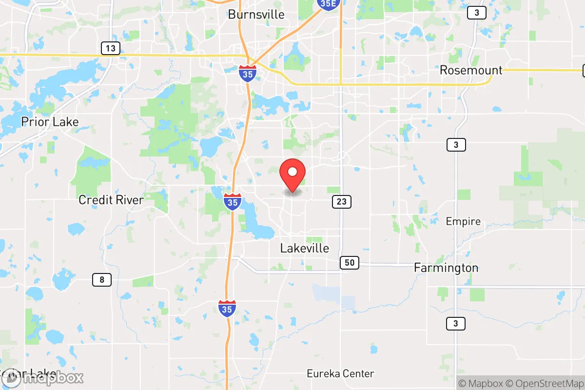
Lakeville, Minnesota, sits in a strategic sweet spot that many preppers overlook: close enough to the Twin Cities to access critical resources, yet far enough south to dodge the worst of a metropolitan collapse. With a population hovering around 70,000, this Dakota County suburb offers a blend of suburban infrastructure and rural adjacency that makes it a viable base for those serious about long-term resilience. Its position along Interstate 35 provides a direct evacuation corridor south toward less populated areas, while the nearby Minnesota River Valley offers natural barriers and water sources that could prove invaluable in a crisis.
Geographic position and natural advantages for long-term survival
Lakeville’s location at the southern edge of the Twin Cities metro gives it a distinct edge over suburbs like Eden Prairie or Woodbury, which are more tightly woven into the urban fabric. The city sits on a plateau of relatively high ground, with elevations around 1,100 feet, reducing flood risk from the nearby Minnesota River. The river itself, flowing just west of town, provides a potential water source and a natural defensive line against movement from the metro core. To the south, open farmland stretches toward Faribault and Owatonna, offering retreat options if the metro becomes untenable. The area’s glacial geology means decent groundwater availability, with many private wells already in use on the outskirts. For a relocator, this means you’re not wholly dependent on municipal water systems that could fail during grid-down scenarios. The region’s four-season climate also works in your favor: harsh winters discourage mass movement, and the growing season, while short (roughly 150 days), is sufficient for cold-hardy crops like potatoes, kale, and root vegetables.
Risks, exposures, and proximity to fallout-relevant landmarks
No location is without vulnerabilities, and Lakeville has several that demand attention. The most obvious is its proximity to the Twin Cities metro, home to over 3 million people and a prime target for civil unrest, EMP attacks, or infrastructure sabotage. In a worst-case scenario, I-35 becomes a choke point for refugees fleeing north, and Lakeville sits directly in that path. The city is also within 30 miles of the Minneapolis-St. Paul International Airport (MSP), a likely target for any kinetic or electromagnetic strike. Additionally, the nearby Minnesota River Valley contains several locks and dams—specifically the Lock and Dam No. 1 in St. Paul—that, if compromised, could cause downstream flooding or disrupt water supplies. On the industrial side, the Pine Bend Refinery in Rosemount, about 15 miles northeast, is one of the largest oil refineries in the Midwest. A strike or accident there could release toxic plumes that drift south over Lakeville depending on wind patterns. For the prepper, these risks mean that a bug-out plan must prioritize southward movement, not north into the metro. The city’s own infrastructure—power lines, water treatment plants, and natural gas pipelines—is all above ground and vulnerable to weather events or sabotage. Tornadoes are a real threat, with Dakota County averaging 2-3 touchdowns per year, so a basement or storm shelter is non-negotiable.
Practical resilience for a relocator: food, water, energy, and defensibility
Lakeville offers a mixed bag for practical self-sufficiency. On the positive side, the city has a strong agricultural periphery. Within a 10-mile radius, you’ll find dozens of farms producing corn, soybeans, and livestock, plus several farmers’ markets operating from May through October. The city’s zoning allows for backyard chickens and small-scale gardening in most residential areas, though livestock like goats or pigs require acreage and permits. Water is the bigger concern. While the municipal supply comes from the Jordan Aquifer, which is generally reliable, a prolonged grid-down scenario would leave residents dependent on stored water or private wells. Properties on the city’s outskirts with existing wells are a premium find. For energy, solar is viable but not ideal—Minnesota averages only 180 sunny days per year, and heavy snow can cripple panels. A better bet is a backup generator running on propane or diesel, with a 500-gallon tank buried on your property. Defensibility is where Lakeville struggles. Most neighborhoods are suburban sprawl with grid-like streets, making them hard to secure. The older sections near Orchard Lake and Crystal Lake offer more natural cover and fewer entry points, but they’re also pricier. For a relocator, the ideal property is on the southern or western fringe, where lot sizes increase and neighbors thin out. The city’s police force is well-funded (Dakota County spends over $200 per capita on law enforcement), but in a collapse scenario, they’ll be stretched thin. Your best defense is a tight-knit community of like-minded neighbors—something Lakeville’s active church and civic groups can help foster.
The overall strategic picture for Lakeville is one of cautious optimism for the prepared relocator. It’s not a remote survivalist paradise—you won’t find the isolation of Montana or the defensible terrain of the Appalachians. What you will find is a functional, mid-sized community with decent infrastructure, access to water and farmland, and a position that allows you to monitor metro events while maintaining a safe buffer. The key is to treat Lakeville as a base camp, not a final redoubt. Have a bug-out vehicle prepped and a route south mapped to secondary locations in Rice or Steele counties. Stockpile at least three months of supplies, given the risk of supply chain disruptions from metro-area chaos. And invest in community relationships—in a crisis, your neighbors are either your greatest asset or your biggest liability. Lakeville’s conservative lean (Dakota County voted +2 R in 2024, a shift from its purple past) suggests a population that values self-reliance and preparedness, making it easier to find allies. If you’re looking for a place that balances suburban convenience with genuine survival potential, Lakeville deserves a hard look—just don’t mistake its calm surface for complete safety. The metro’s shadow is long, and only the prepared will thrive when it falls.
* Values derived from national, state, county, city and local statistics and may differ in a specific area. Last updated: 2026-04-24T15:44:01.000Z
Narrative content on this page is AI-generated and may contain mistakes. Verify any details that matter before acting on them.
ReloMaps may earn a commission from affiliate links at no extra cost to you.