
Photo: Wikipedia
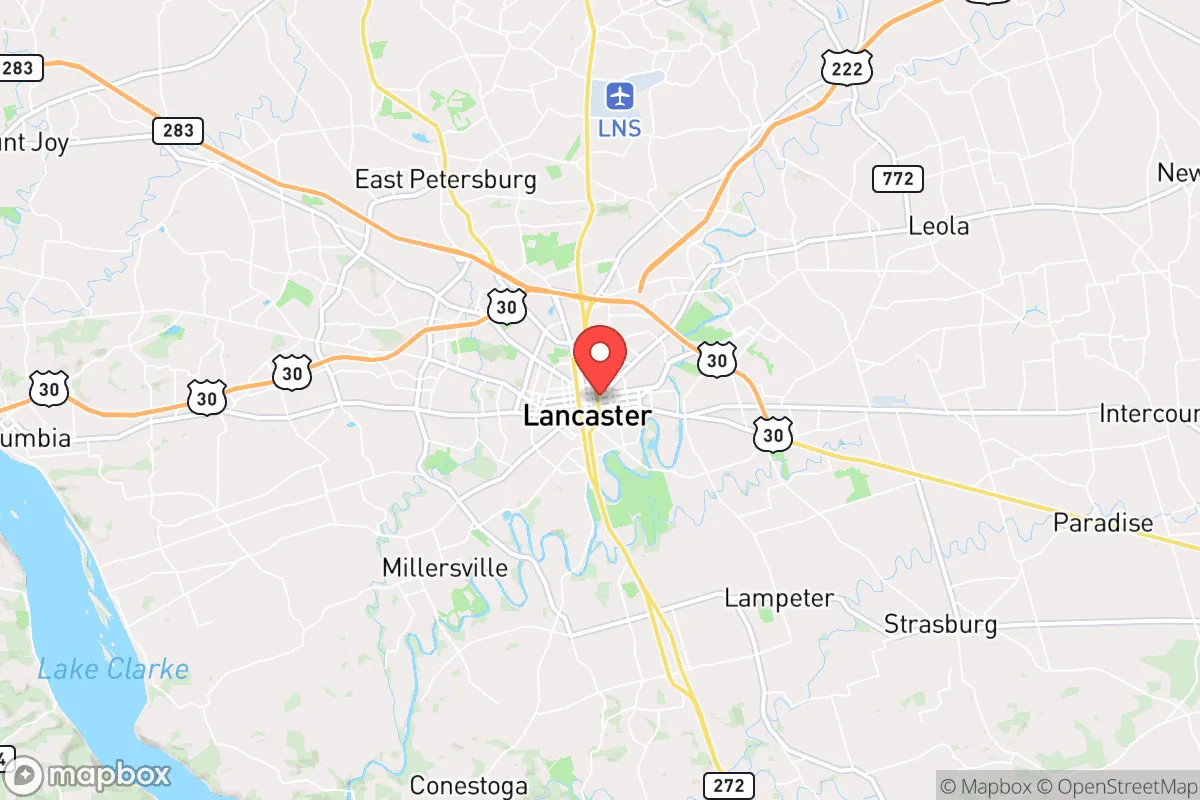
Strategic Assessment of Lancaster, PA
Multiple tactical vulnerabilities. Population density, target proximity, or disaster risk are likely compounding. A retreat property and exit planning is required.
What does the Strategic Assessment tell us?
Our Strategic Assessment grades tactical survivability of an area. Major population centers, military targets, fallout zones, natural disasters, and border exposure all drive risk — lower exposure means a more defensible position in a crisis.
This is heavily inspired by Joel Skousen's Strategic Relocation book. Highly recommended you checkout the book ($)What does this tell us?
Our Strategic Assessment grades tactical survivability of an area. Major population centers, military targets, fallout zones, natural disasters, and border exposure all drive risk — lower exposure means a more defensible position in a crisis.
This is heavily inspired by Joel Skousen's Strategic Relocation book. Highly recommended you checkout the book ($)Strategic Pillars

Key Distances
Regional Safe Places
Below is our recommended "safe zones" in Pennsylvania and the surrounding area based on our strategic heuristics. For most people, it's unrealistic to live in a “safe zone” full-time due to work, family or other personal reasons. They tend to be more rural. However, many of these areas are perfect for second homes and retreat properties that double as a vacation home or even a short-term rental.


Important Note: For informational purposes only. This does not mean nothing bad ever happens in the green zones. Please use common sense. This is based on public data and modeled with AI. We tried to take a conservative approach but mistakes happen. We update this regularly as new information becomes available.
Solar Generator Recommendations
Backup power matters more here than in safer locations. We've picked three solar generators across budgets and capacity tiers — start with the budget unit if you only need a few essentials, or step up if you want to run a fridge and HVAC for days at a time.

Jackery Portable Power Station Explorer 300
Budget OptionPower on the Go: Weighing only 11 lbs, it's convenient to set up and store with book-sized foldable solar panels

BLUETTI Portable Power Station AC180
Designed for both indoor and outdoor scenarios, AC180 is highly capable as it has a robost capacity and continuous output power.

EF ECOFLOW DELTA Pro Ultra Power Station
Upgraded PickEcoFlow DELTA Pro Ultra is a whole-home energy system designed to grow with your family. Integrated with the Smart Home Panel 2, it scales to meet your evolving energy needs — keeping your home powered, intelligent, and secure through every stage of life.
We earn a commission, at no additional cost to you.
Strategic Assessment Analysis
Lancaster, Pennsylvania, sits in a sweet spot that few preppers fully appreciate: close enough to major East Coast infrastructure to access supplies and medical care, but far enough from the primary blast zones and population centers to offer genuine strategic depth. The city itself is a county seat of about 55,000, but the surrounding Lancaster County holds over 550,000 people, with a mix of dense suburban development and vast, productive farmland. For a relocator thinking in terms of decades, not months, this area presents a rare combination of agricultural self-sufficiency, moderate climate, and a cultural baseline that still values self-reliance and community—traits that are increasingly hard to find in the coastal corridor.
Geographic position and natural advantages for long-term security
Lancaster County sits in the heart of the Pennsylvania Dutch Country, roughly 70 miles west of Philadelphia and 80 miles north of Baltimore. That puts it outside the immediate 50-mile radius of any major metropolitan center, which is a critical buffer for avoiding the worst of a grid-down scenario or a mass evacuation event. The terrain is rolling hills and fertile valleys, not mountainous, but the Susquehanna River forms the western border, providing a natural barrier and a reliable water source. The climate is temperate—hot, humid summers and cold winters with moderate snowfall—which means year-round growing seasons are possible with basic season-extension techniques like hoop houses. The area sits on the Piedmont plateau, with deep, well-drained soils that are among the most productive in the Northeast. Lancaster County is the most productive non-irrigated agricultural county in Pennsylvania, and ranks in the top 1% nationally for total agricultural sales. That is not a statistic to gloss over: it means the land itself can support a population without heavy reliance on external supply chains.
Risks, exposures, and proximity to fallout-relevant landmarks
No location is perfect, and Lancaster has real vulnerabilities. The biggest is proximity to the Three Mile Island nuclear plant, located about 25 miles west near Middletown. Though the plant shut down in 2019, the spent fuel remains on site in dry cask storage, and any major incident—whether from sabotage, earthquake, or a cascading grid failure—could create a plume that would affect the western half of the county. The Susquehanna River flows south, so water contamination from a release would be a concern for communities downstream, but Lancaster City draws its water from the Conestoga River and local wells, not directly from the Susquehanna. Another risk: the county is crisscrossed by major rail lines and Interstate 76 (the Pennsylvania Turnpike), which carry hazardous materials daily. A derailment or intentional attack on a chemical train could disrupt travel and contaminate local water tables. Lancaster is also within 100 miles of the Philadelphia Naval Shipyard and the Aberdeen Proving Ground, both potential targets in a conflict scenario. That said, the county is not a primary target itself—no major military bases, no major ports, no critical infrastructure that would make it a first-strike priority. For a relocator, the calculus is: you are close enough to the fallout zone to be affected by secondary effects (refugee flows, supply chain disruption) but far enough to avoid the direct blast and fallout footprint of a major strike on Philadelphia or Baltimore.
Practical resilience for a relocator: food, water, energy, and defensibility
This is where Lancaster shines. The Amish and Mennonite communities that dominate the rural parts of the county have maintained a working agricultural economy that operates largely outside the industrial food system. That means local food production is not a niche hobby here—it is the backbone of the economy. Farmers markets, roadside stands, and bulk food stores are everywhere. You can buy a 50-pound bag of wheat berries, a bushel of apples, or a quarter of a grass-fed beef without ever stepping into a Walmart. For a prepper, this is the single most important advantage: you can build a food stockpile from local sources year-round, and you can learn from people who have been doing it for generations. Water is less of a concern than in the arid West. The county averages about 42 inches of rain per year, and groundwater is plentiful in most areas. A well with a hand pump or a solar-powered pump is a realistic option for most rural properties. The grid is relatively stable, but the county has seen its share of winter storms and derecho events that knock out power for days. Solar panels with battery backup are a common sight on newer construction, and many Amish households run on propane and 12-volt DC systems, so the knowledge base for off-grid living is embedded in the local culture. Defensibility is mixed. The terrain is open farmland with scattered woodlots, not the kind of mountainous redoubt that offers natural chokepoints. But the county is crisscrossed by small roads and farm lanes that make it easy to avoid main highways. A rural property with a long driveway, a good fence, and a clear line of sight to the road is achievable for under $300,000—still a bargain compared to the West Coast or the Northeast corridor. The biggest defensive asset is the community itself. Lancaster County has a strong tradition of mutual aid, volunteer fire departments, and church-based networks. In a crisis, you are not going to be a lone wolf; you will be part of a social fabric that still remembers how to organize for a barn raising or a harvest.
The overall strategic picture for Lancaster is one of high potential with manageable risk. It is not a remote survivalist retreat—you will have neighbors, traffic, and the occasional crime issue in the city proper. But for a relocator who wants to be within a few hours of East Coast resources while maintaining genuine food and water security, it is one of the best options in the Mid-Atlantic. The Amish and Mennonite presence provides a cultural anchor of self-sufficiency that is rare in modern America. The farmland is real, the water is abundant, and the climate is forgiving. The downsides—proximity to Three Mile Island, rail lines, and major highways—are real but manageable with proper planning and a good bug-out location to the north or west. If you are looking for a place to build a life that can weather the next decade of instability, Lancaster County deserves a serious look. It is not a fortress, but it is a garden—and in the long run, gardens outlast fortresses.
* Values derived from national, state, county, city and local statistics and may differ in a specific area. Last updated: 2026-05-02T01:19:40.000Z
Narrative content on this page is AI-generated and may contain mistakes. Verify any details that matter before acting on them.
ReloMaps may earn a commission from affiliate links at no extra cost to you.