
Photo: Wikipedia
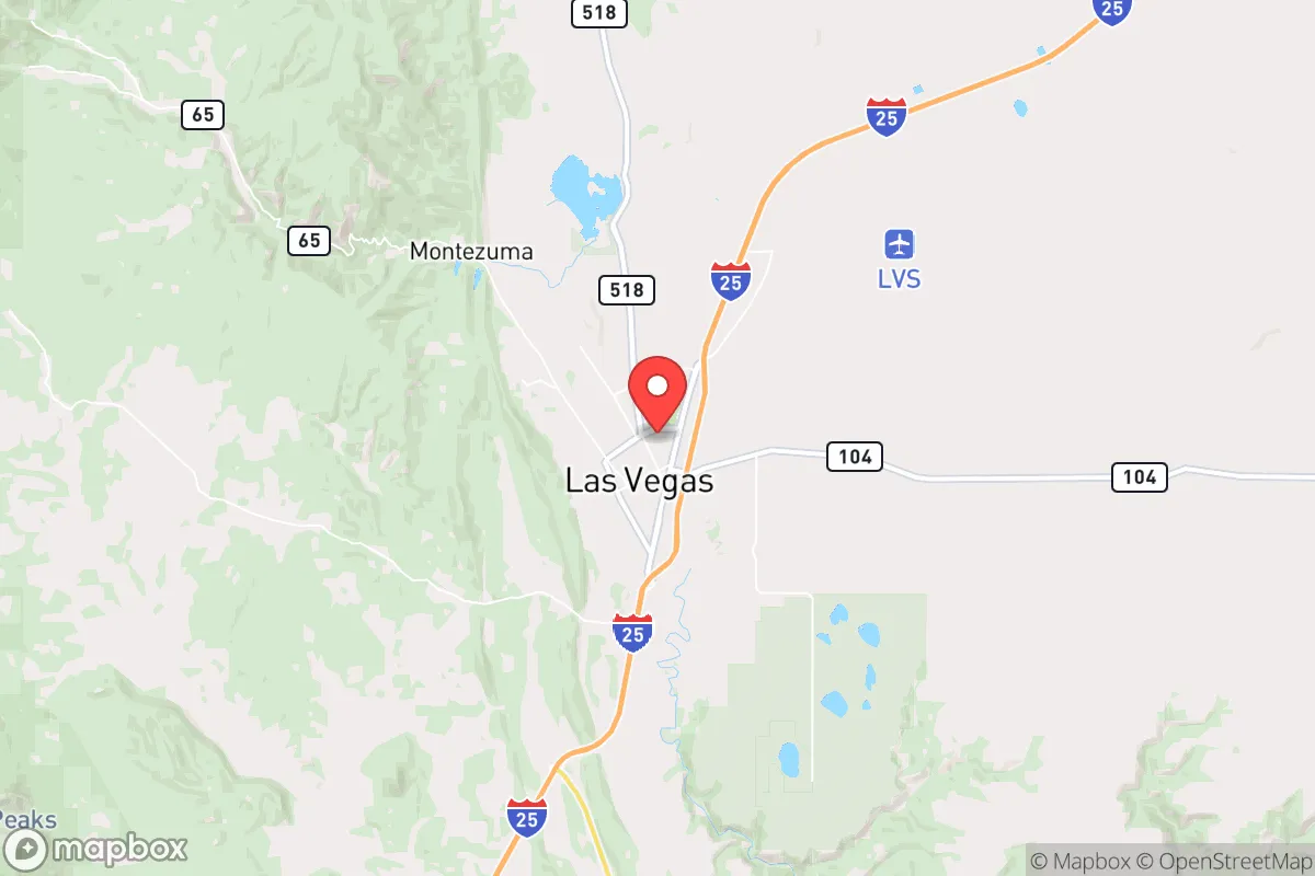
Strategic Assessment of Las Vegas, NM
Workable tactical position. Some exposure to population density or targets, but generally defensible in a crisis.
What does the Strategic Assessment tell us?
Our Strategic Assessment grades tactical survivability of an area. Major population centers, military targets, fallout zones, natural disasters, and border exposure all drive risk — lower exposure means a more defensible position in a crisis.
This is heavily inspired by Joel Skousen's Strategic Relocation book. Highly recommended you checkout the book ($)What does this tell us?
Our Strategic Assessment grades tactical survivability of an area. Major population centers, military targets, fallout zones, natural disasters, and border exposure all drive risk — lower exposure means a more defensible position in a crisis.
This is heavily inspired by Joel Skousen's Strategic Relocation book. Highly recommended you checkout the book ($)Strategic Pillars

Key Distances
Regional Safe Places
Below is our recommended "safe zones" in New Mexico and the surrounding area based on our strategic heuristics. For most people, it's unrealistic to live in a “safe zone” full-time due to work, family or other personal reasons. They tend to be more rural. However, many of these areas are perfect for second homes and retreat properties that double as a vacation home or even a short-term rental.

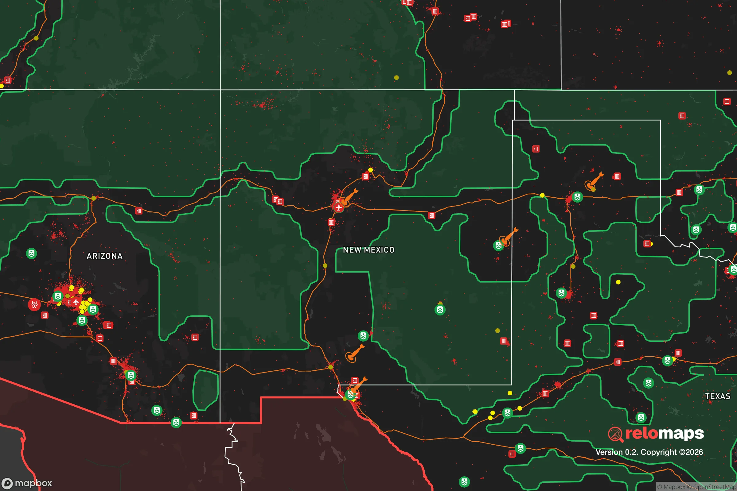
Important Note: For informational purposes only. This does not mean nothing bad ever happens in the green zones. Please use common sense. This is based on public data and modeled with AI. We tried to take a conservative approach but mistakes happen. We update this regularly as new information becomes available.
Solar Generator Recommendations
Backup power matters more here than in safer locations. We've picked three solar generators across budgets and capacity tiers — start with the budget unit if you only need a few essentials, or step up if you want to run a fridge and HVAC for days at a time.

Jackery Portable Power Station Explorer 300
Budget OptionPower on the Go: Weighing only 11 lbs, it's convenient to set up and store with book-sized foldable solar panels

BLUETTI Portable Power Station AC180
Designed for both indoor and outdoor scenarios, AC180 is highly capable as it has a robost capacity and continuous output power.

EF ECOFLOW DELTA Pro Ultra Power Station
Upgraded PickEcoFlow DELTA Pro Ultra is a whole-home energy system designed to grow with your family. Integrated with the Smart Home Panel 2, it scales to meet your evolving energy needs — keeping your home powered, intelligent, and secure through every stage of life.
We earn a commission, at no additional cost to you.
Strategic Assessment Analysis
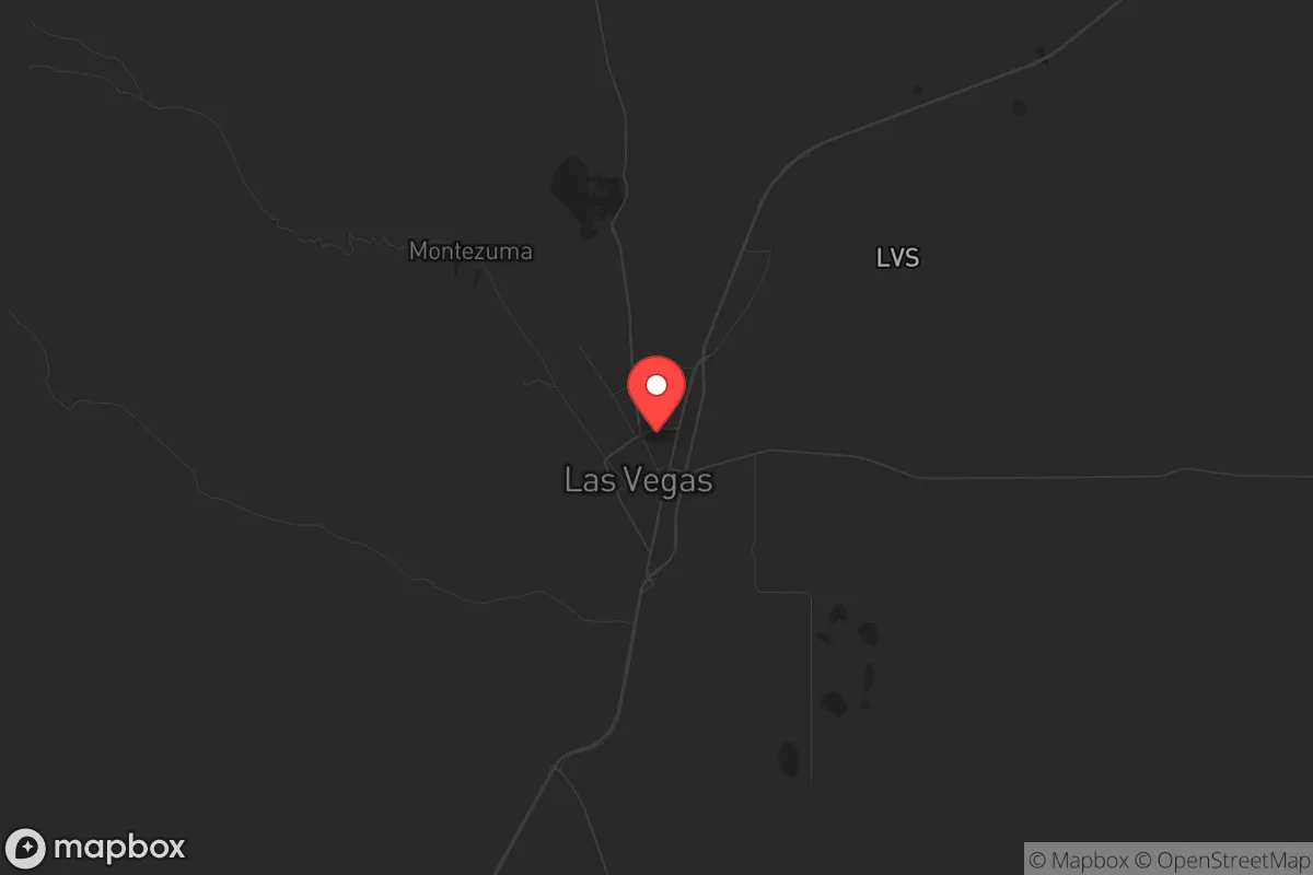
Las Vegas, New Mexico offers a compelling strategic position for those prioritizing resilience, sitting at a deliberate remove from major population centers while retaining access to critical infrastructure. This small city of roughly 13,000 people, nestled in the Sangre de Cristo Mountains at 6,500 feet elevation, provides a natural buffer against the cascading failures that could overwhelm denser urban areas. Its location along the I-25 corridor, roughly 65 miles east of Santa Fe and 130 miles from Albuquerque, places it within a day's drive of essential resources without being in the blast radius of a major metropolitan target.
Geographic position and natural defensive advantages
Las Vegas sits in a high mountain valley surrounded by the Santa Fe National Forest and the Pecos Wilderness, offering multiple layers of natural terrain that complicate any approach by hostile actors or disorganized crowds. The Sangre de Cristo Mountains to the east and the Gallinas River running through town create chokepoints that a prepared community could monitor and control. The elevation provides a cooler climate than the desert floor, reducing water loss through evaporation and making sustainable agriculture more viable than in lower-elevation New Mexico towns. The area's position at the junction of the High Plains and the Rocky Mountain foothills means it receives more precipitation—roughly 15 inches annually—than much of the state, supporting natural forage and small-scale farming without heavy irrigation. For a relocator thinking in terms of decades, this is not a desert outpost but a temperate highland with genuine agricultural potential.
The surrounding national forest lands offer both a resource buffer and a privacy screen. The Pecos Wilderness, over 200,000 acres of roadless terrain, provides a hard-to-traverse barrier to the east, while the open plains to the west offer long sightlines. The town itself is laid out on a grid around the historic plaza, with older neighborhoods featuring thick adobe construction that provides natural thermal mass and ballistic protection. The 1920s-era buildings downtown, built with local stone and brick, could serve as rally points or supply depots in a prolonged disruption. The railroad line running through town—the same one that served the area since the 1880s—offers a secondary transport corridor if highways become compromised.
Risks, exposures, and proximity to fallout-relevant landmarks
No strategic assessment is honest without acknowledging the liabilities. Las Vegas sits roughly 100 miles from Los Alamos National Laboratory, the primary nuclear weapons design facility in the United States. While this distance provides a significant safety margin—prevailing winds generally blow from the southwest, pushing any airborne contamination away from Las Vegas—it is not zero risk. A major incident at Los Alamos, whether accidental or deliberate, would create a plume that could affect the area depending on weather conditions. The same distance applies to the Waste Isolation Pilot Plant (WIPP) near Carlsbad, though that facility is over 300 miles south and poses a lower direct threat. The Kirtland Air Force Base and Sandia National Laboratories in Albuquerque, about 130 miles southwest, represent additional potential targets that could generate fallout or secondary effects like refugee flows.
The city's location along I-25 is a double-edged sword. In a crisis, that highway becomes a funnel for evacuees from Santa Fe and Albuquerque, potentially overwhelming local resources. The 2022 Calf Canyon/Hermits Peak Fire, which burned over 340,000 acres and directly threatened the city, demonstrated how quickly a natural disaster can strain local capacity. That fire, the largest in New Mexico history, was caused by a prescribed burn gone wrong on federal land—a reminder that government incompetence can create disasters as severe as any natural event. The area is also prone to flash flooding in the arroyos that cut through town, particularly after wildfires denude the hillsides. Earthquakes are rare but not unknown; the 2011 magnitude 5.3 event near Raton, 100 miles north, was felt in Las Vegas.
Practical resilience for a relocator: food, water, energy, and defensibility
Water is the first concern for any long-term survival scenario, and Las Vegas has a mixed picture. The Gallinas River provides a surface water source, but it is fed by snowmelt and subject to drought cycles. The city's municipal water comes from a combination of surface reservoirs and groundwater wells, with the Storrie Lake and El Porvenir reservoirs holding roughly 4,000 acre-feet combined. For a relocator, securing a property with a private well or access to a spring is essential—the municipal system could fail or be overwhelmed in a prolonged crisis. The area's average annual precipitation of 15 inches is enough for dryland farming of hardy crops like beans, squash, and certain grains, but irrigation will be necessary for reliable yields. The growing season runs roughly 150 days, from May to October, which is sufficient for most vegetables but tight for corn or soybeans.
Energy resilience is achievable here. The high desert sun provides excellent solar potential, with over 280 sunny days per year. Passive solar heating is effective in the adobe-style homes common in the area, which maintain stable indoor temperatures with minimal input. Wood heating is viable given the surrounding national forest, though firewood permits and sustainable harvesting are considerations. The local electric grid is served by the Los Alamos Department of Public Utilities and the Mora-San Miguel Electric Cooperative, both of which have shown vulnerability to wildfire-related outages. A relocator should plan for off-grid capability: solar panels, battery storage, a backup generator, and a wood stove are not luxuries here but necessities for true independence.
Defensibility is where Las Vegas shines compared to flatter, more exposed towns. The terrain around the city offers numerous natural observation points, and the narrow canyon entrances from the east and south can be monitored with minimal manpower. The local population is small enough that a prepared group could establish relationships with neighbors and form a mutual aid network. The historic downtown's dense layout provides cover and concealment, while the surrounding ranchland offers open fields of fire for those with the means to secure a perimeter. The presence of the New Mexico Highlands University campus could be a liability—college towns tend to attract transient populations with unpredictable behavior in a crisis—but the student body is small (roughly 3,000) and the campus is compact enough to be avoided or secured.
Food production is feasible but requires work. The soil in the valley is a mix of sandy loam and clay, with decent drainage but low organic matter. The local farmers' market and the presence of the Las Vegas Growers' Cooperative indicate a existing agricultural community that could be tapped for knowledge and seed stock. Game is available in the surrounding mountains—mule deer, elk, turkey, and small game—but hunting pressure would increase rapidly in a collapse scenario. The Pecos River, about 20 miles east, offers fishing opportunities. For a relocator serious about food independence, securing acreage with irrigation rights and establishing perennial crops like fruit trees and berries should be a priority from year one.
The local economy is weak by conventional standards, with a poverty rate around 25% and a median household income below $35,000. This is actually a strategic advantage for a relocator with capital: property is affordable, with fixer-upper homes available for under $100,000 and larger ranches for under $500,000. The low cost of living means a smaller nest egg goes further, and the depressed local economy means fewer people have the resources to compete for supplies in a crisis. The downside is that the local job market is limited to healthcare, education, and government work, so a relocator should plan to be self-employed, remote-working, or retired.
The overall strategic picture for Las Vegas, New Mexico is one of calculated trade-offs. It offers genuine defensive terrain, a moderate climate, affordable land, and a position outside the immediate blast radius of major targets. The risks are real: proximity to Los Alamos, vulnerability to wildfire and drought, and the potential for refugee flows along I-25. For a relocator willing to invest in water security, off-grid energy, and community relationships, this area provides a solid foundation for long-term resilience. It is not a bug-out location for a weekend—it is a place to build a life that can withstand the shocks ahead, provided you come prepared and stay alert.
* Values derived from national, state, county, city and local statistics and may differ in a specific area. Last updated: 2026-05-01T00:47:21.000Z
Narrative content on this page is AI-generated and may contain mistakes. Verify any details that matter before acting on them.
ReloMaps may earn a commission from affiliate links at no extra cost to you.