
Photo: Wikipedia
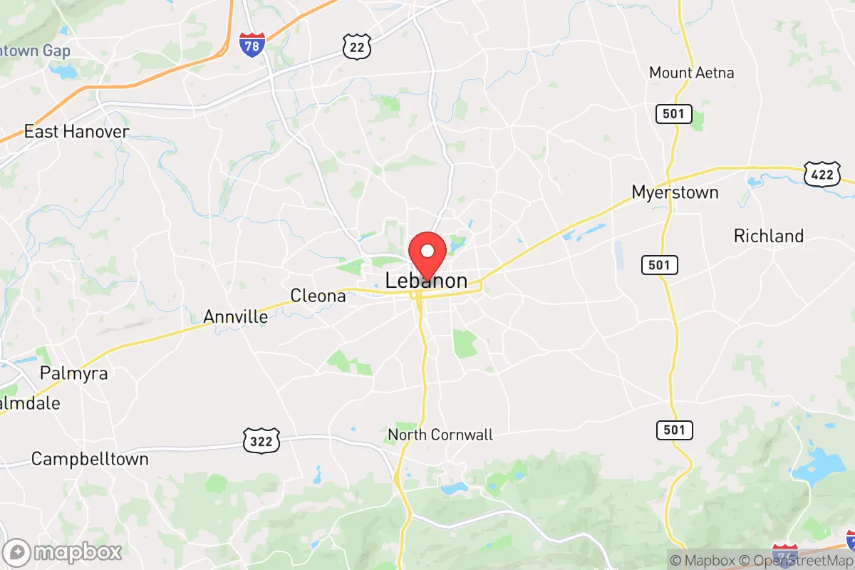
Strategic Assessment of Lebanon, PA
Multiple tactical vulnerabilities. Population density, target proximity, or disaster risk are likely compounding. A retreat property and exit planning is required.
What does the Strategic Assessment tell us?
Our Strategic Assessment grades tactical survivability of an area. Major population centers, military targets, fallout zones, natural disasters, and border exposure all drive risk — lower exposure means a more defensible position in a crisis.
This is heavily inspired by Joel Skousen's Strategic Relocation book. Highly recommended you checkout the book ($)What does this tell us?
Our Strategic Assessment grades tactical survivability of an area. Major population centers, military targets, fallout zones, natural disasters, and border exposure all drive risk — lower exposure means a more defensible position in a crisis.
This is heavily inspired by Joel Skousen's Strategic Relocation book. Highly recommended you checkout the book ($)Strategic Pillars

Key Distances
Regional Safe Places
Below is our recommended "safe zones" in Pennsylvania and the surrounding area based on our strategic heuristics. For most people, it's unrealistic to live in a “safe zone” full-time due to work, family or other personal reasons. They tend to be more rural. However, many of these areas are perfect for second homes and retreat properties that double as a vacation home or even a short-term rental.


Important Note: For informational purposes only. This does not mean nothing bad ever happens in the green zones. Please use common sense. This is based on public data and modeled with AI. We tried to take a conservative approach but mistakes happen. We update this regularly as new information becomes available.
Solar Generator Recommendations
Backup power matters more here than in safer locations. We've picked three solar generators across budgets and capacity tiers — start with the budget unit if you only need a few essentials, or step up if you want to run a fridge and HVAC for days at a time.

Jackery Portable Power Station Explorer 300
Budget OptionPower on the Go: Weighing only 11 lbs, it's convenient to set up and store with book-sized foldable solar panels

BLUETTI Portable Power Station AC180
Designed for both indoor and outdoor scenarios, AC180 is highly capable as it has a robost capacity and continuous output power.

EF ECOFLOW DELTA Pro Ultra Power Station
Upgraded PickEcoFlow DELTA Pro Ultra is a whole-home energy system designed to grow with your family. Integrated with the Smart Home Panel 2, it scales to meet your evolving energy needs — keeping your home powered, intelligent, and secure through every stage of life.
We earn a commission, at no additional cost to you.
Strategic Assessment Analysis
Lebanon, Pennsylvania, occupies a strategic middle ground that resilience-minded relocators should take seriously. Sitting roughly 25 miles east of Harrisburg and 80 miles northwest of Philadelphia, the city and its surrounding Lebanon County offer a blend of agricultural self-sufficiency, modest population density, and access to regional infrastructure without being tethered to any single urban core. For someone weighing long-term preparedness against the realities of modern instability, Lebanon presents a workable balance — close enough to supply chains and medical hubs, far enough from the blast zones and crowd concentrations that make major metros a liability in a crisis.
Geographic position and natural advantages for long-term stability
Lebanon County sits in the Lebanon Valley, a fertile stretch of the Great Appalachian Valley that has supported farming for centuries. The area is framed by Blue Mountain to the north and South Mountain to the south, providing natural barriers that slow movement and offer defensible terrain without the isolation of deep rural counties. The land itself is productive — Lebanon County ranks among Pennsylvania’s top agricultural counties, with rich limestone-based soils that support dairy, grain, and livestock operations. For a relocator thinking about food security, this means local sourcing is not theoretical; you can buy direct from farms within a 15-minute drive of downtown Lebanon. The county also sits atop the Martinsburg Formation, which yields reliable groundwater — a critical detail if municipal systems become compromised. The Susquehanna River lies 20 miles west, and smaller creeks like Quittapahilla Creek run through the area, offering secondary water access. Winters are cold but manageable, with average January lows around 20°F, and summers are humid but not extreme. The region is not prone to hurricanes, earthquakes, or wildfires, which removes several common disaster variables from the equation.
Risks, exposures, and proximity to fallout-relevant landmarks
The most significant vulnerability for Lebanon is its position relative to high-value targets in the Northeast Corridor. Philadelphia, with its refineries, ports, and population of 1.6 million, is roughly 90 minutes east. Harrisburg, home to the state capitol and the Three Mile Island nuclear facility (now decommissioned but still housing spent fuel), is 30 minutes west. The decommissioned TMI site is the closest nuclear-related concern — while the reactors are shut down, dry cask storage of spent fuel remains on-site. A deliberate attack or catastrophic accident there could render parts of the Susquehanna Valley uninhabitable for a period, though prevailing winds typically carry eastward, away from Lebanon. The city itself is not a primary target, but it sits along I-78 and the Norfolk Southern rail line, both of which move hazardous materials and military logistics. In a mass evacuation scenario from the I-95 corridor, Lebanon would see heavy through-traffic and potential resource strain. The county’s population is roughly 143,000, with Lebanon city proper at about 26,000 — dense enough to have infrastructure, sparse enough that you’re not competing with millions for supplies. The Amish and Mennonite communities in northern Lebanon County represent a parallel economy that operates outside the grid, which is both a cultural asset and a practical buffer: they maintain horse-drawn transport, hand tools, and local food networks that would persist if fuel or electricity failed.
Practical resilience for a relocator: food, water, energy, and defensibility
For someone serious about self-sufficiency, Lebanon County delivers on the basics. The local food system is robust: over 1,200 farms operate in the county, producing corn, soybeans, hay, apples, and livestock. The Lebanon Farmers Market, operating since 1948, is a year-round hub where you can stock bulk grains, canned goods, and locally butchered meat without relying on national supply chains. Water is less of a concern here than in many parts of the country — the county’s groundwater recharge rate is high, and private wells are common even in suburban subdivisions. If you buy a property with a well and a backup hand pump, you’re insulated from municipal system failures. Energy resilience is more mixed. The grid is served by PPL Electric Utilities, which has a decent reliability record but is not hardened against EMP or cyberattack. Solar adoption is growing but not dominant; you’ll find more wood stoves and propane tanks than rooftop panels in the rural areas. Defensibility is where Lebanon’s geography shines. The surrounding farmland offers clear sightlines, and the mountain ridges to the north create natural chokepoints. A property on the valley floor near a secondary road gives you escape routes in multiple directions without being visible from main arteries. The county has a strong hunting culture — firearm ownership is common, and the Lebanon County Sportsmen’s Association runs regular training. Law enforcement presence is adequate but not overwhelming; the county has a sheriff’s office and municipal police in the city, but response times in the outlying townships can stretch to 20 minutes or more, which underscores the need for personal capability.
Overall, Lebanon offers a realistic strategic option for someone who wants to be prepared without going full off-grid. It’s not a hardened bunker location — it’s a working agricultural county with a small city at its center, where you can maintain a professional career while building the kind of local knowledge and supply networks that matter when systems falter. The proximity to Harrisburg and Philadelphia is a double-edged sword: it gives you access to trauma centers, hardware stores, and job markets, but it also means you’re in the shadow of potential chaos. The key is to treat Lebanon as a base of operations, not a fortress. Stock your pantry, dig your well, know your neighbors, and keep a vehicle gassed up for a 90-minute drive to the mountains if the valley becomes untenable. For a conservative-minded relocator who sees the writing on the wall but isn’t ready to homestead in Montana, Lebanon County is a serious contender — grounded in reality, not fantasy.
* Values derived from national, state, county, city and local statistics and may differ in a specific area. Last updated: 2026-05-01T09:23:47.000Z
Narrative content on this page is AI-generated and may contain mistakes. Verify any details that matter before acting on them.
ReloMaps may earn a commission from affiliate links at no extra cost to you.