
Photo: Wikipedia
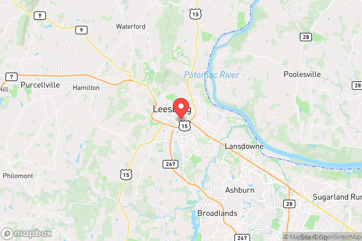
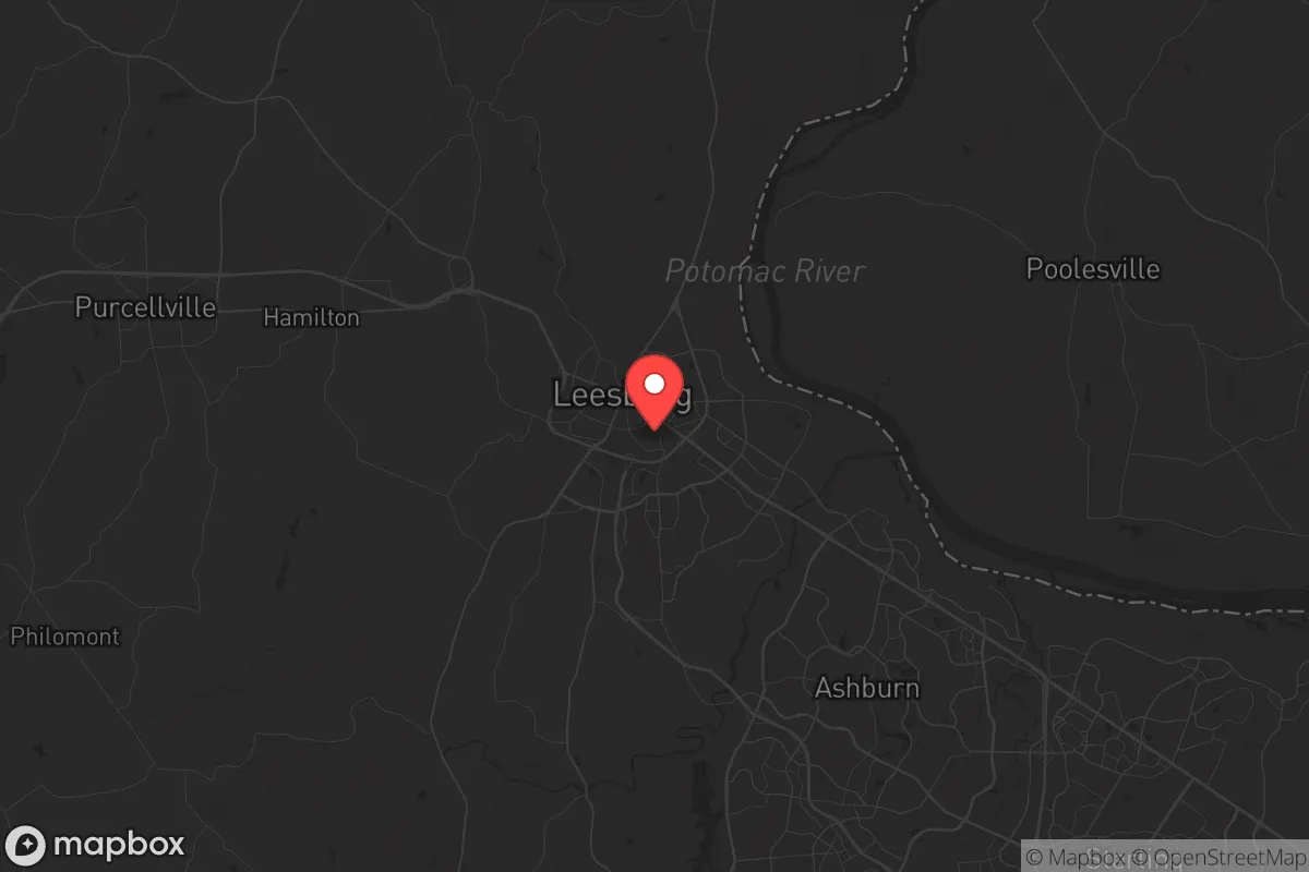
Strategic Assessment of Leesburg, VA
Multiple tactical vulnerabilities. Population density, target proximity, or disaster risk are likely compounding. A retreat property and exit planning is required.
What does the Strategic Assessment tell us?
Our Strategic Assessment grades tactical survivability of an area. Major population centers, military targets, fallout zones, natural disasters, and border exposure all drive risk — lower exposure means a more defensible position in a crisis.
This is heavily inspired by Joel Skousen's Strategic Relocation book. Highly recommended you checkout the book ($)What does this tell us?
Our Strategic Assessment grades tactical survivability of an area. Major population centers, military targets, fallout zones, natural disasters, and border exposure all drive risk — lower exposure means a more defensible position in a crisis.
This is heavily inspired by Joel Skousen's Strategic Relocation book. Highly recommended you checkout the book ($)Strategic Pillars

Key Distances
Regional Safe Places
Below is our recommended "safe zones" in Virginia and the surrounding area based on our strategic heuristics. For most people, it's unrealistic to live in a “safe zone” full-time due to work, family or other personal reasons. They tend to be more rural. However, many of these areas are perfect for second homes and retreat properties that double as a vacation home or even a short-term rental.


Important Note: For informational purposes only. This does not mean nothing bad ever happens in the green zones. Please use common sense. This is based on public data and modeled with AI. We tried to take a conservative approach but mistakes happen. We update this regularly as new information becomes available.
Solar Generator Recommendations
Backup power matters more here than in safer locations. We've picked three solar generators across budgets and capacity tiers — start with the budget unit if you only need a few essentials, or step up if you want to run a fridge and HVAC for days at a time.

Jackery Portable Power Station Explorer 300
Budget OptionPower on the Go: Weighing only 11 lbs, it's convenient to set up and store with book-sized foldable solar panels

BLUETTI Portable Power Station AC180
Designed for both indoor and outdoor scenarios, AC180 is highly capable as it has a robost capacity and continuous output power.

EF ECOFLOW DELTA Pro Ultra Power Station
Upgraded PickEcoFlow DELTA Pro Ultra is a whole-home energy system designed to grow with your family. Integrated with the Smart Home Panel 2, it scales to meet your evolving energy needs — keeping your home powered, intelligent, and secure through every stage of life.
We earn a commission, at no additional cost to you.
Strategic Assessment Analysis
Leesburg, Virginia, offers a compelling mix of strategic depth and practical vulnerability for those prioritizing long-term resilience. Positioned at the western edge of the Washington, D.C. metro area, it sits far enough from the urban core to avoid the worst of a sudden evacuation or grid collapse, yet close enough to major supply routes and infrastructure to be useful. For a conservative-minded relocator concerned with civic unrest, mass casualty events, or systemic breakdown, Leesburg presents a solid base—but only if you understand its specific exposures and plan accordingly.
Geographic position and natural advantages for long-term stability
Leesburg’s location in Loudoun County places it in the rolling Piedmont region, with the Blue Ridge Mountains visible to the west and the Potomac River forming its northern boundary. This terrain offers natural defensibility: the area is not flat, open farmland, but a mix of wooded hills, valleys, and creek beds that provide cover, line-of-sight advantages, and multiple escape routes. The town itself sits at roughly 300 feet elevation, which reduces flood risk compared to low-lying areas along the Potomac. The surrounding countryside is dotted with small farms, orchards, and vineyards—meaning local food production is not just theoretical but actual. Several working farms within a 15-minute drive of downtown Leesburg still produce vegetables, poultry, and beef, which is a significant advantage if supply chains falter. The Catoctin Mountains to the northwest and the Bull Run Mountains to the southeast create natural chokepoints that could slow movement from the D.C. direction, buying time for residents to react. Water access is decent: the Potomac River is a major freshwater source, though drawing from it requires treatment. More practically, the area has numerous springs, creeks, and private wells—many older homes in the county still operate on well water, which is a resilience plus if municipal systems fail.
Risks, exposures, and proximity to fallout-relevant landmarks
The single biggest vulnerability for Leesburg is its proximity to Washington, D.C., roughly 35 miles east. In a mass evacuation scenario—whether from a nuclear incident, a major terrorist attack, or a cascading grid failure—Leesburg sits directly in the path of anyone fleeing west on Route 7, Route 15, or the Dulles Greenway. The town’s population of roughly 50,000 could swell to double or triple that within hours as D.C. residents pour out. This is not speculation; it happened during the 9/11 attacks and again during the 2020 unrest, when traffic on the Greenway became a parking lot. Additionally, Leesburg is within 20 miles of Dulles International Airport, a high-value target for any adversary, and within 40 miles of the Pentagon, the Capitol, and other national command nodes. A ground-level nuclear detonation at the Pentagon would put Leesburg outside the lethal blast radius but well within the fallout plume zone, depending on wind direction. The town also sits near the Loudoun County Government Center and multiple data centers that power federal systems—these are potential secondary targets. On the natural disaster side, the area is low-risk for earthquakes and hurricanes, but severe thunderstorms, tornadoes, and ice storms are annual events. The 2012 derecho knocked out power for nearly a week in parts of Loudoun, and the 2021 ice storm caused widespread tree damage and road closures. Flooding along Goose Creek and the Potomac is localized but can cut off access to certain neighborhoods.
Practical resilience for a relocator: food, water, energy, and defensibility
For a relocator serious about self-sufficiency, Leesburg offers a mixed bag. Food security is above average: the Loudoun County Farmers Market operates year-round, and several CSAs (community-supported agriculture programs) deliver from farms within 10 miles. The area also has a strong hunting culture—deer, turkey, and small game are abundant in the surrounding woods—and fishing in the Potomac is viable, though you’ll want to check contamination advisories. Water is the bigger concern. The town’s municipal water comes from the Potomac via the Loudoun Water system, which is vulnerable to both contamination and power loss. Homes with private wells are far more resilient, but well pumps still require electricity. A backup generator or solar-plus-battery system is essential here—grid outages are common enough that many locals already own generators. Energy independence is achievable but not cheap. The area gets good sun exposure, and rooftop solar is increasingly common, but HOA restrictions in some subdivisions can be a hurdle. Propane is widely available for heating and cooking, and wood-burning stoves are legal in most of the county. Defensibility is where Leesburg shines relative to closer-in suburbs. The town has a historic core with narrow streets and stone buildings that could be held more easily than a sprawling subdivision. Many newer developments, however, are cul-de-sac neighborhoods with single points of entry—easy to block but also easy to trap. The ideal property is on the western or northern edge of town, with tree cover, a well, and access to back roads that bypass Route 7 and Route 15. The Loudoun County Sheriff’s Office is well-funded and professional, but in a widespread crisis, response times will stretch to hours or days. The local gun culture is strong, and Virginia is a shall-issue state for concealed carry, which matters for those who take personal security seriously. Medical facilities are adequate: Inova Loudoun Hospital is a full-service trauma center, but it would be overwhelmed in a mass casualty event. Having a trauma kit, training, and a plan for treating injuries at home is non-negotiable.
The overall strategic picture for Leesburg is one of calculated risk. It is not a remote bunker—it is a suburban town with real exposure to the chaos that could emanate from D.C. But for someone who wants to stay within a few hours of the capital for work or family reasons, while maintaining a credible posture of self-reliance, it is one of the better options in Northern Virginia. The key is to avoid the trap of complacency: owning a house in a nice neighborhood does not equal resilience. You need to harden your property, stockpile supplies, build community with like-minded neighbors, and have a plan for getting out if the evacuation wave hits. Leesburg gives you the terrain and the resources to make that work—but only if you treat it as a base of operations, not a sanctuary. The mountains are 30 minutes west; the chaos is 30 minutes east. Where you position yourself in that corridor determines everything.
* Values derived from national, state, county, city and local statistics and may differ in a specific area. Last updated: 2026-05-01T15:31:00.000Z
Narrative content on this page is AI-generated and may contain mistakes. Verify any details that matter before acting on them.
ReloMaps may earn a commission from affiliate links at no extra cost to you.