

Photo: Wikipedia
Strategic Assessment of Lexington, SC
Meaningful friction. Expect exposure to either population pressure, blast zones, or natural disaster risk. Consider buying a retreat property.
What does the Strategic Assessment tell us?
Our Strategic Assessment grades tactical survivability of an area. Major population centers, military targets, fallout zones, natural disasters, and border exposure all drive risk — lower exposure means a more defensible position in a crisis.
This is heavily inspired by Joel Skousen's Strategic Relocation book. Highly recommended you checkout the book ($)What does this tell us?
Our Strategic Assessment grades tactical survivability of an area. Major population centers, military targets, fallout zones, natural disasters, and border exposure all drive risk — lower exposure means a more defensible position in a crisis.
This is heavily inspired by Joel Skousen's Strategic Relocation book. Highly recommended you checkout the book ($)Strategic Pillars

Key Distances
Regional Safe Places
Below is our recommended "safe zones" in South Carolina and the surrounding area based on our strategic heuristics. For most people, it's unrealistic to live in a “safe zone” full-time due to work, family or other personal reasons. They tend to be more rural. However, many of these areas are perfect for second homes and retreat properties that double as a vacation home or even a short-term rental.


Important Note: For informational purposes only. This does not mean nothing bad ever happens in the green zones. Please use common sense. This is based on public data and modeled with AI. We tried to take a conservative approach but mistakes happen. We update this regularly as new information becomes available.
Solar Generator Recommendations
Backup power matters more here than in safer locations. We've picked three solar generators across budgets and capacity tiers — start with the budget unit if you only need a few essentials, or step up if you want to run a fridge and HVAC for days at a time.

Jackery Portable Power Station Explorer 300
Budget OptionPower on the Go: Weighing only 11 lbs, it's convenient to set up and store with book-sized foldable solar panels

BLUETTI Portable Power Station AC180
Designed for both indoor and outdoor scenarios, AC180 is highly capable as it has a robost capacity and continuous output power.

EF ECOFLOW DELTA Pro Ultra Power Station
Upgraded PickEcoFlow DELTA Pro Ultra is a whole-home energy system designed to grow with your family. Integrated with the Smart Home Panel 2, it scales to meet your evolving energy needs — keeping your home powered, intelligent, and secure through every stage of life.
We earn a commission, at no additional cost to you.
Strategic Assessment Analysis
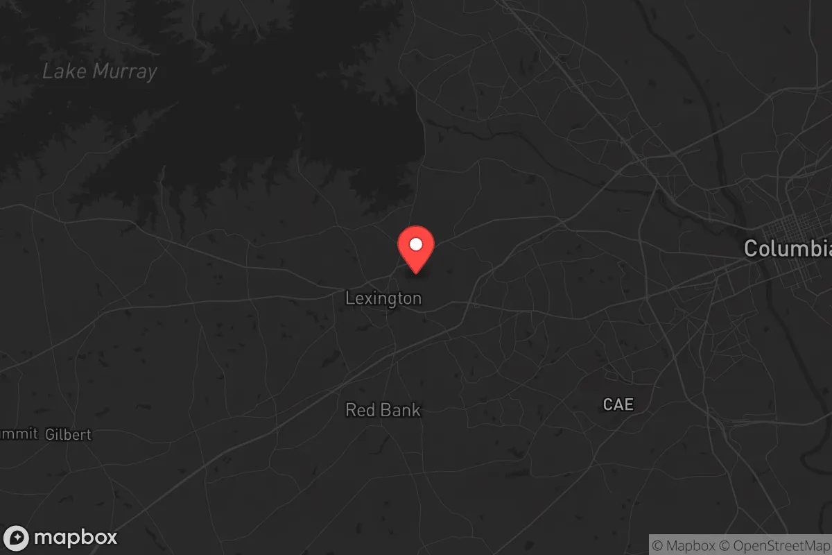
Lexington, South Carolina, presents a mixed strategic picture for the conservative prepper or survivalist. Its primary advantage is its position in the Midlands, roughly 15 miles west of Columbia, placing it within a reasonable distance of state-level resources while offering a buffer from the immediate chaos of a major urban center. The area’s resilience is rooted in its geographic insulation from coastal hurricane surges and its access to the Lake Murray watershed, but its proximity to a state capital and major interstate corridors introduces significant vulnerabilities for those prioritizing long-term self-sufficiency and fallout avoidance.
Geographic position and natural advantages for long-term security
Lexington’s location on the fall line between the Piedmont and the Coastal Plain gives it a strategic edge. The terrain is gently rolling, with mixed hardwood and pine forests that provide natural cover and resources for foraging or timber. The town sits on the western edge of Lake Murray, a 50,000-acre reservoir managed by Dominion Energy. This body of water is a critical asset: it supplies the region’s drinking water, supports local agriculture, and offers a potential food source via fishing. The lake’s dam, however, is a single point of failure—if compromised, it could flood downstream areas, including parts of Lexington itself. The area’s elevation averages around 400 feet, which is high enough to avoid most riverine flooding but low enough to be sheltered from the worst wind events. The climate is humid subtropical, with hot summers and mild winters, meaning a relocator can grow food year-round with proper planning. The soil in the region is primarily sandy loam, which drains well but requires amendment for intensive gardening. For a prepper, the ability to cultivate a substantial garden, raise small livestock, and harvest rainwater is realistic here, provided you secure a parcel with adequate acreage away from the suburban sprawl.
Risks, exposures, and proximity to fallout-relevant landmarks
The most glaring vulnerability for Lexington is its proximity to Columbia, the state capital and home to Fort Jackson, the U.S. Army’s largest initial entry training installation. In a scenario of civil unrest or mass casualty events, Columbia would be a primary target for disruption, looting, or federal intervention. Lexington sits directly on Interstate 20 and Interstate 26, both of which are major east-west and north-south evacuation and logistics corridors. During a crisis, these highways would become chokepoints or avenues for displaced populations. The town is also within 50 miles of the Savannah River Site, a nuclear weapons facility and waste storage site near Aiken. While a catastrophic release is unlikely, the site’s existence means that prevailing winds from the southwest could carry fallout toward Lexington in a worst-case event. Additionally, the region is in Seismic Zone 2, meaning minor earthquakes are possible, though not a primary concern. For the survivalist, the presence of a major military base and a nuclear facility within a 60-mile radius is a significant negative. In a societal collapse, these assets would attract federal security forces, potential adversaries, and desperate populations. Lexington’s growth as a bedroom community for Columbia also means it has a high density of suburban subdivisions with limited defensibility and heavy reliance on grid infrastructure.
Practical resilience for a relocator: food, water, energy, and defensibility
For a relocator serious about self-sufficiency, Lexington offers a mixed bag. Water is the strongest asset: Lake Murray provides a massive, renewable source, and the area’s average annual rainfall of 45 inches means rainwater catchment is viable. However, municipal water treatment plants are vulnerable to cyberattacks or contamination events, so a private well with a hand pump or a filtration system for lake water is essential. Food production is feasible but requires land. The growing season runs from April to October, with a mild winter allowing for cold-hardy crops like kale and carrots. Local farmers’ markets and the Lexington County Farm Bureau offer resources for seed and livestock, but zoning in incorporated areas restricts chickens and goats. For energy, the grid is served by Dominion Energy and is moderately reliable, but solar is a strong play here—Lexington averages 215 sunny days per year, slightly above the national average. Battery storage and a backup generator are recommended, as ice storms and thunderstorms can cause outages. Defensibility is the weak point. Most homes in Lexington are in subdivisions with open layouts, shared driveways, and minimal setback. For a prepper, a rural property on the outskirts—toward Batesburg-Leesville or along the Saluda River—offers better terrain, natural barriers, and distance from population centers. The local sheriff’s office is well-funded and responsive, but in a widespread crisis, law enforcement will be stretched thin. The community itself leans conservative, with a strong church presence and a culture of hunting and outdoor skills, which can be a social asset for mutual aid networks.
The overall strategic picture for Lexington is one of calculated trade-offs. It is not a remote bunker location, nor is it a high-risk urban core. For the conservative relocator who wants to be within a few hours of the coast, mountains, and state government while maintaining a low profile, it works—provided you choose your specific plot wisely. The proximity to Columbia and the Savannah River Site are real liabilities that cannot be ignored, but the water security, agricultural potential, and like-minded community offset some of those risks. If your plan is to hunker down and ride out a short-term disruption, Lexington’s infrastructure and location are adequate. If you are preparing for a long-term collapse or a nuclear event, you will need to push farther west or into the Upstate. For a single individual or family willing to invest in off-grid systems and a rural parcel, Lexington offers a solid foundation, but it demands vigilance and a clear-eyed understanding of its exposure to the very systems you are trying to escape.
* Values derived from national, state, county, city and local statistics and may differ in a specific area. Last updated: 2026-04-29T17:51:16.000Z
Narrative content on this page is AI-generated and may contain mistakes. Verify any details that matter before acting on them.
ReloMaps may earn a commission from affiliate links at no extra cost to you.