Photo: Wikipedia
Strategic Assessment of Llano, TX
Workable tactical position. Some exposure to population density or targets, but generally defensible in a crisis.
What does the Strategic Assessment tell us?
Our Strategic Assessment grades tactical survivability of an area. Major population centers, military targets, fallout zones, natural disasters, and border exposure all drive risk — lower exposure means a more defensible position in a crisis.
This is heavily inspired by Joel Skousen's Strategic Relocation book. Highly recommended you checkout the book ($)What does this tell us?
Our Strategic Assessment grades tactical survivability of an area. Major population centers, military targets, fallout zones, natural disasters, and border exposure all drive risk — lower exposure means a more defensible position in a crisis.
This is heavily inspired by Joel Skousen's Strategic Relocation book. Highly recommended you checkout the book ($)Strategic Pillars

Key Distances
Regional Safe Places
Below is our recommended "safe zones" in Texas and the surrounding area based on our strategic heuristics. For most people, it's unrealistic to live in a “safe zone” full-time due to work, family or other personal reasons. They tend to be more rural. However, many of these areas are perfect for second homes and retreat properties that double as a vacation home or even a short-term rental.


Important Note: For informational purposes only. This does not mean nothing bad ever happens in the green zones. Please use common sense. This is based on public data and modeled with AI. We tried to take a conservative approach but mistakes happen. We update this regularly as new information becomes available.
Solar Generator Recommendations
Backup power matters more here than in safer locations. We've picked three solar generators across budgets and capacity tiers — start with the budget unit if you only need a few essentials, or step up if you want to run a fridge and HVAC for days at a time.

Jackery Portable Power Station Explorer 300
Budget OptionPower on the Go: Weighing only 11 lbs, it's convenient to set up and store with book-sized foldable solar panels

BLUETTI Portable Power Station AC180
Designed for both indoor and outdoor scenarios, AC180 is highly capable as it has a robost capacity and continuous output power.

EF ECOFLOW DELTA Pro Ultra Power Station
Upgraded PickEcoFlow DELTA Pro Ultra is a whole-home energy system designed to grow with your family. Integrated with the Smart Home Panel 2, it scales to meet your evolving energy needs — keeping your home powered, intelligent, and secure through every stage of life.
We earn a commission, at no additional cost to you.
Strategic Assessment Analysis
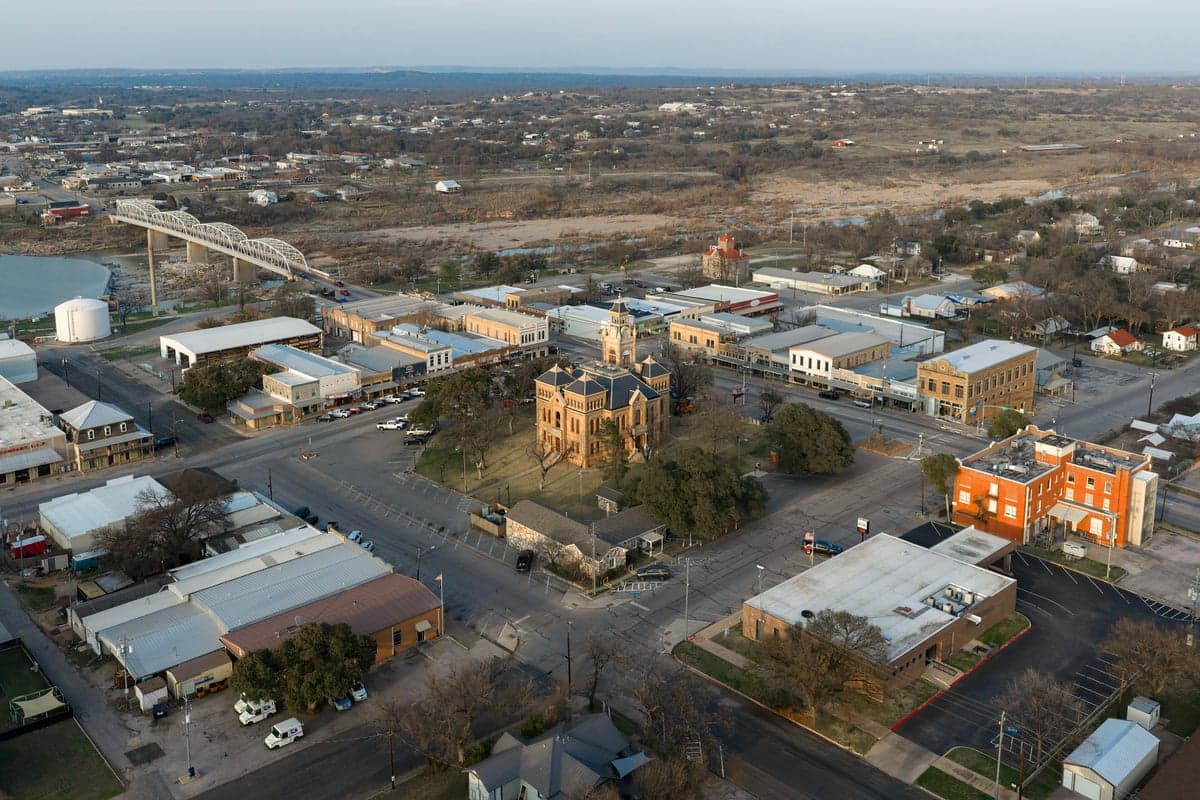
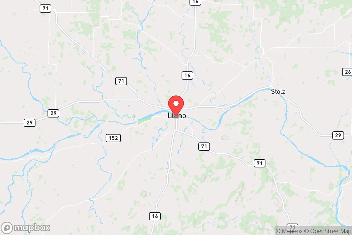
Llano, Texas, offers a strategic depth that is increasingly rare in a state dominated by sprawling metroplexes and vulnerable supply chains. Sitting roughly 65 miles northwest of Austin and 90 miles from Fort Cavazos (formerly Hood), this Hill Country seat of Llano County provides a genuine buffer from the immediate blast zones and civil chaos that would likely engulf larger cities in a national emergency. Its position along the Llano River, combined with low population density and a historically self-reliant local culture, makes it a location worth serious consideration for anyone prioritizing long-term security over convenience.
How Llano's Hill Country location and natural barriers provide strategic depth
Llano sits in a natural basin carved by the Llano River, surrounded by granite domes and rugged limestone hills that create genuine defensive terrain. The area's most prominent feature, Enchanted Rock, is not just a tourist draw—it is a landmark that signals the kind of hard, fractured geology that makes large-scale mechanized movement difficult. Unlike the flat, exposed expanses of West Texas or the congested I-35 corridor, Llano County offers multiple natural chokepoints and observation positions. The river itself provides a reliable water source that runs year-round in most conditions, a critical asset that many Texas towns lack. The local economy has historically revolved around granite quarrying, ranching, and light manufacturing—industries that translate well into a post-disruption scenario. The Llano County Airport (KAQO) is a general aviation field that could serve as a resupply or evacuation point without the scrutiny of a major commercial hub. For a relocator, the key advantage is simple: you are not in the blast radius of a major city, and the terrain gives you options that flatland dwellers simply do not have.
What risks and exposure to fallout zones mean for long-term security
No location is without exposure, and Llano has specific vulnerabilities that must be weighed honestly. The most significant risk is proximity to the I-35 corridor, which runs from San Antonio through Austin and up to Dallas-Fort Worth. In a mass evacuation scenario, this highway becomes a liability—choke points at the Llano River crossings and the intersection with TX-29 could see desperate traffic from Austin refugees. The Highland Lakes chain, including Lake Buchanan and Inks Lake, lies roughly 20 miles to the south. While these lakes are assets for water, they are also potential targets for sabotage or contamination if civil order collapses. The city of Llano itself has a population under 3,500, but the county seat concentrates government services, law enforcement, and medical facilities—meaning it could become a magnet for displaced persons. Fallout from a nuclear event at Fort Cavazos or a major strike on Austin would likely pass to the east or northeast given prevailing winds, but the margin is thin. The Llano area is also in the Texas Hill Country wildfire risk zone; dry summers and high grass loads create a seasonal hazard that demands active mitigation. For the prepper, these risks are manageable with planning, but they are real and should not be dismissed.
How practical resilience in food, water, energy, and defensibility holds up
Water is the single most important factor in any long-term survival scenario, and Llano has a genuine advantage here. The Llano River is a perennial stream fed by springs in the Edwards Plateau, and groundwater in the surrounding granite formations is accessible via wells at reasonable depths—typically 100 to 300 feet. The city's municipal water supply comes from the river and from wells, but a relocator with a private well and a hand pump or solar-powered pump has a redundant source that most suburban properties cannot match. Food resilience is moderate: Llano County has active ranching operations, and the local soil in river bottoms can support vegetable production, but the growing season is limited by occasional late freezes and summer heat. The local hunting pressure is moderate, with white-tailed deer and feral hogs available, but game populations are not unlimited. Energy resilience is improving: the area has good solar exposure, and off-grid solar installations are becoming more common among local landowners. Natural gas and propane are available in town, but a relocator should plan for a minimum of two weeks of fuel storage for generators. Defensibility is where Llano shines. The terrain offers natural standoff, and the local culture is heavily armed and self-reliant. Llano County has a strong tradition of private property rights and minimal zoning enforcement, which means a relocator can build a perimeter, establish a garden, and maintain a low profile without attracting unwanted attention from code enforcement or busybody neighbors. The sheriff's office is small but responsive, and the local population is generally suspicious of outside interference—a trait that works in your favor if you integrate quietly and respectfully.
The overall strategic picture for Llano is one of calculated trade-offs. You gain genuine geographic depth, a reliable water source, defensible terrain, and a community that values self-sufficiency over government dependency. You accept moderate exposure to evacuation routes, wildfire risk, and the long shadow of Austin's potential collapse. For a single individual or a family willing to invest in well water, solar power, and a low-profile lifestyle, Llano offers a base that can be hardened over time without the astronomical land costs of the Western states. It is not a fortress, and it is not immune to the cascading failures that could follow a national crisis. But for someone looking to step off the grid of vulnerability while staying within striking distance of resources and medical care, Llano represents a solid, sober choice in a state where such options are shrinking fast.
* Values derived from national, state, county, city and local statistics and may differ in a specific area. Last updated: 2026-05-14T18:25:51.000Z
Narrative content on this page is AI-generated and may contain mistakes. Verify any details that matter before acting on them.
ReloMaps may earn a commission from affiliate links at no extra cost to you.