
Photo: Wikipedia
Strategic Assessment of Long Branch, NJ
High tactical risk. This location is likely close to major population centers, strategic targets, or sits in a high-disaster corridor. A retreat property and careful exit planning is required.
What does the Strategic Assessment tell us?
Our Strategic Assessment grades tactical survivability of an area. Major population centers, military targets, fallout zones, natural disasters, and border exposure all drive risk — lower exposure means a more defensible position in a crisis.
This is heavily inspired by Joel Skousen's Strategic Relocation book. Highly recommended you checkout the book ($)What does this tell us?
Our Strategic Assessment grades tactical survivability of an area. Major population centers, military targets, fallout zones, natural disasters, and border exposure all drive risk — lower exposure means a more defensible position in a crisis.
This is heavily inspired by Joel Skousen's Strategic Relocation book. Highly recommended you checkout the book ($)Strategic Pillars

Key Distances
Regional Safe Places
Below is our recommended "safe zones" in New Jersey and the surrounding area based on our strategic heuristics. For most people, it's unrealistic to live in a “safe zone” full-time due to work, family or other personal reasons. They tend to be more rural. However, many of these areas are perfect for second homes and retreat properties that double as a vacation home or even a short-term rental.


Important Note: For informational purposes only. This does not mean nothing bad ever happens in the green zones. Please use common sense. This is based on public data and modeled with AI. We tried to take a conservative approach but mistakes happen. We update this regularly as new information becomes available.
Solar Generator Recommendations
Backup power matters more here than in safer locations. We've picked three solar generators across budgets and capacity tiers — start with the budget unit if you only need a few essentials, or step up if you want to run a fridge and HVAC for days at a time.

Jackery Portable Power Station Explorer 300
Budget OptionPower on the Go: Weighing only 11 lbs, it's convenient to set up and store with book-sized foldable solar panels

BLUETTI Portable Power Station AC180
Designed for both indoor and outdoor scenarios, AC180 is highly capable as it has a robost capacity and continuous output power.

EF ECOFLOW DELTA Pro Ultra Power Station
Upgraded PickEcoFlow DELTA Pro Ultra is a whole-home energy system designed to grow with your family. Integrated with the Smart Home Panel 2, it scales to meet your evolving energy needs — keeping your home powered, intelligent, and secure through every stage of life.
We earn a commission, at no additional cost to you.
Strategic Assessment Analysis
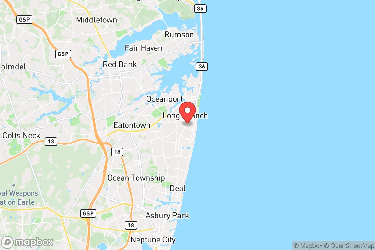
Long Branch, New Jersey, presents a complex strategic picture for the conservative prepper or survivalist. Its location on the Jersey Shore offers some natural advantages, but its proximity to major metropolitan areas and critical infrastructure introduces significant vulnerabilities that must be weighed carefully. For the individual or family prioritizing resilience against civic unrest, mass casualty events, and large-scale disasters, Long Branch is a location that demands a clear-eyed assessment of both its defensive potential and its exposure to cascading risks.
Geographic position and natural advantages for a survival scenario
Long Branch sits on a narrow strip of land between the Atlantic Ocean and the Shrewsbury River, roughly 50 miles south of New York City and 60 miles east of Philadelphia. This coastal position provides a few notable strategic benefits. The ocean offers a reliable source of seafood and a potential evacuation route by boat, assuming one has the means and knowledge to navigate coastal waters. The Shrewsbury River and the Navesink River to the south create natural chokepoints, limiting ground access from the mainland. In a grid-down scenario, the peninsula-like geography could be easier to defend than a sprawling inland suburb, provided you control the few bridges and causeways. The area also benefits from a moderate climate, with no extreme cold or heat that would stress off-grid living as severely as the interior or the Deep South. The local soil, while sandy, can support raised-bed gardening with amendments, and the region's rainfall is generally reliable. For a relocator, the key natural advantage is the ability to leverage the water for both sustenance and a potential fallback position, but this is contingent on securing a property with direct water access or a nearby secure marina.
Risks, exposures, and proximity to fallout-relevant landmarks
The most glaring vulnerability for Long Branch is its proximity to high-value, high-risk targets. You are within the blast radius and fallout plume of several critical infrastructure nodes. The New York City metropolitan area, with its financial centers, ports, and population density, is a prime target for any state-level adversary or domestic terror event. A nuclear detonation or a dirty bomb in Manhattan would send fallout eastward over Long Branch, depending on wind patterns. Similarly, the Philadelphia metro area and the massive oil refining and chemical storage complexes along the Delaware River (including the Paulsboro and Marcus Hook facilities) are potential targets. A conventional attack or major industrial accident at these sites could release toxic clouds that would drift over the Jersey Shore. Beyond WMD events, the area is exposed to natural hazards. Hurricanes and nor'easters are a recurring threat; Superstorm Sandy in 2012 caused widespread flooding and prolonged power outages across Long Branch. The city's low-lying coastal neighborhoods are in FEMA flood zones, meaning any storm surge can inundate roads, homes, and critical infrastructure. For the prepper, the risk of being trapped in a traffic jam on the Garden State Parkway during an evacuation is very real. The bridges across the Shrewsbury and Navesink rivers become choke points that could be blocked by fleeing crowds or disabled vehicles. In short, while the ocean provides resources, it also puts you directly in the path of fallout from two major metro areas and the Atlantic's storm track.
Practical resilience for a relocator: food, water, energy, and defensibility
For a family or individual looking to establish a resilient homestead, Long Branch presents significant challenges. Water is the most critical issue. The municipal water supply comes from the New Jersey American Water system, which draws from the Swimming River Reservoir and the Manasquan River. In a prolonged grid-down event, this system will fail. You must have a private well, a rainwater catchment system, or a reliable method to treat surface water from the Shrewsbury River or the ocean. Desalination is energy-intensive, so a robust rainwater collection setup with first-flush diverters and a high-quality filter (like a Berkey or a reverse osmosis system) is non-negotiable. Food production is possible but limited. The sandy soil requires heavy amendment with compost and raised beds. A greenhouse extends the growing season, but salt spray from the ocean can damage crops. Local fishing and crabbing are viable protein sources, but you must account for potential contamination from runoff or a fallout event. Energy independence is difficult. Solar panels are viable, but coastal storms and salt corrosion reduce their lifespan. A backup generator with a large fuel store (stored safely and rotated) is essential, but fuel resupply will be impossible during a crisis. Defensibility is mixed. The dense suburban layout of Long Branch means close neighbors. OPSEC (operational security) is paramount; you cannot hide a large garden, a generator, or a stockpile. The best defensive properties are those on larger lots, ideally with a buffer of trees or a fenced perimeter, and with a clear line of sight to the single road access point. A property on a dead-end street near the water is ideal, but such homes are expensive and often in flood zones. For the relocator, the practical reality is that Long Branch requires a high level of pre-positioned supplies and a plan to bug in for at least 30-60 days, with a secondary bug-out location inland (perhaps in the Pine Barrens or the Poconos) as a fallback.
The overall strategic picture for Long Branch is one of calculated risk. It is not a remote survival retreat, nor is it a defensible fortress. It is a coastal suburb with access to marine resources but with severe exposure to fallout from New York and Philadelphia, hurricane threats, and a dense population that will become a liability during a crisis. For the conservative prepper who values proximity to the ocean and a moderate climate, and who has the financial resources to secure a well-positioned, flood-safe property with independent water and power, Long Branch can be a viable location. However, it demands a higher level of preparation, a lower expectation of privacy, and a realistic plan for evacuation if the worst occurs. For most relocators seeking a resilient, low-profile lifestyle, the risks likely outweigh the rewards. The smart move is to treat Long Branch as a secondary location—a coastal base for normal times—while maintaining a more defensible, inland primary retreat for when the grid goes down and the cities burn.
* Values derived from national, state, county, city and local statistics and may differ in a specific area. Last updated: 2026-05-02T14:35:09.000Z
Narrative content on this page is AI-generated and may contain mistakes. Verify any details that matter before acting on them.
ReloMaps may earn a commission from affiliate links at no extra cost to you.