
Photo: Wikipedia
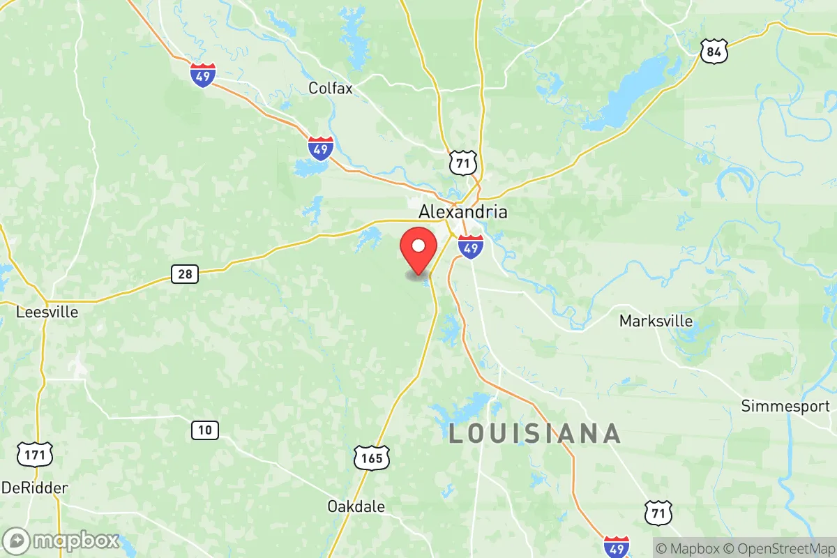
Strategic Assessment of Rapides County
Workable tactical position. Some exposure to population density or targets, but generally defensible in a crisis.
What does the Strategic Assessment tell us?
Our Strategic Assessment grades tactical survivability of an area. Major population centers, military targets, fallout zones, natural disasters, and border exposure all drive risk — lower exposure means a more defensible position in a crisis.
This is heavily inspired by Joel Skousen's Strategic Relocation book. Highly recommended you checkout the book ($)What does this tell us?
Our Strategic Assessment grades tactical survivability of an area. Major population centers, military targets, fallout zones, natural disasters, and border exposure all drive risk — lower exposure means a more defensible position in a crisis.
This is heavily inspired by Joel Skousen's Strategic Relocation book. Highly recommended you checkout the book ($)Strategic Pillars

Key Distances
Strategic Assessment Analysis
Rapides County, Louisiana, offers a compelling mix of strategic depth and practical resilience for those prioritizing self-reliance and distance from major urban collapse zones. Anchored by the city of Alexandria, this central Louisiana region sits far from the hurricane-prone coastlines of New Orleans and the refinery corridors of Baton Rouge, yet remains within a day’s drive of critical infrastructure. Its position along the Red River, combined with a low population density and a historically conservative, self-sufficient culture, makes it a viable relocation target for individuals and families seeking a buffer from coastal disasters, civil unrest, and the fallout risks associated with major industrial targets.
Geographic position and natural advantages for long-term security
Rapides County’s primary strategic asset is its location in the geographic heart of Louisiana, roughly 100 miles northwest of Baton Rouge and 150 miles from the Gulf Coast. This inland buffer significantly reduces exposure to hurricane storm surges, which have devastated coastal parishes in recent decades. The county is bisected by the Red River, providing a reliable water source and natural defensive terrain, while the surrounding Kisatchie National Forest offers vast tracts of timberland for hunting, foraging, and off-grid living. The area’s elevation, averaging around 100 feet above sea level, is notably higher than much of southern Louisiana, reducing flood risk from river overflow. For a relocator, this means a lower probability of evacuation orders and a greater ability to maintain self-sufficiency during regional emergencies. The presence of the Alexandria International Airport and the England Airpark (a former Air Force base) also provides logistical redundancy for supply movement or evacuation if needed, though the area remains far enough from major interstate choke points like I-10 to avoid refugee traffic from coastal cities.
Risks, exposures, and proximity to fallout-relevant landmarks
While Rapides County avoids the worst of coastal threats, it is not without exposure. The county sits within the Mississippi River Valley, which means tornadoes and severe thunderstorms are a seasonal reality—though modern construction and basement options can mitigate this. The most significant risk for a prepper-minded relocator is proximity to the Louisiana Chemical Corridor, commonly called "Cancer Alley," which runs along the Mississippi River from Baton Rouge to New Orleans. While Rapides County is roughly 80 miles northwest of this corridor, prevailing winds from the south could carry airborne contaminants from a major industrial accident or terrorist attack at facilities like the ExxonMobil Baton Rouge Refinery or the Port of South Louisiana. Additionally, the county is within 150 miles of Fort Polk (now Joint Readiness Training Center) to the west, a major military installation that could become a staging area during civil unrest, potentially drawing federal attention or refugee flows. The presence of the Rapides Parish Correctional Facility and the Alexandria VA Health Care System are also potential targets for disruption. For the survivalist, the key takeaway is that Rapides County is not a zero-risk zone, but its distance from the most volatile coastal and industrial targets makes it a far safer bet than suburban Houston or New Orleans.
Practical resilience for a relocator: food, water, energy, and defensibility
For a family or individual looking to establish a resilient homestead, Rapides County offers tangible advantages in basic necessities. The Red River and its tributaries, including Bayou Rapides and the Calcasieu River, provide ample surface water for filtration and irrigation, though well drilling is common in rural areas and recommended for independence from municipal systems. The region’s long growing season (typically 8–9 months) and fertile alluvial soils support year-round gardening, with local farmers’ markets in Alexandria, Pineville, and Boyce offering seed stock and livestock. Energy resilience is bolstered by the county’s position near the Haynesville Shale natural gas fields, though most residents rely on the grid; solar potential is moderate but viable with battery storage. Defensibility is a mixed bag: the county’s rural areas, particularly around the towns of Woodworth and Forest Hill, offer dense forest cover and limited road access, making them harder to approach for looters or hostile groups. However, Alexandria itself is a population center of roughly 45,000, which could become a chokepoint during a crisis. The ideal strategy is to secure property on the outskirts—preferably north of the Red River near the Kisatchie National Forest boundary—where natural barriers and low traffic provide a buffer. Local gun culture is strong, with numerous shooting ranges and a high rate of firearm ownership, which aligns with a conservative self-defense mindset.
In the broader strategic picture, Rapides County represents a middle-ground option for those who want to be far enough from coastal collapse zones to avoid immediate fallout, yet close enough to major supply routes (I-49 and US-71) to access resources if needed. It lacks the extreme isolation of the Rocky Mountain states but compensates with a lower cost of living, a conservative political climate (Rapides County voted +30 points Republican in 2024), and a community that largely values self-reliance over government dependency. For a single individual or family with a prepper mindset, the county offers a realistic balance: you can buy acreage near the forest, drill a well, and raise food without the paranoia of being a target, while still being a day’s drive from the Gulf’s oil infrastructure if you need to bug out. The risks—tornadoes, chemical drift from the south, and potential refugee pressure from Alexandria—are manageable with proper planning. If your goal is to avoid the chaos of urban collapse while maintaining a functional, defensible lifestyle, Rapides County deserves a serious look. It’s not a fortress, but it’s a damn sight better than being in the blast radius of a refinery or the crosshairs of a coastal evacuation route.
* Values derived from national, state, county, city and local statistics and may differ in a specific area. Last updated: 2026-05-29T09:18:06.000Z
Narrative content on this page is AI-generated and may contain mistakes. Verify any details that matter before acting on them.
ReloMaps may earn a commission from affiliate links at no extra cost to you.