Photo: Wikipedia
Strategic Assessment of Mackinac Island, MI
Workable tactical position. Some exposure to population density or targets, but generally defensible in a crisis.
What does the Strategic Assessment tell us?
Our Strategic Assessment grades tactical survivability of an area. Major population centers, military targets, fallout zones, natural disasters, and border exposure all drive risk — lower exposure means a more defensible position in a crisis.
This is heavily inspired by Joel Skousen's Strategic Relocation book. Highly recommended you checkout the book ($)What does this tell us?
Our Strategic Assessment grades tactical survivability of an area. Major population centers, military targets, fallout zones, natural disasters, and border exposure all drive risk — lower exposure means a more defensible position in a crisis.
This is heavily inspired by Joel Skousen's Strategic Relocation book. Highly recommended you checkout the book ($)Strategic Pillars

Key Distances
Regional Safe Places
Below is our recommended "safe zones" in Michigan and the surrounding area based on our strategic heuristics. For most people, it's unrealistic to live in a “safe zone” full-time due to work, family or other personal reasons. They tend to be more rural. However, many of these areas are perfect for second homes and retreat properties that double as a vacation home or even a short-term rental.


Important Note: For informational purposes only. This does not mean nothing bad ever happens in the green zones. Please use common sense. This is based on public data and modeled with AI. We tried to take a conservative approach but mistakes happen. We update this regularly as new information becomes available.
Solar Generator Recommendations
Backup power matters more here than in safer locations. We've picked three solar generators across budgets and capacity tiers — start with the budget unit if you only need a few essentials, or step up if you want to run a fridge and HVAC for days at a time.

Jackery Portable Power Station Explorer 300
Budget OptionPower on the Go: Weighing only 11 lbs, it's convenient to set up and store with book-sized foldable solar panels

BLUETTI Portable Power Station AC180
Designed for both indoor and outdoor scenarios, AC180 is highly capable as it has a robost capacity and continuous output power.

EF ECOFLOW DELTA Pro Ultra Power Station
Upgraded PickEcoFlow DELTA Pro Ultra is a whole-home energy system designed to grow with your family. Integrated with the Smart Home Panel 2, it scales to meet your evolving energy needs — keeping your home powered, intelligent, and secure through every stage of life.
We earn a commission, at no additional cost to you.
Strategic Assessment Analysis
Mackinac Island is one of the most defensible residential locations in the Midwest, but its resilience comes with a hard trade-off: total logistical dependence on a single ferry system and a short seasonal window. For a relocator weighing disaster readiness, the island offers a unique combination of natural moat, low population density, and zero through-traffic, yet those same features create severe constraints on supply chains, medical evacuation, and winter self-sufficiency. The strategic picture is not about surviving a blast—it is about whether you can function when the boats stop running.
Geographic position and natural defensive advantages
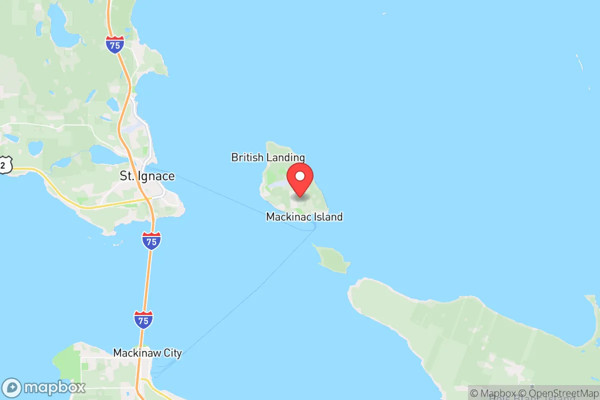
Mackinac Island sits in the Straits of Mackinac, the narrow waterway connecting Lake Michigan and Lake Huron, roughly 8 miles from the mainland cities of St. Ignace to the north and Mackinaw City to the south. The island itself is only 3.8 square miles, with about 80 percent of that land held as state park—meaning the developed footprint is tiny, and the permanent population hovers around 500 to 600 residents. That density profile is a genuine asset: there are no suburbs, no strip malls, and no industrial corridors to complicate a crisis scenario.
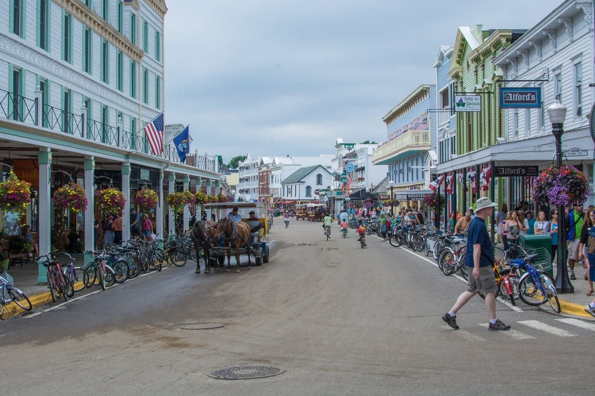
The island’s defining feature is the absolute prohibition on motor vehicles. No cars, no trucks, no emergency vehicles larger than a golf cart or a horse-drawn wagon. This ban, in force since 1898, creates a defensive perimeter that is nearly impossible to breach by road—because there is no road network to speak of. The only paved thoroughfare is M-185, a scenic loop that circles the island and is used primarily by bicycles and horse carriages. For a family thinking about security, this means the island is effectively a pedestrian-only fortress with a natural water barrier on all sides. The limestone bluffs on the eastern shore, including the 150-foot Arch Rock formation, provide elevated sightlines over the shipping lanes, and the island’s highest point, Fort Holmes, sits at 320 feet above lake level—historically used for military observation and still offering a commanding view of the Straits.
The Straits themselves are a chokepoint for Great Lakes shipping, with the Mackinac Bridge carrying I-75 traffic just a few miles west. That bridge is both a lifeline and a liability: if it were compromised, the island’s mainland connection would shift entirely to ferry and air service. The island does have a small airport (Mackinac County Airport, KMCD) with a 3,200-foot runway, capable of handling light aircraft and medevac helicopters, which provides a secondary evacuation route when the water is frozen or the ferries are down.
Risk exposure and proximity to fallout-relevant landmarks
Mackinac Island’s exposure to man-made threats is remarkably low compared to most of the Midwest, but it is not zero. The nearest population center of any size is Petoskey, roughly 30 miles southwest, and the closest major metropolitan area is Grand Rapids, over 200 miles away. For a reader concerned about fallout from a nuclear exchange, the island’s distance from strategic targets—military installations, major ports, large cities—is a significant advantage. The nearest obvious target would be the Soo Locks at Sault Ste. Marie, about 50 miles northeast, which are a critical chokepoint for Great Lakes shipping and a plausible strategic asset in a conflict. Prevailing winds in the region blow from the west and northwest, which means fallout from a strike on the Soo would likely drift eastward, away from the island, though this is a probabilistic assessment, not a guarantee.
The island’s real vulnerability is natural, not man-made. It sits in a zone prone to severe lake-effect snow, with annual accumulations often exceeding 100 inches, and the Straits freeze over in most winters, creating shifting ice that can halt ferry service for days or weeks. The 2023–2024 winter saw the Straits freeze solid enough to allow ice fishing and snowmobile crossings, which is a resilience asset in one sense—it opens a land bridge—but a hazard in another, as ice conditions are unpredictable and can strand residents who rely on the ferries. The island also faces erosion risk on its eastern bluffs, and the limestone substrate is karstic, meaning there are sinkholes and underground drainage channels that can complicate any attempt to drill wells or build underground shelters.
Proximity to the Mackinac Bridge is a double-edged sword. The bridge is a critical piece of national infrastructure, carrying I-75 and connecting the Upper and Lower Peninsulas. In a crisis, it would be a target for sabotage or a chokepoint for military movement, and the island sits directly in its shadow. However, the island itself has no bridges, no tunnels, and no fixed connection to the mainland—which means it is not a target in its own right, and any adversary would have to commit significant naval or air assets to reach it.
Practical resilience for a relocator: food, water, energy, and defensibility
For a family serious about self-sufficiency, Mackinac Island presents a paradox: the natural defenses are excellent, but the practical logistics are brutal. There is no grocery store on the island that can sustain a year-round population of 500, let alone the thousands of seasonal workers and tourists who swell the numbers each summer. The two main markets—Doud’s Market, which claims to be the oldest grocery store in Michigan (est. 1884), and the smaller Murray’s—stock primarily for the tourist season and have limited cold storage. A relocator would need to plan for a minimum of six months of stored food, because the ferry season typically runs from mid-April to late October, and even in good years, the last boats of the season can be canceled on short notice due to ice.
Water is the island’s most underrated vulnerability. The island has no natural lakes or rivers; the sole source of freshwater is a single aquifer beneath the island, tapped by a municipal well system that serves the downtown area. Residents outside the downtown core—which is most of the island’s private land—rely on private wells, and the karstic geology means groundwater is susceptible to contamination from septic systems and horse waste. The island’s famous horse population, numbering around 600 animals, produces a significant waste stream that must be managed carefully to avoid polluting the aquifer. In a prolonged grid-down scenario, water would be the first critical shortage, and desalination of lake water is not a practical option for most residents due to the energy required.
Energy is another weak point. The island is connected to the mainland grid via a submarine cable from St. Ignace, but that cable is a single point of failure. There is no natural gas pipeline; heating is primarily via propane, delivered by barge and stored in large tanks, or via wood and coal for older homes. Electricity outages in winter are not just inconvenient—they are life-threatening, because the island’s housing stock is largely historic, with poor insulation and old windows. A family would need a robust backup power system, preferably solar with battery storage, but the island’s northern latitude and frequent cloud cover in winter mean solar generation is severely limited from November through February. Wind is more consistent, but zoning restrictions and the island’s historic preservation rules make installing a wind turbine or a large solar array a bureaucratic challenge.
Defensibility, however, is where the island shines. The lack of motor vehicles means any threat—whether human or animal—must approach on foot, by boat, or by air, and the island’s small size means the entire perimeter is observable from the central high ground. The state park land is largely undeveloped forest, providing cover but also making it difficult to patrol. The permanent population is tight-knit and historically self-reliant, with a strong culture of mutual aid during the harsh winters. The island’s medical clinic, the Mackinac Island Medical Center, is staffed year-round but is a small facility—serious emergencies require a medevac flight to Petoskey or Sault Ste. Marie, which may not be available in a crisis.
The overall strategic picture for Mackinac Island is one of exceptional natural defense paired with fragile logistics. For a relocator who can afford to stockpile a year of supplies, invest in a well-insulated home with redundant heating and power, and accept the isolation of a six-month winter, the island offers a level of security that few places in the Lower 48 can match. But for a family expecting to live off the land or rely on local infrastructure, the island is a trap—beautiful, historic, and defensible, but utterly dependent on the boats, the cable, and the propane barges that keep it alive. The wise assessment is this: Mackinac Island is a fortress, but a fortress with a very thin supply line, and the strategic value depends entirely on whether you can hold that line through the ice.

* Values derived from national, state, county, city and local statistics and may differ in a specific area. Last updated: 2026-10-20T08:17:16.000Z
Narrative content on this page is AI-generated and may contain mistakes. Verify any details that matter before acting on them.
ReloMaps may earn a commission from affiliate links at no extra cost to you.

