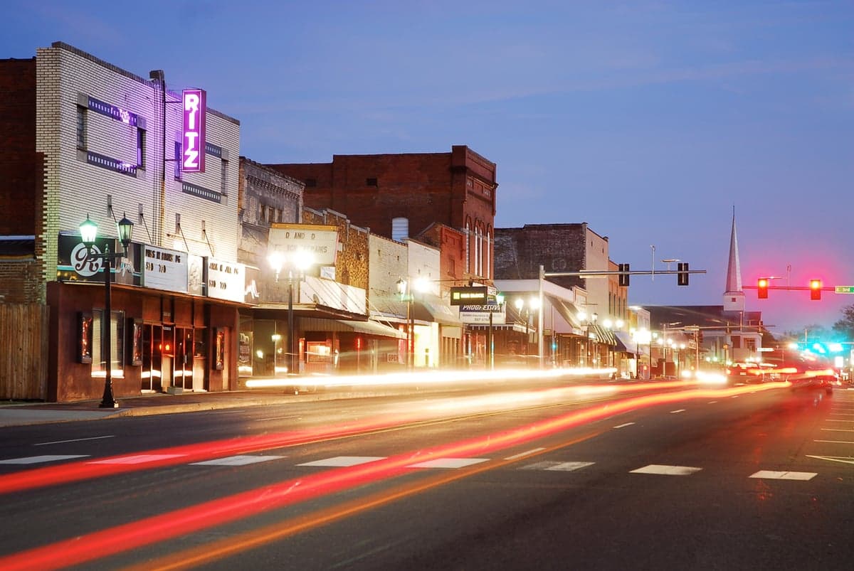
Photo: Wikipedia
Strategic Assessment of Malvern, AR
Workable tactical position. Some exposure to population density or targets, but generally defensible in a crisis.
What does the Strategic Assessment tell us?
Our Strategic Assessment grades tactical survivability of an area. Major population centers, military targets, fallout zones, natural disasters, and border exposure all drive risk — lower exposure means a more defensible position in a crisis.
This is heavily inspired by Joel Skousen's Strategic Relocation book. Highly recommended you checkout the book ($)What does this tell us?
Our Strategic Assessment grades tactical survivability of an area. Major population centers, military targets, fallout zones, natural disasters, and border exposure all drive risk — lower exposure means a more defensible position in a crisis.
This is heavily inspired by Joel Skousen's Strategic Relocation book. Highly recommended you checkout the book ($)Strategic Pillars

Key Distances
Regional Safe Places
Below is our recommended "safe zones" in Arkansas and the surrounding area based on our strategic heuristics. For most people, it's unrealistic to live in a “safe zone” full-time due to work, family or other personal reasons. They tend to be more rural. However, many of these areas are perfect for second homes and retreat properties that double as a vacation home or even a short-term rental.


Important Note: For informational purposes only. This does not mean nothing bad ever happens in the green zones. Please use common sense. This is based on public data and modeled with AI. We tried to take a conservative approach but mistakes happen. We update this regularly as new information becomes available.
Solar Generator Recommendations
Backup power matters more here than in safer locations. We've picked three solar generators across budgets and capacity tiers — start with the budget unit if you only need a few essentials, or step up if you want to run a fridge and HVAC for days at a time.

Jackery Portable Power Station Explorer 300
Budget OptionPower on the Go: Weighing only 11 lbs, it's convenient to set up and store with book-sized foldable solar panels

BLUETTI Portable Power Station AC180
Designed for both indoor and outdoor scenarios, AC180 is highly capable as it has a robost capacity and continuous output power.

EF ECOFLOW DELTA Pro Ultra Power Station
Upgraded PickEcoFlow DELTA Pro Ultra is a whole-home energy system designed to grow with your family. Integrated with the Smart Home Panel 2, it scales to meet your evolving energy needs — keeping your home powered, intelligent, and secure through every stage of life.
We earn a commission, at no additional cost to you.
Strategic Assessment Analysis
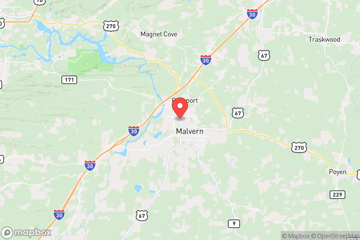
Malvern, Arkansas, sits in a strategic pocket of the Ouachita foothills that offers genuine resilience advantages for those thinking ahead about civic unrest, supply-chain disruptions, or large-scale disasters. Roughly 45 minutes southwest of Little Rock and an hour north of the Texas border, this town of about 11,000 people occupies a position that is close enough to regional resources but far enough from the immediate blast radius of a major metropolitan target. The surrounding Hot Spring County is sparsely populated, heavily wooded, and punctuated by the Ouachita National Forest to the west, creating natural buffers and multiple egress routes that make Malvern a more defensible relocation option than most towns its size in the Mid-South.
Geographic position and natural advantages for long-term stability
Malvern’s location at the intersection of Interstate 30 and U.S. Highway 67 gives it a logistical edge that preppers and strategic relocators should note. I-30 runs directly from Little Rock southwest to Texarkana, meaning you can reach Dallas-Fort Worth in about four hours if needed, but the town itself sits outside the 50-mile high-risk zone around Little Rock’s metropolitan core. The Ouachita Mountains to the west provide rugged terrain that slows movement and offers natural cover, while the flat agricultural land to the east gives you open sightlines and room for self-sufficient food production. The area’s elevation—roughly 300 to 500 feet above sea level—keeps it above most floodplains, and the numerous creeks and rivers (including the Ouachita River running through town) mean water access is not a theoretical concern but a practical reality. For someone evaluating fallout risk from a nuclear event, Malvern is far enough from Little Rock’s major infrastructure (the Port of Little Rock, the Clinton National Airport, and the interstate bridges) to avoid the worst of a ground-zero scenario, yet close enough to monitor regional developments and make a calculated retreat deeper into the Ouachitas if conditions deteriorate.
Risks, exposures, and proximity to fallout-relevant landmarks
No strategic assessment is honest without acknowledging the liabilities. Malvern’s biggest exposure is its proximity to Little Rock—45 miles as the crow flies, which puts it within the moderate fallout zone for a ground burst targeting the capital’s military, government, or transportation hubs. The city’s water treatment plant and the nearby Lake Catherine dam are potential secondary targets for sabotage or cascading failure. Additionally, Malvern sits along a major rail line (the Union Pacific mainline through Arkansas), which is a vulnerability in a civil unrest scenario where rail transport becomes a vector for looting or military movement. The town itself has no hardened infrastructure—no underground bunkers, no redundant power grid, and a single hospital (CHI St. Vincent Malvern) that would be overwhelmed in a mass casualty event. The local police force is small, and the county sheriff’s office covers a large rural area, so self-reliance is not optional; it is the baseline expectation. For the conservative relocator, the calculus is that Malvern’s risks are manageable with preparation—stockpiling water filtration, maintaining off-grid power, and establishing a mutual-aid network with neighbors—whereas the risks of staying in a major metro are existential and uncontrollable.
Practical resilience for a relocator: food, water, energy, and defensibility
For someone serious about self-sufficiency, Malvern offers a workable foundation. The surrounding Hot Spring County has abundant agricultural land, with local farms producing cattle, poultry, soybeans, and hay. The Ouachita National Forest to the west provides hunting opportunities (deer, turkey, small game) and foraging for wild edibles like persimmons, blackberries, and hickory nuts. Water is the strongest asset: the Ouachita River runs through town, Lake Catherine is 15 minutes north, and numerous springs and creeks dot the area. A basic well-drilling operation on a rural property is feasible, and rainwater catchment is straightforward given the region’s 50+ inches of annual rainfall. Energy resilience is weaker—the local grid is served by Entergy Arkansas, which has a mixed reliability record during ice storms and summer thunderstorms. Solar is viable (the area gets about 210 sunny days per year), but you will need battery storage and a backup generator for the cloudy stretches. Defensibility is moderate: the terrain is rolling hills with mixed hardwood forest, offering good concealment for a rural homestead but also limiting long-range visibility. The town itself is compact and walkable, with a historic downtown that could be secured with minimal effort in a grid-down scenario, but the real strategic value is in the outlying areas—properties along Highway 9 west of town or near the Lake Catherine State Park area give you isolation, water access, and multiple escape routes into the national forest. The local gun culture is strong, with several gun shops and a county sheriff who is generally supportive of Second Amendment rights, which matters for both practical defense and community trust.
Overall strategic picture for the conservative relocator
Malvern is not a prepper paradise—it lacks the extreme isolation of Montana or the high-altitude security of Colorado—but it is a realistic, affordable option for someone who wants to be within a day’s drive of major resources while maintaining a low profile in a community that still values self-reliance. The town’s demographic is predominantly white, working-class, and politically conservative, with a strong church presence and a culture of neighborly mutual aid that aligns with traditional values. The cost of living is roughly 20% below the national average, and land prices in the surrounding county are still reasonable (under $5,000 per acre for raw timberland). The biggest strategic weakness is the lack of a deep local economy—Malvern’s largest employers are a few manufacturing plants (including a large aluminum extrusion facility) and the school district, so if you are relocating for work, you will likely need a remote job or a trade that travels. For the single individual or family looking to build a resilient life outside the chaos of the cities, Malvern offers a solid middle ground: close enough to monitor the storm, far enough to survive the fallout, and grounded in a community that still remembers how to live without a government lifeline.
* Values derived from national, state, county, city and local statistics and may differ in a specific area. Last updated: 2026-04-30T03:13:21.000Z
Narrative content on this page is AI-generated and may contain mistakes. Verify any details that matter before acting on them.
ReloMaps may earn a commission from affiliate links at no extra cost to you.