Photo: Wikipedia
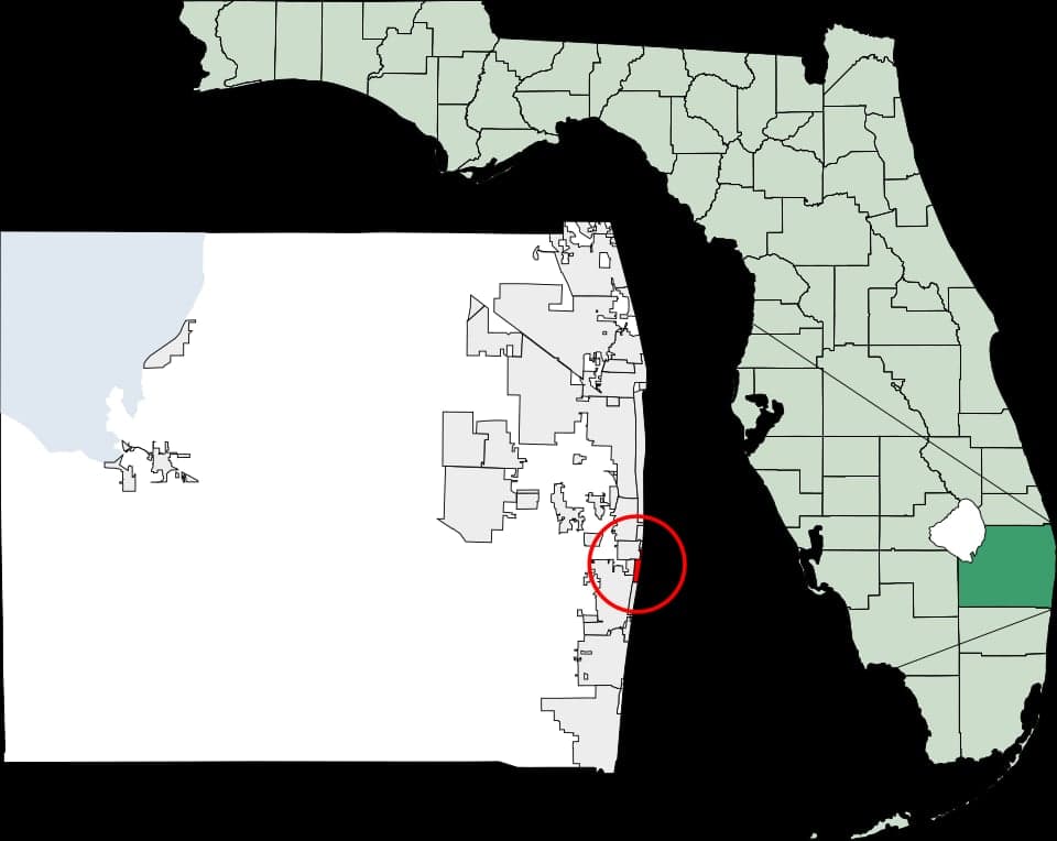
Strategic Assessment of Manalapan, FL
Meaningful friction. Expect exposure to either population pressure, blast zones, or natural disaster risk. Consider buying a retreat property.
What does the Strategic Assessment tell us?
Our Strategic Assessment grades tactical survivability of an area. Major population centers, military targets, fallout zones, natural disasters, and border exposure all drive risk — lower exposure means a more defensible position in a crisis.
This is heavily inspired by Joel Skousen's Strategic Relocation book. Highly recommended you checkout the book ($)What does this tell us?
Our Strategic Assessment grades tactical survivability of an area. Major population centers, military targets, fallout zones, natural disasters, and border exposure all drive risk — lower exposure means a more defensible position in a crisis.
This is heavily inspired by Joel Skousen's Strategic Relocation book. Highly recommended you checkout the book ($)Strategic Pillars

Key Distances
Regional Safe Places
Below is our recommended "safe zones" in Florida and the surrounding area based on our strategic heuristics. For most people, it's unrealistic to live in a “safe zone” full-time due to work, family or other personal reasons. They tend to be more rural. However, many of these areas are perfect for second homes and retreat properties that double as a vacation home or even a short-term rental.

Important Note: For informational purposes only. This does not mean nothing bad ever happens in the green zones. Please use common sense. This is based on public data and modeled with AI. We tried to take a conservative approach but mistakes happen. We update this regularly as new information becomes available.
Solar Generator Recommendations
Backup power matters more here than in safer locations. We've picked three solar generators across budgets and capacity tiers — start with the budget unit if you only need a few essentials, or step up if you want to run a fridge and HVAC for days at a time.

Jackery Portable Power Station Explorer 300
Budget OptionPower on the Go: Weighing only 11 lbs, it's convenient to set up and store with book-sized foldable solar panels

BLUETTI Portable Power Station AC180
Designed for both indoor and outdoor scenarios, AC180 is highly capable as it has a robost capacity and continuous output power.

EF ECOFLOW DELTA Pro Ultra Power Station
Upgraded PickEcoFlow DELTA Pro Ultra is a whole-home energy system designed to grow with your family. Integrated with the Smart Home Panel 2, it scales to meet your evolving energy needs — keeping your home powered, intelligent, and secure through every stage of life.
We earn a commission, at no additional cost to you.
Strategic Assessment Analysis
Manalapan, Florida, presents a complex strategic picture for the conservative prepper or survivalist. Its primary advantage is its location on a barrier island in Palm Beach County, offering a natural moat against ground-based civil unrest, but this same geography creates a severe vulnerability: a single-point-of-failure evacuation route. For the individual or family prioritizing resilience against societal collapse, mass casualty events, or natural disasters, Manalapan is a high-risk, high-reward proposition that demands a clear-eyed assessment of its choke points and proximity to major population centers.
Geographic position and natural defensive advantages
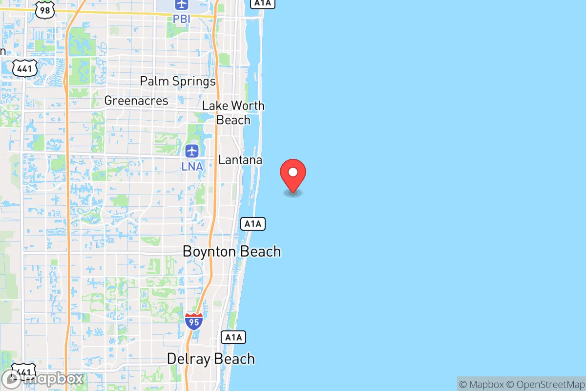
Manalapan sits on a narrow barrier island between the Atlantic Ocean and the Intracoastal Waterway, connected to the mainland by a single bridge at State Road A1A. This isolation is a double-edged sword. In a scenario of widespread civil unrest or a coordinated attack on infrastructure, the island’s limited access points make it naturally defensible—a small group could theoretically secure the bridge approach. The surrounding water provides a buffer against rioters or looters traveling on foot. However, the same geography means that any disruption to that bridge—whether from a hurricane, a terrorist strike on the nearby Port of Palm Beach, or a deliberate blockade—turns Manalapan into a trap. The town’s elevation is negligible, averaging just 6–10 feet above sea level, which places it squarely in the storm surge zone for a Category 2 or higher hurricane. For a relocator, the defensive upside is real but conditional on maintaining control of the only egress.
Risks, exposures, and proximity to fallout-relevant landmarks
The most glaring strategic weakness is Manalapan’s proximity to high-value, high-risk targets. The town lies roughly 5 miles south of the Port of Palm Beach, a major cargo and cruise port that would be a primary target in a conflict or a choke point during a mass evacuation. It is also less than 10 miles from Palm Beach International Airport and 15 miles from the Loxahatchee National Wildlife Refuge, which contains a U.S. Army Corps of Engineers water management facility. In a grid-down or EMP scenario, these locations become magnets for desperate populations. The town itself is a wealthy enclave—median home values exceed $2 million—which could make it a target for organized looting during a breakdown of civil order. The single evacuation route (A1A) is also the only road for the entire barrier island chain, meaning any accident, storm, or security incident on that road traps everyone north and south of the break. For a prepper, the risk of being caught in a mass casualty event from a hurricane or a terrorist strike on the port is high, and the escape options are dangerously limited.
Practical resilience for a relocator: food, water, energy, and defensibility
Manalapan’s practical resilience is poor for a long-term survival scenario. The town has no agricultural land, no freshwater aquifer of its own, and relies entirely on mainland utilities. All drinking water comes from the Palm Beach County water utility, which draws from the Biscayne Aquifer—vulnerable to saltwater intrusion during storm surge and to contamination from the nearby landfill and industrial sites. Food supply is equally fragile: the nearest grocery stores are in Hypoluxo or Boynton Beach, both requiring the bridge crossing. For energy, Florida Power & Light serves the area, but the grid is notoriously vulnerable to hurricanes and has experienced multi-day outages even in minor storms. A prepper would need to invest heavily in solar panels with battery storage, a rainwater catchment system, and at least a 90-day food supply—and even then, the lack of space for gardening or livestock on most lots (typical lot sizes are 0.2–0.5 acres) limits self-sufficiency. Defensibility is the one bright spot: the island’s layout, with a single road and limited beach access, allows for effective perimeter control. But that advantage evaporates if the bridge is compromised. For a family, the lack of a secondary escape route—no boat ramp, no helicopter pad, no inland path—is a dealbreaker for many serious preppers.
The overall strategic picture for Manalapan is one of calculated risk. It offers a defensible, isolated position that could serve as a short-term refuge during localized unrest, but it fails the long-term resilience test for a conservative relocator concerned with national-scale collapse. The proximity to Palm Beach’s critical infrastructure, the single evacuation route, and the complete dependence on mainland utilities create a scenario where the town is more of a gilded cage than a redoubt. For a single individual or a family willing to invest heavily in off-grid systems and maintain a secondary bug-out location inland (perhaps in the Lake Okeechobee region or the rural areas west of I-95), Manalapan could work as a seasonal or temporary base. But as a permanent, standalone survival location, it is a high-maintenance, high-exposure option that demands constant vigilance and a robust contingency plan. The conservative prepper should view Manalapan as a place to visit, not to dig in.
* Values derived from national, state, county, city and local statistics and may differ in a specific area. Last updated: 2026-05-14T02:02:41.000Z
Narrative content on this page is AI-generated and may contain mistakes. Verify any details that matter before acting on them.
ReloMaps may earn a commission from affiliate links at no extra cost to you.