

Photo: Wikipedia
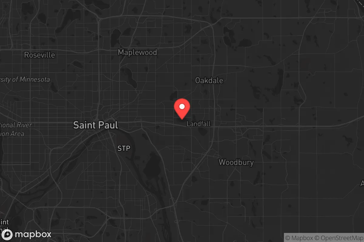
Strategic Assessment of Maplewood, MN
Multiple tactical vulnerabilities. Population density, target proximity, or disaster risk are likely compounding. A retreat property and exit planning is required.
What does the Strategic Assessment tell us?
Our Strategic Assessment grades tactical survivability of an area. Major population centers, military targets, fallout zones, natural disasters, and border exposure all drive risk — lower exposure means a more defensible position in a crisis.
This is heavily inspired by Joel Skousen's Strategic Relocation book. Highly recommended you checkout the book ($)What does this tell us?
Our Strategic Assessment grades tactical survivability of an area. Major population centers, military targets, fallout zones, natural disasters, and border exposure all drive risk — lower exposure means a more defensible position in a crisis.
This is heavily inspired by Joel Skousen's Strategic Relocation book. Highly recommended you checkout the book ($)Strategic Pillars

Key Distances
Regional Safe Places
Below is our recommended "safe zones" in Minnesota and the surrounding area based on our strategic heuristics. For most people, it's unrealistic to live in a “safe zone” full-time due to work, family or other personal reasons. They tend to be more rural. However, many of these areas are perfect for second homes and retreat properties that double as a vacation home or even a short-term rental.


Important Note: For informational purposes only. This does not mean nothing bad ever happens in the green zones. Please use common sense. This is based on public data and modeled with AI. We tried to take a conservative approach but mistakes happen. We update this regularly as new information becomes available.
Solar Generator Recommendations
Backup power matters more here than in safer locations. We've picked three solar generators across budgets and capacity tiers — start with the budget unit if you only need a few essentials, or step up if you want to run a fridge and HVAC for days at a time.

Jackery Portable Power Station Explorer 300
Budget OptionPower on the Go: Weighing only 11 lbs, it's convenient to set up and store with book-sized foldable solar panels

BLUETTI Portable Power Station AC180
Designed for both indoor and outdoor scenarios, AC180 is highly capable as it has a robost capacity and continuous output power.

EF ECOFLOW DELTA Pro Ultra Power Station
Upgraded PickEcoFlow DELTA Pro Ultra is a whole-home energy system designed to grow with your family. Integrated with the Smart Home Panel 2, it scales to meet your evolving energy needs — keeping your home powered, intelligent, and secure through every stage of life.
We earn a commission, at no additional cost to you.
Strategic Assessment Analysis
Maplewood, Minnesota, sits in a precarious strategic position that demands a clear-eyed assessment for anyone serious about long-term resilience. As a suburban ring of Saint Paul, it offers proximity to essential infrastructure while carrying the inherent liabilities of being within the blast and fallout shadow of a major metropolitan area. For the conservative prepper or survivalist, this location is a mixed bag—close enough to tap into resources, yet dangerously near the primary target zones of civil unrest and potential state-level collapse. The key is understanding that Maplewood’s resilience depends entirely on your ability to leverage its advantages while mitigating its glaring exposure to the Twin Cities’ vulnerabilities.
Geographic position and natural advantages for long-term survival
Maplewood’s location along the eastern edge of Ramsey County places it within a corridor of relatively stable suburban development, but its real asset is the proximity to the Mississippi River and the surrounding hardwood forests. The river provides a reliable water source—critical for any extended grid-down scenario—and the region’s abundant lakes and wetlands offer natural barriers that could slow movement from the urban core during unrest. The area sits on a high bluff overlooking the river valley, which gives a modest elevation advantage for observation and defensibility, though nothing like the rugged terrain of the Driftless Zone to the southeast. The soil here is fertile, with a growing season long enough for cold-hardy crops like potatoes, squash, and root vegetables, making small-scale subsistence farming feasible if you secure land away from the densest subdivisions. The proximity to Interstate 94 and Highway 36 is a double-edged sword: it allows rapid evacuation north toward Duluth or west toward the Dakotas, but it also funnels traffic and potential looters directly through the area during a crisis. For a relocator, the natural advantages are real but require deliberate planning—you’re not in a remote fortress, but you’re not in a dead-end urban trap either.
Risks, exposures, and proximity to fallout-relevant landmarks
The most significant risk for Maplewood is its location within the immediate fallout zone of the Twin Cities. In a nuclear exchange or a major industrial accident, the prevailing westerly winds would carry radioactive debris directly over the area from targets like the Minneapolis–Saint Paul International Airport, the Xcel Energy coal plants, and the numerous rail yards and refineries along the Mississippi. The 3M headquarters and manufacturing facilities in Maplewood itself are a secondary concern—chemical fires or toxic releases from such a site could render large sections of the city uninhabitable for weeks. Civil unrest is another major exposure: the 2020 riots after George Floyd’s death demonstrated that the Twin Cities can erupt quickly, with looting and arson spreading into suburbs like Maplewood within hours. The city’s police force is small relative to its population of roughly 40,000, and mutual aid from surrounding jurisdictions would be strained during a widespread event. Additionally, the area’s high population density—over 2,500 people per square mile—means that any prolonged grid-down scenario would lead to rapid resource depletion and increased competition for food, water, and medical supplies. The proximity to the State Capitol in Saint Paul (just 10 miles west) makes Maplewood a likely staging ground for government or military operations during a declared emergency, which could bring unwanted attention or forced evacuations.
Practical resilience for a relocator: food, water, energy, and defensibility
For a relocator serious about self-sufficiency, Maplewood requires a proactive approach to every pillar of resilience. Water is the most immediate concern: while the Mississippi River is a reliable source, it’s also heavily polluted with agricultural runoff and industrial discharge, meaning you’ll need a high-quality filtration system (Berkey or similar) and knowledge of boiling and chemical treatment. The municipal water supply comes from the Mississippi and is treated, but a grid failure would cut pressure quickly—storing at least 50 gallons per person is non-negotiable. Food security is possible but not easy: the city’s zoning allows for backyard chickens and small gardens, but most lots are less than a quarter-acre, limiting production. Partnering with a community garden or securing a lease on a plot in nearby Washington County would be wise. Energy is a bright spot: Minnesota has net metering laws that make solar panels a viable investment, and the state’s relatively high electricity rates mean a 10kW system could pay for itself in 7–10 years. A backup generator with a 100-gallon propane tank is essential for winter storms, which can knock out power for days. Defensibility is the weakest link: Maplewood’s suburban layout—with cul-de-sacs, open yards, and multiple access points—makes it hard to secure a single property against a determined group. A corner lot with a privacy fence and reinforced doors is better than a mid-block house, but you’re still vulnerable to neighbors who may not share your preparedness mindset. The best strategy is to build a small network of like-minded families within a 15-minute drive, creating a mutual support group that can pool resources and provide early warning of threats moving from the urban core.
The overall strategic picture for Maplewood is one of calculated risk. It’s not a bug-out location—you wouldn’t want to be here if the SHTF and you had the option to head for the Iron Range or the Boundary Waters. But for someone who needs to stay within commuting distance of a job or family obligations, it offers a workable middle ground. The key is to treat Maplewood as a base of operations rather than a final redoubt: store supplies for 90 days, maintain a vehicle capable of a 200-mile evacuation, and have a secondary location in mind (northern Wisconsin or the Black Hills are both within a day’s drive). The conservative prepper mindset here is about stacking the odds in your favor—acknowledging that no suburban location is truly safe, but that with discipline and foresight, you can ride out most scenarios short of a full societal collapse. If you’re willing to put in the work, Maplewood can be a defensible outpost. If you’re looking for a place to ride out the storm without constant vigilance, keep looking north.
* Values derived from national, state, county, city and local statistics and may differ in a specific area. Last updated: 2026-04-19T04:24:20.000Z
Narrative content on this page is AI-generated and may contain mistakes. Verify any details that matter before acting on them.
ReloMaps may earn a commission from affiliate links at no extra cost to you.