Photo: Wikipedia
Strategic Assessment of Martinsburg, WV
Meaningful friction. Expect exposure to either population pressure, blast zones, or natural disaster risk. Consider buying a retreat property.
What does the Strategic Assessment tell us?
Our Strategic Assessment grades tactical survivability of an area. Major population centers, military targets, fallout zones, natural disasters, and border exposure all drive risk — lower exposure means a more defensible position in a crisis.
This is heavily inspired by Joel Skousen's Strategic Relocation book. Highly recommended you checkout the book ($)What does this tell us?
Our Strategic Assessment grades tactical survivability of an area. Major population centers, military targets, fallout zones, natural disasters, and border exposure all drive risk — lower exposure means a more defensible position in a crisis.
This is heavily inspired by Joel Skousen's Strategic Relocation book. Highly recommended you checkout the book ($)Strategic Pillars

Key Distances
Regional Safe Places
Below is our recommended "safe zones" in West Virginia and the surrounding area based on our strategic heuristics. For most people, it's unrealistic to live in a “safe zone” full-time due to work, family or other personal reasons. They tend to be more rural. However, many of these areas are perfect for second homes and retreat properties that double as a vacation home or even a short-term rental.


Important Note: For informational purposes only. This does not mean nothing bad ever happens in the green zones. Please use common sense. This is based on public data and modeled with AI. We tried to take a conservative approach but mistakes happen. We update this regularly as new information becomes available.
Solar Generator Recommendations
Backup power matters more here than in safer locations. We've picked three solar generators across budgets and capacity tiers — start with the budget unit if you only need a few essentials, or step up if you want to run a fridge and HVAC for days at a time.

Jackery Portable Power Station Explorer 300
Budget OptionPower on the Go: Weighing only 11 lbs, it's convenient to set up and store with book-sized foldable solar panels

BLUETTI Portable Power Station AC180
Designed for both indoor and outdoor scenarios, AC180 is highly capable as it has a robost capacity and continuous output power.

EF ECOFLOW DELTA Pro Ultra Power Station
Upgraded PickEcoFlow DELTA Pro Ultra is a whole-home energy system designed to grow with your family. Integrated with the Smart Home Panel 2, it scales to meet your evolving energy needs — keeping your home powered, intelligent, and secure through every stage of life.
We earn a commission, at no additional cost to you.
Strategic Assessment Analysis
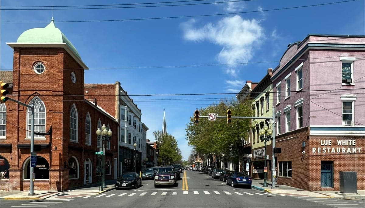
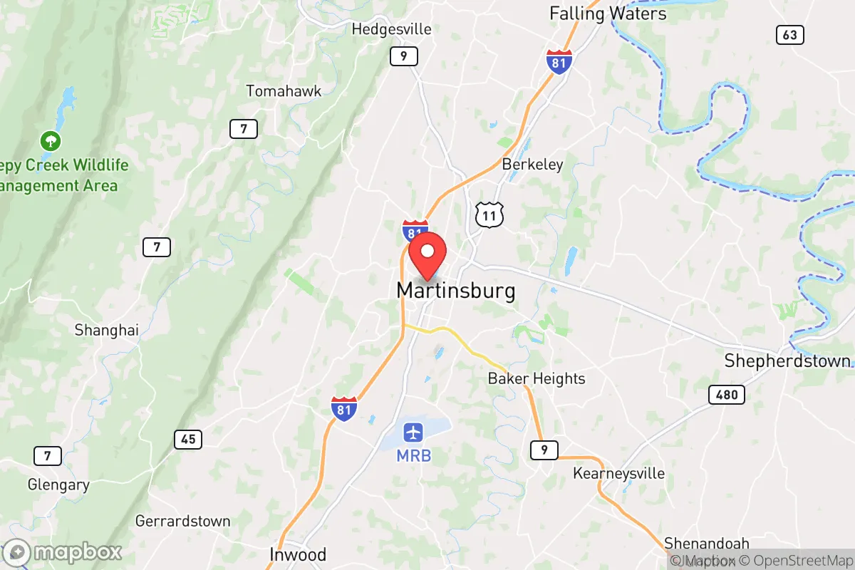
Martinsburg, West Virginia, sits in a strategic sweet spot that resilience-minded relocators should take seriously: close enough to the D.C. metro to access resources and job markets, but far enough to avoid the blast radius of a major event. Its position in the Eastern Panhandle, nestled between the Blue Ridge Mountains and the Potomac River, offers natural buffers, a lower population density than the crowded I-95 corridor, and a history of self-reliance that predates the modern federal state. For a conservative audience weighing civic unrest, supply chain disruptions, or mass casualty scenarios, Martinsburg presents a credible fallback position—not a fortress, but a defensible base with real advantages.
Geographic position and natural advantages for long-term security
Martinsburg’s location at the intersection of I-81 and I-70 places it on a major north-south logistics spine, but one that runs through rural and small-town territory rather than dense urban cores. The area is ringed by the Appalachian Mountains to the west and the Potomac River to the east, creating natural chokepoints that slow movement and limit exposure from any single direction. The surrounding Berkeley County is predominantly agricultural, with working farms, orchards, and pastureland that could sustain local food production if supply chains falter. The climate is temperate four-season, with reliable rainfall and a growing season long enough for serious gardening or small-scale farming—critical for anyone thinking about food security beyond a pantry. Elevation ranges from 400 to 1,200 feet, which reduces flood risk compared to low-lying areas along the Potomac itself, and the region sits outside the highest-risk zones for hurricanes, earthquakes, and wildfires. For a relocator, the natural advantages here are about redundancy: multiple escape routes (I-81 north/south, US 11, and secondary roads through the mountains), abundant water from the Potomac and its tributaries, and a landscape that offers cover and concealment if things go sideways.
Risks, exposures, and proximity to fallout-relevant landmarks
The biggest strategic downside of Martinsburg is its proximity to the Washington, D.C. metropolitan area—roughly 75 miles east. In a mass casualty event or large-scale civil unrest, the D.C. region would be a primary target or epicenter, and Martinsburg sits within the zone where fallout, refugee flows, or secondary effects could reach. The area is also within 50 miles of the Fort Detrick biodefense lab in Frederick, Maryland, and about 100 miles from the Indian Point nuclear plant (though that plant is decommissioning, the spent fuel remains a concern). On the plus side, Martinsburg is not near any major military bases, nuclear weapons storage sites, or high-value government facilities that would draw direct strikes. The biggest risk is not a direct hit but the cascade: a collapse of the D.C. metro would send hundreds of thousands of people westward along I-70 and I-66, and Martinsburg would be a natural choke point. The local infrastructure—roads, hospitals, law enforcement—is sized for a population of roughly 20,000, not a surge of refugees. For a prepper, the calculus is that Martinsburg offers a buffer zone with enough distance to react, but not enough to be immune. The key is to have a plan for the first 72 hours after a major event, when the roads out of D.C. would be gridlocked and the panic would peak.
Practical resilience for a relocator: food, water, energy, and defensibility
For someone serious about self-sufficiency, Martinsburg’s practical infrastructure is a mixed bag that rewards preparation. The municipal water supply comes from the Potomac River and the Opequon Creek watershed, which are reliable but vulnerable to contamination or disruption. A well on private property is the gold standard here, and many rural properties in Berkeley County have them—something to prioritize when house hunting. The electric grid is served by Potomac Edison (FirstEnergy), which has a mixed reliability record in storms; backup solar with battery storage or a propane generator is a wise investment. Natural gas is available in town but less common in outlying areas, so plan for heating with wood or propane. Food resilience is where Martinsburg shines: the county has dozens of farms, farmers’ markets, and a strong hunting culture (deer, turkey, small game). The local soil is fertile, and the growing season runs April through October. For defensibility, the terrain offers natural advantages—the mountains to the west provide observation points and escape routes, while the Potomac forms a natural barrier to the east. The town itself is laid out on a grid with a historic core, but most residential areas are spread out with good sightlines. The local law enforcement presence is modest (Berkeley County Sheriff’s Office and Martinsburg Police), so community self-defense networks and neighborhood watch groups are common among the prepper-minded. The biggest practical gap is medical infrastructure: the local hospital (WVU Medicine Berkeley Medical Center) is a 200-bed facility that would be overwhelmed in a crisis. A trauma kit, training, and a plan for evacuation to a more rural location are essential.
Overall, Martinsburg is a solid B+ on the resilience scale for a conservative relocator. It’s not a remote bunker in Montana, but it’s not a soft target inside the Beltway either. The strategic picture is one of balance: you get proximity to the economic and social resources of the D.C. area during stable times, with enough distance and natural buffers to ride out the first wave of a major event. The real value is in the community—there’s a strong network of like-minded individuals, churches, and local organizations that share a self-reliant, conservative ethos. If you’re looking for a place that lets you live a normal life while keeping one eye on the horizon, Martinsburg deserves a serious look. Just don’t expect to be completely insulated from the chaos of the broader world—no place in the Eastern Seaboard is. The goal here is not invulnerability, but survivability with a plan.
* Values derived from national, state, county, city and local statistics and may differ in a specific area. Last updated: 2026-04-23T05:45:27.000Z
Narrative content on this page is AI-generated and may contain mistakes. Verify any details that matter before acting on them.
ReloMaps may earn a commission from affiliate links at no extra cost to you.