Strategic Assessment of Mason, WV
Meaningful friction. Expect exposure to either population pressure, blast zones, or natural disaster risk. Consider buying a retreat property.
What does the Strategic Assessment tell us?
Our Strategic Assessment grades tactical survivability of an area. Major population centers, military targets, fallout zones, natural disasters, and border exposure all drive risk — lower exposure means a more defensible position in a crisis.
This is heavily inspired by Joel Skousen's Strategic Relocation book. Highly recommended you checkout the book ($)What does this tell us?
Our Strategic Assessment grades tactical survivability of an area. Major population centers, military targets, fallout zones, natural disasters, and border exposure all drive risk — lower exposure means a more defensible position in a crisis.
This is heavily inspired by Joel Skousen's Strategic Relocation book. Highly recommended you checkout the book ($)Strategic Pillars

Key Distances
Regional Safe Places
Below is our recommended "safe zones" in West Virginia and the surrounding area based on our strategic heuristics. For most people, it's unrealistic to live in a “safe zone” full-time due to work, family or other personal reasons. They tend to be more rural. However, many of these areas are perfect for second homes and retreat properties that double as a vacation home or even a short-term rental.


Important Note: For informational purposes only. This does not mean nothing bad ever happens in the green zones. Please use common sense. This is based on public data and modeled with AI. We tried to take a conservative approach but mistakes happen. We update this regularly as new information becomes available.
Solar Generator Recommendations
Backup power matters more here than in safer locations. We've picked three solar generators across budgets and capacity tiers — start with the budget unit if you only need a few essentials, or step up if you want to run a fridge and HVAC for days at a time.

Jackery Portable Power Station Explorer 300
Budget OptionPower on the Go: Weighing only 11 lbs, it's convenient to set up and store with book-sized foldable solar panels

BLUETTI Portable Power Station AC180
Designed for both indoor and outdoor scenarios, AC180 is highly capable as it has a robost capacity and continuous output power.

EF ECOFLOW DELTA Pro Ultra Power Station
Upgraded PickEcoFlow DELTA Pro Ultra is a whole-home energy system designed to grow with your family. Integrated with the Smart Home Panel 2, it scales to meet your evolving energy needs — keeping your home powered, intelligent, and secure through every stage of life.
We earn a commission, at no additional cost to you.
Strategic Assessment Analysis
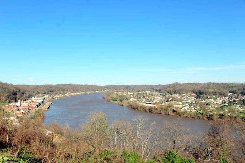
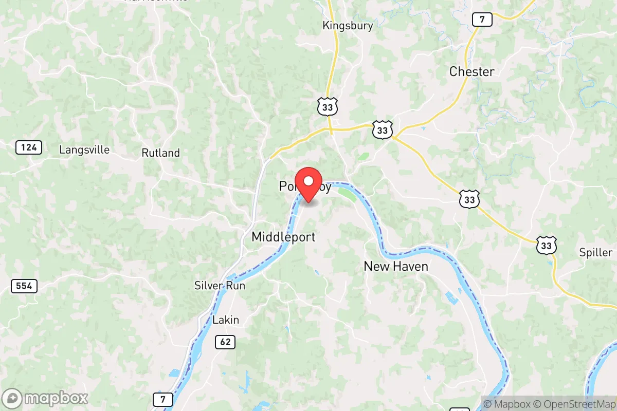
Mason, West Virginia, sits in a pocket of the Ohio River Valley that offers genuine strategic depth for those thinking seriously about long-term resilience. Its location—roughly 40 miles from the Ohio state line and 50 miles from the West Virginia capital in Charleston—places it far enough from major population centers to avoid the worst of any cascading collapse, yet close enough to access critical supply routes if they remain open. For a relocator with a prepper or survivalist mindset, Mason’s combination of river access, low population density, and relative obscurity makes it a candidate worth a hard look, though not without significant trade-offs.
Geographic position and natural advantages for long-term security
Mason’s primary strategic asset is the Ohio River, which forms its western border and provides a natural barrier to approach from that direction. The river is navigable and could serve as a water source, transportation corridor, or defensive line in a prolonged disruption. The surrounding terrain is hilly and forested, with the Appalachian foothills offering ample cover and limited lines of sight for anyone approaching from the east or south. The town itself sits on relatively flat ground near the river, but the immediate hinterland rises quickly into ridges and hollows that would be difficult to traverse without local knowledge. Mason County’s population density is roughly 50 people per square mile, which is low enough that a determined relocator could find a property with significant buffer from neighbors. The nearest city of any real size is Point Pleasant (about 15 miles north), and the closest major metro is Charleston (50 miles east), but neither is close enough to pose an immediate threat from civil unrest or mass casualty events originating in urban centers. The area is also far from any known nuclear power plants—the closest is the Beaver Valley plant in Pennsylvania, over 200 miles away—and well outside the blast or fallout zones of any major military or industrial targets.
Risks, exposures, and proximity to fallout-relevant landmarks
No location is immune to risk, and Mason has its share. The Ohio River, while a strategic asset, is also a flood hazard. The town has experienced significant flooding in the past, particularly during heavy rain events or rapid snowmelt upstream. Any property within the 100-year floodplain should be avoided for a permanent retreat, as a single major flood could destroy stored supplies and force evacuation. The broader region is also within the general fallout zone of the Ohio River Valley industrial corridor, which includes chemical plants, refineries, and rail lines that could become secondary targets or sources of toxic releases during a conflict. The closest major rail line runs through Point Pleasant, and the CSX mainline passes within 20 miles to the east. A derailment or attack on that line could release hazardous materials that drift into the Mason area depending on wind direction. Additionally, the town is about 100 miles from the Portsmouth Gaseous Diffusion Plant in Ohio, a decommissioned but still monitored nuclear site. While not an active reactor, any incident there could produce localized contamination. For a relocator prioritizing fallout avoidance, Mason’s position is moderate—better than the I-95 corridor or the Ohio River cities, but not as secure as deeper Appalachian hollows like those in eastern Kentucky or western Virginia.
Practical resilience for a relocator: food, water, energy, and defensibility
For daily life in a degraded scenario, Mason offers several practical advantages. The Ohio River provides an essentially unlimited water source, though it requires filtration and treatment—boiling, chemical treatment, or a high-quality backpacking filter would be mandatory. The area’s agricultural potential is modest but real; the river bottoms have fertile soil suitable for small-scale vegetable and grain production, and the surrounding forests support deer, turkey, and small game. Mason County has a growing season of roughly 170 days, which is enough for most staple crops if planted early. Local food production would be supplemented by foraging—morels, ramps, blackberries, and walnuts are abundant in season. Energy is a more complex issue. The grid in this part of West Virginia is aging and prone to outages from storms or equipment failure. Solar is viable, but the hilly terrain and tree cover mean careful site selection is critical. A south-facing slope with clear exposure is ideal. Wood heating is the most reliable backup, and the area has plenty of firewood if you have the means to harvest and season it. Defensibility is mixed. The town itself is not defensible—it’s a small, spread-out community with multiple road approaches. A rural property set back from main roads, ideally at the end of a dead-end hollow with a single access point, would be far more secure. The local population is generally self-reliant and conservative, which could be an asset for forming a mutual-aid network, but it also means outsiders are viewed with some suspicion. Building trust would take time.
The overall strategic picture for Mason, West Virginia, is one of moderate potential with clear limitations. It offers a solid baseline for a relocator who wants to be out of the immediate blast radius of major targets, with access to water and some local food production. The flood risk and proximity to industrial corridors are real concerns that require careful property selection and contingency planning. For a single individual or family willing to invest in off-grid water treatment, solar or wood heat, and a defensible property in the surrounding hills, Mason could serve as a viable long-term retreat. It is not a fortress, and it will not shield you from every threat, but it is far better than staying in a suburb of a major city when the lights go out. The key is to treat it as a base to be hardened over time, not a ready-made sanctuary. If you are looking for a place to start building resilience without the extreme isolation of deeper Appalachia, Mason is worth a serious visit—but go in with eyes open to the river, the rail lines, and the need to become a part of the local community rather than a distant observer.
* Values derived from national, state, county, city and local statistics and may differ in a specific area. Last updated: 2026-04-23T06:01:21.000Z
Narrative content on this page is AI-generated and may contain mistakes. Verify any details that matter before acting on them.
ReloMaps may earn a commission from affiliate links at no extra cost to you.