Strategic Assessment of Melissa, TX
Meaningful friction. Expect exposure to either population pressure, blast zones, or natural disaster risk. Consider buying a retreat property.
What does the Strategic Assessment tell us?
Our Strategic Assessment grades tactical survivability of an area. Major population centers, military targets, fallout zones, natural disasters, and border exposure all drive risk — lower exposure means a more defensible position in a crisis.
This is heavily inspired by Joel Skousen's Strategic Relocation book. Highly recommended you checkout the book ($)What does this tell us?
Our Strategic Assessment grades tactical survivability of an area. Major population centers, military targets, fallout zones, natural disasters, and border exposure all drive risk — lower exposure means a more defensible position in a crisis.
This is heavily inspired by Joel Skousen's Strategic Relocation book. Highly recommended you checkout the book ($)Strategic Pillars

Key Distances
Regional Safe Places
Below is our recommended "safe zones" in Texas and the surrounding area based on our strategic heuristics. For most people, it's unrealistic to live in a “safe zone” full-time due to work, family or other personal reasons. They tend to be more rural. However, many of these areas are perfect for second homes and retreat properties that double as a vacation home or even a short-term rental.


Important Note: For informational purposes only. This does not mean nothing bad ever happens in the green zones. Please use common sense. This is based on public data and modeled with AI. We tried to take a conservative approach but mistakes happen. We update this regularly as new information becomes available.
Solar Generator Recommendations
Backup power matters more here than in safer locations. We've picked three solar generators across budgets and capacity tiers — start with the budget unit if you only need a few essentials, or step up if you want to run a fridge and HVAC for days at a time.

Jackery Portable Power Station Explorer 300
Budget OptionPower on the Go: Weighing only 11 lbs, it's convenient to set up and store with book-sized foldable solar panels

BLUETTI Portable Power Station AC180
Designed for both indoor and outdoor scenarios, AC180 is highly capable as it has a robost capacity and continuous output power.

EF ECOFLOW DELTA Pro Ultra Power Station
Upgraded PickEcoFlow DELTA Pro Ultra is a whole-home energy system designed to grow with your family. Integrated with the Smart Home Panel 2, it scales to meet your evolving energy needs — keeping your home powered, intelligent, and secure through every stage of life.
We earn a commission, at no additional cost to you.
Strategic Assessment Analysis
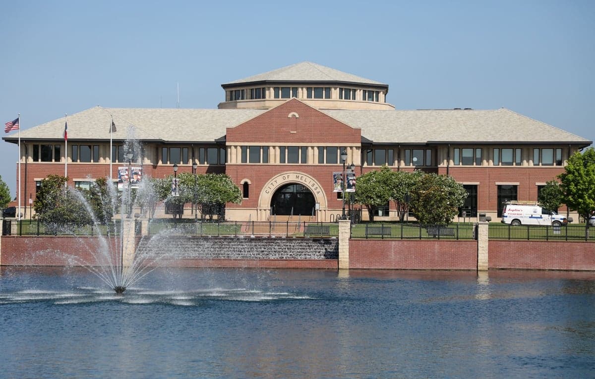
Melissa, Texas, sits in a sweet spot that few relocation analysts can honestly recommend for a prepper or survivalist: close enough to the economic engine of the Dallas-Fort Worth metroplex to sustain a career and supply chain, yet far enough north that you’re not breathing the fallout of a major urban collapse. The town’s rapid growth—from under 5,000 residents in 2010 to over 15,000 by 2025—signals a deliberate migration of families and professionals who are betting on long-term stability, not just a cheap mortgage. For a conservative-leaning individual or parent looking to hedge against civic unrest, mass casualty events, or a breakdown in federal response, Melissa offers a rare combination of rural buffer and suburban infrastructure. The key is understanding that this isn’t a bug-out bunker location; it’s a strategic base of operations with real advantages and equally real vulnerabilities.
Geographic position and natural advantages for long-term security
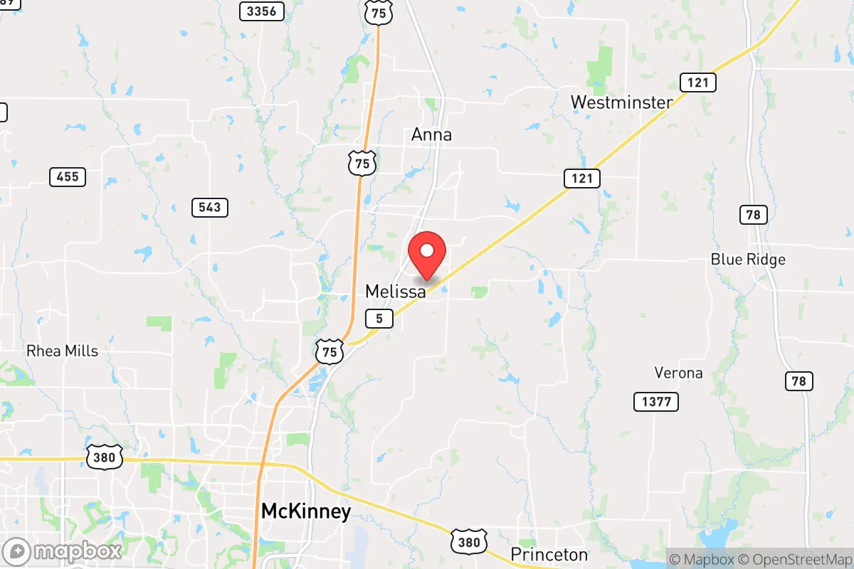
Melissa’s location in Collin County, roughly 40 miles north of downtown Dallas, places it in the Blackland Prairie region—flat, fertile, and historically agricultural. The natural advantages here are subtle but critical for a prepper mindset. The area sits atop the Woodbine and Trinity aquifers, meaning groundwater access is viable for private wells if municipal systems fail. The soil is heavy clay, which complicates basement construction but supports robust gardening and rainwater catchment if you’re willing to amend the earth. The climate is continental with hot summers and cold winters, but tornado risk is real—this is the southern edge of Tornado Alley. However, the flat terrain means you can see weather coming from miles away, and the lack of dense forest reduces wildfire risk compared to East Texas. For a family, the absence of major floodplains within the town limits (unlike nearby McKinney or Frisco) is a quiet win. The town’s elevation—around 650 feet—is unremarkable but sufficient to avoid the flash flooding that plagues lower-lying areas of the metroplex. The natural defensibility is moderate: open fields provide clear sightlines, but the lack of natural barriers means you’re relying on community and distance, not terrain, for security.
Risks, exposures, and proximity to fallout-relevant landmarks
Let’s be direct: Melissa’s biggest vulnerability is its proximity to Dallas-Fort Worth, a primary target for any mass casualty event—whether from a coordinated attack, a grid-down scenario, or a pandemic-driven urban exodus. The town is less than 10 miles from the major rail and highway corridors (US-75 and the BNSF mainline) that would become chokepoints during an evacuation. If a dirty bomb or EMP hits DFW, the fallout zone—both radiological and social—will extend north. Melissa is also within 50 miles of the Pantex nuclear weapons plant near Amarillo (though that’s a secondary risk) and within 100 miles of the Comanche Peak nuclear power plant near Glen Rose. A worst-case release from Comanche Peak, while unlikely, would put Melissa in a downwind risk zone depending on prevailing southerly winds. More immediate: the town’s explosive growth means new subdivisions are pushing against farmland, creating a “suburban fringe” that is neither rural nor urban. In a collapse, this fringe is the worst place to be—too far from city resources to get help, too close to city refugees to avoid contact. The local hospital is a small emergency center (Baylor Scott & White Medical Center in McKinney, 15 minutes south), not a trauma facility. For a parent, the school system (Melissa ISD) is excellent academically, but in a crisis, the schools are a concentration point for children with no hardened security. The town’s police force is small—around 20 officers—and would be overwhelmed in a regional emergency.
Practical resilience for a relocator: food, water, energy, and defensibility
For a single individual or family serious about resilience, Melissa requires deliberate preparation. Food security is achievable but not automatic. The surrounding farmland grows corn, wheat, and hay, but local grocery stores (Brookshire’s, Walmart) rely on just-in-time delivery. A 30-day supply of shelf-stable food is non-negotiable. The Collin County Farmers Market in McKinney is a seasonal option, but you’ll want to establish relationships with local ranchers for meat and eggs—there are several small cattle and poultry operations within a 10-mile radius. Water is the stronger play: the Trinity Aquifer is accessible at depths of 200-400 feet, and many newer homes in the outskirts have well permits. If you’re buying, prioritize a property with an existing well or the legal ability to drill one. Rainwater harvesting is legal in Texas and practical here—average annual rainfall is 38 inches, enough to supply a household with a 1,000-gallon cistern. Energy resilience is mixed. The ERCOT grid is notoriously fragile, and Collin County has experienced rolling blackouts during winter storms (2021’s Uri being the prime example). Solar is viable—the region gets 200+ sunny days per year—but net metering policies are less favorable than in California. A whole-home generator running on propane or natural gas is the standard recommendation for preppers here. Defensibility is about community, not fortifications. Melissa’s small-town culture (population still under 20,000) means neighbors know each other, and the local church and civic groups are active. In a breakdown, this social capital is your best defense. The town’s layout—a compact downtown with sprawling subdivisions—means you can secure a perimeter if you’re on the edge, but interior lots are vulnerable to foot traffic from evacuees. Firearm ownership is common and culturally accepted, and Collin County has a strong sheriff’s office with a conservative stance on self-defense. For a parent, the school district’s emergency plans are standard (lockdown drills, reunification protocols), but you’ll want to have your own family plan for pickup and communication if cell networks go down.
The overall strategic picture for Melissa is one of calculated risk. It is not a remote survivalist retreat—you are 40 minutes from a major city that could become a humanitarian disaster zone. But for a conservative relocator who wants to maintain a professional career, raise children in a safe school system, and build a resilient household without going off-grid, Melissa is one of the better options in North Texas. The town’s growth is a double-edged sword: it brings infrastructure and tax base, but also attracts the very urban problems you’re trying to escape. The smart play is to buy on the northern or eastern fringe, drill a well, install solar with battery backup, and build a network of like-minded neighbors. Avoid the new subdivisions near US-75—they’re too exposed to evacuation traffic. Instead, look at properties along FM-545 or near the Lavon Lake area, which offer a buffer of farmland and a secondary water source. In a worst-case scenario—grid collapse, civil unrest, or a regional disaster—Melissa gives you a 72-hour window to assess and act before the urban wave hits. That window is your advantage. Use it to secure your family, not to flee.
* Values derived from national, state, county, city and local statistics and may differ in a specific area. Last updated: 2026-05-11T19:35:58.000Z
Narrative content on this page is AI-generated and may contain mistakes. Verify any details that matter before acting on them.
ReloMaps may earn a commission from affiliate links at no extra cost to you.