Photo: Wikipedia
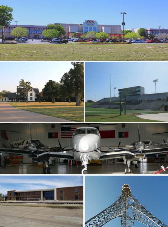
Strategic Assessment of Mesquite, TX
Multiple tactical vulnerabilities. Population density, target proximity, or disaster risk are likely compounding. A retreat property and exit planning is required.
What does the Strategic Assessment tell us?
Our Strategic Assessment grades tactical survivability of an area. Major population centers, military targets, fallout zones, natural disasters, and border exposure all drive risk — lower exposure means a more defensible position in a crisis.
This is heavily inspired by Joel Skousen's Strategic Relocation book. Highly recommended you checkout the book ($)What does this tell us?
Our Strategic Assessment grades tactical survivability of an area. Major population centers, military targets, fallout zones, natural disasters, and border exposure all drive risk — lower exposure means a more defensible position in a crisis.
This is heavily inspired by Joel Skousen's Strategic Relocation book. Highly recommended you checkout the book ($)Strategic Pillars

Key Distances
Regional Safe Places
Below is our recommended "safe zones" in Texas and the surrounding area based on our strategic heuristics. For most people, it's unrealistic to live in a “safe zone” full-time due to work, family or other personal reasons. They tend to be more rural. However, many of these areas are perfect for second homes and retreat properties that double as a vacation home or even a short-term rental.


Important Note: For informational purposes only. This does not mean nothing bad ever happens in the green zones. Please use common sense. This is based on public data and modeled with AI. We tried to take a conservative approach but mistakes happen. We update this regularly as new information becomes available.
Solar Generator Recommendations
Backup power matters more here than in safer locations. We've picked three solar generators across budgets and capacity tiers — start with the budget unit if you only need a few essentials, or step up if you want to run a fridge and HVAC for days at a time.

Jackery Portable Power Station Explorer 300
Budget OptionPower on the Go: Weighing only 11 lbs, it's convenient to set up and store with book-sized foldable solar panels

BLUETTI Portable Power Station AC180
Designed for both indoor and outdoor scenarios, AC180 is highly capable as it has a robost capacity and continuous output power.

EF ECOFLOW DELTA Pro Ultra Power Station
Upgraded PickEcoFlow DELTA Pro Ultra is a whole-home energy system designed to grow with your family. Integrated with the Smart Home Panel 2, it scales to meet your evolving energy needs — keeping your home powered, intelligent, and secure through every stage of life.
We earn a commission, at no additional cost to you.
Strategic Assessment Analysis
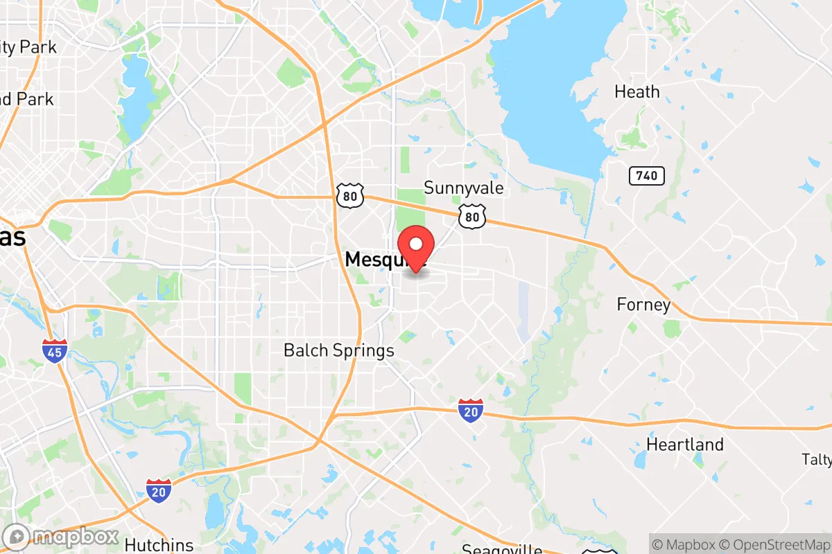
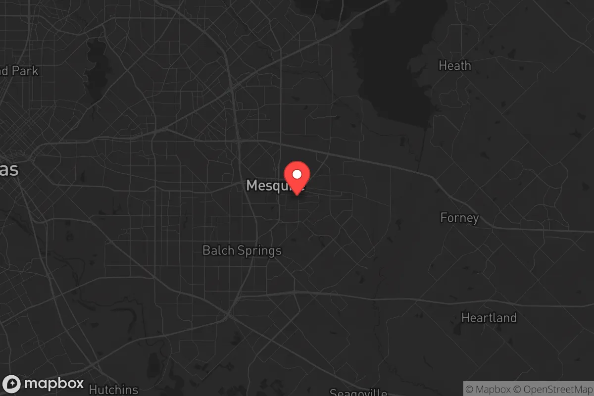
Mesquite, Texas, sits in a precarious strategic position that demands a clear-eyed assessment for anyone serious about long-term preparedness. Its location on the eastern edge of the Dallas-Fort Worth metroplex offers a mix of immediate access to resources and significant exposure to the risks of a major urban center. For a relocator weighing resilience against convenience, Mesquite is a compromise—one that requires deliberate planning to offset its inherent vulnerabilities. The city’s proximity to major interstate corridors (I-30, I-635, and US 80) provides rapid egress routes, but those same arteries become choke points during a crisis, funneling chaos from Dallas directly into the suburbs.
Geographic position and natural advantages for long-term stability
Mesquite’s geography is defined by its position on the Blackland Prairie, a region of fertile soil and relatively flat terrain that historically supported agriculture. This is a double-edged sword: the land is productive for small-scale farming or gardening, but it offers little in the way of natural defensive features like hills, forests, or waterways that could slow an advancing threat. The Trinity River flows roughly 10 miles west, providing a potential water source, but it’s also a flood risk corridor that has historically swamped low-lying areas during heavy rains. The city’s elevation averages around 450 feet, with no significant high ground to offer a tactical advantage. For a prepper, the flat, open landscape means visibility is good, but cover is scarce—defensible positions are limited to built structures, not natural terrain. The climate is typical of North Texas: hot summers, mild winters, and periodic severe weather including tornadoes and hailstorms. This means any long-term plan must account for storm shelters, reinforced construction, and reliable backup power for HVAC systems during summer blackouts.
Risks, exposures, and proximity to fallout-relevant landmarks
The single greatest strategic liability for Mesquite is its proximity to Dallas, just 15 miles west. In a scenario involving civil unrest, mass casualty events, or a major disaster, Dallas becomes a source of cascading problems: refugee flows, supply chain collapse, and potential targeting for secondary attacks. Mesquite is also within 20 miles of the Dallas Love Field airport and roughly 30 miles from DFW International Airport—both are high-value targets in any conflict scenario involving air power or logistical disruption. Additionally, the city lies near major rail lines and interstate highways that could be used for troop movements or become targets for sabotage. The presence of large industrial facilities in the eastern DFW corridor, including chemical plants and fuel storage, adds another layer of risk. A release event at one of these sites could contaminate air or water supplies for miles downwind. For a conservative-minded relocator, the key takeaway is that Mesquite is not a bug-out location—it’s a position that requires constant situational awareness and a pre-planned evacuation route to the east or south, away from the metroplex core.
Practical resilience for a relocator: food, water, energy, and defensibility
For day-to-day preparedness, Mesquite offers a mixed bag. The city’s water supply comes from the Dallas Water Utilities system, drawing from reservoirs like Lake Ray Hubbard (10 miles east) and the Trinity River. This centralized system is vulnerable to contamination, sabotage, or pressure loss during a grid-down event. A serious prepper should plan for at least two weeks of stored water per person, plus a means to purify from local sources—the Trinity River is not potable without treatment, but it’s a viable backup. Food security is better than in denser urban areas: Mesquite has multiple grocery stores, but also a growing number of community gardens and farmers’ markets that indicate local food production capacity. The city’s zoning allows for backyard chickens and small livestock in many residential areas, which is a plus for self-sufficiency. Energy resilience is a weak point. Mesquite is served by Oncor Electric Delivery, and the Texas grid (ERCOT) has proven unreliable during winter storms (e.g., 2021’s Uri) and summer heat waves. Solar panels with battery storage are a wise investment here, as is a backup generator with a fuel supply for at least a week. Defensibility at the neighborhood level varies. Older parts of Mesquite have tighter street grids and more alleyways, which can be secured with barriers or observation points. Newer subdivisions with cul-de-sacs offer natural chokepoints but also limited escape routes. A strategic relocator should prioritize a property with a fenced perimeter, a basement or storm shelter, and a layout that allows for 360-degree observation of approach routes. The local police presence is adequate for routine crime, but during a widespread event, response times will stretch thin—self-reliance is the only reliable defense.
The overall strategic picture for Mesquite is one of calculated risk. It is not a fortress, nor is it a wasteland. For a single individual or family with a conservative, preparedness-oriented mindset, the city offers a foothold near urban resources without being fully immersed in the chaos of a major city. The key is to treat Mesquite as a base of operations, not a final redoubt. Have a vehicle prepped for rapid evacuation, maintain a cache of supplies that can be moved, and build relationships with neighbors who share your outlook. The flat terrain and urban proximity mean you cannot rely on geography to protect you—you must rely on planning, discipline, and community. If you can accept that trade-off, Mesquite can work as a strategic relocation point. If you want true isolation and natural defensibility, look farther east toward the Piney Woods or farther west toward the Hill Country. But for those who need to stay close to work, family, or medical infrastructure while maintaining a serious prepping posture, Mesquite is a viable, if imperfect, option.
* Values derived from national, state, county, city and local statistics and may differ in a specific area. Last updated: 2026-04-21T12:08:11.000Z
Narrative content on this page is AI-generated and may contain mistakes. Verify any details that matter before acting on them.
ReloMaps may earn a commission from affiliate links at no extra cost to you.