Photo: Wikipedia
Demographics of Metairie, LA
Affluence Level in Metairie, LA
A middle-class area roughly in line with national averages across income, home values, education, and employment.
People of Metairie, LA
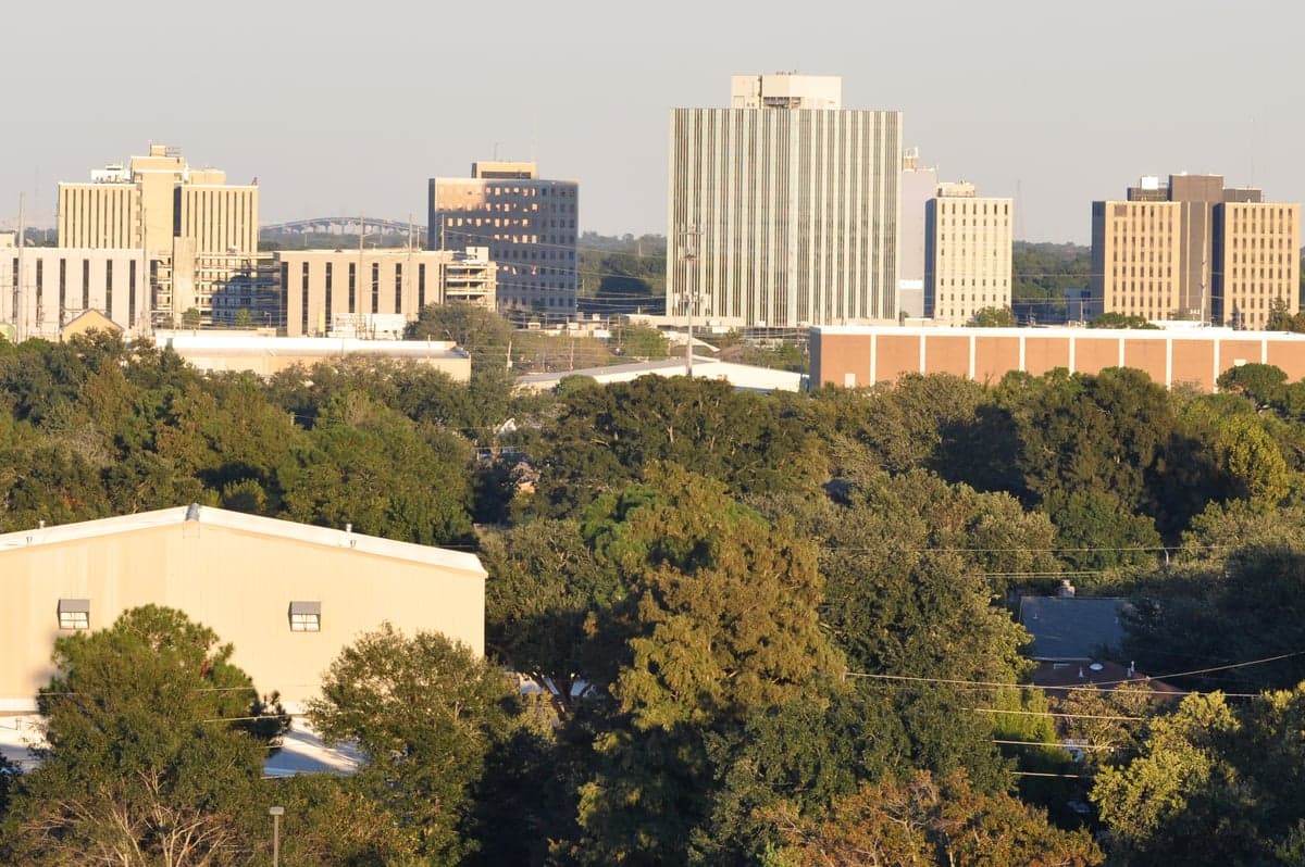
Metairie, Louisiana, is a densely populated unincorporated community of 138,995 residents that functions as the commercial and residential heart of Jefferson Parish. Its population is predominantly White (64.6%) with a significant Hispanic minority (17.5%), a smaller Black population (10.1%), and growing East/Southeast Asian (2.7%) and Indian-subcontinent (1.1%) communities. The area is characterized by its suburban feel, strong Catholic cultural roots, and a population that is notably more college-educated (39.9%) than the state average, yet retains a distinct local identity separate from neighboring New Orleans.
How the city was settled and grew
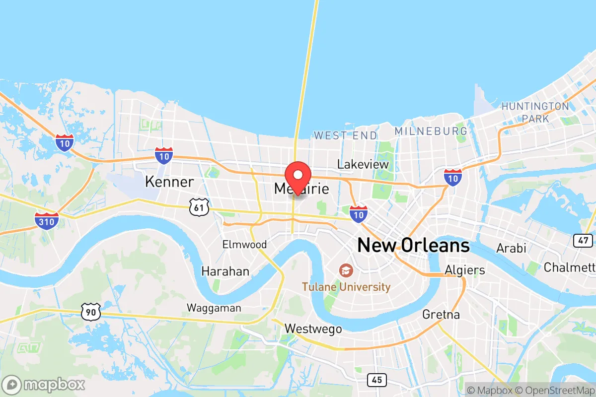
Metairie was not a planned city but rather a series of settlements that grew along the natural ridge of Metairie Road, an old portage route used by Native Americans. The name itself derives from a French term for a sharecropping or tenant-farming arrangement, reflecting the area's early agricultural character. The original population consisted of French and Spanish colonial settlers who established plantations along the Mississippi River and the Metairie Ridge. After the Louisiana Purchase, Anglo-American planters arrived, but the area remained sparsely populated through the 19th century, dominated by truck farms and dairies. The first major population wave came in the early 20th century with the draining of the swamps, which opened land for suburban development. Old Metairie, the historic core along Metairie Road, was built by the area's original Creole and Anglo-American families, and its oak-lined streets still house some of the oldest homes in the parish. The construction of the Huey P. Long Bridge in 1935 and the expansion of Airline Highway accelerated growth, drawing working-class families, many of Italian and Irish descent, who moved from New Orleans to Bucktown and Fat City, areas that became known for their fishing villages and later, their nightlife.
Modern era (post-1965)
The post-1965 era transformed Metairie from a sleepy suburb into a dense, self-contained urban center. The Immigration and Nationality Act of 1965 opened the door for new waves of immigrants, but Metairie's most significant demographic shift came from domestic migration. White flight from New Orleans, accelerating after the 1960s and peaking after Hurricane Katrina in 2005, drove a massive influx of families into Metairie's subdivisions. Lake Vista and Lakewood became the primary destinations for these upwardly mobile White families, drawn by newer homes, better schools, and lower crime rates. The Hispanic population began to grow noticeably in the 1990s and 2000s, with many immigrants from Honduras, Mexico, and Guatemala settling in the Elmwood and Fat City areas, drawn by construction and service-industry jobs. The East/Southeast Asian community, primarily Vietnamese and Filipino, established a presence in the Bonnabel and Airline Park neighborhoods, often arriving as secondary migrants from New Orleans East after Hurricane Katrina. The Indian-subcontinent community, though smaller at 1.1%, is concentrated in the professional class, with many working in the medical and technology sectors near the Ochsner Medical Center campus. The Black population, at 10.1%, is notably lower than New Orleans' majority-Black population, reflecting Metairie's history as a destination for White flight, though it has grown modestly since 2010.
The future
Metairie's population is trending toward greater diversity, but the pace is gradual and the community remains largely tribalized along neighborhood lines. The Hispanic population, now 17.5%, is the fastest-growing segment, driven by both immigration and higher birth rates, and is expected to approach 25% by 2040. This growth is most visible in Fat City, which is transitioning from a nightlife district into a Hispanic commercial and residential hub. The White population, while still a majority, is aging and declining slightly as younger families move to newer suburbs in St. Tammany Parish. The East/Southeast Asian and Indian communities are stable but not rapidly expanding, as most new Asian immigrants to the region now settle directly in Jefferson Parish's newer areas or in New Orleans proper. The Black population is expected to grow slowly, as Metairie remains less affordable than neighboring Kenner and parts of New Orleans East. The community is not homogenizing; instead, distinct ethnic enclaves are solidifying, with Old Metairie remaining overwhelmingly White and affluent, Fat City becoming predominantly Hispanic, and Lakewood retaining its White, middle-class character with modest inroads by Asian and Indian families.
For someone moving in now, Metairie offers a stable, family-oriented environment with good schools and low violent crime, but it is a community where neighborhood choice strongly determines social and cultural experience. The area is becoming more Hispanic and slightly more diverse, but it remains a predominantly White, Catholic-influenced suburb that values tradition and local identity. New residents should expect a place that is welcoming but not rapidly changing, where the old guard still holds sway in local politics and civic life, and where the next decade will see a slow, steady diversification rather than a dramatic transformation.
* Values derived from national, state, county, city and local statistics and may differ in a specific area. Last updated: 2026-04-23T04:58:29.000Z
Narrative content on this page is AI-generated and may contain mistakes. Verify any details that matter before acting on them.
ReloMaps may earn a commission from affiliate links at no extra cost to you.