
Photo: Wikipedia
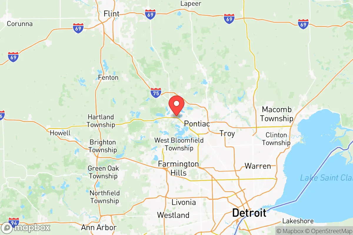
Strategic Assessment of Oakland County
Meaningful friction. Expect exposure to either population pressure, blast zones, or natural disaster risk. Consider buying a retreat property.
What does the Strategic Assessment tell us?
Our Strategic Assessment grades tactical survivability of an area. Major population centers, military targets, fallout zones, natural disasters, and border exposure all drive risk — lower exposure means a more defensible position in a crisis.
This is heavily inspired by Joel Skousen's Strategic Relocation book. Highly recommended you checkout the book ($)What does this tell us?
Our Strategic Assessment grades tactical survivability of an area. Major population centers, military targets, fallout zones, natural disasters, and border exposure all drive risk — lower exposure means a more defensible position in a crisis.
This is heavily inspired by Joel Skousen's Strategic Relocation book. Highly recommended you checkout the book ($)Strategic Pillars

Key Distances
Strategic Assessment Analysis
Oakland County, Michigan, offers a surprisingly resilient strategic position for those prioritizing preparedness and stability, balancing proximity to Great Lakes freshwater resources with a buffer from the most acute risks of major urban collapse. While it sits adjacent to Detroit’s potential fallout zones and civil unrest corridors, the county’s inland geography, dispersed suburban infrastructure, and access to multiple escape routes make it a viable base for a conservative-leaning relocator who wants to be near—but not inside—a major metro area. The key is understanding that Oakland County is not a remote retreat; it is a fortified staging ground where daily life functions normally until it doesn’t, and where pre-positioning supplies and skills matters more than isolation.
Geographic position and natural advantages: Great Lakes buffer and inland security
Oakland County sits about 20 miles northwest of Detroit’s urban core, placing it outside the immediate blast or fallout radius of any plausible Detroit-centric event while still within a two-hour drive of Lake Huron and Lake St. Clair for emergency water access. The county’s terrain is rolling hills and hardwood forests—not flat farmland—which provides natural cover and drainage advantages over flood-prone areas like Macomb County to the east. The Clinton River and Huron River watersheds run through the county, offering surface water sources that are less contaminated than Detroit’s industrial waterways. For a prepper, the key natural advantage is the abundance of small lakes: Oakland County has over 1,400 inland lakes, meaning decentralized water sources that are harder to target or contaminate than a single reservoir. Towns like Milford, Holly, and Oxford sit on higher ground with good well potential, while the more developed areas like Troy and Bloomfield Hills rely on municipal systems that could fail in a grid-down scenario. The county’s position also puts it within a three-hour drive of the Mackinac Bridge—a chokepoint to the Upper Peninsula’s remote refuge areas—and within 90 minutes of the Canadian border via Port Huron, though that border is a double-edged sword in a crisis.
Risks, exposures, and proximity to fallout-relevant landmarks
The most significant risk for Oakland County relocators is its proximity to Detroit’s urban instability and the industrial infrastructure along the I-75 and I-94 corridors. Detroit’s population density and history of civil unrest mean that any major economic collapse, disease outbreak, or political crisis could trigger a mass exodus northward along those highways, turning Oakland County’s suburbs into a bottleneck. The county also sits within 50 miles of the Fermi 2 nuclear power plant in Monroe County—a pressurized water reactor that, while not as catastrophic as a Chernobyl-style event, would produce a fallout plume that could affect southern and eastern Oakland County depending on wind direction. Additionally, the oil refineries in Toledo, Ohio (about 70 miles south) and the chemical plants along the Detroit River are high-value targets for sabotage or accident. For those concerned with military or government targets, Selfridge Air National Guard Base in Macomb County is 30 miles east, and the Detroit Arsenal in Warren—home to the U.S. Army’s Tank-automotive and Armaments Command—is a clear strategic asset that could draw attention. On the positive side, Oakland County has no major military bases, no nuclear weapons storage sites, and no major ports, which reduces its likelihood of being a primary target in a conflict scenario. The risk profile is moderate: not a safe zone, but not a bullseye either.
Practical resilience for a relocator: food, water, energy, and defensibility
For a single individual or family looking to establish a resilient household in Oakland County, the practical picture is mixed but workable. Water is the strongest asset: the county’s numerous lakes and rivers mean that with a good filtration system (Berkey, Sawyer, or a DIY sand filter), you can source water indefinitely without relying on municipal treatment plants. The groundwater in the western townships—places like White Lake, Highland, and Springfield Township—is generally good quality, though well drilling costs vary. Food security is moderate: Oakland County has some remaining farmland in its northern and western reaches, but it is not an agricultural powerhouse like Michigan’s Thumb region. You will need to stockpile or establish relationships with local farmers in Lapeer County (30 minutes north) or Washtenaw County (southwest) for bulk grains, meat, and produce. The county does have a strong network of farmers’ markets and CSAs, but these are not reliable in a crisis. Energy resilience is achievable: the county has no coal or natural gas production, but solar potential is decent (Michigan averages 4-5 peak sun hours in summer, less in winter). Many homes in the rural townships already have backup generators, and wood-burning stoves are common in older homes. For defensibility, Oakland County’s suburban sprawl is a double-edged sword: neighborhoods with cul-de-sacs and single-entry roads (common in places like Rochester Hills and Novi) are easier to secure than the grid-like streets of Pontiac or Southfield. The county’s law enforcement presence is robust—Oakland County Sheriff’s Office is well-funded and has a strong SWAT capability—but in a prolonged grid-down scenario, you cannot rely on them for perimeter security. The best defensive strategy is to choose a home on a dead-end road with good sightlines and a well-sealed basement, and to avoid properties adjacent to major highways or rail lines that could become refugee corridors.
The overall strategic picture for Oakland County is that of a high-functioning buffer zone—close enough to Detroit’s resources (hospitals, supply chains, specialized labor) to benefit from them in normal times, but far enough to avoid the worst of a collapse’s initial shockwave. For a conservative-leaning relocator who values community, self-reliance, and proximity to freshwater, the county offers a realistic middle ground between urban vulnerability and rural isolation. The trade-off is that you will need to invest in your own infrastructure—water filtration, solar panels, food storage, and security measures—because the county’s suburban comfort is a veneer that can peel away quickly when the lights go out. If you are willing to put in the work, Oakland County can be a solid base for weathering the storms ahead. If you are looking for a turnkey survival retreat, look farther north to the Upper Peninsula or the Rockies. But for those who want to stay engaged with the world while being prepared for its worst, this is a defensible choice.
* Values derived from national, state, county, city and local statistics and may differ in a specific area. Last updated: 2026-05-11T22:51:11.000Z
Narrative content on this page is AI-generated and may contain mistakes. Verify any details that matter before acting on them.
ReloMaps may earn a commission from affiliate links at no extra cost to you.