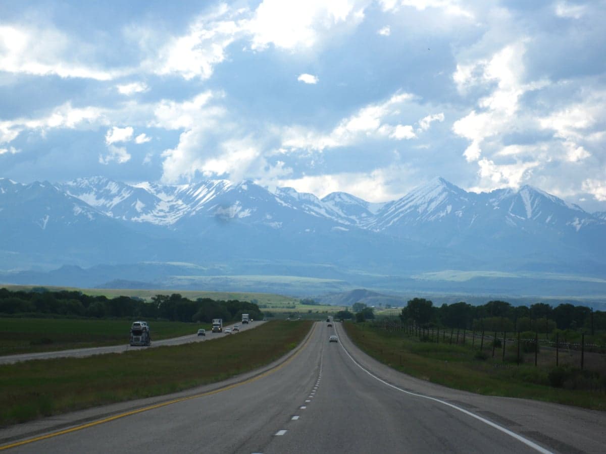
Photo: Wikipedia
Strategic Assessment of Stillwater County
Deep buffer from population centers and strategic targets. Low natural disaster risk and minimal exposure to border or coastal threats.
What does the Strategic Assessment tell us?
Our Strategic Assessment grades tactical survivability of an area. Major population centers, military targets, fallout zones, natural disasters, and border exposure all drive risk — lower exposure means a more defensible position in a crisis.
This is heavily inspired by Joel Skousen's Strategic Relocation book. Highly recommended you checkout the book ($)What does this tell us?
Our Strategic Assessment grades tactical survivability of an area. Major population centers, military targets, fallout zones, natural disasters, and border exposure all drive risk — lower exposure means a more defensible position in a crisis.
This is heavily inspired by Joel Skousen's Strategic Relocation book. Highly recommended you checkout the book ($)Strategic Pillars

Key Distances
Strategic Assessment Analysis
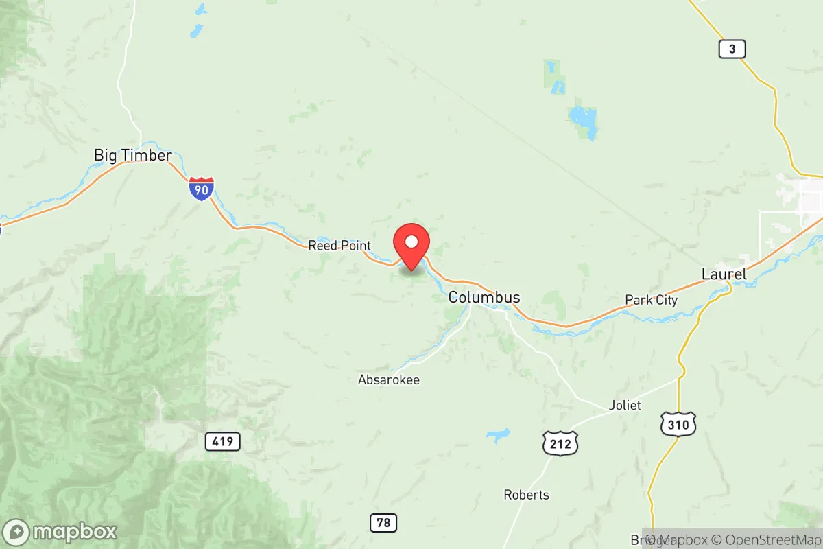
Stillwater County, Montana, offers a compelling mix of geographic isolation and practical self-sufficiency that appeals to relocation-minded individuals and families prioritizing long-term resilience. Situated along the Yellowstone River and anchored by the towns of Columbus (the county seat) and Absarokee, the county sits roughly 50 miles west of Billings and 90 miles east of Bozeman—close enough for supply runs but far enough to avoid the population density and infrastructure vulnerabilities of those urban centers. The county’s strategic position, with the Beartooth Mountains to the south and the Yellowstone River Valley as a natural corridor, provides both defensible terrain and access to critical resources like water and arable land.
Geographic position and natural advantages for self-sufficiency
Stillwater County’s geography is a major asset for anyone seeking a resilient relocation site. The Yellowstone River runs through the heart of the county, providing a reliable surface water source that is less prone to drought than many other parts of the Intermountain West. The surrounding landscape includes the Beartooth Front, a rugged mountain escarpment that offers natural barriers to the south and east, while the open plains to the north and west allow for agriculture and grazing. The county’s elevation—around 3,600 feet in Columbus—means cooler summers and a shorter growing season, but the fertile river bottomlands support hay, alfalfa, and small grains, which are staples for livestock and personal food production. The area’s low population density (roughly 9 people per square mile) and limited through-traffic reduce the risk of disease spread and supply chain disruption, making it a strong candidate for a decentralized, self-reliant lifestyle.
Risks, exposures, and proximity to fallout-relevant landmarks
While Stillwater County is far from major metropolitan targets, it is not without strategic risks. The county is home to the Stillwater Mine (near Nye), one of the largest palladium and platinum mines in the world, and the Columbus-area Stillwater Refinery, a precious metals processing facility. These industrial sites could be secondary targets in a conflict scenario, though their remote location and low profile make them less likely than major refineries or military bases. The nearest significant military installation is Malmstrom Air Force Base near Great Falls, about 200 miles northwest, which is a primary ICBM field and a potential first-strike target. Fallout from such a strike would likely be carried by prevailing winds away from Stillwater County, but the risk is non-zero. Natural hazards include wildfire—especially in the forested foothills south of Absarokee—and occasional flooding along the Yellowstone River during spring snowmelt. The county’s distance from major ports, refineries, and population centers (Billings is the closest city of any size) actually works in its favor for fallout avoidance, as there are no high-value civilian or military targets within a 50-mile radius.
Practical resilience for a relocator: food, water, energy, and defensibility
For a family or individual serious about self-sufficiency, Stillwater County offers strong fundamentals. Water access is the standout advantage: the Yellowstone River and its tributaries (including the Stillwater River) provide year-round flow, and groundwater is generally accessible via wells in the valley. Food production is viable, with local farms and ranches producing beef, hay, and some vegetables; the Columbus Farmers Market and local co-ops supplement what can be grown at home. Energy is a mixed picture: the county is served by Northwestern Energy, with grid power from coal and hydro sources, but off-grid solar is feasible given the region’s 200+ sunny days per year. Wood heating is common in rural homes, and the surrounding national forest (Custer Gallatin) provides ample fuel. Defensibility is aided by the county’s geography—the Beartooth Mountains create a natural choke point to the south, and the Yellowstone River acts as a barrier to the north. The small population and dispersed settlement pattern mean that a determined group could secure a homestead with relative ease. However, the county’s limited law enforcement presence (the Stillwater County Sheriff’s Office has fewer than 20 deputies) means that community self-policing and mutual aid networks are essential for long-term security.
Overall, Stillwater County presents a balanced strategic picture for the resilience-minded relocator. Its combination of reliable water, arable land, low population density, and distance from major targets makes it one of the more defensible and self-sufficient areas in the northern Rockies. The presence of the Stillwater Mine and refinery introduces a modest industrial risk, but the county’s isolation and natural barriers mitigate most fallout and infrastructure concerns. For a family willing to invest in off-grid energy, food storage, and community relationships, Stillwater County offers a realistic foundation for long-term preparedness without the extremes of deep wilderness or the vulnerabilities of suburban sprawl.

* Values derived from national, state, county, city and local statistics and may differ in a specific area. Last updated: 2026-08-08T16:45:46.000Z
Narrative content on this page is AI-generated and may contain mistakes. Verify any details that matter before acting on them.
ReloMaps may earn a commission from affiliate links at no extra cost to you.

