

Photo: Wikipedia
Strategic Assessment of Mount Vernon, WA
Meaningful friction. Expect exposure to either population pressure, blast zones, or natural disaster risk. Consider buying a retreat property.
What does the Strategic Assessment tell us?
Our Strategic Assessment grades tactical survivability of an area. Major population centers, military targets, fallout zones, natural disasters, and border exposure all drive risk — lower exposure means a more defensible position in a crisis.
This is heavily inspired by Joel Skousen's Strategic Relocation book. Highly recommended you checkout the book ($)What does this tell us?
Our Strategic Assessment grades tactical survivability of an area. Major population centers, military targets, fallout zones, natural disasters, and border exposure all drive risk — lower exposure means a more defensible position in a crisis.
This is heavily inspired by Joel Skousen's Strategic Relocation book. Highly recommended you checkout the book ($)Strategic Pillars

Key Distances
Regional Safe Places
Below is our recommended "safe zones" in Washington and the surrounding area based on our strategic heuristics. For most people, it's unrealistic to live in a “safe zone” full-time due to work, family or other personal reasons. They tend to be more rural. However, many of these areas are perfect for second homes and retreat properties that double as a vacation home or even a short-term rental.


Important Note: For informational purposes only. This does not mean nothing bad ever happens in the green zones. Please use common sense. This is based on public data and modeled with AI. We tried to take a conservative approach but mistakes happen. We update this regularly as new information becomes available.
Solar Generator Recommendations
Backup power matters more here than in safer locations. We've picked three solar generators across budgets and capacity tiers — start with the budget unit if you only need a few essentials, or step up if you want to run a fridge and HVAC for days at a time.

Jackery Portable Power Station Explorer 300
Budget OptionPower on the Go: Weighing only 11 lbs, it's convenient to set up and store with book-sized foldable solar panels

BLUETTI Portable Power Station AC180
Designed for both indoor and outdoor scenarios, AC180 is highly capable as it has a robost capacity and continuous output power.

EF ECOFLOW DELTA Pro Ultra Power Station
Upgraded PickEcoFlow DELTA Pro Ultra is a whole-home energy system designed to grow with your family. Integrated with the Smart Home Panel 2, it scales to meet your evolving energy needs — keeping your home powered, intelligent, and secure through every stage of life.
We earn a commission, at no additional cost to you.
Strategic Assessment Analysis
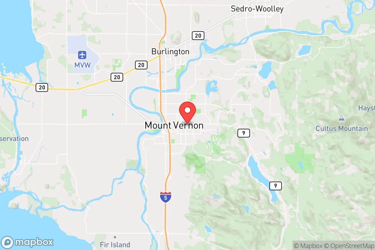
Mount Vernon, Washington, sits in a geographic sweet spot that offers genuine strategic depth for those thinking about long-term resilience, but it’s not without serious trade-offs. Located in the Skagit Valley, roughly 60 miles north of Seattle and 50 miles south of the Canadian border, this agricultural hub provides a rare combination of fertile land, abundant freshwater, and relative isolation from the densest urban corridors. For a relocator with a prepper mindset, the key question isn’t whether Mount Vernon can support a self-reliant lifestyle—it’s whether the area’s proximity to major population centers and critical infrastructure introduces risks that outweigh its natural advantages.
Geographic position and natural advantages for long-term self-sufficiency
Mount Vernon’s position in the Skagit River delta is its single greatest asset. The Skagit River, fed by the North Cascades, provides a massive, reliable freshwater source that is unlikely to be contaminated by upstream industrial activity in a crisis scenario. The surrounding Skagit Valley is some of the most productive agricultural land in the Pacific Northwest, producing everything from potatoes and berries to dairy and livestock. In a grid-down or supply-chain disruption event, this valley could feed a local population far beyond its current size—assuming the distribution networks hold. The area also sits at the convergence of I-5 and State Route 20, giving residents two major evacuation routes: south toward the less-dense areas of Snohomish County, or east over the North Cascades Highway into central Washington, which offers a completely different climate and resource base. The proximity to the San Juan Islands and the Strait of Juan de Fuca also opens maritime options for resupply or relocation, though that requires boat access and skills most relocators won’t have on day one.
Risks, exposures, and proximity to fallout-relevant landmarks
The biggest strategic liability for Mount Vernon is its location along the I-5 corridor, which is the primary north-south artery for the entire West Coast. In a mass evacuation event—whether from a Cascadia Subduction Zone earthquake, a nuclear incident at the Hanford Site (roughly 200 miles southeast), or civil unrest in Seattle—I-5 will become a parking lot or a chokepoint. Mount Vernon itself sits about 60 miles from the Seattle metropolitan area, which means fallout from a major urban disaster (conventional or nuclear) could reach the valley within hours, depending on wind patterns. The Skagit Valley is also directly under the flight path for Naval Air Station Whidbey Island, a major military installation that could become a target in a conflict scenario. The base is roughly 30 miles southwest as the crow flies, and while it provides some security presence, it also makes the area a potential secondary target. Additionally, the Skagit River has a history of severe flooding—the 2021 flood event caused millions in damage—and the valley’s flat, low-lying terrain offers little natural defensibility against a determined group moving north from the urban core.
Practical resilience for a relocator: food, water, energy, and defensibility
For a relocator serious about self-sufficiency, Mount Vernon offers a strong baseline but requires significant upfront work. Water is abundant—the Skagit River and its tributaries provide year-round flow, and the shallow aquifer means private wells are viable in most rural parcels outside the city limits. Food production is the area’s standout feature: the valley’s soil is rich, the growing season is long (March through October), and local farmers’ markets and U-pick operations are plentiful even in normal times. A family with a half-acre plot can realistically produce a significant portion of their own calories within two seasons. Energy resilience is more challenging. The region is served by Puget Sound Energy, which relies on a mix of hydro, natural gas, and some coal. In a grid-down scenario, solar is viable but the frequent overcast from October through March means battery storage and backup generation (propane or diesel) are essential. Wood heating is common in the area, and the surrounding forests provide ample fuel, but cutting and seasoning it requires labor and space. Defensibility is the weakest link. The valley is flat, open, and crisscrossed by roads and canals. A rural property with a long driveway and good sightlines is possible, but most of the area lacks natural chokepoints. The nearest defensible terrain is in the foothills of the North Cascades, 15-20 miles east, where properties become more isolated but also more expensive and harder to access in winter.
From a strategic standpoint, Mount Vernon is a solid B+ location for a prepper or conservative relocator who values agricultural self-sufficiency and water security but is willing to accept the risks of being within a day’s drive of a major urban collapse zone. The area’s biggest strength—its fertile valley and reliable water—is also its biggest vulnerability: it’s a natural target for refugees fleeing Seattle or Portland in a crisis. If you’re looking for a place to hunker down and ride out a short-term disruption (weeks to months), Mount Vernon works well. For a long-term collapse scenario (years), you’d want to be farther east, in the drier, more defensible terrain of the Methow Valley or the Okanogan. But if you’re willing to invest in flood mitigation, a good well, and a solid perimeter plan, the Skagit Valley offers a rare combination of resources that most of the Pacific Northwest simply cannot match. Just don’t plan on staying put if the big one hits—have a bug-out route east mapped out and practiced before you need it.
* Values derived from national, state, county, city and local statistics and may differ in a specific area. Last updated: 2026-04-21T11:08:52.000Z
Narrative content on this page is AI-generated and may contain mistakes. Verify any details that matter before acting on them.
ReloMaps may earn a commission from affiliate links at no extra cost to you.