
Photo: Wikipedia
Strategic Assessment of Dawes County
Deep buffer from population centers and strategic targets. Low natural disaster risk and minimal exposure to border or coastal threats.
What does the Strategic Assessment tell us?
Our Strategic Assessment grades tactical survivability of an area. Major population centers, military targets, fallout zones, natural disasters, and border exposure all drive risk — lower exposure means a more defensible position in a crisis.
This is heavily inspired by Joel Skousen's Strategic Relocation book. Highly recommended you checkout the book ($)What does this tell us?
Our Strategic Assessment grades tactical survivability of an area. Major population centers, military targets, fallout zones, natural disasters, and border exposure all drive risk — lower exposure means a more defensible position in a crisis.
This is heavily inspired by Joel Skousen's Strategic Relocation book. Highly recommended you checkout the book ($)Strategic Pillars

Key Distances
Strategic Assessment Analysis
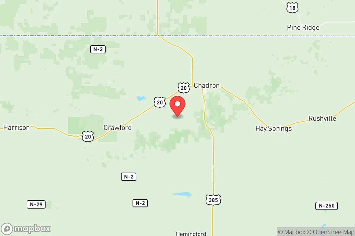
Dawes County, Nebraska, offers a strategic relocation option for those prioritizing resilience and self-sufficiency, anchored by its remote location in the state’s northwestern corner. The county’s sparse population—roughly 8,000 residents spread across 1,400 square miles—combined with its distance from major metropolitan targets like Denver (over 200 miles south) and the strategic nuclear missile fields of central Nebraska, creates a low-probability profile for direct fallout exposure. The county seat, Chadron, serves as the primary population hub and economic center, while smaller communities like Crawford and Whitney provide additional rural outposts. This geographic isolation, paired with access to the Pine Ridge escarpment and the Niobrara River valley, positions Dawes County as a defensible, resource-rich area for a relocator thinking seriously about long-term preparedness.
Geographic position and natural advantages for self-sufficiency
Dawes County sits at the intersection of the Nebraska Panhandle and the Pine Ridge region, a geological formation that provides natural elevation and defensible terrain. The county’s highest points, near the Nebraska National Forest and the Oglala National Grassland, rise over 4,000 feet, offering vantage points and cooler temperatures than the surrounding plains. The Niobrara River, which flows through the southern part of the county, provides a reliable surface water source, while the White River and numerous smaller creeks drain the northern slopes. This water network is a critical asset for off-grid living, as groundwater in the High Plains Aquifer is generally accessible at moderate depths. The county’s agricultural base—primarily cattle ranching and dryland wheat farming—means that local food production is feasible, with Chadron hosting a USDA-approved meat processing facility and several farm-to-table operations. The Nebraska National Forest, covering over 90,000 acres within the county, offers timber for construction and fuel, as well as wildlife for hunting (deer, turkey, and upland birds). For a relocator, the combination of water, arable land, and forest resources makes Dawes County one of the more naturally self-sufficient areas in the Great Plains.
Risks, exposures, and proximity to fallout-relevant landmarks
Dawes County’s primary risk exposure is not from direct nuclear strikes but from secondary effects like fallout drift and supply chain disruptions. The nearest strategic targets are the Minuteman III missile silos in the central Nebraska region, roughly 150 miles east, and the Ellsworth Air Force Base near Rapid City, South Dakota, about 100 miles north. While these are potential targets, prevailing westerly winds would likely carry fallout eastward, away from Dawes County. The county’s distance from major industrial centers—Denver, Cheyenne, and Rapid City are all over 100 miles away—reduces the risk of blast or thermal damage. However, the county is not immune to natural hazards: severe thunderstorms, hail, and occasional tornadoes are common in spring and summer, and the region experiences periodic droughts that can stress water supplies. The Pine Ridge area is also prone to wildfires, particularly in dry years, though the sparse population limits property exposure. For a relocator, the key risk is isolation during a crisis: Chadron’s hospital (Chadron Community Hospital) is a critical access facility with limited trauma capacity, and the nearest major medical center is in Rapid City, a 90-minute drive. Road access is primarily via US Highway 20 and US Highway 385, both two-lane routes that could become congested or impassable during a mass evacuation.
Practical resilience for a relocator: food, water, energy, and defensibility
Dawes County offers strong practical resilience for those willing to invest in off-grid infrastructure. Water access is the standout advantage: the Niobrara River and the High Plains Aquifer provide reliable sources, and well drilling is straightforward in most areas, with depths typically between 100 and 300 feet. Surface water from the river requires treatment but is abundant. Food production is viable due to the county’s agricultural heritage—local ranchers and farmers supply beef, pork, and grains, and Chadron’s farmers’ market operates from May through October. For long-term self-sufficiency, the growing season is short (about 130 frost-free days), but cold-hardy crops like potatoes, carrots, and kale thrive. Energy resilience is moderate: the county is served by the Nebraska Public Power District, which relies heavily on coal and natural gas, but solar potential is good (over 200 sunny days per year), and wind speeds average 12-15 mph, making small-scale wind turbines practical. Chadron State College has a small solar installation, but residential off-grid systems are uncommon and require upfront investment. Defensibility is high due to the low population density and natural terrain: the Pine Ridge escarpment provides natural chokepoints and observation points, and the county’s road network is limited, making it easy to monitor access. However, the open plains to the south and east offer little cover, so a relocator should prioritize a property near the forest or river breaks for concealment. The county’s gun culture is strong, with a high rate of firearm ownership and a local sheriff’s office that is responsive but understaffed (about 10 deputies for the entire county). For a family or individual, the practical takeaway is that Dawes County rewards preparation: those who arrive with stored supplies, renewable energy systems, and a plan for water treatment will find the environment forgiving, while those expecting immediate infrastructure support may struggle.
Overall, Dawes County presents a balanced strategic picture for the disaster-conscious relocator. Its greatest strengths—geographic isolation, abundant water, and arable land—are offset by its vulnerabilities: limited medical infrastructure, exposure to natural hazards, and dependence on long supply chains for manufactured goods. The county is not a fallout-free zone, but its distance from high-value targets and prevailing wind patterns make it a lower-risk option than areas closer to the missile fields or Denver. For a single individual or family willing to invest in self-sufficiency, Dawes County offers a defensible, resource-rich base in a region that is often overlooked by those focused on the more famous refuges of the Mountain West. The key is to arrive prepared, build local connections, and treat the county’s isolation as an asset rather than a liability.

* Values derived from national, state, county, city and local statistics and may differ in a specific area. Last updated: 2026-10-15T13:15:28.000Z
Narrative content on this page is AI-generated and may contain mistakes. Verify any details that matter before acting on them.
ReloMaps may earn a commission from affiliate links at no extra cost to you.

