Photo: Wikipedia
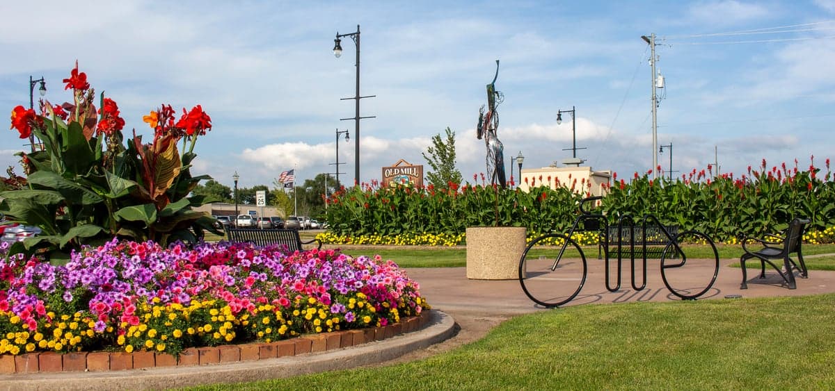
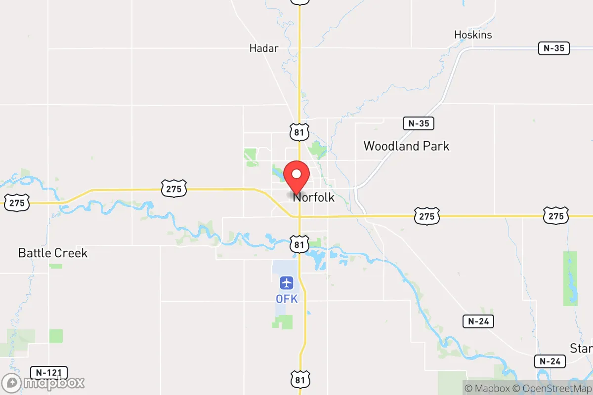
Strategic Assessment of Norfolk, NE
Workable tactical position. Some exposure to population density or targets, but generally defensible in a crisis.
What does the Strategic Assessment tell us?
Our Strategic Assessment grades tactical survivability of an area. Major population centers, military targets, fallout zones, natural disasters, and border exposure all drive risk — lower exposure means a more defensible position in a crisis.
This is heavily inspired by Joel Skousen's Strategic Relocation book. Highly recommended you checkout the book ($)What does this tell us?
Our Strategic Assessment grades tactical survivability of an area. Major population centers, military targets, fallout zones, natural disasters, and border exposure all drive risk — lower exposure means a more defensible position in a crisis.
This is heavily inspired by Joel Skousen's Strategic Relocation book. Highly recommended you checkout the book ($)Strategic Pillars

Key Distances
Regional Safe Places
Below is our recommended "safe zones" in Nebraska and the surrounding area based on our strategic heuristics. For most people, it's unrealistic to live in a “safe zone” full-time due to work, family or other personal reasons. They tend to be more rural. However, many of these areas are perfect for second homes and retreat properties that double as a vacation home or even a short-term rental.
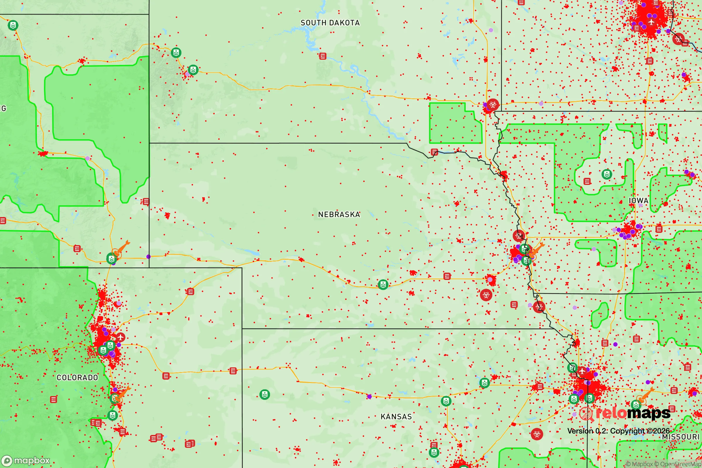
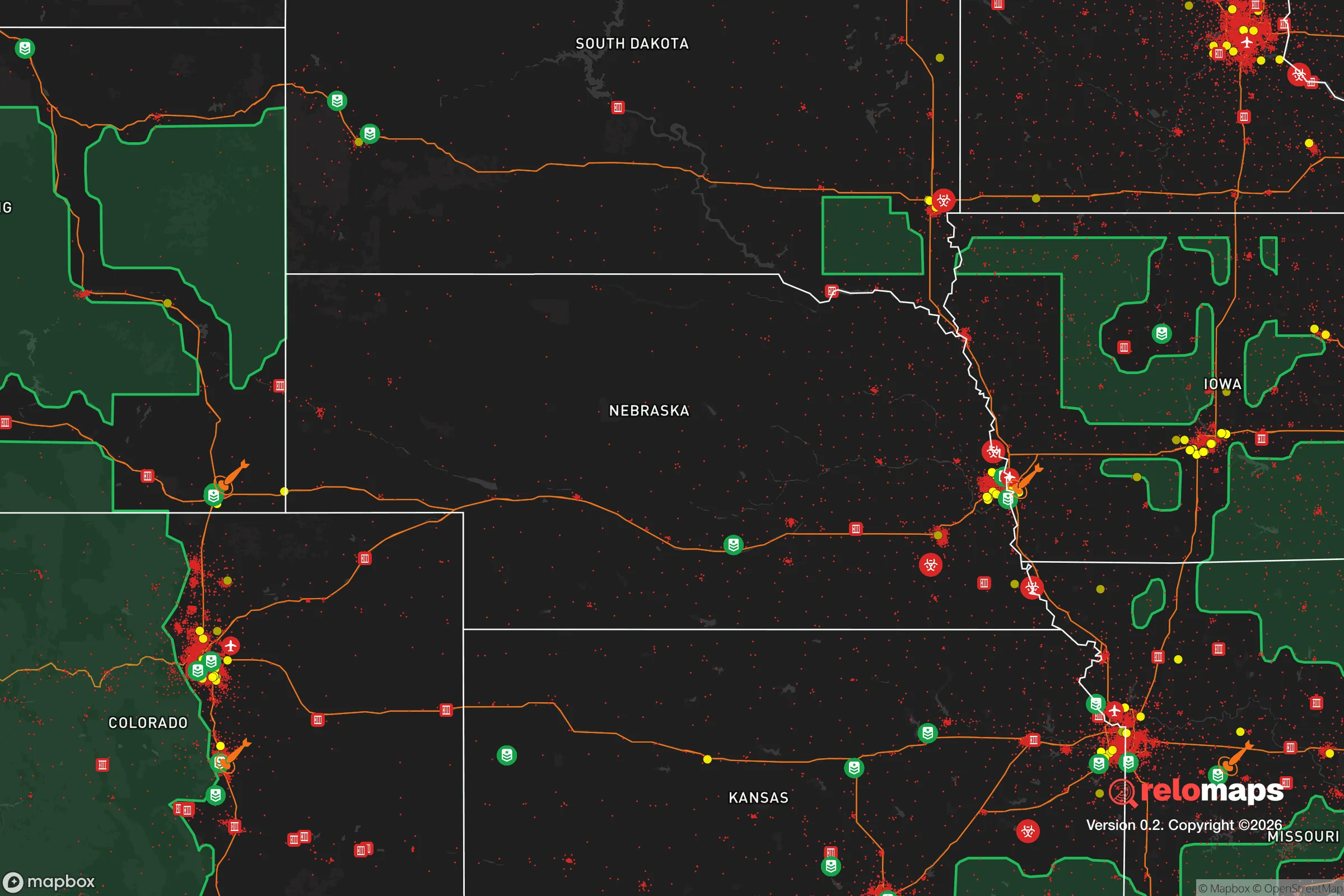
Important Note: For informational purposes only. This does not mean nothing bad ever happens in the green zones. Please use common sense. This is based on public data and modeled with AI. We tried to take a conservative approach but mistakes happen. We update this regularly as new information becomes available.
Solar Generator Recommendations
Backup power matters more here than in safer locations. We've picked three solar generators across budgets and capacity tiers — start with the budget unit if you only need a few essentials, or step up if you want to run a fridge and HVAC for days at a time.

Jackery Portable Power Station Explorer 300
Budget OptionPower on the Go: Weighing only 11 lbs, it's convenient to set up and store with book-sized foldable solar panels

BLUETTI Portable Power Station AC180
Designed for both indoor and outdoor scenarios, AC180 is highly capable as it has a robost capacity and continuous output power.

EF ECOFLOW DELTA Pro Ultra Power Station
Upgraded PickEcoFlow DELTA Pro Ultra is a whole-home energy system designed to grow with your family. Integrated with the Smart Home Panel 2, it scales to meet your evolving energy needs — keeping your home powered, intelligent, and secure through every stage of life.
We earn a commission, at no additional cost to you.
Strategic Assessment Analysis
Norfolk, Nebraska, sits as a quietly strategic outpost in the Great Plains, offering a blend of agricultural self-sufficiency and geographic isolation that appeals to those prioritizing long-term resilience. Its location roughly 110 miles northwest of Omaha and 80 miles southwest of Sioux Falls places it outside the immediate blast and fallout zones of major metropolitan targets, while still providing access to regional supply chains and medical infrastructure. For a relocator with a prepper or survivalist mindset, Norfolk’s combination of a stable water table, productive farmland, and a community that still values self-reliance makes it a defensible base for weathering civic unrest or large-scale disruptions.
Geographic position and natural advantages for long-term survival
Norfolk’s position in the Elkhorn River Valley is a natural asset for those thinking about food and water security. The surrounding region is part of the Nebraska Sandhills and the Loess Hills, which together offer some of the most productive agricultural land in the country. The Ogallala Aquifer lies beneath much of this area, providing a deep, reliable freshwater source that is less vulnerable to surface contamination than many coastal or river-dependent cities. The local climate is semi-arid but supports dryland farming and livestock grazing, meaning a family with a few acres could produce a significant portion of their own calories. The flat to rolling terrain also makes the area defensible in a practical sense—there are few natural chokepoints for large-scale movement, but the open landscape allows for early warning of approaching threats. Norfolk’s elevation, around 1,500 feet, is not mountainous but is high enough to avoid the flood risks that plague many Midwestern river towns, though the Elkhorn River itself can flood during heavy rains.
Risks, exposures, and proximity to fallout-relevant landmarks
The primary risk for Norfolk is its proximity to Offutt Air Force Base near Omaha, which is a high-priority target for any strategic strike. Offutt houses the U.S. Strategic Command (STRATCOM), making it a likely first-wave target in a nuclear exchange. Norfolk sits roughly 110 miles northwest of Offutt, which places it outside the immediate blast radius (typically 5-10 miles for a ground burst) but well within the fallout plume zone for prevailing westerly winds. In a worst-case scenario, fallout could arrive within 6-12 hours, requiring a well-stocked shelter and at least two weeks of supplies. The city itself is not a primary target, but its rail lines and Highway 81 corridor could become chokepoints for refugee movement or military logistics during a crisis. There are no major military bases, nuclear power plants, or chemical facilities within 50 miles, which reduces the risk of secondary industrial accidents. The nearest major population centers—Omaha, Sioux Falls, and Lincoln—are all within a two-hour drive, meaning Norfolk could see a surge of evacuees if those cities are compromised. This is a double-edged sword: the area is isolated enough to avoid direct targeting, but close enough to be affected by the collapse of regional infrastructure.
Practical resilience for a relocator: food, water, energy, and defensibility
For a relocator looking to establish a self-sufficient homestead, Norfolk offers several concrete advantages. Local food production is the strongest pillar: the surrounding counties (Madison, Stanton, and Pierce) are among the top corn, soybean, and cattle producers in the state. Farmers’ markets and local meat lockers are common, and the cost of raw land is still reasonable—agricultural parcels can be found for $3,000–$5,000 per acre, far less than in Colorado or the Pacific Northwest. Water access is straightforward: most rural properties have wells tapping into the Ogallala Aquifer, and the city’s municipal water comes from groundwater sources, not surface reservoirs that could be contaminated or drained. Energy resilience is more mixed. Norfolk is served by the Nebraska Public Power District, which relies heavily on coal and nuclear (the Cooper Nuclear Station is 90 miles south, near Brownville). Solar and wind potential are good—the area averages 220 sunny days per year and has consistent winds—but local permitting for off-grid systems is straightforward, and there are no HOA restrictions in unincorporated areas. Defensibility is moderate: the open plains offer clear sightlines, but the lack of natural barriers means a determined group could approach from any direction. A rural property with a gravel road, a good fence, and a well-placed garden is more defensible than a suburban lot. The local gun culture is strong, with multiple gun shops and ranges in the area, and Nebraska is a constitutional carry state, which aligns with a prepper’s need for self-defense without bureaucratic hurdles.
Community and infrastructure in a crisis scenario
Norfolk’s population of roughly 25,000 is small enough to maintain social cohesion but large enough to have a hospital (Faith Regional Health Services), a regional airport, and a Walmart Supercenter that could serve as a supply hub in the early days of a crisis. The community is predominantly conservative, with a strong agricultural ethic and a low tolerance for crime or disorder. The local sheriff’s office and police department are well-regarded, and the area has a history of mutual aid between farmers and townspeople during blizzards or floods. For a relocator, this means you’re not going to be a lone wolf—there’s a network of like-minded individuals, including several prepper-oriented churches and gun clubs. The downside is that Norfolk is not a “bug-out” location; it’s a “bug-in” town. If you arrive without a plan for water, food storage, and community integration, you’ll be dependent on the same supply chains that could fail. The local economy is tied to agriculture and manufacturing (including a Tyson Foods plant and a Nucor steel facility), which means job opportunities exist but are not diverse. In a long-term collapse scenario, Norfolk’s reliance on industrial agriculture and long-distance supply chains could become a vulnerability, as fertilizer, fuel, and spare parts become scarce.
Overall, Norfolk presents a balanced strategic picture for the conservative prepper. It is not a remote mountain redoubt, but it is far enough from major targets to survive a first strike and resilient enough to sustain a family through a prolonged disruption. The key trade-off is between isolation and access: you get a defensible, self-sufficient base with good water and food potential, but you are close enough to Omaha and Sioux Falls to feel the ripple effects of their collapse. For a single individual or a family willing to invest in a well-stocked shelter, a few acres of farmland, and a network of local contacts, Norfolk offers a realistic path to long-term survival without the extreme isolation of the Rockies or the high costs of the Southeast. The smart move is to buy land now, dig a well, and start building relationships with local farmers and tradesmen before the next crisis hits.
* Values derived from national, state, county, city and local statistics and may differ in a specific area. Last updated: 2026-04-23T02:30:40.000Z
Narrative content on this page is AI-generated and may contain mistakes. Verify any details that matter before acting on them.
ReloMaps may earn a commission from affiliate links at no extra cost to you.