
Photo: Wikipedia
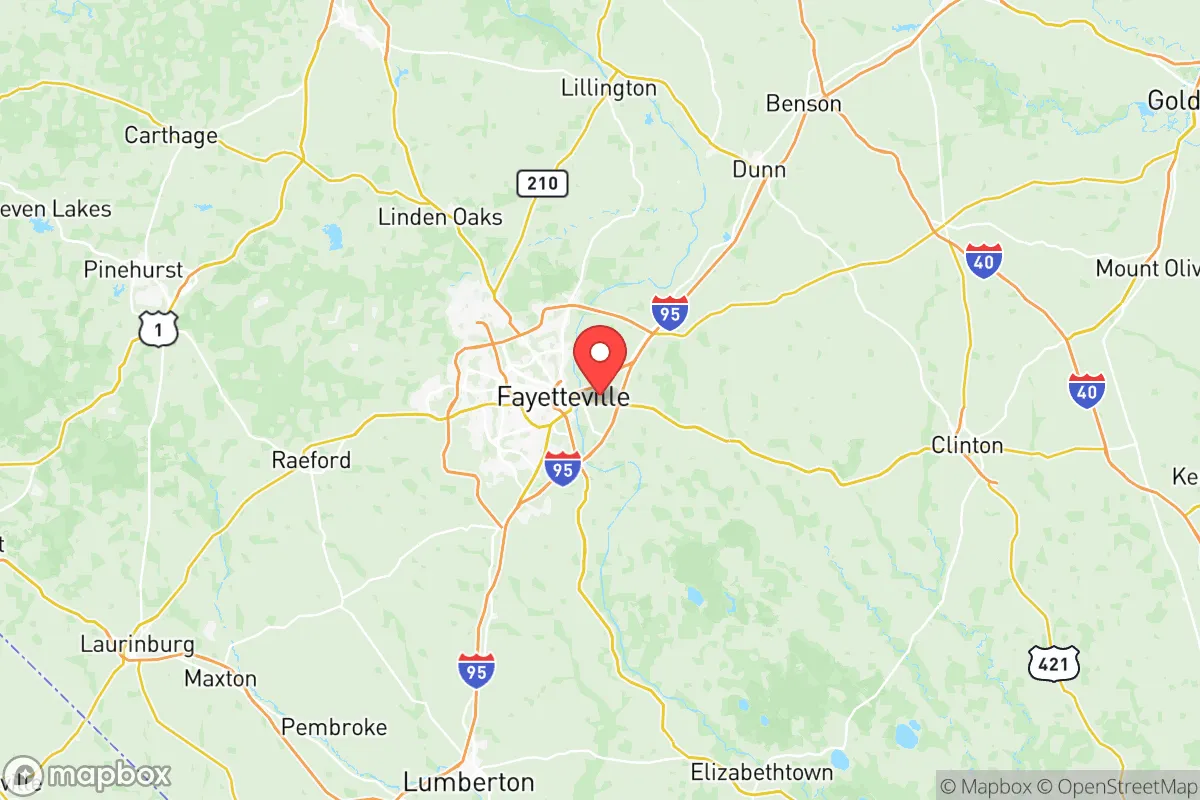
Strategic Assessment of Cumberland County
Meaningful friction. Expect exposure to either population pressure, blast zones, or natural disaster risk. Consider buying a retreat property.
What does the Strategic Assessment tell us?
Our Strategic Assessment grades tactical survivability of an area. Major population centers, military targets, fallout zones, natural disasters, and border exposure all drive risk — lower exposure means a more defensible position in a crisis.
This is heavily inspired by Joel Skousen's Strategic Relocation book. Highly recommended you checkout the book ($)What does this tell us?
Our Strategic Assessment grades tactical survivability of an area. Major population centers, military targets, fallout zones, natural disasters, and border exposure all drive risk — lower exposure means a more defensible position in a crisis.
This is heavily inspired by Joel Skousen's Strategic Relocation book. Highly recommended you checkout the book ($)Strategic Pillars

Key Distances
Strategic Assessment Analysis
Cumberland County, anchored by Fayetteville and the massive Fort Liberty military installation, presents a complex strategic picture for relocators prioritizing resilience and self-sufficiency. Its position in the Sandhills region of North Carolina offers a blend of geographic advantages and notable vulnerabilities that demand careful consideration. While the area benefits from a robust local economy and a population accustomed to structured preparedness, its proximity to major transportation corridors and high-value military assets introduces risks that a conservative-leaning, disaster-conscious individual or family must weigh against the region's genuine strengths in water availability and defensible terrain.
Geographic position and natural advantages for long-term stability
Cumberland County sits in the North Carolina Sandhills, a region defined by ancient, well-drained sandy soils and rolling terrain that offers distinct advantages over the flood-prone coastal plain or the more densely packed Piedmont. The area's elevation, averaging around 100 to 200 feet above sea level, provides natural drainage that significantly reduces the risk of catastrophic flooding compared to communities along the Cape Fear River downstream. The Cape Fear River itself runs through the county's western edge, providing a substantial freshwater resource, though its proximity to Fayetteville means prime waterfront access is often developed. The region's sandy soil is also a practical asset for those interested in private water systems, as it allows for relatively straightforward well drilling and septic installation on rural parcels outside the city limits. The climate is temperate, with four distinct seasons that support year-round gardening and livestock management, a key consideration for families aiming to reduce reliance on external supply chains. The county's location roughly 60 miles from the Atlantic coast and 100 miles from the Research Triangle offers a balance: close enough to access urban medical and supply hubs, but far enough to avoid the immediate fallout of a coastal hurricane landfall or a major metropolitan crisis.
Risks, exposures, and proximity to high-value military and industrial landmarks
The single most defining risk factor for Cumberland County is the presence of Fort Liberty, one of the largest military installations in the world by population. While the base provides economic stability and a culture of discipline, it also makes the county a high-priority target in any conflict scenario involving state actors. The base's airfields, ammunition depots, and command centers are concentrated near the county's northern and western edges, particularly around the towns of Spring Lake and Hope Mills. Additionally, the county is bisected by Interstate 95, a major north-south logistical artery that would likely be a chokepoint during any large-scale evacuation or supply disruption. The presence of the Fayetteville Regional Airport and the Cape Fear River as a navigable waterway further increases the area's strategic visibility. For a relocator concerned with fallout from industrial accidents or targeted strikes, the concentration of military infrastructure within a 15-mile radius of downtown Fayetteville is a significant liability. Natural disaster risks are moderate: the county is inland enough to avoid the worst of hurricane storm surge, but it still experiences tropical storm-force winds and heavy rainfall events that can cause localized flooding in low-lying areas near the river and its tributaries. Tornadoes are a seasonal concern, though the Sandhills terrain does not produce the same frequency as the Great Plains.
Practical resilience for a relocator: food, water, energy, and defensibility
For a family or individual serious about self-sufficiency, Cumberland County offers a mixed but workable environment. Water availability is a genuine strength: the Cape Fear River and the underlying Black Creek aquifer provide reliable sources for private wells, and the county's average annual rainfall of roughly 48 inches supports rainwater catchment systems. However, water quality in the Cape Fear River has been a concern due to industrial discharges upstream, so well testing and filtration are advisable. Food production potential is good in the rural eastern and southern parts of the county, where sandy loam soils are suitable for row crops, orchards, and pasture. The county's agricultural extension service and a network of local farms around Stedman and Wade provide resources for those learning to grow their own food. Energy resilience is a weak point: the grid is heavily dependent on Duke Energy's centralized infrastructure, and the area has experienced notable outages during ice storms and hurricane remnants. Solar potential is moderate, with roughly 200 sunny days per year, but tree cover in many residential areas can limit panel efficiency. Defensibility is a double-edged sword. The rural areas east of Fayetteville, toward Godwin and Autryville, offer low population density, multiple road networks, and natural chokepoints that could be monitored. However, the county's overall population of over 200,000 means that any large-scale crisis would likely trigger significant movement along I-95 and Highway 24, creating congestion and potential security concerns. The presence of a large, well-armed military and veteran population could be a stabilizing factor in a breakdown scenario, but it also means a higher baseline of firearms and tactical knowledge among the general populace, which cuts both ways.
The overall strategic picture for Cumberland County is one of calculated trade-offs. It is not a remote survivalist retreat, nor is it a high-risk urban core. The area's genuine advantages—abundant water, defensible terrain in the Sandhills, a climate suited to self-sufficient agriculture, and a population with a strong preparedness culture—are counterbalanced by the undeniable target risk posed by Fort Liberty and the vulnerability of the I-95 corridor. For a relocator who values community resilience, access to military-grade medical and logistical resources, and a lower cost of living than the North Carolina coast or Triangle, Cumberland County deserves serious consideration. The key is to locate well away from the base's immediate footprint and the river's floodplain, ideally in the rural eastern or southern reaches, and to invest in independent water, power, and food systems from day one. This is not a location for those seeking isolation, but for those who want a strategic foothold in a region that combines natural resources with a hard-wired culture of readiness.

* Values derived from national, state, county, city and local statistics and may differ in a specific area. Last updated: 2026-08-08T12:36:14.000Z
Narrative content on this page is AI-generated and may contain mistakes. Verify any details that matter before acting on them.
ReloMaps may earn a commission from affiliate links at no extra cost to you.

