Photo: Wikipedia
Strategic Assessment of North Myrtle Beach, SC
Meaningful friction. Expect exposure to either population pressure, blast zones, or natural disaster risk. Consider buying a retreat property.
What does the Strategic Assessment tell us?
Our Strategic Assessment grades tactical survivability of an area. Major population centers, military targets, fallout zones, natural disasters, and border exposure all drive risk — lower exposure means a more defensible position in a crisis.
This is heavily inspired by Joel Skousen's Strategic Relocation book. Highly recommended you checkout the book ($)What does this tell us?
Our Strategic Assessment grades tactical survivability of an area. Major population centers, military targets, fallout zones, natural disasters, and border exposure all drive risk — lower exposure means a more defensible position in a crisis.
This is heavily inspired by Joel Skousen's Strategic Relocation book. Highly recommended you checkout the book ($)Strategic Pillars

Key Distances
Regional Safe Places
Below is our recommended "safe zones" in South Carolina and the surrounding area based on our strategic heuristics. For most people, it's unrealistic to live in a “safe zone” full-time due to work, family or other personal reasons. They tend to be more rural. However, many of these areas are perfect for second homes and retreat properties that double as a vacation home or even a short-term rental.


Important Note: For informational purposes only. This does not mean nothing bad ever happens in the green zones. Please use common sense. This is based on public data and modeled with AI. We tried to take a conservative approach but mistakes happen. We update this regularly as new information becomes available.
Solar Generator Recommendations
Backup power matters more here than in safer locations. We've picked three solar generators across budgets and capacity tiers — start with the budget unit if you only need a few essentials, or step up if you want to run a fridge and HVAC for days at a time.

Jackery Portable Power Station Explorer 300
Budget OptionPower on the Go: Weighing only 11 lbs, it's convenient to set up and store with book-sized foldable solar panels

BLUETTI Portable Power Station AC180
Designed for both indoor and outdoor scenarios, AC180 is highly capable as it has a robost capacity and continuous output power.

EF ECOFLOW DELTA Pro Ultra Power Station
Upgraded PickEcoFlow DELTA Pro Ultra is a whole-home energy system designed to grow with your family. Integrated with the Smart Home Panel 2, it scales to meet your evolving energy needs — keeping your home powered, intelligent, and secure through every stage of life.
We earn a commission, at no additional cost to you.
Strategic Assessment Analysis
North Myrtle Beach presents a mixed strategic picture for the conservative prepper. Its primary advantage is geographic isolation from the major population centers that are likely to become focal points for civil unrest, while its primary disadvantage is the inherent vulnerability of a coastal barrier island to natural disasters and the logistical challenges of a single evacuation route. The area offers a buffer from the immediate chaos of a collapsing urban center, but that buffer comes with its own set of exposure risks that require serious consideration before a relocation decision is made.
Geographic position and natural advantages for a prepper
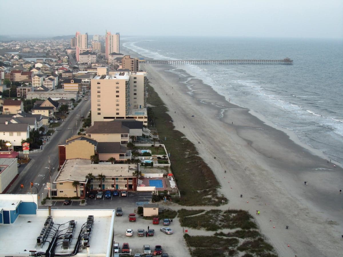
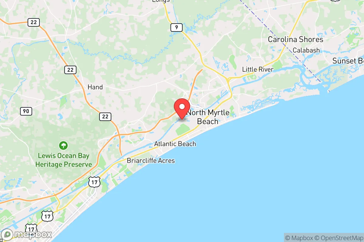
North Myrtle Beach sits on a narrow barrier island, roughly 15 miles north of Myrtle Beach proper and about 30 miles south of the North Carolina state line. This positioning places it far enough from the major metropolitan areas of Charlotte (roughly 100 miles northwest) and Charleston (roughly 95 miles southwest) to avoid the immediate shockwaves of a major urban crisis. The Intracoastal Waterway runs parallel to the coast, creating a natural defensive barrier between the beachfront communities and the mainland. This waterway, combined with the extensive marshlands and tidal creeks that characterize the area, creates a fragmented geography that would slow any large-scale movement of people or vehicles. The surrounding Horry County is largely rural, with pine forests and farmland that offer some degree of natural resource availability. The area's climate is subtropical, with a growing season that extends from March through November, allowing for year-round food production if you have the right setup. The ocean itself is a massive, renewable source of protein and water (with proper desalination), and the Intracoastal Waterway provides a secondary source of fish and shellfish that is less exposed to storm surge. The proximity to the Waccamaw River and the Little River also offers freshwater sources that are not directly tied to municipal infrastructure.
Risks, exposures, and proximity to fallout-relevant landmarks
The most significant risk is the area's exposure to hurricanes and tropical storms. North Myrtle Beach sits in a zone that has been directly hit by major storms, including Hurricane Hugo in 1989 and Hurricane Florence in 2018. A Category 3 or higher storm would likely render the area uninhabitable for weeks or months, with storm surge flooding, wind damage, and complete infrastructure collapse. The single evacuation route, Highway 17, becomes a parking lot during mandatory evacuations, and the bridges connecting the barrier island to the mainland are vulnerable to storm damage. Beyond natural disasters, the proximity to the Savannah River Site (roughly 120 miles southwest) is a concern. This is a nuclear weapons facility and waste storage site that has a history of leaks and accidents. A major incident there could contaminate the water table and the coastal zone, depending on wind patterns. The area is also within 150 miles of the Charleston Naval Weapons Station and the Marine Corps Recruit Depot at Parris Island, both of which could become targets in a large-scale conflict. The presence of the Myrtle Beach International Airport and the Grand Strand's massive tourism infrastructure means that in a crisis, the area would be a destination for tens of thousands of displaced people from the interior, overwhelming local resources. The population of Horry County swells from roughly 350,000 year-round residents to over 2 million during peak tourist season, and that infrastructure is designed for temporary visitors, not long-term survival.
Practical resilience for a relocator: food, water, energy, and defensibility
Water is the most immediate concern. The area's municipal water supply comes from the Pee Dee River and groundwater wells, both of which are vulnerable to saltwater intrusion during storm surge and contamination from upstream agricultural runoff. A prepper relocating here should plan for a well with a hand pump or a rainwater catchment system with adequate storage. The average annual rainfall is roughly 50 inches, so rainwater is plentiful, but it needs to be collected and filtered. Food production is feasible but requires effort. The sandy, acidic soil is not ideal for traditional gardening, but raised beds with imported soil and compost work well. The growing season is long enough for two crop cycles, and the local farmers' markets and roadside stands provide a backup supply during normal times. The ocean and waterways offer a reliable protein source, but fishing pressure is high, and overfishing is a concern. Energy is a mixed bag. The grid is vulnerable to storm damage, and power outages are common during hurricane season. Solar is viable, with the area averaging 215 sunny days per year, but coastal storms and salt spray degrade panels faster than inland installations. A backup generator with a fuel storage plan is essential. Defensibility is the area's weakest point. The barrier island geography means there are only a few roads in and out, which is good for controlling access but terrible for escape. The dense, suburban-style development of North Myrtle Beach means that properties are close together, with limited privacy and clear lines of sight. A rural property on the mainland side of the Intracoastal Waterway, in areas like Little River or Longs, offers better defensibility with more land, fewer neighbors, and multiple access routes. The local law enforcement presence is strong during normal times, but in a crisis, the sheer number of tourists and second-home owners would overwhelm the Horry County Police Department and the North Myrtle Beach Department of Public Safety.
The overall strategic picture for North Myrtle Beach is one of calculated risk. It offers a genuine escape from the urban collapse scenarios that are likely to play out in Charlotte, Atlanta, and the Northeast corridor, but it does so at the cost of exposure to natural disasters and the logistical nightmare of a single evacuation route. For a single individual or a family willing to invest in robust infrastructure—a well, solar panels, a generator, a boat, and a well-stocked pantry—the area can work as a long-term retreat. The key is to avoid the beachfront and the dense tourist zones and instead focus on the mainland side of the waterway, where you have more land, better water access, and a lower population density. The conservative values of the local population, the strong gun culture, and the general self-reliance of the rural South are assets that align with a prepper mindset. But this is not a bug-out location for a sudden crisis; it is a place to build a life that is already resilient, with the understanding that when the storm comes—whether natural or man-made—you will be riding it out where you stand, not running from it. The area's greatest strength is its isolation from the major flashpoints; its greatest weakness is that isolation becomes a trap when the bridges are out and the roads are clogged. Plan accordingly.
* Values derived from national, state, county, city and local statistics and may differ in a specific area. Last updated: 2026-04-30T06:59:29.000Z
Narrative content on this page is AI-generated and may contain mistakes. Verify any details that matter before acting on them.
ReloMaps may earn a commission from affiliate links at no extra cost to you.