Photo: Wikipedia
Strategic Assessment of Northglenn, CO
Multiple tactical vulnerabilities. Population density, target proximity, or disaster risk are likely compounding. A retreat property and exit planning is required.
What does the Strategic Assessment tell us?
Our Strategic Assessment grades tactical survivability of an area. Major population centers, military targets, fallout zones, natural disasters, and border exposure all drive risk — lower exposure means a more defensible position in a crisis.
This is heavily inspired by Joel Skousen's Strategic Relocation book. Highly recommended you checkout the book ($)What does this tell us?
Our Strategic Assessment grades tactical survivability of an area. Major population centers, military targets, fallout zones, natural disasters, and border exposure all drive risk — lower exposure means a more defensible position in a crisis.
This is heavily inspired by Joel Skousen's Strategic Relocation book. Highly recommended you checkout the book ($)Strategic Pillars

Key Distances
Regional Safe Places
Below is our recommended "safe zones" in Colorado and the surrounding area based on our strategic heuristics. For most people, it's unrealistic to live in a “safe zone” full-time due to work, family or other personal reasons. They tend to be more rural. However, many of these areas are perfect for second homes and retreat properties that double as a vacation home or even a short-term rental.


Important Note: For informational purposes only. This does not mean nothing bad ever happens in the green zones. Please use common sense. This is based on public data and modeled with AI. We tried to take a conservative approach but mistakes happen. We update this regularly as new information becomes available.
Solar Generator Recommendations
Backup power matters more here than in safer locations. We've picked three solar generators across budgets and capacity tiers — start with the budget unit if you only need a few essentials, or step up if you want to run a fridge and HVAC for days at a time.

Jackery Portable Power Station Explorer 300
Budget OptionPower on the Go: Weighing only 11 lbs, it's convenient to set up and store with book-sized foldable solar panels

BLUETTI Portable Power Station AC180
Designed for both indoor and outdoor scenarios, AC180 is highly capable as it has a robost capacity and continuous output power.

EF ECOFLOW DELTA Pro Ultra Power Station
Upgraded PickEcoFlow DELTA Pro Ultra is a whole-home energy system designed to grow with your family. Integrated with the Smart Home Panel 2, it scales to meet your evolving energy needs — keeping your home powered, intelligent, and secure through every stage of life.
We earn a commission, at no additional cost to you.
Strategic Assessment Analysis
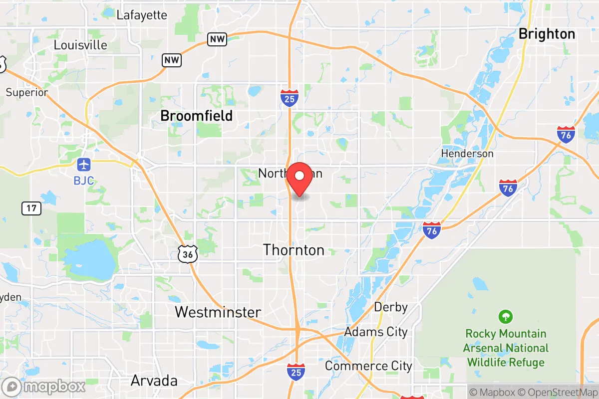
Northglenn, Colorado, sits in a precarious strategic position that demands a clear-eyed assessment for anyone serious about resilience and preparedness. Located just north of Denver along the I-25 corridor, this suburb of roughly 38,000 offers a mix of suburban convenience and proximity to open spaces, but its location also introduces significant vulnerabilities for those planning for civic unrest, mass casualty events, or large-scale disasters. The area’s resilience is a double-edged sword: it provides access to resources and escape routes, but it also places you squarely in the shadow of a major metropolitan target zone. For a conservative-leaning relocator focused on self-reliance, Northglenn requires careful weighing of its advantages against its exposures.
Geographic position and natural advantages for long-term survival
Northglenn’s geographic position offers a few genuine strategic benefits for a prepper mindset. The city sits at roughly 5,400 feet elevation on the Colorado Front Range, placing it in a semi-arid climate with low humidity and minimal risk of hurricanes, tornadoes, or flooding compared to other regions. The nearby Rocky Mountains, less than 30 miles west, provide a natural barrier and potential retreat zone if urban conditions deteriorate. The South Platte River runs through the area, offering a surface water source, though it’s heavily managed and not pristine. The city’s location along I-25 gives you a direct north-south evacuation corridor toward Wyoming or New Mexico, while I-76 connects east to the plains. However, this same highway network makes Northglenn a chokepoint during any mass evacuation—traffic can gridlock within minutes, as seen during the 2021 Marshall Fire evacuations south of Boulder. The Front Range’s mountain backdrop also creates a rain shadow effect, meaning water scarcity is a real, long-term concern; the region relies heavily on snowmelt and reservoir storage, both vulnerable to drought and climate shifts.
Risks, exposures, and proximity to fallout-relevant landmarks
The most glaring strategic weakness of Northglenn is its proximity to high-value targets that would attract attention during a national crisis. Northglenn is less than 10 miles from Denver International Airport (DIA), a major transportation hub that would be a primary target for any coordinated attack or a focal point for mass evacuation chaos. The city also sits within 15 miles of the Rocky Mountain Arsenal National Wildlife Refuge, a former chemical weapons manufacturing site that still contains buried contaminants—a potential secondary hazard if infrastructure fails. Buckley Space Force Base in Aurora, about 20 miles southeast, is a key military installation that could become a target or a source of military traffic during unrest. The I-25 corridor itself is a vulnerability: it’s the spine of Colorado’s population, and any disruption—whether from a natural disaster, grid failure, or civil unrest—would cut off supply chains and movement. Northglenn’s dense suburban layout, with homes on small lots and limited rural buffer, means you’re surrounded by neighbors in a grid-dependent environment. A prolonged power outage or water system failure would turn this area into a liability quickly, as most homes lack well water or off-grid energy. The city’s proximity to Denver (just 10 miles south) also means you’d be in the path of any urban unrest spillover, including protests, looting, or resource shortages that radiate outward from the city core.
Practical resilience for a relocator: food, water, energy, and defensibility
For a relocator serious about practical resilience, Northglenn presents a mixed bag that requires significant upfront investment. Water is the most critical concern: the city’s water comes from the Denver Water system, which draws from reservoirs in the mountains. This system is vulnerable to contamination, earthquake damage to tunnels, or cyberattacks on infrastructure. A private well is not an option in most of Northglenn’s subdivisions, so you’d need to store at least two weeks of water per person—about 14 gallons minimum—and have a plan for rainwater catchment or purification from the South Platte, which carries agricultural runoff and urban pollutants. Food security is moderately achievable: the growing season is short (roughly May to September) due to elevation and occasional late frosts, but community gardens and backyard plots can supplement supplies. The area has several grocery stores, but they’d empty quickly during a crisis—stockpiling is essential. Energy resilience is a weak point: Xcel Energy provides grid power, and natural gas is common for heating. Solar panels are viable given 300+ sunny days per year, but most homes aren’t equipped for off-grid living. A generator with fuel storage is a near-necessity for any extended outage. Defensibility is poor in the suburban core: homes are close together, with limited sightlines and multiple entry points. The city’s police department is well-funded but would be stretched thin during a mass event. Your best bet for security is a home on the northern or western edges of town, where lots are larger and you’re closer to open land. The nearby Adams County Open Space and Rocky Flats National Wildlife Refuge (though the latter has contamination concerns) offer some buffer, but they’re not defensible positions. Community resilience is a wildcard: Northglenn has a mix of long-term residents and newer transplants, with a median age around 35. There’s no strong prepper or survivalist community visible, but local churches and gun clubs (like the nearby Colorado Gun Club) could serve as networking hubs for like-minded individuals. The city’s zoning allows for some livestock in certain areas, but it’s not rural enough for serious homesteading.
The overall strategic picture for Northglenn is one of calculated risk. It’s not a survivalist’s paradise—the proximity to Denver, reliance on grid infrastructure, and suburban density create real vulnerabilities that require proactive mitigation. For a single individual or family willing to invest in water storage, backup power, and a solid security plan, it can serve as a staging ground for a more remote retreat in the mountains or plains. But if you’re looking for a location that offers natural defensibility, resource independence, and distance from major targets, Northglenn falls short. Its best use is as a temporary base for someone who needs to stay near Denver for work or family but is actively planning an exit strategy to a more resilient location like the San Luis Valley or the Western Slope. For the serious prepper, Northglenn is a place to pass through, not to dig in. The Front Range’s growing population and water constraints only amplify these concerns—by 2030, the region is projected to add another 500,000 residents, straining resources further. If you’re committed to this area, focus on building a self-sufficient network with neighbors, securing a reliable vehicle for evacuation, and keeping a low profile. In a crisis, the suburbs can become a trap; Northglenn’s location makes that trap more likely than most.
* Values derived from national, state, county, city and local statistics and may differ in a specific area. Last updated: 2026-04-19T08:31:41.000Z
Narrative content on this page is AI-generated and may contain mistakes. Verify any details that matter before acting on them.
ReloMaps may earn a commission from affiliate links at no extra cost to you.