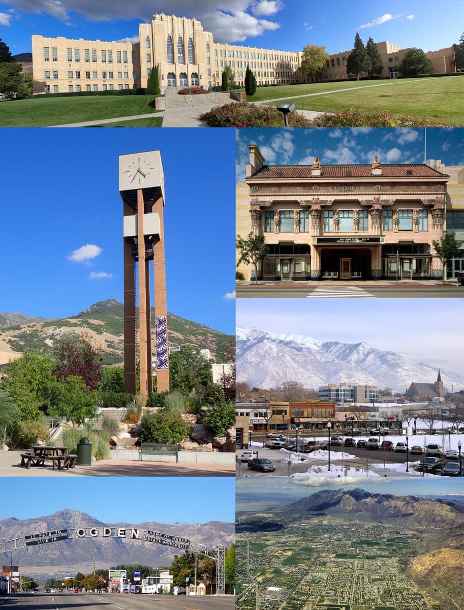
Photo: Wikipedia
Strategic Assessment of Ogden, UT
Workable tactical position. Some exposure to population density or targets, but generally defensible in a crisis.
What does the Strategic Assessment tell us?
Our Strategic Assessment grades tactical survivability of an area. Major population centers, military targets, fallout zones, natural disasters, and border exposure all drive risk — lower exposure means a more defensible position in a crisis.
This is heavily inspired by Joel Skousen's Strategic Relocation book. Highly recommended you checkout the book ($)What does this tell us?
Our Strategic Assessment grades tactical survivability of an area. Major population centers, military targets, fallout zones, natural disasters, and border exposure all drive risk — lower exposure means a more defensible position in a crisis.
This is heavily inspired by Joel Skousen's Strategic Relocation book. Highly recommended you checkout the book ($)Strategic Pillars

Key Distances
Regional Safe Places
Below is our recommended "safe zones" in Utah and the surrounding area based on our strategic heuristics. For most people, it's unrealistic to live in a “safe zone” full-time due to work, family or other personal reasons. They tend to be more rural. However, many of these areas are perfect for second homes and retreat properties that double as a vacation home or even a short-term rental.


Important Note: For informational purposes only. This does not mean nothing bad ever happens in the green zones. Please use common sense. This is based on public data and modeled with AI. We tried to take a conservative approach but mistakes happen. We update this regularly as new information becomes available.
Solar Generator Recommendations
Backup power matters more here than in safer locations. We've picked three solar generators across budgets and capacity tiers — start with the budget unit if you only need a few essentials, or step up if you want to run a fridge and HVAC for days at a time.

Jackery Portable Power Station Explorer 300
Budget OptionPower on the Go: Weighing only 11 lbs, it's convenient to set up and store with book-sized foldable solar panels

BLUETTI Portable Power Station AC180
Designed for both indoor and outdoor scenarios, AC180 is highly capable as it has a robost capacity and continuous output power.

EF ECOFLOW DELTA Pro Ultra Power Station
Upgraded PickEcoFlow DELTA Pro Ultra is a whole-home energy system designed to grow with your family. Integrated with the Smart Home Panel 2, it scales to meet your evolving energy needs — keeping your home powered, intelligent, and secure through every stage of life.
We earn a commission, at no additional cost to you.
Strategic Assessment Analysis
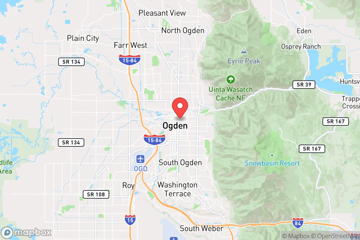
Ogden, Utah, sits in a unique strategic pocket that offers genuine resilience advantages for those thinking seriously about long-term preparedness, but it comes with trade-offs that demand clear-eyed assessment. Nestled at the base of the Wasatch Range and flanked by the Great Salt Lake to the west, the city benefits from a geographic buffer that keeps it out of the direct blast radius of major metropolitan targets while still providing access to critical infrastructure. For a relocator weighing civic unrest, mass casualty events, or broader societal disruptions, Ogden presents a mixed picture: strong natural defenses and resource potential, but real exposure to fallout from nearby high-value military and industrial sites.
Geographic position and natural advantages for long-term security
Ogden’s location is its strongest card. The city sits about 35 miles north of Salt Lake City, placing it far enough from the Wasatch Front’s primary population and government hub to avoid the worst of a major urban collapse, yet close enough to tap into regional supply chains when things are stable. The Wasatch Mountains rise immediately east, providing a natural barrier that limits approach vectors and offers countless escape routes into high-altitude terrain. To the west, the Great Salt Lake acts as a massive open-space buffer, making a direct ground assault from that direction impractical. The Ogden River and Weber River systems run through the valley, giving the area a reliable freshwater source that many arid Western cities lack. The surrounding canyons—like Ogden Canyon and Weber Canyon—offer defensible choke points for anyone with a rural retreat in mind, and the mountain valleys beyond (such as Huntsville and Eden) provide fertile ground for small-scale agriculture. For a prepper, this geography means you can live in town for work and community but be in a hardened, self-sufficient position within 20 minutes.
Risks, exposures, and proximity to fallout-relevant landmarks
The sobering reality is that Ogden sits uncomfortably close to several high-priority targets. Hill Air Force Base, a major logistics and maintenance hub for the U.S. Air Force’s F-35 and nuclear-capable bomber fleet, is just 10 miles south of downtown. In a major conflict or terrorist scenario, that base is a top-tier target—conventional or nuclear. The fallout plume from a ground burst at Hill would likely sweep northeast over Ogden depending on prevailing winds, which typically blow from the south-southwest. Additionally, the Union Pacific rail yard and the I-15 corridor running through Ogden are critical national logistics arteries; any disruption here would ripple across the region. The nearby Tooele Chemical Depot (about 50 miles southwest) and the Dugway Proving Ground (a U.S. Army chemical and biological defense testing facility) add another layer of risk—accidental releases or targeted strikes could contaminate large areas. For the conservative relocator, this means Ogden is not a remote bunker; it’s a front-row seat to strategic infrastructure. If you’re planning to bug in, you need a solid plan for sheltering from fallout and a route out of the valley if the wind shifts wrong.
Practical resilience for a relocator: food, water, energy, and defensibility
On the practical side, Ogden offers a mix of strengths and gaps. Water is the biggest win: the Weber and Ogden Rivers are snowmelt-fed and run year-round, and the city’s municipal supply comes from mountain reservoirs like Causey and Pineview. A well in the bench areas (east of Washington Boulevard) can tap into shallow aquifers, and rainwater catchment is legal in Utah with a permit. Food resilience is moderate—the Weber County area has some small farms and orchards (especially fruit trees in the bench neighborhoods), but the growing season is short (about 120 frost-free days) and soil is alkaline. You’ll want to stockpile heirloom seeds and plan for greenhouse growing. Energy is a bright spot: Utah has a deregulated electricity market, and rooftop solar is viable with net metering. Natural gas is abundant, and propane delivery is common in the foothills. Defensibility is situational—the city itself is a typical grid layout with open sightlines along the bench, but the canyons and mountain neighborhoods (like North Ogden and the east bench) offer natural chokepoints and limited access roads. The local gun culture is strong, with multiple ranges and a high rate of private ownership, which matters for community defense in a breakdown scenario. The downsides: Ogden’s population density (about 88,000 in the city, 270,000 in the county) means you’re not isolated, and the I-15 corridor can become a death trap if mass evacuation is needed. Plan for a rural retreat within 30 miles—Cache Valley to the north or the Uinta Basin to the east are better long-term holds.
The overall strategic picture for Ogden is that of a high-potential but high-exposure location. It’s not a hidden gem—the proximity to Hill AFB and the Wasatch Front’s population density means you’re in a secondary target zone, not a safe zone. But for a relocator who wants to stay connected to a functioning economy (defense, logistics, healthcare) while maintaining a credible preparedness posture, Ogden works if you’re disciplined. The mountains give you an escape hatch, the water gives you a buffer, and the local culture is aligned with self-reliance. The key is to treat Ogden as a base of operations, not a final redoubt. Have a bug-out location in the high country, a fallout shelter plan for the first 72 hours, and a community network of like-minded neighbors. If you can accept that risk, Ogden offers a rare balance of access and resilience that few other Western cities can match.
* Values derived from national, state, county, city and local statistics and may differ in a specific area. Last updated: 2026-04-21T09:14:02.000Z
Narrative content on this page is AI-generated and may contain mistakes. Verify any details that matter before acting on them.
ReloMaps may earn a commission from affiliate links at no extra cost to you.