Photo: Wikipedia
Strategic Assessment of Cherokee County
Workable tactical position. Some exposure to population density or targets, but generally defensible in a crisis.
What does the Strategic Assessment tell us?
Our Strategic Assessment grades tactical survivability of an area. Major population centers, military targets, fallout zones, natural disasters, and border exposure all drive risk — lower exposure means a more defensible position in a crisis.
This is heavily inspired by Joel Skousen's Strategic Relocation book. Highly recommended you checkout the book ($)What does this tell us?
Our Strategic Assessment grades tactical survivability of an area. Major population centers, military targets, fallout zones, natural disasters, and border exposure all drive risk — lower exposure means a more defensible position in a crisis.
This is heavily inspired by Joel Skousen's Strategic Relocation book. Highly recommended you checkout the book ($)Strategic Pillars

Key Distances
Strategic Assessment Analysis
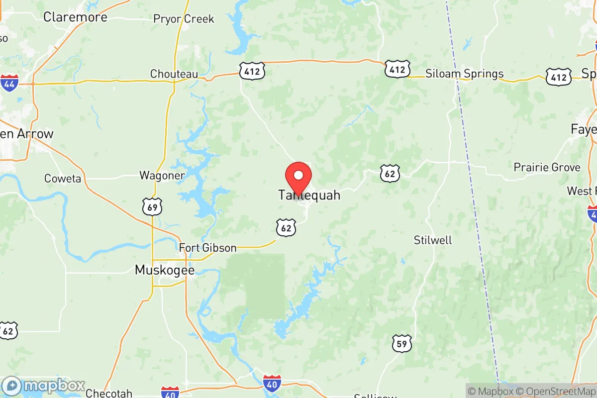
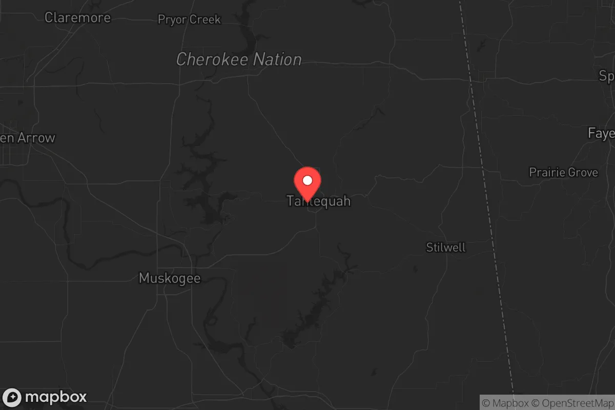
Cherokee County, Oklahoma, offers a compelling strategic position for those prioritizing resilience and self-sufficiency, particularly for conservative-minded individuals and families looking to insulate themselves from the volatility of major urban centers. Its location in the eastern part of the state, anchored by the county seat of Tahlequah, provides a meaningful buffer from the immediate fallout zones of large cities like Tulsa (about 70 miles west) and the Dallas-Fort Worth metroplex (roughly 200 miles south). The area’s rugged terrain, abundant water resources, and lower population density create a natural advantage for those seeking a sustainable retreat without complete isolation from essential services.
Geographic position and natural advantages for long-term security
Cherokee County sits within the Boston Mountains of the Ozark Plateau, a region characterized by steep hills, dense forests, and numerous spring-fed creeks and rivers. This topography is a double-edged sword: it makes large-scale military or mechanized movement difficult, which is a defensive plus, but it also limits agricultural flatland. The Illinois River and Lake Tenkiller (partially within the county) provide reliable surface water sources, critical for off-grid water collection and small-scale irrigation. The county’s elevation, averaging around 1,000 feet, offers some protection against the worst of tornado alley’s activity, though it’s not immune. The proximity to the Ozark National Forest in Arkansas (about 30 miles east) adds a vast, sparsely populated buffer zone for hunting, foraging, and emergency relocation. For a relocator, the key advantage is that this is not prime agricultural land, so it’s less likely to be a target for resource grabs during a crisis, yet it’s fertile enough for subsistence gardening and livestock.
Risks, exposures, and proximity to fallout-relevant landmarks
The primary risk in Cherokee County is its relative proximity to several potential fallout-relevant targets. The Port of Catoosa near Tulsa, a major inland port handling petroleum and chemicals, is roughly 70 miles west—within the range of a significant blast or fallout plume depending on wind direction. Similarly, the Keystone Dam on the Arkansas River, about 60 miles southwest, is a critical infrastructure target that, if breached, could cause downstream flooding but is less of a direct fallout concern. More concerning is the McAlester Army Ammunition Plant (about 80 miles south), a massive storage and demilitarization facility for conventional munitions. A major event there could produce a significant blast wave and secondary fires, though prevailing winds typically blow from the south-southwest, which would push fallout away from Cherokee County. The county itself has no major military bases, refineries, or nuclear power plants, which is a net positive. The nearest active military installation is Fort Sill (about 180 miles southwest), well outside any immediate danger zone. The real exposure here is not a direct strike but the secondary effects of a collapse in Tulsa or the I-44 corridor—refugee flows, supply chain disruptions, and potential civil unrest spilling into the area. The county’s limited road network (primarily US-62 and OK-51) can be a choke point, but also a defensible funnel if managed.
Practical resilience for a relocator: food, water, energy, and defensibility
For a family or individual serious about prepping, Cherokee County offers a solid baseline. Water is abundant: the Illinois River and its tributaries provide year-round flow, and the Ozark aquifer beneath the county yields reliable well water at depths of 100-300 feet. Rainwater catchment is also viable given the region’s 45-50 inches of annual precipitation. Food production is feasible but requires work. The rocky, acidic soil needs amendment for row crops, but the area excels in livestock—goats, chickens, and hogs thrive on the brushy terrain. The Cherokee Nation’s extensive land holdings (about 66,000 acres within the county) include agricultural leases and community gardens, which could be a resource or a point of friction depending on governance after a collapse. Energy independence is achievable: the region has decent solar exposure (about 4.5 peak sun hours per day) and numerous small streams suitable for micro-hydro. Wood is plentiful for heating and cooking, with the county being 60% forested. Defensibility is moderate. The terrain offers natural chokepoints along the narrow valley roads, but the county’s population of roughly 50,000 is spread out, meaning you’ll have neighbors but not a dense urban threat. The town of Hulbert (population ~600) and Lost City (a tiny unincorporated community) are examples of low-profile locations where a relocator could establish a discreet homestead. The biggest practical challenge is medical access: the nearest trauma center is in Tulsa, and local clinics in Tahlequah are adequate for routine care but not for major emergencies. Stockpiling antibiotics and trauma supplies is a must.
The overall strategic picture for Cherokee County is one of balanced opportunity. It’s not a fortress, but it’s not a target either. For a conservative-leaning relocator who values community, self-reliance, and a buffer from the chaos of the coasts and big cities, this area provides a workable middle ground. The presence of the Cherokee Nation adds a layer of cultural and legal complexity—tribal sovereignty means local laws and land use can differ from state norms, which can be an advantage for those seeking autonomy or a disadvantage if jurisdictional disputes arise. The county’s distance from major fallout zones like the Houston Ship Channel (over 400 miles) or the Dallas-Fort Worth metroplex (200 miles) means you’re unlikely to see immediate fallout, but you will see refugees. The key is to arrive before the crisis, build relationships with local landowners and the Cherokee community, and secure a water source and defensible position. If you’re looking for a place that’s off the radar but not off the grid, Cherokee County deserves a serious look.
* Values derived from national, state, county, city and local statistics and may differ in a specific area. Last updated: 2026-05-12T10:28:20.000Z
Narrative content on this page is AI-generated and may contain mistakes. Verify any details that matter before acting on them.
ReloMaps may earn a commission from affiliate links at no extra cost to you.