Photo: Wikipedia
Strategic Assessment of Ontario, CA
Multiple tactical vulnerabilities. Population density, target proximity, or disaster risk are likely compounding. A retreat property and exit planning is required.
What does the Strategic Assessment tell us?
Our Strategic Assessment grades tactical survivability of an area. Major population centers, military targets, fallout zones, natural disasters, and border exposure all drive risk — lower exposure means a more defensible position in a crisis.
This is heavily inspired by Joel Skousen's Strategic Relocation book. Highly recommended you checkout the book ($)What does this tell us?
Our Strategic Assessment grades tactical survivability of an area. Major population centers, military targets, fallout zones, natural disasters, and border exposure all drive risk — lower exposure means a more defensible position in a crisis.
This is heavily inspired by Joel Skousen's Strategic Relocation book. Highly recommended you checkout the book ($)Strategic Pillars

Key Distances
Regional Safe Places
Below is our recommended "safe zones" in California and the surrounding area based on our strategic heuristics. For most people, it's unrealistic to live in a “safe zone” full-time due to work, family or other personal reasons. They tend to be more rural. However, many of these areas are perfect for second homes and retreat properties that double as a vacation home or even a short-term rental.


Important Note: For informational purposes only. This does not mean nothing bad ever happens in the green zones. Please use common sense. This is based on public data and modeled with AI. We tried to take a conservative approach but mistakes happen. We update this regularly as new information becomes available.
Solar Generator Recommendations
Backup power matters more here than in safer locations. We've picked three solar generators across budgets and capacity tiers — start with the budget unit if you only need a few essentials, or step up if you want to run a fridge and HVAC for days at a time.

Jackery Portable Power Station Explorer 300
Budget OptionPower on the Go: Weighing only 11 lbs, it's convenient to set up and store with book-sized foldable solar panels

BLUETTI Portable Power Station AC180
Designed for both indoor and outdoor scenarios, AC180 is highly capable as it has a robost capacity and continuous output power.

EF ECOFLOW DELTA Pro Ultra Power Station
Upgraded PickEcoFlow DELTA Pro Ultra is a whole-home energy system designed to grow with your family. Integrated with the Smart Home Panel 2, it scales to meet your evolving energy needs — keeping your home powered, intelligent, and secure through every stage of life.
We earn a commission, at no additional cost to you.
Strategic Assessment Analysis
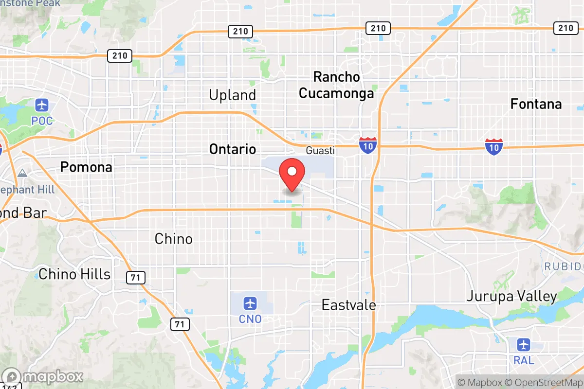
Ontario, California, sits at a critical intersection of vulnerability and opportunity for the strategic relocator. Its location at the crossroads of Interstates 10 and 15, plus the presence of Ontario International Airport (ONT), makes it a logistical hub—but that same connectivity is a double-edged sword in a crisis. For a conservative-leaning prepper, the city offers a unique blend of access to Southern California’s resources while being far enough from the immediate blast zones of Los Angeles and San Diego to warrant serious consideration, provided you understand its specific risks and workarounds.
Geographic position and natural advantages for a prepper
Ontario’s geography is its primary strategic asset. Sitting on the western edge of the Inland Empire, it occupies a transitional zone between the coastal basin and the high desert. This position gives you relatively quick access to multiple escape corridors: east toward the Mojave Desert and Nevada, north toward the San Gabriel Mountains, and south toward the Temecula Valley. The San Bernardino National Forest is less than an hour’s drive, offering remote retreat potential. The city itself sits at an elevation of roughly 1,000 feet, which provides a slight thermal buffer against the extreme heat of the low desert and the coastal fog. The climate is semi-arid, with over 280 sunny days per year—ideal for solar power generation and long-term food drying. Water is a concern, as the region relies heavily on the State Water Project and the Colorado River Aqueduct, but the local groundwater basin (the Chino Basin) is managed and offers some redundancy. For a relocator, the natural advantage is the ability to move in four directions quickly, a critical factor when a single disaster—wildfire, earthquake, or civil unrest—closes one route.
Risks, exposures, and proximity to fallout-relevant landmarks
This is where Ontario’s assessment gets sobering. The city is less than 35 miles from the San Onofre Nuclear Generating Station (SONGS), a decommissioned but still radioactive site. While the plant is shut down, the spent fuel pools remain a target for any major seismic event or deliberate attack. A worst-case release would put Ontario downwind in prevailing westerly winds, meaning fallout could arrive within hours. Additionally, Ontario is directly under the flight paths of both ONT and LAX traffic, and it sits near the March Air Reserve Base (a major logistics hub for the US military). In a mass casualty event or war scenario, this area becomes a high-value target for both conventional and asymmetric threats. The city is also crisscrossed by major rail lines carrying hazardous materials, including crude oil and chemicals. For the prepper, the risk profile is clear: Ontario is not a bug-out location; it’s a staging area. You are close enough to the coast to be affected by a nuclear incident or port shutdown, but far enough to have a fighting chance if you have a vehicle and a plan. The proximity to Los Angeles (about 40 miles) means that any civil unrest in LA will spill over into the Inland Empire within hours, as seen during the 1992 riots and the 2020 protests. The city’s own population of roughly 180,000 is diverse and politically mixed, but the surrounding San Bernardino County leans more conservative, offering potential allies in a crisis.
Practical resilience for a relocator: food, water, energy, and defensibility
For the individual or family looking to establish a resilient foothold, Ontario presents a mixed bag. Food security is achievable but requires work. The city has a strong agricultural history—the “Ontario Model” of citrus groves—but most of that land is now developed. However, the nearby Inland Empire still has working farms and wholesale markets (like the Ontario Produce Terminal), which can be a source of bulk food in normal times. In a collapse, those supply chains will be the first to be looted. You’ll want to establish a home garden, but the clay soil and water restrictions mean raised beds and drip irrigation are essential. Rainwater harvesting is legal in California but limited; you can capture up to 5,000 gallons without a permit. Water storage is non-negotiable. The municipal supply is treated and reliable day-to-day, but a major earthquake on the San Andreas Fault (which runs less than 30 miles east) could sever the aqueducts for weeks. A 55-gallon drum per person is the bare minimum; a 1,000-gallon cistern is better. Energy is a bright spot: Ontario gets abundant sun, and net metering policies (though being phased out) still allow for solar panel payback. Battery storage (like a Tesla Powerwall or DIY LiFePO4 system) is critical because the grid is old and prone to Public Safety Power Shutoffs during fire season. Defensibility is the weak point. Ontario is a sprawling suburban grid with few natural chokepoints. Your best bet is a home on a corner lot with good sightlines, or a property near the foothills where you can retreat upward. Community is your best defense—the conservative-leaning neighborhoods in areas like North Ontario or near the Cucamonga-Guasti Regional Park tend to have stronger neighborhood watch and mutual-aid networks. Avoid areas directly adjacent to the 10 or 15 freeways, as those become escape routes for panicked populations.
The overall strategic picture for Ontario is that of a high-risk, high-reward staging ground. It is not a remote survival bunker, nor is it a doomed urban trap. For the conservative prepper who values access to logistics, medical facilities (several major hospitals within 15 miles), and a large, politically mixed population that includes plenty of like-minded individuals, Ontario offers a viable base of operations. The key is to treat it as a forward operating location: have a vehicle prepped for a 200-mile bug-out east to the desert or north to the mountains, maintain at least 90 days of supplies, and build relationships with neighbors who share your worldview. The city’s greatest strength is its connectivity; its greatest weakness is that everyone else knows it too. If you can manage the water and security equation, and you’re willing to be the calm, prepared presence in a chaotic region, Ontario can work. But if you’re looking for a low-profile, off-grid retreat, keep driving east.
* Values derived from national, state, county, city and local statistics and may differ in a specific area. Last updated: 2026-04-24T11:46:54.000Z
Narrative content on this page is AI-generated and may contain mistakes. Verify any details that matter before acting on them.
ReloMaps may earn a commission from affiliate links at no extra cost to you.