Photo: Wikipedia
Strategic Assessment of Oswego, NY
Multiple tactical vulnerabilities. Population density, target proximity, or disaster risk are likely compounding. A retreat property and exit planning is required.
What does the Strategic Assessment tell us?
Our Strategic Assessment grades tactical survivability of an area. Major population centers, military targets, fallout zones, natural disasters, and border exposure all drive risk — lower exposure means a more defensible position in a crisis.
This is heavily inspired by Joel Skousen's Strategic Relocation book. Highly recommended you checkout the book ($)What does this tell us?
Our Strategic Assessment grades tactical survivability of an area. Major population centers, military targets, fallout zones, natural disasters, and border exposure all drive risk — lower exposure means a more defensible position in a crisis.
This is heavily inspired by Joel Skousen's Strategic Relocation book. Highly recommended you checkout the book ($)Strategic Pillars

Key Distances
Regional Safe Places
Below is our recommended "safe zones" in New York and the surrounding area based on our strategic heuristics. For most people, it's unrealistic to live in a “safe zone” full-time due to work, family or other personal reasons. They tend to be more rural. However, many of these areas are perfect for second homes and retreat properties that double as a vacation home or even a short-term rental.




Important Note: For informational purposes only. This does not mean nothing bad ever happens in the green zones. Please use common sense. This is based on public data and modeled with AI. We tried to take a conservative approach but mistakes happen. We update this regularly as new information becomes available.
Solar Generator Recommendations
Backup power matters more here than in safer locations. We've picked three solar generators across budgets and capacity tiers — start with the budget unit if you only need a few essentials, or step up if you want to run a fridge and HVAC for days at a time.

Jackery Portable Power Station Explorer 300
Budget OptionPower on the Go: Weighing only 11 lbs, it's convenient to set up and store with book-sized foldable solar panels

BLUETTI Portable Power Station AC180
Designed for both indoor and outdoor scenarios, AC180 is highly capable as it has a robost capacity and continuous output power.

EF ECOFLOW DELTA Pro Ultra Power Station
Upgraded PickEcoFlow DELTA Pro Ultra is a whole-home energy system designed to grow with your family. Integrated with the Smart Home Panel 2, it scales to meet your evolving energy needs — keeping your home powered, intelligent, and secure through every stage of life.
We earn a commission, at no additional cost to you.
Strategic Assessment Analysis
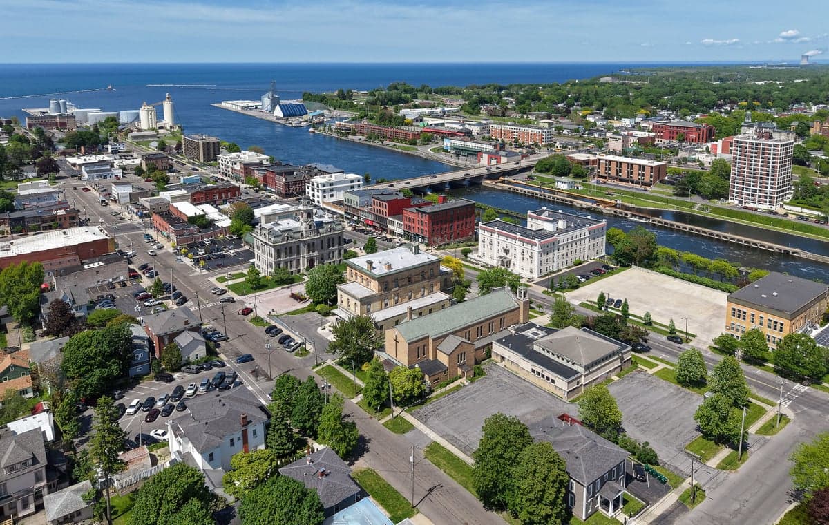
Oswego, New York, occupies a strategic position on the southeastern shore of Lake Ontario that offers a blend of natural defensibility and logistical access, but its resilience profile is shaped by proximity to both major population centers and critical infrastructure. For a relocator weighing disaster readiness and self-sufficiency, the city provides a moderate baseline of geographic insulation while carrying distinct exposure risks that require honest assessment. The area’s cold climate, lake-effect snow patterns, and industrial history create a unique set of advantages and vulnerabilities that a conservative-leaning individual or family should evaluate carefully before committing to relocation.
Geographic position and natural advantages for self-sufficiency
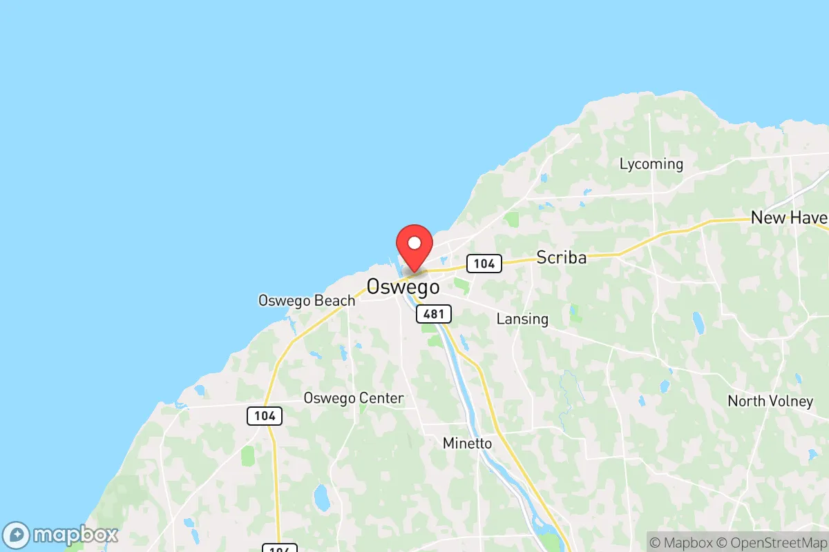
Oswego’s location on Lake Ontario gives it a significant natural buffer against many common disaster scenarios. The lake itself provides an immense freshwater resource—roughly 393 cubic miles of water—that is less susceptible to drought than inland reservoirs. The surrounding terrain is relatively flat but features wooded areas and agricultural land in Oswego County, which supports local food production. The city sits about 35 miles northwest of Syracuse and roughly 70 miles east of Rochester, placing it far enough from major urban centers to avoid the immediate fallout zone of a metropolitan disaster while remaining within a reasonable distance for supply runs or medical evacuation. The Oswego River, which flows through the city into the lake, offers an additional water source and potential hydroelectric power, though the existing hydro plant at the Varick Dam is grid-tied. Winters are harsh, with average snowfall exceeding 120 inches annually due to lake-effect snow, which can isolate the area for days at a time—a double-edged sword that both tests and builds self-reliance. The cold climate naturally limits pest-borne diseases and reduces the risk of wildfires, which are rare in this region. For a family seeking defensibility, the city’s layout along the lake and river provides natural chokepoints, but the flat terrain offers little in the way of elevated strongpoints.
Risks, exposures, and proximity to fallout-relevant landmarks
The most significant risk for Oswego in a disaster scenario is its proximity to the Nine Mile Point Nuclear Generating Station, located just 7 miles northeast of the city in Scriba. This facility houses two operating reactors—Unit 1 (a 621 MW boiling water reactor) and Unit 2 (a 1,307 MW pressurized water reactor)—along with the decommissioned James A. FitzPatrick plant. While nuclear plants are heavily regulated, a major accident or targeted attack could produce a fallout plume that would directly threaten Oswego, especially given prevailing westerly winds that would carry contamination toward the city. The 10-mile emergency planning zone (EPZ) covers most of Oswego and surrounding communities, meaning residents would be in the primary evacuation or shelter-in-place zone. Additionally, the city lies within 100 miles of the New York City metropolitan area, a high-value target for any adversary, and is roughly 150 miles from the Canadian border, which could become a chokepoint in a national emergency. The nearby Interstate 81 corridor, running north-south through Syracuse, is a major logistics route that could become congested or targeted. Natural risks include severe lake-effect snowstorms that can dump 3-5 feet of snow in 24 hours, causing roof collapses, road closures, and power outages. Flooding from the Oswego River and lake storm surges is a periodic concern, particularly in low-lying areas near the waterfront. The region is in a low seismic zone, so earthquakes are not a primary worry, but the combination of industrial infrastructure and weather extremes creates a moderate overall risk profile.
Practical resilience for a relocator: food, water, energy, and defensibility
For a relocator focused on self-sufficiency, Oswego offers a mixed bag. Water is abundant: Lake Ontario provides an essentially unlimited supply, but treatment requires either municipal infrastructure or personal filtration systems. The city’s water treatment plant draws from the lake, and in a grid-down scenario, residents would need hand-pumps, gravity filters, or boiling capacity to make lake water potable. The Oswego River is a secondary source but carries industrial runoff from upstream. Food production is viable but seasonal. Oswego County has over 400 farms, many producing dairy, apples, corn, and vegetables, but the growing season is short (roughly 140 frost-free days). A family could supplement with greenhouses or cold frames, but year-round self-sufficiency would require significant investment in storage and preservation. Local farmers’ markets operate from May through October, and the city has several grocery stores, but supply chains are vulnerable to winter storms. Energy resilience is a weak point. The grid is reliable under normal conditions, but winter storms frequently cause outages lasting 12-48 hours. The Nine Mile Point plant provides baseload power, but its proximity is a double-edged sword. Solar panels are less effective in this cloudy, snowy climate—Oswego averages only 160 sunny days per year, well below the national average of 205. Wood heating is practical, given the surrounding forests, but requires a woodlot or reliable supplier. Propane is commonly used for heating and cooking, and bulk storage is available. Defensibility is moderate. The city’s population of roughly 18,000 is small enough to avoid the chaos of a major urban center, but the flat terrain and grid-like street layout offer few natural defensive positions. The lake provides a barrier to the north, but the south and east are open. The local sheriff’s office and Oswego Police Department are professional but small, with about 40 officers. Gun ownership is common in upstate New York, but the state’s strict firearm laws—including the SAFE Act—limit magazine capacity and require permits for handguns, which could be a concern for a relocator prioritizing self-defense. The nearest major medical facility is Oswego Hospital, a 164-bed community hospital, but trauma care would require transport to Syracuse’s Upstate University Hospital, about 35 minutes away by ambulance.
The overall strategic picture for Oswego is one of moderate resilience with clear trade-offs. The city’s lakefront position and distance from major metropolitan targets provide a meaningful buffer against many disaster scenarios, while the abundant freshwater and agricultural land support a baseline of self-sufficiency. However, the proximity to a nuclear power plant, the harsh winter climate, and the relatively flat terrain introduce vulnerabilities that cannot be ignored. For a conservative-leaning family willing to invest in winter preparedness, water filtration, and alternative heating, Oswego offers a livable environment with room for self-reliance. It is not a bug-out location for a doomsday prepper—the nuclear risk alone disqualifies it for that role—but for a relocator seeking a quiet, affordable community with access to natural resources and a reasonable distance from urban chaos, it deserves consideration. The key is to go in with eyes open: stockpile for winter, secure a backup water source, and understand that the lake that gives life can also take it away in a storm.

* Values derived from national, state, county, city and local statistics and may differ in a specific area. Last updated: 2026-08-12T18:27:45.000Z
Narrative content on this page is AI-generated and may contain mistakes. Verify any details that matter before acting on them.
ReloMaps may earn a commission from affiliate links at no extra cost to you.

