Photo: Wikipedia
Strategic Assessment of Pagosa Springs, CO
Strong survivability profile. Good buffer from population centers, with manageable environmental and tactical risks.
What does the Strategic Assessment tell us?
Our Strategic Assessment grades tactical survivability of an area. Major population centers, military targets, fallout zones, natural disasters, and border exposure all drive risk — lower exposure means a more defensible position in a crisis.
This is heavily inspired by Joel Skousen's Strategic Relocation book. Highly recommended you checkout the book ($)What does this tell us?
Our Strategic Assessment grades tactical survivability of an area. Major population centers, military targets, fallout zones, natural disasters, and border exposure all drive risk — lower exposure means a more defensible position in a crisis.
This is heavily inspired by Joel Skousen's Strategic Relocation book. Highly recommended you checkout the book ($)Strategic Pillars

Key Distances
Regional Safe Places
Below is our recommended "safe zones" in Colorado and the surrounding area based on our strategic heuristics. For most people, it's unrealistic to live in a “safe zone” full-time due to work, family or other personal reasons. They tend to be more rural. However, many of these areas are perfect for second homes and retreat properties that double as a vacation home or even a short-term rental.


Important Note: For informational purposes only. This does not mean nothing bad ever happens in the green zones. Please use common sense. This is based on public data and modeled with AI. We tried to take a conservative approach but mistakes happen. We update this regularly as new information becomes available.
Solar Generator Recommendations
Backup power matters more here than in safer locations. We've picked three solar generators across budgets and capacity tiers — start with the budget unit if you only need a few essentials, or step up if you want to run a fridge and HVAC for days at a time.

Jackery Portable Power Station Explorer 300
Budget OptionPower on the Go: Weighing only 11 lbs, it's convenient to set up and store with book-sized foldable solar panels

BLUETTI Portable Power Station AC180
Designed for both indoor and outdoor scenarios, AC180 is highly capable as it has a robost capacity and continuous output power.

EF ECOFLOW DELTA Pro Ultra Power Station
Upgraded PickEcoFlow DELTA Pro Ultra is a whole-home energy system designed to grow with your family. Integrated with the Smart Home Panel 2, it scales to meet your evolving energy needs — keeping your home powered, intelligent, and secure through every stage of life.
We earn a commission, at no additional cost to you.
Strategic Assessment Analysis
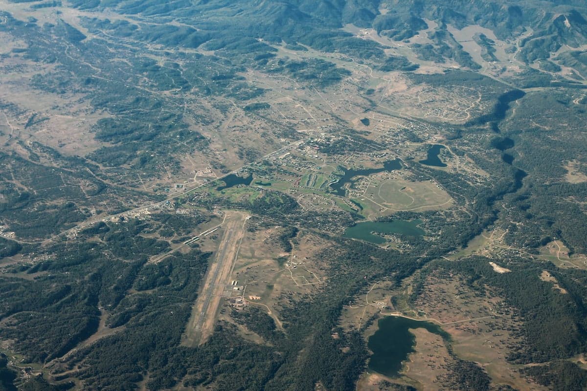
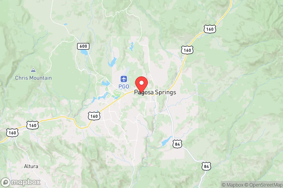
Pagosa Springs, Colorado, offers a compelling mix of geographic isolation and practical self-sufficiency that makes it a serious contender for those prioritizing long-term resilience. Nestled in the San Juan Mountains at the headwaters of the San Juan River, this town of roughly 1,800 full-time residents sits far from major population centers—over 150 miles from Albuquerque and 200 miles from Denver—while still maintaining access to essential supply routes via US-160 and US-84. Its elevation of 7,100 feet and position in a high mountain valley provide natural barriers against both casual traffic and large-scale threats, making it a location where a prepared individual or family could realistically ride out a range of disruptions.
Geographic position and natural defensive advantages
Pagosa Springs sits in a bowl-shaped valley surrounded by the San Juan National Forest and the Southern Ute Indian Reservation, creating a natural buffer zone that limits approach vectors. The town is not on any major interstate, which means through-traffic is minimal and any large-scale movement of people or goods would bypass it. The San Juan River runs directly through town, providing a reliable surface water source that is less likely to be contested than in arid regions. The surrounding mountains offer numerous choke points—Wolf Creek Pass to the east, the Continental Divide to the north, and the New Mexico border to the south—that could be monitored or defended with minimal effort. For a relocator concerned with civic unrest or mass casualty events, this geography means you are not a target of opportunity; you are a hard-to-reach, low-profile location that most people fleeing cities would overlook.
Risks, exposures, and proximity to fallout-relevant landmarks
No location is without vulnerabilities, and Pagosa Springs has several that a strategic relocator must weigh. The town is within 50 miles of the Los Alamos National Laboratory and the San Juan Basin's natural gas fields, both of which could be targets in a conflict or major industrial accident. While the prevailing winds generally carry fallout eastward, a worst-case scenario involving a ground burst or a major gas-field explosion could still affect air quality and water tables in the valley. The nearby Wolf Creek Pass is a critical east-west corridor; if it becomes impassable due to a natural disaster or civil disruption, supply chains for fuel, food, and medical goods would be severely constrained. Additionally, the town's reliance on a single major employer—the Pagosa Springs Medical Center and the local tourism industry—means that a prolonged economic downturn or disaster could hollow out the local economy faster than in more diversified communities. Wildfire risk is moderate but real, with the 2018 416 Fire burning over 54,000 acres just north of town, demonstrating how quickly the surrounding forest can become a threat.
Practical resilience for a relocator: food, water, energy, and defensibility
For a survivalist-minded individual or family, Pagosa Springs offers several concrete advantages. The San Juan River provides a year-round, gravity-fed water source that can be filtered or treated with basic equipment; the town's municipal water comes from deep wells and the river, but a private well or a river-access property gives you independence from the grid. Local food production is viable but limited—the growing season is short (roughly 90 frost-free days), but high tunnels and cold frames can extend it, and the surrounding national forest offers hunting for elk, mule deer, and turkey, plus fishing in the river and nearby lakes. The area has a strong hunting culture, so acquiring game meat is a realistic option, not a theoretical one. Energy resilience is a mixed bag: the grid is relatively stable but prone to winter outages from snow and ice; solar panels work well here due to 300+ days of sunshine annually, but battery storage is essential for winter nights. Propane is widely available and used for heating in most homes, which gives you a backup fuel source that can be stockpiled. Defensibility is high if you choose property wisely—homes on the valley floor are exposed, but properties on the surrounding mesas or in the national forest inholdings offer natural cover and limited access points. The local sheriff's office is small (roughly 20 deputies for the entire county), so in a prolonged disruption, you would largely be responsible for your own security. The community is tight-knit and generally self-reliant, but it is not a prepper enclave; you will need to build relationships and contribute to the local economy to gain trust.
The overall strategic picture for Pagosa Springs is one of high potential with real trade-offs. It is not a bug-out location for a weekend—it is a place to build a life that can withstand shocks, provided you arrive with skills, supplies, and a realistic plan for the short growing season and the isolation. The town's distance from major cities and its natural barriers make it a strong candidate for those who want to be off the beaten path without being completely cut off from medical care or supply runs. But the risks—proximity to Los Alamos, wildfire potential, and a thin local economy—mean that complacency is not an option. For a conservative-leaning relocator who values self-sufficiency, community, and a low-profile existence, Pagosa Springs deserves serious consideration, but only if you are prepared to work the land, store your own supplies, and accept that you are trading convenience for resilience.
* Values derived from national, state, county, city and local statistics and may differ in a specific area. Last updated: 2026-04-28T23:24:28.000Z
Narrative content on this page is AI-generated and may contain mistakes. Verify any details that matter before acting on them.
ReloMaps may earn a commission from affiliate links at no extra cost to you.