

Photo: Wikipedia
Strategic Assessment of Pella, IA
Workable tactical position. Some exposure to population density or targets, but generally defensible in a crisis.
What does the Strategic Assessment tell us?
Our Strategic Assessment grades tactical survivability of an area. Major population centers, military targets, fallout zones, natural disasters, and border exposure all drive risk — lower exposure means a more defensible position in a crisis.
This is heavily inspired by Joel Skousen's Strategic Relocation book. Highly recommended you checkout the book ($)What does this tell us?
Our Strategic Assessment grades tactical survivability of an area. Major population centers, military targets, fallout zones, natural disasters, and border exposure all drive risk — lower exposure means a more defensible position in a crisis.
This is heavily inspired by Joel Skousen's Strategic Relocation book. Highly recommended you checkout the book ($)Strategic Pillars

Key Distances
Regional Safe Places
Below is our recommended "safe zones" in Iowa and the surrounding area based on our strategic heuristics. For most people, it's unrealistic to live in a “safe zone” full-time due to work, family or other personal reasons. They tend to be more rural. However, many of these areas are perfect for second homes and retreat properties that double as a vacation home or even a short-term rental.


Important Note: For informational purposes only. This does not mean nothing bad ever happens in the green zones. Please use common sense. This is based on public data and modeled with AI. We tried to take a conservative approach but mistakes happen. We update this regularly as new information becomes available.
Solar Generator Recommendations
Backup power matters more here than in safer locations. We've picked three solar generators across budgets and capacity tiers — start with the budget unit if you only need a few essentials, or step up if you want to run a fridge and HVAC for days at a time.

Jackery Portable Power Station Explorer 300
Budget OptionPower on the Go: Weighing only 11 lbs, it's convenient to set up and store with book-sized foldable solar panels

BLUETTI Portable Power Station AC180
Designed for both indoor and outdoor scenarios, AC180 is highly capable as it has a robost capacity and continuous output power.

EF ECOFLOW DELTA Pro Ultra Power Station
Upgraded PickEcoFlow DELTA Pro Ultra is a whole-home energy system designed to grow with your family. Integrated with the Smart Home Panel 2, it scales to meet your evolving energy needs — keeping your home powered, intelligent, and secure through every stage of life.
We earn a commission, at no additional cost to you.
Strategic Assessment Analysis
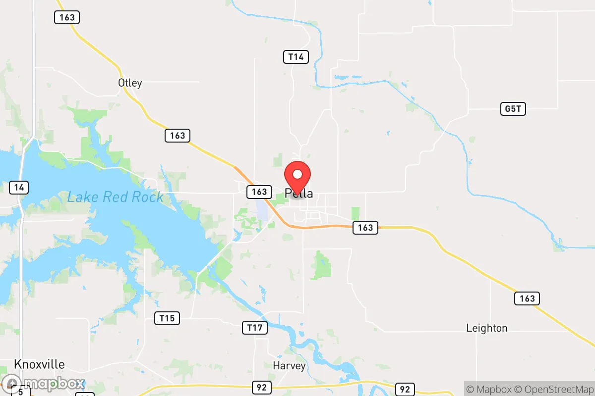
Pella, Iowa, offers a strategic relocation option that balances Midwestern stability with a surprising degree of inherent resilience, making it a serious contender for those prioritizing preparedness and community cohesion. Its location in central Iowa, roughly 40 miles southeast of Des Moines, places it far enough from major metropolitan chaos while still providing access to essential resources and infrastructure. The town’s Dutch heritage and strong local governance have fostered a tight-knit, self-reliant culture that aligns well with conservative values of personal responsibility and community support, a critical asset when external systems falter.
Geographic position and natural advantages for long-term stability
Pella sits in Marion County, a region characterized by rolling farmland, the Des Moines River, and a relatively low population density—the county has roughly 33,000 residents, with Pella itself at about 10,000. This positioning offers a key advantage: it is not a primary target for any large-scale disruption. The area is far from the nation’s major fault lines, hurricane zones, and wildfire corridors. The primary natural risks are severe thunderstorms, tornadoes (Iowa averages about 50 per year, though Marion County sees fewer than the state average), and occasional winter storms. These are manageable with standard preparedness—a basement, a generator, and a three-month food supply. The Des Moines River provides a reliable freshwater source, though it’s not a massive, flood-prone system like the Mississippi. The surrounding agricultural land means local food production is a realistic possibility, with numerous small farms and farmers’ markets within a 20-minute drive. The region’s elevation is modest (around 850 feet), but the flat terrain offers good visibility and defensibility for a prepared homestead.
Risks, exposures, and proximity to fallout-relevant landmarks
From a survivalist perspective, Pella’s primary exposure is its proximity to Des Moines (population ~215,000 metro area), which is about a 40-minute drive via Highway 163. In a scenario of civil unrest or mass casualty events, Des Moines could become a source of refugees, supply chain disruption, or targeted violence. However, Pella is not a direct satellite suburb; it’s a distinct town with its own economy and identity, which reduces the likelihood of being overwhelmed. The nearest significant infrastructure targets are the Des Moines International Airport and the city’s major government and corporate centers. Further out, the Omaha metro area (about 2.5 hours west) and the Quad Cities (about 2 hours east) are larger population centers. There are no nuclear power plants within 100 miles—the closest is the Duane Arnold Energy Center near Cedar Rapids (about 90 miles north), which is permanently shut down. The nearest major military installation is Camp Dodge in Johnston (north of Des Moines), a National Guard base that could be a mobilization point but not a primary target. The area’s primary risk is not a direct strike but the secondary effects of a national crisis: supply chain collapse, economic disruption, and potential unrest spilling out from Des Moines. The good news is that Pella’s agricultural base and local manufacturing (Pella Corporation, a major window and door manufacturer, employs over 2,000 people locally) provide a degree of economic insulation.
Practical resilience for a relocator: food, water, energy, and defensibility
For a relocator focused on practical self-sufficiency, Pella scores well on several fronts. Water: The city draws from the Des Moines River and a series of wells. A private well is feasible on rural properties outside city limits, with depths typically 100-200 feet. The water table is reliable, and the area is not prone to drought like the western U.S. Food: Marion County is prime farmland. Within a 30-minute drive, you can find dozens of small farms selling beef, pork, poultry, eggs, and produce. The Pella Farmers Market (May-October) is a solid resource. For long-term storage, the local climate supports root cellaring and canning. Energy: The grid is reasonably stable, but winter ice storms can cause outages. Solar is viable—Iowa gets about 200 sunny days per year—though net metering policies are state-regulated and have been stable. Propane and wood are common backup heating sources. Defensibility: Pella is not a fortress, but its layout helps. The town is compact, with a historic downtown core and residential neighborhoods that are easily monitored. The surrounding farmland provides open sightlines. The local police force is professional (about 20 officers) and the sheriff’s office is responsive. For a prepared individual, a rural property on the outskirts—say, 5-10 acres—offers a good balance of privacy, defensibility, and access to town resources. The community is homogeneous (over 90% white, with strong religious ties—many residents are members of the Reformed Church in America), which can be a double-edged sword: it fosters trust and mutual aid but may be less welcoming to outsiders. For a relocator willing to integrate, the social fabric is a significant resilience asset.
Overall strategic picture for the conservative prepper
Pella presents a solid, if not spectacular, strategic option for those seeking a lower-risk, community-oriented relocation. It avoids the high-profile dangers of coastal cities, major military targets, and nuclear zones. Its primary vulnerability is its proximity to Des Moines, but that is mitigated by the town’s own economic base and cultural cohesion. The area’s agricultural abundance and water access are genuine advantages for long-term self-sufficiency. The conservative, family-oriented culture is a practical asset—neighbors are more likely to help than to loot. The main drawbacks are the lack of extreme geographic barriers (no mountains, no swamps) and the potential for social friction if you’re not aligned with the dominant religious and cultural norms. For a single individual or a family willing to invest in a basement, a well, and a good relationship with local farmers, Pella offers a defensible, sustainable base of operations. It’s not a bug-out location for a doomsday scenario—it’s a place to build a life that can weather the storms, both literal and societal, that are increasingly common. The key is to arrive prepared, integrate quietly, and contribute to the community’s resilience rather than just consuming it. That’s the real strategic advantage here: a place where preparedness is not an outlier but a quiet norm.
* Values derived from national, state, county, city and local statistics and may differ in a specific area. Last updated: 2026-04-30T01:35:13.000Z
Narrative content on this page is AI-generated and may contain mistakes. Verify any details that matter before acting on them.
ReloMaps may earn a commission from affiliate links at no extra cost to you.