
Photo: Wikipedia
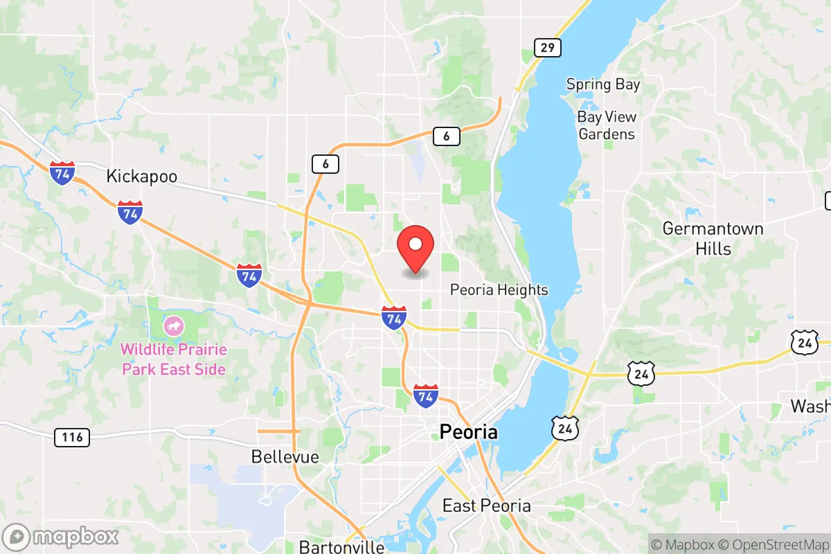
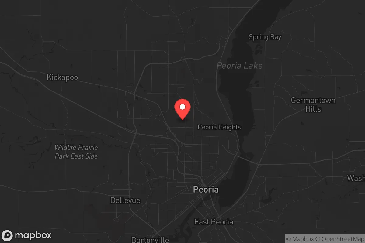
Strategic Assessment of Peoria, IL
Meaningful friction. Expect exposure to either population pressure, blast zones, or natural disaster risk. Consider buying a retreat property.
What does the Strategic Assessment tell us?
Our Strategic Assessment grades tactical survivability of an area. Major population centers, military targets, fallout zones, natural disasters, and border exposure all drive risk — lower exposure means a more defensible position in a crisis.
This is heavily inspired by Joel Skousen's Strategic Relocation book. Highly recommended you checkout the book ($)What does this tell us?
Our Strategic Assessment grades tactical survivability of an area. Major population centers, military targets, fallout zones, natural disasters, and border exposure all drive risk — lower exposure means a more defensible position in a crisis.
This is heavily inspired by Joel Skousen's Strategic Relocation book. Highly recommended you checkout the book ($)Strategic Pillars

Key Distances
Regional Safe Places
Below is our recommended "safe zones" in Illinois and the surrounding area based on our strategic heuristics. For most people, it's unrealistic to live in a “safe zone” full-time due to work, family or other personal reasons. They tend to be more rural. However, many of these areas are perfect for second homes and retreat properties that double as a vacation home or even a short-term rental.
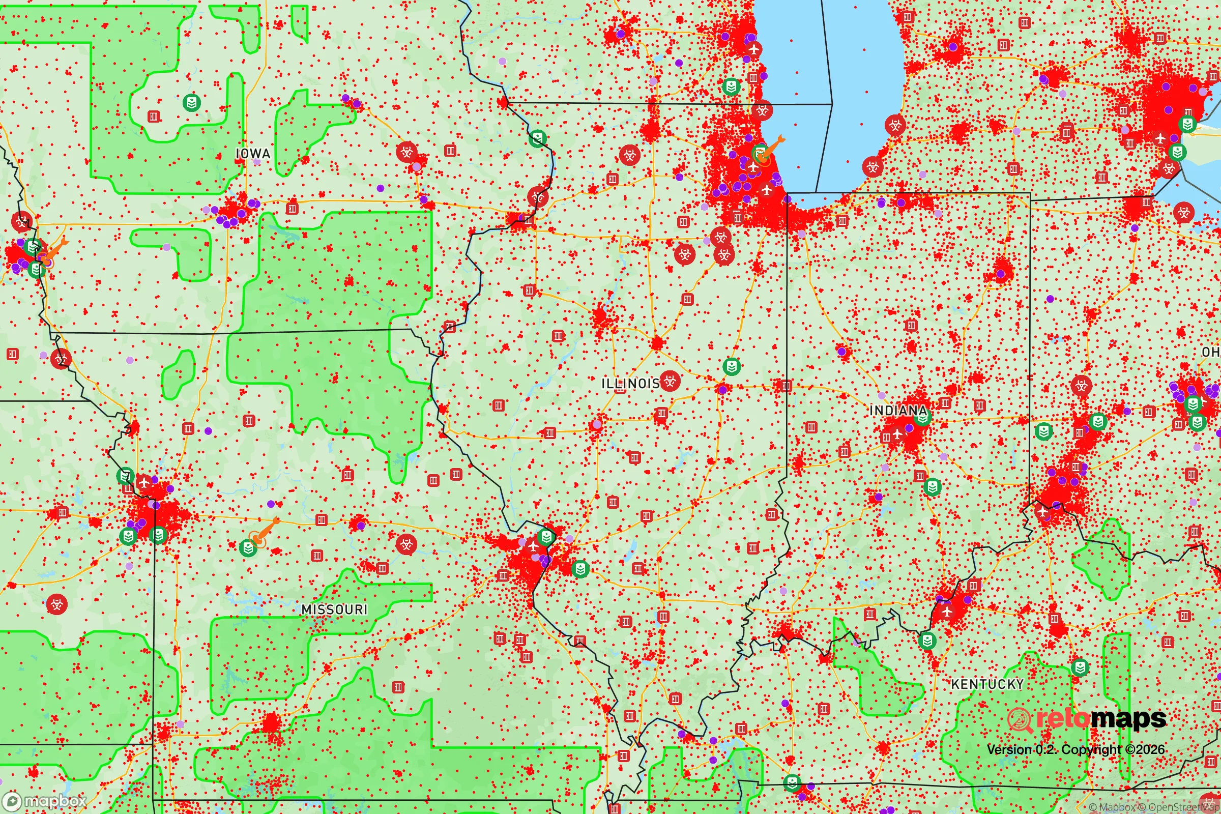
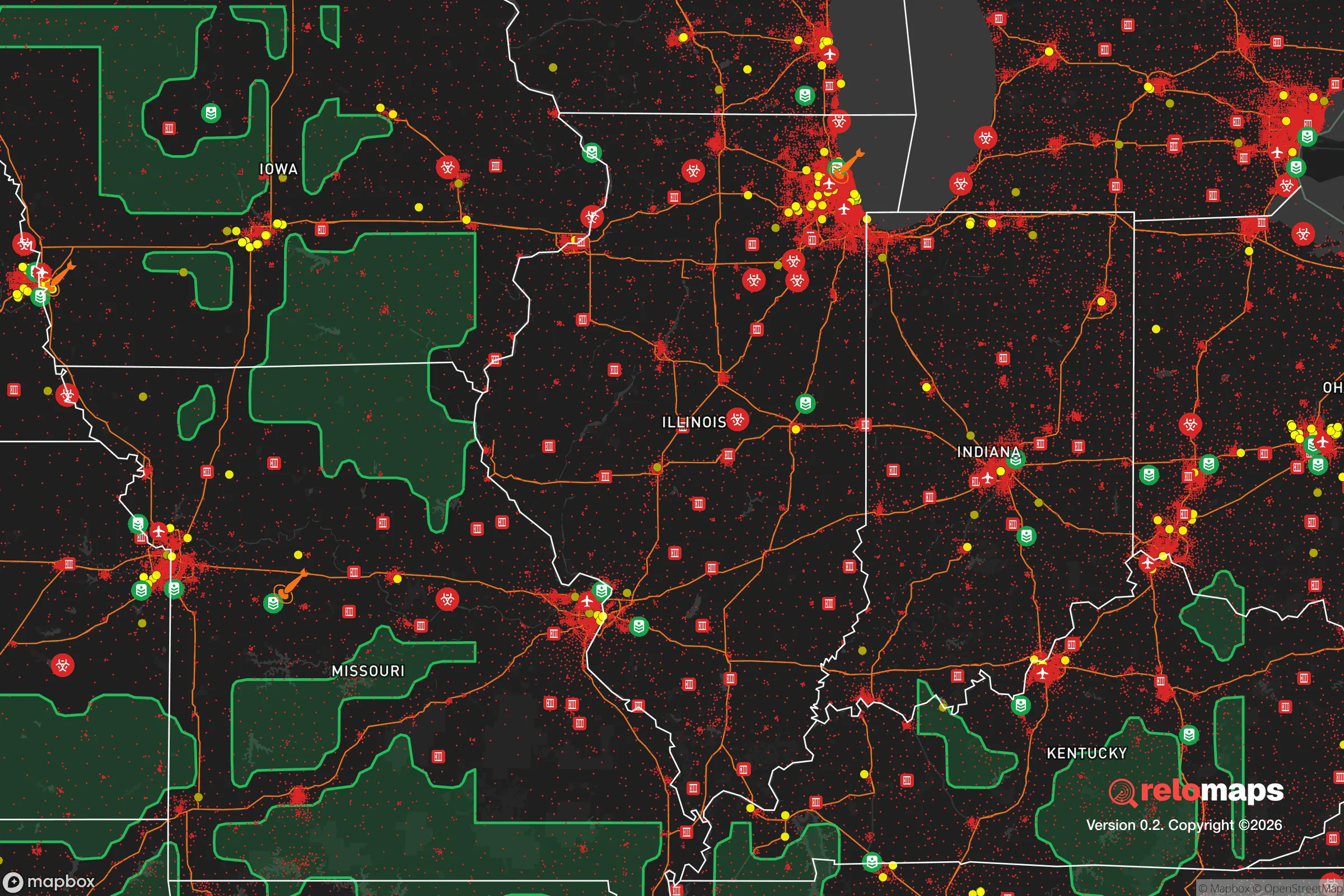
Important Note: For informational purposes only. This does not mean nothing bad ever happens in the green zones. Please use common sense. This is based on public data and modeled with AI. We tried to take a conservative approach but mistakes happen. We update this regularly as new information becomes available.
Solar Generator Recommendations
Backup power matters more here than in safer locations. We've picked three solar generators across budgets and capacity tiers — start with the budget unit if you only need a few essentials, or step up if you want to run a fridge and HVAC for days at a time.

Jackery Portable Power Station Explorer 300
Budget OptionPower on the Go: Weighing only 11 lbs, it's convenient to set up and store with book-sized foldable solar panels

BLUETTI Portable Power Station AC180
Designed for both indoor and outdoor scenarios, AC180 is highly capable as it has a robost capacity and continuous output power.

EF ECOFLOW DELTA Pro Ultra Power Station
Upgraded PickEcoFlow DELTA Pro Ultra is a whole-home energy system designed to grow with your family. Integrated with the Smart Home Panel 2, it scales to meet your evolving energy needs — keeping your home powered, intelligent, and secure through every stage of life.
We earn a commission, at no additional cost to you.
Strategic Assessment Analysis
Peoria, Illinois, sits as a surprisingly resilient anchor in the central Illinois river valley, offering a blend of industrial hardiness and geographic isolation that appeals to those thinking long-term about stability. Its position along the Illinois River, roughly 150 miles southwest of Chicago and 170 miles northeast of St. Louis, places it outside the immediate blast radius of major population centers while still providing access to critical supply chains. For a relocator with a prepper mindset, Peoria’s combination of a diversified economy, ample fresh water, and a relatively low population density makes it a candidate worth serious consideration, though it is not without its own strategic vulnerabilities.
Geographic position and natural advantages for long-term stability
Peoria’s location in the Illinois River Valley is its strongest natural asset. The river itself provides a reliable source of fresh water, a critical resource that many inland cities lack, and the surrounding bluffs offer natural elevation advantages for defensibility and flood avoidance. The area sits within the Illinois River watershed, which feeds into the Mississippi, giving residents potential access to a major waterway for transport or evacuation if road networks become compromised. The local topography—rolling hills and wooded ravines—is unusual for Illinois and provides natural cover and microclimates that can support small-scale agriculture and livestock. The region’s fertile black soil is among the best in the world for crop production, meaning that even in a disrupted supply chain scenario, local food production capacity is high. Peoria’s distance from both Chicago and St. Louis—each roughly a two-hour drive—means it is far enough to avoid the immediate chaos of a major urban collapse, but close enough to monitor events and access resources if needed. The city’s position along Interstate 74 and several rail lines also provides redundancy in transportation, though these same routes could become chokepoints in a crisis.
Risks, exposures, and proximity to fallout-relevant landmarks
No location is without risk, and Peoria has several exposures that a strategic relocator must weigh. The most immediate concern is its proximity to nuclear power infrastructure: the Clinton Power Station is about 60 miles east, and the LaSalle County Generating Station is roughly 80 miles northeast. While these are not within a likely direct-target zone, a major incident at either could affect wind-borne fallout patterns, especially given prevailing westerly winds. Peoria is also within 200 miles of Scott Air Force Base near St. Louis, a major military logistics hub that could be a target in a conflict scenario. The city itself hosts Caterpillar Inc.’s global headquarters and several heavy manufacturing plants, which could become secondary targets in a war economy due to their production of industrial and military-grade equipment. On the civil unrest front, Peoria has a history of sporadic gang violence and economic disparity, but it lacks the concentrated urban density that makes cities like Chicago or St. Louis prone to widespread rioting. The Peoria County jail and federal courthouse are downtown, but the city’s overall footprint is spread out enough that a motivated resident can live in a low-crime, semi-rural area within a 15-minute drive of downtown. Flooding is a periodic risk along the river, but the bluffs and higher elevations—where most desirable residential areas are located—are largely unaffected. Tornadoes are a genuine threat, as central Illinois sits in the heart of Tornado Alley, but the river valley’s topography can sometimes disrupt storm formation, and modern warning systems provide adequate lead time for sheltering.
Practical resilience for a relocator: food, water, energy, and defensibility
For someone serious about self-sufficiency, Peoria offers a practical mix of resources. Water is abundant from the Illinois River and local aquifers, and the city’s municipal water treatment infrastructure is robust, but a prepper should plan for private well access or rainwater catchment if grid water becomes unreliable. The surrounding farmland means that local food production is viable year-round, with farmers’ markets, CSAs, and bulk grain suppliers available within a 30-mile radius. Peoria County has relatively lax zoning laws compared to coastal states, allowing for backyard chickens, small livestock, and substantial gardening on standard residential lots. Energy resilience is mixed: the grid is fed by coal, natural gas, and nuclear plants, but winter ice storms can cause outages. Solar potential is moderate—central Illinois gets about 200 sunny days per year—but battery storage and backup generators are recommended. Defensibility is a strong point for those willing to live outside the city core. The bluffs and river bends create natural chokepoints, and many rural properties have long sightlines and limited access points. The local gun culture is strong, with several gun shops, ranges, and a concealed carry permit rate well above the national average, meaning that a prepared individual will find a community that takes personal security seriously. The Peoria area also has a network of volunteer fire departments and a capable sheriff’s office, but response times in rural areas can be 20-30 minutes, so medical self-sufficiency is a must. For community resilience, there are several active prepper and homesteading groups in the region, though they tend to be low-key and require vetting.
The overall strategic picture for Peoria is one of cautious optimism for a relocator with a conservative, self-reliant mindset. It offers a rare combination of industrial capacity, agricultural abundance, and geographic buffer from the most likely flashpoints of national instability. The city itself has a blue-leaning political history, but the surrounding county and rural areas lean conservative, and the local economy is grounded in manufacturing and logistics rather than government or tech—meaning it is less vulnerable to the kind of cultural and economic disruptions seen on the coasts. The biggest trade-off is that Peoria is not a hidden gem; it is a known industrial hub with a population of about 110,000, and it will attract attention in any major crisis. But for someone who wants to be within striking distance of critical infrastructure while maintaining a low profile and a high degree of personal preparedness, Peoria deserves a spot on the short list. The key is to secure property on the bluffs, invest in water and energy independence, and build relationships with the local farming and firearms communities before the situation deteriorates. It is not a fortress, but it is a solid fallback position.
* Values derived from national, state, county, city and local statistics and may differ in a specific area. Last updated: 2026-04-23T09:18:09.000Z
Narrative content on this page is AI-generated and may contain mistakes. Verify any details that matter before acting on them.
ReloMaps may earn a commission from affiliate links at no extra cost to you.