 Popular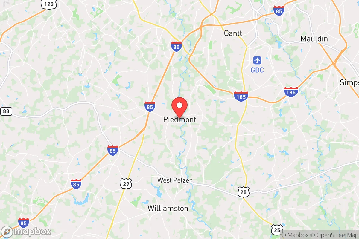
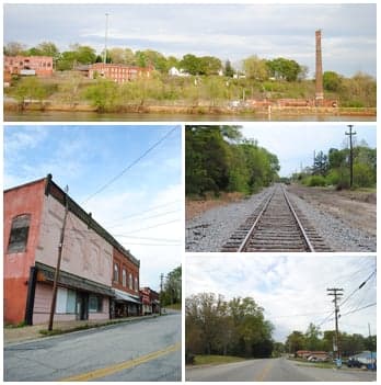
Photo: Wikipedia
Strategic Assessment of Piedmont, SC
Workable tactical position. Some exposure to population density or targets, but generally defensible in a crisis.
What does the Strategic Assessment tell us?
Our Strategic Assessment grades tactical survivability of an area. Major population centers, military targets, fallout zones, natural disasters, and border exposure all drive risk — lower exposure means a more defensible position in a crisis.
This is heavily inspired by Joel Skousen's Strategic Relocation book. Highly recommended you checkout the book ($)What does this tell us?
Our Strategic Assessment grades tactical survivability of an area. Major population centers, military targets, fallout zones, natural disasters, and border exposure all drive risk — lower exposure means a more defensible position in a crisis.
This is heavily inspired by Joel Skousen's Strategic Relocation book. Highly recommended you checkout the book ($)Strategic Pillars

Key Distances
Regional Safe Places
Below is our recommended "safe zones" in South Carolina and the surrounding area based on our strategic heuristics. For most people, it's unrealistic to live in a “safe zone” full-time due to work, family or other personal reasons. They tend to be more rural. However, many of these areas are perfect for second homes and retreat properties that double as a vacation home or even a short-term rental.
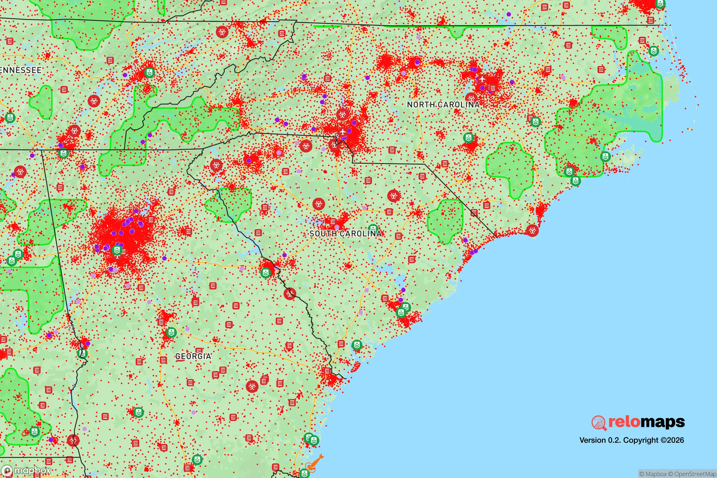
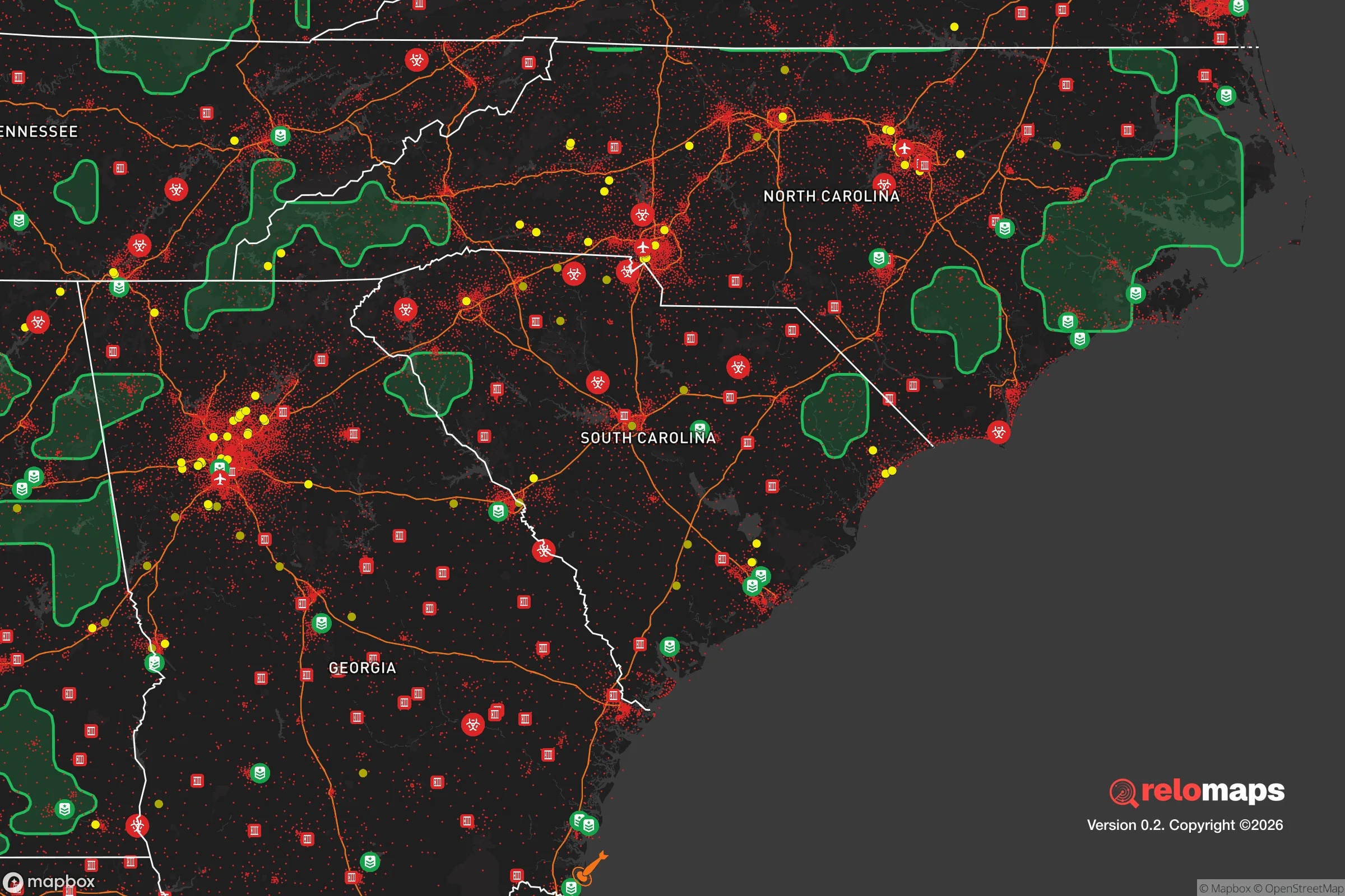


Important Note: For informational purposes only. This does not mean nothing bad ever happens in the green zones. Please use common sense. This is based on public data and modeled with AI. We tried to take a conservative approach but mistakes happen. We update this regularly as new information becomes available.
Solar Generator Recommendations
Backup power matters more here than in safer locations. We've picked three solar generators across budgets and capacity tiers — start with the budget unit if you only need a few essentials, or step up if you want to run a fridge and HVAC for days at a time.

Jackery Portable Power Station Explorer 300
Budget OptionPower on the Go: Weighing only 11 lbs, it's convenient to set up and store with book-sized foldable solar panels

BLUETTI Portable Power Station AC180
Designed for both indoor and outdoor scenarios, AC180 is highly capable as it has a robost capacity and continuous output power.

EF ECOFLOW DELTA Pro Ultra Power Station
Upgraded PickEcoFlow DELTA Pro Ultra is a whole-home energy system designed to grow with your family. Integrated with the Smart Home Panel 2, it scales to meet your evolving energy needs — keeping your home powered, intelligent, and secure through every stage of life.
We earn a commission, at no additional cost to you.
Strategic Assessment Analysis
Piedmont, South Carolina, occupies a strategic position in the upper Piedmont region that offers a meaningful blend of geographic insulation and practical self-sufficiency potential, making it a location worth serious consideration for those prioritizing disaster readiness and long-term resilience. Situated roughly 15 miles southwest of Greenville and 12 miles northeast of Anderson, the town sits at the edge of the rapidly growing I-85 corridor while retaining a distinctly rural character that provides both buffer and access. For a relocator thinking about preparedness, Piedmont’s key advantage is its location within the Blue Ridge Escarpment’s rain shadow—a zone that receives reliable annual precipitation (averaging 50–55 inches) while being shielded from the worst of hurricane storm surge and coastal flooding that plague the Lowcountry. The area’s rolling hills, mixed hardwood forests, and numerous creeks create a landscape that is both defensible and resource-rich, though the trade-off is proximity to the economic and population centers that could become liabilities in a crisis.
Geographic position and natural advantages for long-term security
Piedmont’s geography is defined by its position in the Piedmont physiographic province, a region of low, rolling hills and fertile valleys that historically supported small-scale agriculture and dispersed settlement. The town sits at an elevation of roughly 800–900 feet above sea level, which places it above the floodplains of the Saluda River (which forms the town’s eastern boundary) while still being low enough to avoid the severe winter weather and steep terrain of the nearby Blue Ridge Mountains. This elevation also means the area is well outside the 50-mile evacuation zone for any nuclear power plant—the nearest reactors are the Oconee Nuclear Station (about 30 miles northwest, near Seneca) and the Catawba Nuclear Station (about 70 miles northeast, near Rock Hill). The Saluda River and its tributaries, including Rocky Creek and Big Creek, provide surface water resources that are generally reliable, though they are subject to seasonal fluctuations and upstream development pressures. The surrounding forests are predominantly mixed pine-hardwood, offering a sustainable source of timber for construction, fuel, and foraging, though the region’s biodiversity is moderate compared to the Appalachian foothills just to the north. For a relocator, the key natural advantage is the combination of reliable water, moderate climate, and defensible terrain—the rolling hills create natural chokepoints and vantage points, while the absence of extreme weather (tornadoes are rare, hurricanes are weakened by the time they arrive, and earthquakes are infrequent and low-magnitude) reduces the baseline risk profile.
Risks, exposures, and proximity to fallout-relevant landmarks
The most significant risk for Piedmont is its proximity to Greenville-Spartanburg International Airport (GSP), located about 20 miles northeast, and the broader I-85 corridor that connects Charlotte, Greenville, and Atlanta. In a major crisis—whether a pandemic, civil unrest, or a large-scale natural disaster—this corridor would become a major chokepoint and potential target for population movement, supply chain disruption, or even military/terrorist action. The town is also within 30 miles of the Greenville-Spartanburg metropolitan area, which has a population of over 1.4 million people; in a collapse scenario, this population could flow outward into rural areas like Piedmont, overwhelming local resources. Additionally, the Oconee Nuclear Station (30 miles northwest) and the Savannah River Site (a nuclear weapons facility about 100 miles southwest, near Aiken) are both within a radius that could be affected by a radiological release, though the prevailing winds in this region are from the southwest, which would carry fallout away from Piedmont in most scenarios. The area also sits near the Eastern Continental Divide, meaning that surface water drains toward the Atlantic rather than the Gulf, which is a minor advantage for water security but not a major factor. For a relocator, the practical takeaway is that Piedmont is not a remote survivalist retreat—it is a semi-rural exurb with real exposure to the risks of the I-85 corridor, but its distance from the most critical infrastructure (major military bases, nuclear plants, and population centers) is sufficient to provide a buffer that many other locations in the Upstate lack.
Practical resilience for a relocator: food, water, energy, and defensibility
For a relocator serious about self-sufficiency, Piedmont offers a mixed but workable picture. Water security is the strongest asset: the Saluda River and its tributaries are perennial, and the area’s groundwater is generally accessible via shallow wells (typical depths of 50–150 feet) with moderate yields. However, the water table is vulnerable to contamination from agricultural runoff and septic systems, so a well should be tested and a backup filtration system (e.g., a Berkey or ceramic filter) is advisable. Food production is feasible: the growing season runs from April to October, with average last frost around April 10 and first frost around October 25. The soil is primarily sandy loam and clay, which requires amendment but is workable for gardens, orchards, and small livestock. The area’s agricultural history means that many properties still have barns, pastures, and fencing, though land prices have risen sharply since 2020 (average acreage in the $10,000–$15,000 range). Energy resilience is a weak point: the grid is served by Duke Energy, which has a mixed reliability record in the region (outages are common during thunderstorms and ice storms, typically lasting 2–6 hours). Solar potential is good (about 4.5 peak sun hours per day), but net metering policies are limited, and battery storage is essential for off-grid capability. Wood heating is a viable backup, as firewood is abundant and relatively cheap ($150–$200 per cord). Defensibility is moderate: the rolling terrain and forest cover provide natural concealment and chokepoints, but the town’s layout—a mix of older homes along Highway 86 and newer subdivisions on former farmland—means that many properties are visible from the road and lack natural barriers. A relocator should prioritize a property with good setback from main roads, a reliable water source, and southern exposure for solar, ideally on at least 5–10 acres to create a buffer zone. The local community is generally self-reliant and conservative, with a strong tradition of hunting, gardening, and firearms ownership, which is a social asset for mutual aid networks but also means that newcomers should be prepared to integrate respectfully.
The overall strategic picture for Piedmont is that of a moderate-resilience location with a favorable risk-to-reward ratio for a relocator who is not seeking extreme isolation. It is not a bug-out location for a total collapse scenario—the proximity to the I-85 corridor and the Greenville metro area are genuine liabilities—but it offers a solid baseline of natural resources, a moderate climate, and a community that is culturally aligned with self-sufficiency. For a family or individual looking to balance access to employment and services (Greenville’s job market is strong, with major employers like Michelin, GE, and Prisma Health) with a defensible, resource-rich property, Piedmont is a pragmatic choice. The key is to buy land with water and solar access, build or retrofit for energy independence, and establish local connections before a crisis hits. The area’s resilience is not automatic—it requires active preparation—but the foundation is there for those willing to put in the work.

* Values derived from national, state, county, city and local statistics and may differ in a specific area. Last updated: 2026-10-10T16:28:41.000Z
Narrative content on this page is AI-generated and may contain mistakes. Verify any details that matter before acting on them.
ReloMaps may earn a commission from affiliate links at no extra cost to you.

