Photo: Wikipedia
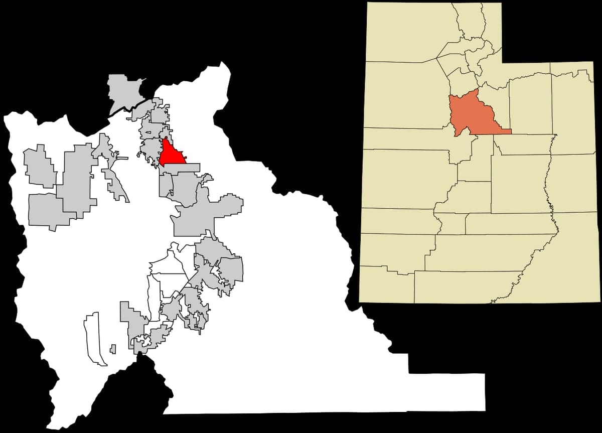
Strategic Assessment of Pleasant Grove, UT
Meaningful friction. Expect exposure to either population pressure, blast zones, or natural disaster risk. Consider buying a retreat property.
What does the Strategic Assessment tell us?
Our Strategic Assessment grades tactical survivability of an area. Major population centers, military targets, fallout zones, natural disasters, and border exposure all drive risk — lower exposure means a more defensible position in a crisis.
This is heavily inspired by Joel Skousen's Strategic Relocation book. Highly recommended you checkout the book ($)What does this tell us?
Our Strategic Assessment grades tactical survivability of an area. Major population centers, military targets, fallout zones, natural disasters, and border exposure all drive risk — lower exposure means a more defensible position in a crisis.
This is heavily inspired by Joel Skousen's Strategic Relocation book. Highly recommended you checkout the book ($)Strategic Pillars

Key Distances
Regional Safe Places
Below is our recommended "safe zones" in Utah and the surrounding area based on our strategic heuristics. For most people, it's unrealistic to live in a “safe zone” full-time due to work, family or other personal reasons. They tend to be more rural. However, many of these areas are perfect for second homes and retreat properties that double as a vacation home or even a short-term rental.


Important Note: For informational purposes only. This does not mean nothing bad ever happens in the green zones. Please use common sense. This is based on public data and modeled with AI. We tried to take a conservative approach but mistakes happen. We update this regularly as new information becomes available.
Solar Generator Recommendations
Backup power matters more here than in safer locations. We've picked three solar generators across budgets and capacity tiers — start with the budget unit if you only need a few essentials, or step up if you want to run a fridge and HVAC for days at a time.

Jackery Portable Power Station Explorer 300
Budget OptionPower on the Go: Weighing only 11 lbs, it's convenient to set up and store with book-sized foldable solar panels

BLUETTI Portable Power Station AC180
Designed for both indoor and outdoor scenarios, AC180 is highly capable as it has a robost capacity and continuous output power.

EF ECOFLOW DELTA Pro Ultra Power Station
Upgraded PickEcoFlow DELTA Pro Ultra is a whole-home energy system designed to grow with your family. Integrated with the Smart Home Panel 2, it scales to meet your evolving energy needs — keeping your home powered, intelligent, and secure through every stage of life.
We earn a commission, at no additional cost to you.
Strategic Assessment Analysis
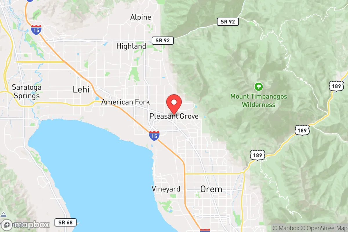
Pleasant Grove, Utah, sits in a strategic pocket that balances proximity to resources with a degree of natural separation from the worst-case scenarios of a fractured nation. Nestled against the western face of the Wasatch Range, this city of roughly 40,000 offers a blend of suburban infrastructure and mountain-adjacent defensibility that appeals to those thinking beyond the next election cycle. While no location in the continental US is truly immune from the cascading effects of societal collapse, Pleasant Grove’s position in Utah County—roughly 35 miles south of Salt Lake City—provides a buffer from the densest urban chaos while still allowing access to the logistical arteries that matter when supply chains falter.
Geographic position and natural advantages for long-term stability
The city’s location at the mouth of American Fork Canyon is its single greatest asset for a prepper mindset. The Wasatch Front’s east-west canyons create natural chokepoints that can be monitored or controlled, and the mountains themselves offer both a water source and a fallback zone if the valley becomes untenable. Pleasant Grove sits at roughly 4,600 feet elevation, which means cooler summers and a genuine winter—snowpack that feeds the American Fork River and the nearby Utah Lake. Utah Lake, the state’s largest freshwater body, is less than 10 minutes west of downtown Pleasant Grove, providing a potential water source for irrigation and fishing, though its algae blooms in late summer require filtration. The surrounding Wasatch-Cache National Forest offers timber, game, and terrain that complicates any large-scale movement of hostile groups. For a relocator, the key advantage is that Pleasant Grove is not a pass-through city on any major interstate—I-15 runs west of the city, but the town itself sits off the main drag, reducing the risk of being caught in refugee flows or looters moving between population centers.
Risks, exposures, and proximity to fallout-relevant landmarks
The sobering reality is that Pleasant Grove is within the shadow of several high-value targets. Hill Air Force Base, located about 40 miles north near Ogden, is a primary nuclear and conventional strike target, and the resulting electromagnetic pulse (EMP) or fallout plume could affect the entire Wasatch Front depending on wind patterns. Salt Lake City’s international airport, the Kennecott copper mine (a strategic industrial asset), and the numerous military and government facilities along the I-15 corridor all make this region a potential secondary or tertiary target in a major conflict. Closer to home, the Utah Valley is home to a dense concentration of LDS Church infrastructure, including the Provo Missionary Training Center and the Salt Lake Temple—symbolic targets that could attract civil unrest or terrorist attention. The risk of a Cascadia Subduction Zone earthquake is often discussed for the Pacific coast, but the Wasatch Fault runs directly through the valley floor. A major quake on the Wasatch Fault would devastate the I-15 corridor, collapsing bridges, rupturing gas lines, and isolating communities for weeks. Pleasant Grove’s older housing stock (pre-1990s) is particularly vulnerable to liquefaction in the low-lying areas near the lake. For the strategic relocator, these risks mean that a home on the east bench—closer to the mountain base and on bedrock—is not a luxury but a necessity.
Practical resilience for a relocator: food, water, energy, and defensibility
Pleasant Grove’s suburban character works both for and against self-sufficiency. The city’s water comes primarily from the American Fork River and groundwater wells, and the municipal supply is generally reliable, but a prolonged grid-down scenario would see pressure drop within hours. Homes with private wells on the east bench are rare but exist, and any serious prepper should prioritize a property with a well or at least a rainwater catchment system. The local climate supports a three-season growing season, with the last frost typically in mid-May and first frost in early October. Community gardens and backyard orchards are common in the older neighborhoods, and the nearby farmlands of Utah County (corn, alfalfa, and some livestock) mean that local food production is not just a hobby but a regional economic reality. Energy resilience is mixed: Rocky Mountain Power’s grid is vulnerable to both cyberattack and physical sabotage, but solar potential is excellent—Pleasant Grove averages over 220 sunny days per year, making rooftop solar with battery storage a viable hedge. Natural gas is the primary heating fuel, and a backup propane tank for cooking and heating is a standard recommendation. Defensibility is where Pleasant Grove shines relative to flatter suburbs. The east-west canyon roads (American Fork Canyon Road, 200 East) create natural funnels, and the city’s layout of cul-de-sacs and limited entry points in the foothill neighborhoods makes perimeter control feasible for a coordinated neighborhood watch or HOA security team. The local police department is well-funded by Utah County standards, but in a prolonged crisis, response times will stretch to hours or days—neighborhood mutual aid networks are the real first line of defense.
The overall strategic picture for Pleasant Grove is one of calculated trade-offs. It is not a remote bunker location—it is a suburban community within striking distance of major infrastructure that could become a liability. But for the relocator who wants to maintain a professional career (via remote work or local tech jobs in Lehi’s “Silicon Slopes”) while building a resilient household, it offers a rare combination: access to mountain water, defensible terrain, a conservative cultural baseline that values self-reliance, and a community that still knows its neighbors. The key is to buy on the east bench, drill a well if possible, store at least 90 days of food and medicine, and build relationships with the local LDS ward or preparedness groups—not for religious reasons, but because those networks will be the ones organizing water distribution and security when the grid goes dark. Pleasant Grove won’t save you from a direct nuclear strike on Hill AFB, but it will give you a fighting chance to ride out the aftermath of a regional crisis that leaves the Wasatch Front intact but shaken. For the conservative prepper who values community over isolation, it is one of the better bets in the Intermountain West.
* Values derived from national, state, county, city and local statistics and may differ in a specific area. Last updated: 2026-04-19T09:00:44.000Z
Narrative content on this page is AI-generated and may contain mistakes. Verify any details that matter before acting on them.
ReloMaps may earn a commission from affiliate links at no extra cost to you.