
Photo: Wikipedia
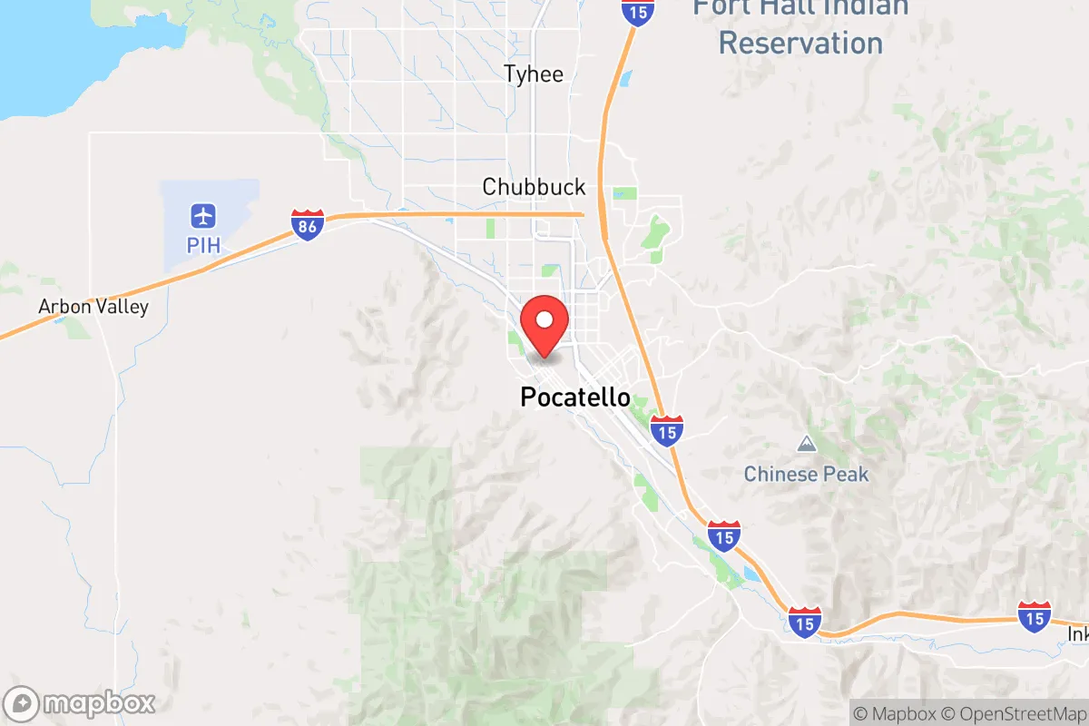
Strategic Assessment of Pocatello, ID
Workable tactical position. Some exposure to population density or targets, but generally defensible in a crisis.
What does the Strategic Assessment tell us?
Our Strategic Assessment grades tactical survivability of an area. Major population centers, military targets, fallout zones, natural disasters, and border exposure all drive risk — lower exposure means a more defensible position in a crisis.
This is heavily inspired by Joel Skousen's Strategic Relocation book. Highly recommended you checkout the book ($)What does this tell us?
Our Strategic Assessment grades tactical survivability of an area. Major population centers, military targets, fallout zones, natural disasters, and border exposure all drive risk — lower exposure means a more defensible position in a crisis.
This is heavily inspired by Joel Skousen's Strategic Relocation book. Highly recommended you checkout the book ($)Strategic Pillars

Key Distances
Regional Safe Places
Below is our recommended "safe zones" in Idaho and the surrounding area based on our strategic heuristics. For most people, it's unrealistic to live in a “safe zone” full-time due to work, family or other personal reasons. They tend to be more rural. However, many of these areas are perfect for second homes and retreat properties that double as a vacation home or even a short-term rental.


Important Note: For informational purposes only. This does not mean nothing bad ever happens in the green zones. Please use common sense. This is based on public data and modeled with AI. We tried to take a conservative approach but mistakes happen. We update this regularly as new information becomes available.
Solar Generator Recommendations
Backup power matters more here than in safer locations. We've picked three solar generators across budgets and capacity tiers — start with the budget unit if you only need a few essentials, or step up if you want to run a fridge and HVAC for days at a time.

Jackery Portable Power Station Explorer 300
Budget OptionPower on the Go: Weighing only 11 lbs, it's convenient to set up and store with book-sized foldable solar panels

BLUETTI Portable Power Station AC180
Designed for both indoor and outdoor scenarios, AC180 is highly capable as it has a robost capacity and continuous output power.

EF ECOFLOW DELTA Pro Ultra Power Station
Upgraded PickEcoFlow DELTA Pro Ultra is a whole-home energy system designed to grow with your family. Integrated with the Smart Home Panel 2, it scales to meet your evolving energy needs — keeping your home powered, intelligent, and secure through every stage of life.
We earn a commission, at no additional cost to you.
Strategic Assessment Analysis
Pocatello, Idaho, sits in a strategic sweet spot that few relocation analysts fully appreciate: it offers genuine geographic isolation from major population centers while retaining the logistical infrastructure needed for long-term resilience. Located roughly 150 miles from Boise, 160 miles from Salt Lake City, and 250 miles from Spokane, the city is far enough from the West Coast's seismic and social fault lines to avoid the worst of cascading failures, yet close enough to supply chains and medical hubs to avoid being completely cut off. The surrounding Bannock and Portneuf River valleys provide natural chokepoints, defensible terrain, and access to water—factors that make this area a serious candidate for anyone thinking through a strategic relocation in an era of increasing instability.
Geographic position and natural advantages for long-term security
Pocatello sits at the intersection of Interstates 15 and 86, which is both a blessing and a consideration. The city is the regional transportation hub for southeastern Idaho, meaning it has rail access (Union Pacific's main line runs through town), a regional airport, and direct highway routes to the Mountain West's major corridors. For a prepper or survivalist, this means you can move supplies in and out efficiently during normal times, but those same routes become chokepoints you can control or monitor during disruptions. The surrounding topography is dominated by the Portneuf Range and the Bannock Range, with elevations ranging from 4,400 to over 7,000 feet. This provides natural defensive positions, multiple escape routes into the high desert and national forest lands, and significant cover from aerial or satellite observation in the more rugged pockets. The area's volcanic soil and relatively reliable snowpack-fed water systems mean that small-scale agriculture is viable—something that matters if supply chains ever buckle. The nearby Fort Hall Indian Reservation and the vast Caribou-Targhee National Forest to the east offer additional buffer zones and resources, though you'll want to respect jurisdictional boundaries.
Risks, exposures, and proximity to fallout-relevant landmarks
No strategic assessment is honest without addressing the downsides, and Pocatello has a few that demand attention. The most obvious is the Idaho National Laboratory (INL), located about 50 miles west near Idaho Falls. INL is a major nuclear research facility with reactors, spent fuel storage, and historical ties to weapons-related work. While the risk of a catastrophic release is low, it's not zero—and in a scenario involving civil unrest or targeted attacks on critical infrastructure, INL could become a target. The prevailing winds generally blow eastward, which puts Pocatello in a less exposed position than Idaho Falls itself, but it's still within a 100-mile radius. Additionally, the city lies in a seismically active region; the nearby Wasatch Fault and the Yellowstone Caldera are distant enough to be low-probability threats, but the 2020 magnitude 6.5 earthquake near Stanley (about 200 miles northwest) was a reminder that the entire Intermountain West is not immune. On the human-risk side, Pocatello's population of roughly 57,000 means it's small enough to avoid the chaos of a major metro collapse, but it's large enough to have a hospital (Portneuf Medical Center), a university (Idaho State University), and a police force that could maintain order in the short term. The real concern is the potential for refugee flow from Boise or Salt Lake City if those areas experience unrest—the highways funnel directly through Pocatello, and the city's infrastructure could be overwhelmed by even a modest influx of displaced people.
Practical resilience for a relocator: food, water, energy, and defensibility
For someone serious about self-sufficiency, Pocatello offers a mix of advantages and homework. Water is the strongest asset here: the Portneuf River runs through town, and the area sits atop the Eastern Snake River Plain Aquifer, one of the largest and most productive groundwater systems in the West. Well drilling is feasible in many parts of the county, and surface water from the river is accessible with proper filtration. The city's municipal water supply comes from both surface and groundwater sources, so even if one system fails, the other may hold. Food production is viable but not effortless: the growing season is short (about 100-120 frost-free days), and the soil is alkaline and rocky in many spots. However, the nearby Fort Hall Bottoms and the irrigated farmland along the Snake River Plain produce potatoes, wheat, alfalfa, and hay at scale. For a relocator, securing a property with irrigation rights or a well is the difference between subsistence and comfort. Energy is a mixed picture: Idaho Power provides electricity from a mix of hydro, natural gas, and coal, and the grid is generally reliable. But the region's cold winters (average January highs around 30°F) mean that heating is a non-negotiable. Natural gas is available in town, but propane and wood are the backup options for rural properties. Solar is viable but limited by winter cloud cover and snow accumulation—plan on battery storage and a generator if you want true independence. Defensibility is excellent in the outlying areas: the valleys and canyons around Pocatello offer natural funnels and observation points. Properties in the Mink Creek area, the Portneuf Valley, or up toward Lava Hot Springs provide good cover, multiple egress routes, and distance from the main population center. The city itself is more exposed, but its grid layout and the presence of ISU's campus (which could serve as a rally point or medical hub) make it defensible in a coordinated community effort.
The overall strategic picture for Pocatello is one of calculated risk with significant upside. It is not a bug-out location for someone who wants to disappear into the wilderness—it's a working town with a functioning economy, a hospital, and a university, which means it has the institutional capacity to weather moderate disruptions. The proximity to INL and the potential for refugee flow from larger cities are real concerns, but they are manageable with proper planning: a well-stocked retreat 20-30 minutes outside of town, a community network of like-minded individuals, and a solid understanding of the local terrain and resources. For a conservative-leaning relocator who values self-reliance, community, and geographic buffer, Pocatello ranks as one of the more viable options in the Intermountain West. It's not a fortress, but it's a damn good place to build one.
* Values derived from national, state, county, city and local statistics and may differ in a specific area. Last updated: 2026-04-21T20:51:18.000Z
Narrative content on this page is AI-generated and may contain mistakes. Verify any details that matter before acting on them.
ReloMaps may earn a commission from affiliate links at no extra cost to you.